
Pachnes - Highest peak in Crete's White Mountains (30.05.2019)


Geschrieben von Stigun

| Startpunkt | Dirt road 1643 m asl (1.643m) |
|---|---|
| Endpunkt | Anopoli 586 m asl (586m) |
| Tourcharakter | Bergtour |
| Tourlänge | 7h 52min |
| Entfernung | 24,9km |
| Höhenmeter | 1.040m |
| GPS |
|
| Besteigungen | Páchnes (2.453m) | 30.05.2019 15:05 |
|---|
Crete has three mountainous areas with peaks above 2000m altitude, with the highest peak in each "range" with a prominence of more than 1500 meters(5000 feet), thereby cathegorized as "Ultra Peaks". The mountain range by far outnumbering the two others regarding number of peaks higher than 2000m is The White Mountains or Lefka Ori in the western part of the island. Pachnes 2453m asl, only 3 meters lower than Psiloritis or Timios Stavros; is the highest peak in Lefka Ori, and also the least accessible of the Ultras on Crete; or so I thought before going there...
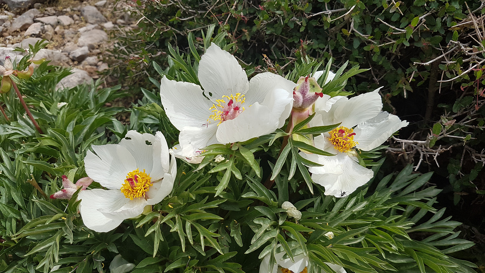
Prior to our vacation in Crete I had studied several websites on "how to get to Pachnes by the easiest way", and got to know that there was some kind of road going high up in the White Mountains from the village of Anopoli in the south, but there were no details regarding which state this road was in; most probably it was not very good.. I asked several locals in Rethymnon, both hotel employees, waiters in restaurants and even the manager of the car rental company; but no one knew anything for sure about the road. So by driving towards Anopoli in the morning my plan was to drive to the village; ask about the road, and eventually hire some local to drive me as high up as possible on the road if driving with an ordinary car was not recommendable. Crossing the island from the north to the south the sky was cloudy, and even some raindrops fell on my windshield; this was far from "sun from a clear sky all day long" forecasted by norwegian weatherforecaster Yr.no. Eventually arriving in Anopoli after 1 hour 40 min drive from Rethymnon, I stopped my car at the local taverna, and immediately met Costas; the manager. He told med the road was in a bad condition, and that driving a "normal" car was not at all recommendable. But the good news was that his son; Manousos, could drive me up to almost 1700m asl in his Pickup in about half an hour! Costas was one of those people with "a big heart"; I was given coffee "on the house" and he handed me some books with marvelous pictures from Crete while waiting for Manousos. He even offered me a bag of fruit for the hike and let me borrow his detailed map of the White Mountains area! And by arriving, Manosous was much alike his father; in excellent English language he told med about the area including the White Mountains, while driving upwards the road winding through numerous turns, deviating significantly in a long eastward turn before ; higher up, again headed west and northwest. Manosous had a lot of knowledge, also of local flora. He even stopped the car to show me the endemic Paeonia of the area; still blossoming.
The road was rough, with loose rocks, and here and there deep grooves from eroding water. Manousos also told about an unlucky couple driving up the road with their rented car, and unnoticed experienced a leakage of engine oil, eventually breaking the car's engine. Total cost; 4000 Euros.. Finally, after some 15-17 km, we reached the first snow; a huge, almost 10m deep snowdrift blocked further advance on the road. Just prior to this point, at about 1580m asl, he showed me the upper entrance to a gorge with a marked trail, which I could follow down to Anopoli returning from the mountain. At a point close to the snowdrift at about 1650 m asl, we detected the trail with red and white markings, on the right side of the road. I said goodbye to Manousos; a net gain of almost 1100 vertical meters was more than worth the cost of 50 Euros for the shuttle.
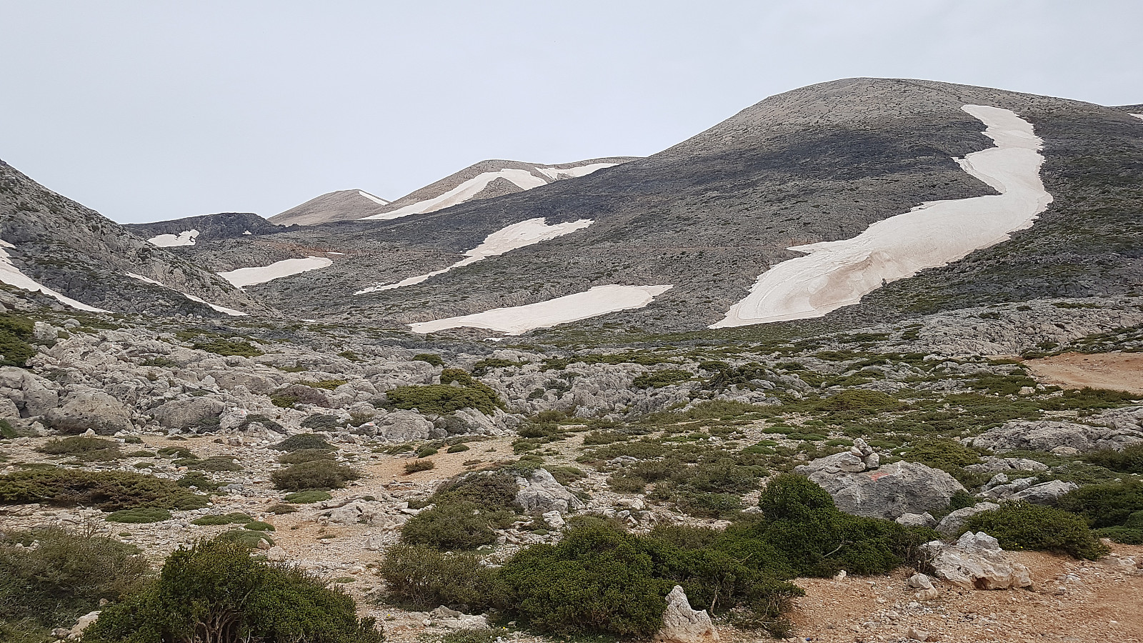
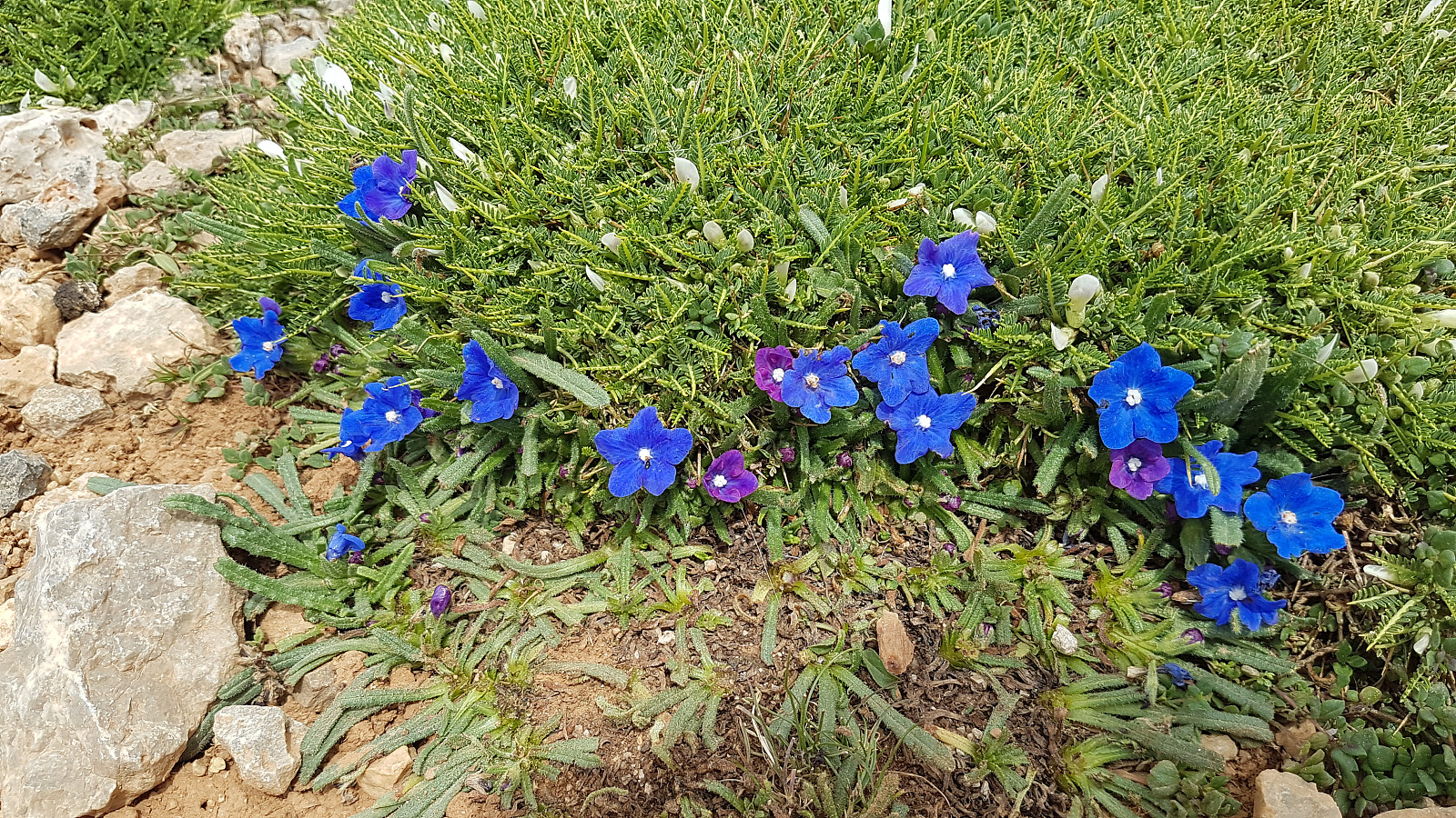
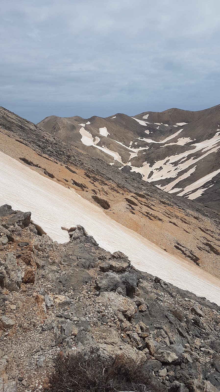
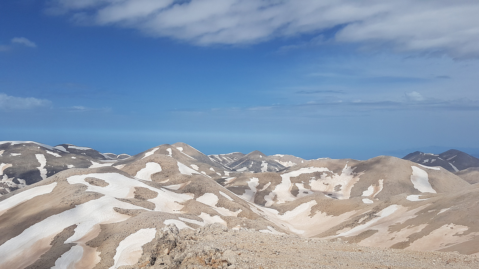
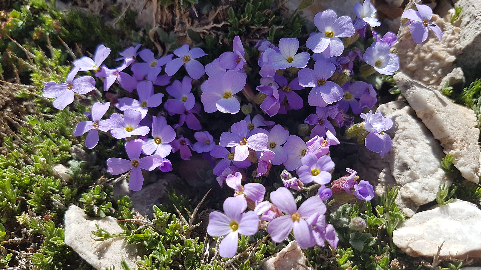
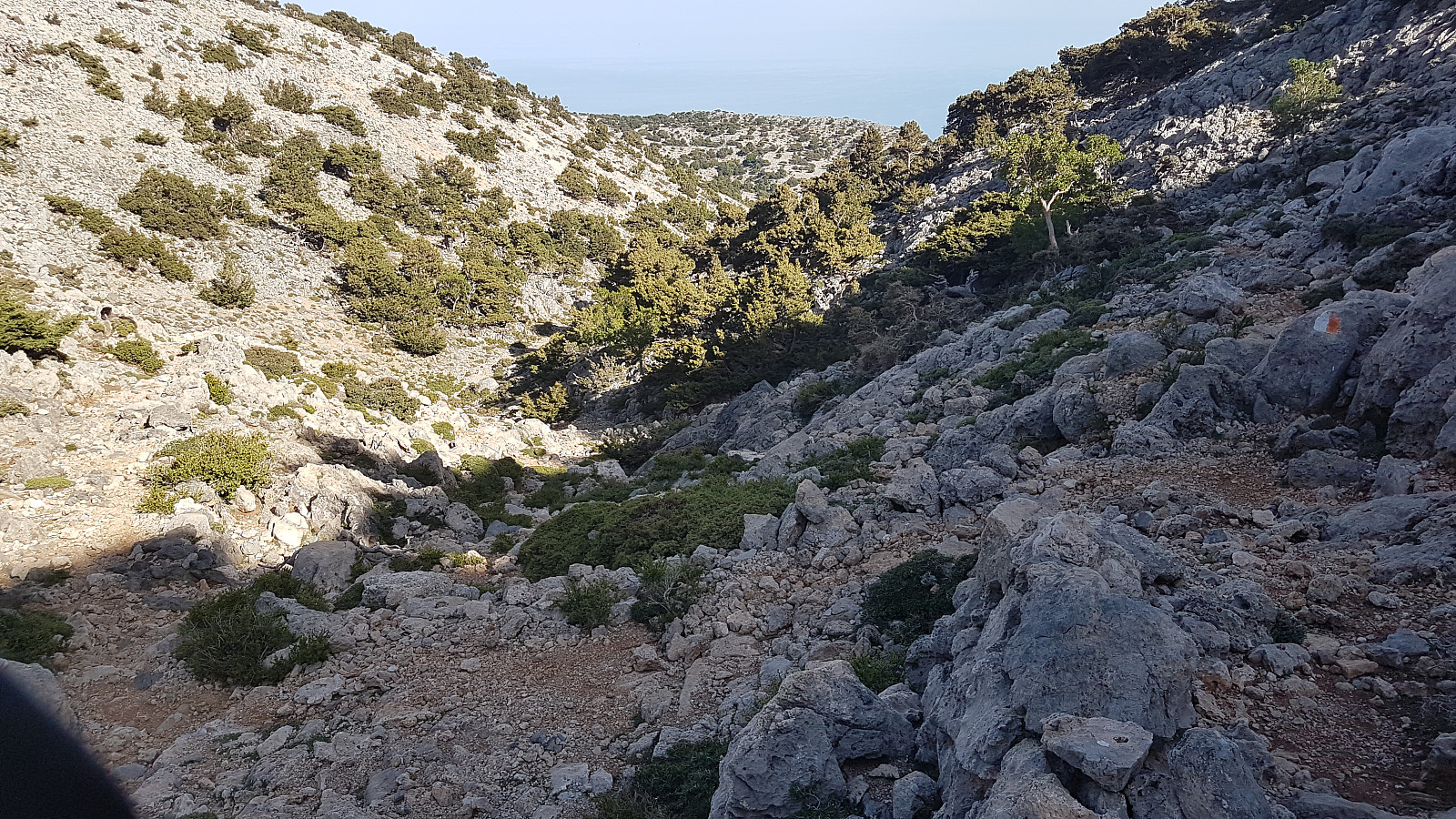
The terrain was barren; described as a high desert, but here and there small plants. In fact, the White Mountains inhabits as much as 30 endemic plant species; plants found only here!
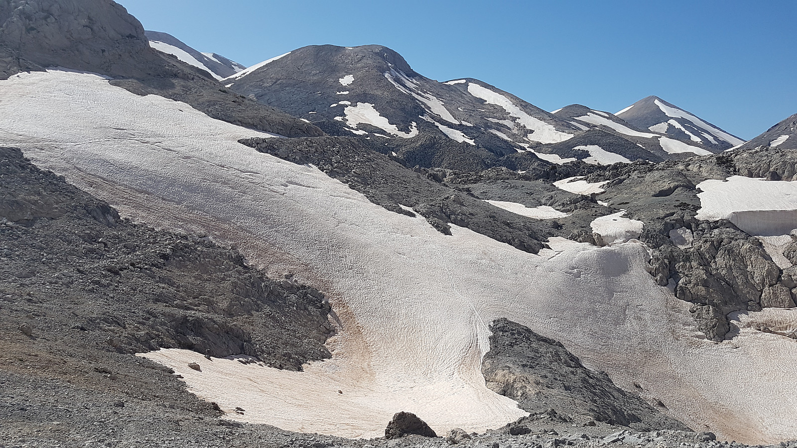
Even at relatively low altitudes, and also in this Southern part of the range; there was a lot of snow, mainly collected in southeastern flanks, reflecting supposedly nortwestern winds prevailing in winter. Manousos had told this winter had a particularly high amount of snow; every second year alternating between relatively sparse and high amounts of snow; respectively.
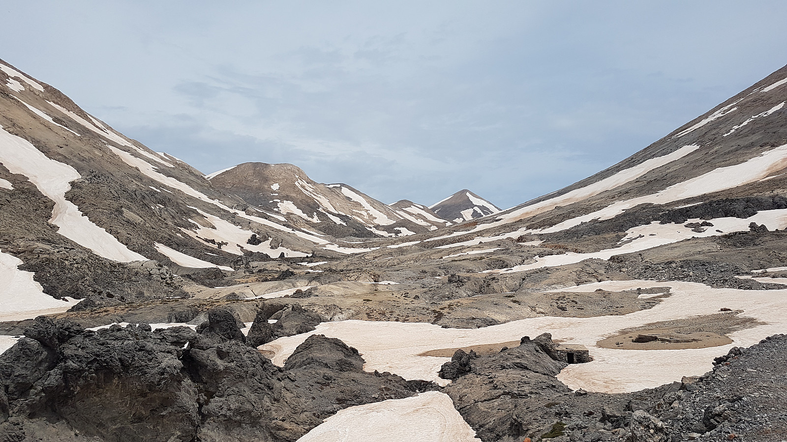
And the snow came to be the main challenge of this otherwise relatively easy hike; many places I had to go around steep snowfilled gullies, other places the only option was to cross them. Wearing relatively soft flexible shoes I had to be careful crossing the steepest of these, some of them with a steepness of 35-40 degrees; kicking steps and placing my walking sticks firmly in the snow, fortunately almost exclusively in a soft condition. I could all the time see sections of the road and also of the trail. At a little above 1900m asl the road abruptly stopped, and the still well marked trail continued on the right/upper side of the road. The clouds had gradually disappeared, and in warm sunshine I had my first break with something to eat at about 2030m asl
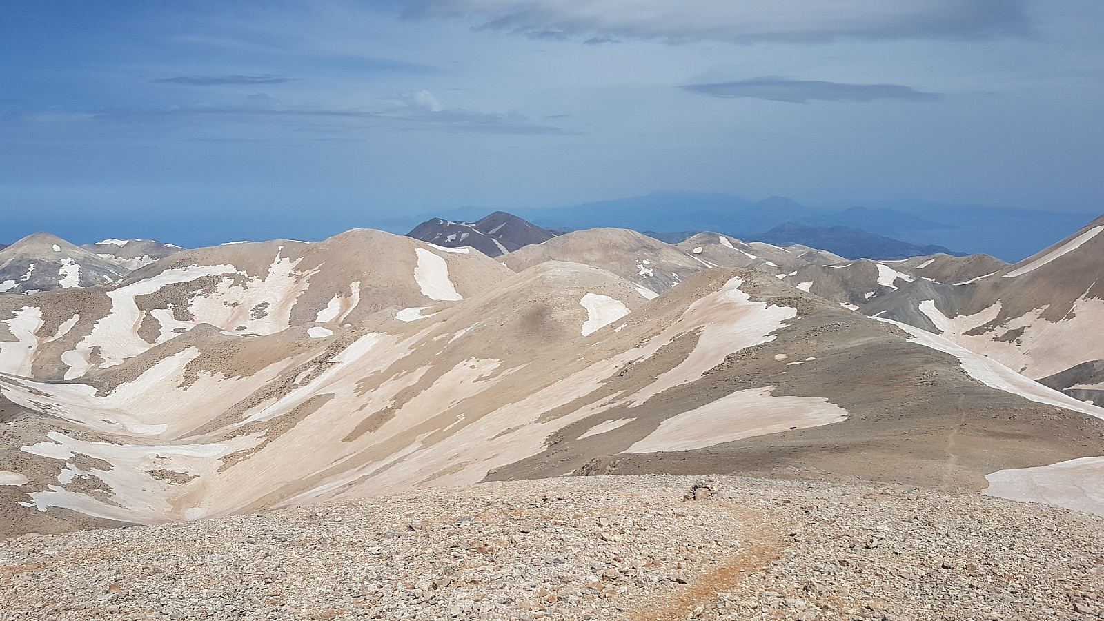
After the break, two more somewhat steep snow-gullies had to be crossed, one place scrambling on dry rock to avoid an especially steep section of a gully. From about 2100m asl the terrain was easier; again heading straight westwards, and soon I could see Pachnes for the first time.
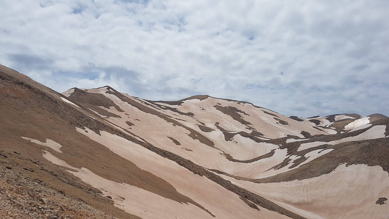
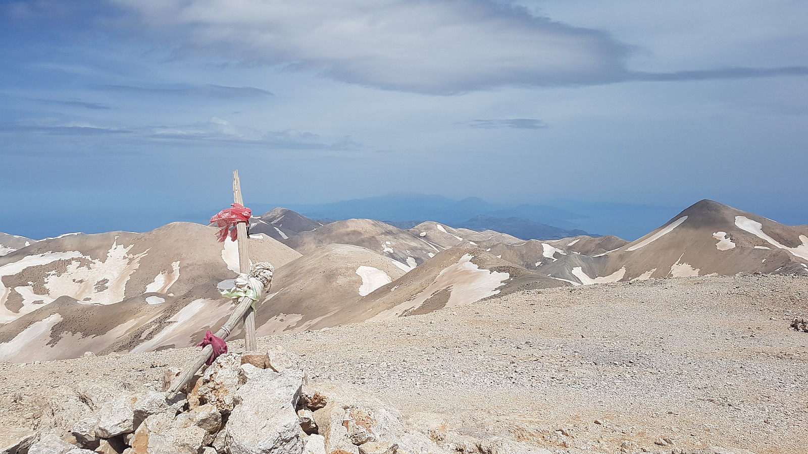
To avoid further snow-gullies I climbed to the ridge rising to the left(south) of the trail, and after a while I finally reached the summit of Pachnes 3 1/2 hours after starting; having spent more time than expected due to the numerous crossings of snow-gullies.
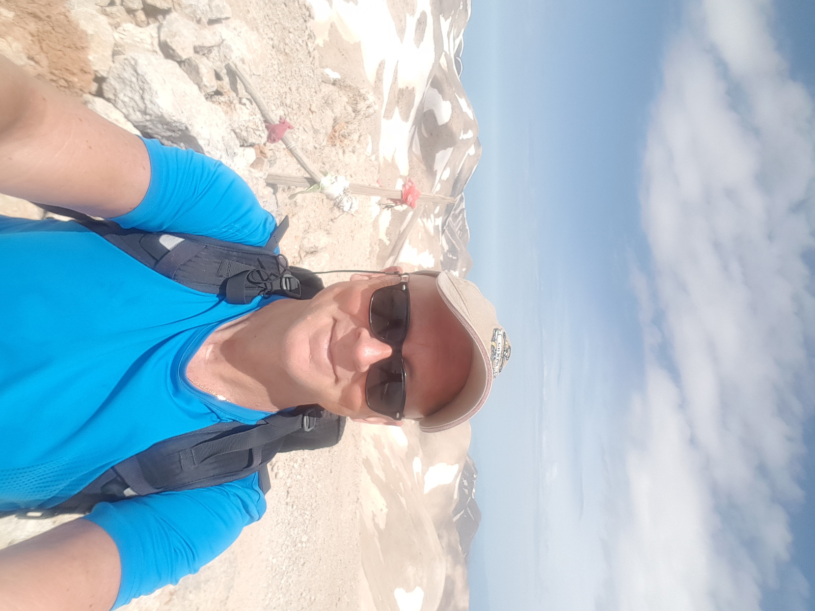
Magnificent views, but somewhat hazy horizon(There is a claim one can see all the way to Peloponnese on Greece's main land in clear winter skies from the White Mountains..)
The descent was considerably faster then the ascent; now I had my own steps in the gullies and I also had the possibility of choosing less steeper sections in some of the snowfields not having been visible while ascending. Even at these altitudes it was hot, and I used of all of the three liters of water I had carried with me.
I easily located the upper entrance of the gorge, well marked by cairns and red/white markings. Afternoon as it was, the gorge was in shadow. The trail was good, but the ground was somewhat loose due to gravel and small rocks.
Manosous had offered to pick me up in the lower entrance of gorge, but my cellphone was empty of power and I was unable to call him up, so I walked the last kilometers down to Anopoli. Finally reaching the tavern I was again met with great hospitality and kindness by Costas and Manosous and other nice people in the tavern. Saying goodbye to my new friends I started the drive back to Rethymnon, with a sun setting and darkness gradually arriving, with a happy feeling; not only because of a fine and successful mountain hike, but as much of learning to know more of the friendly people of Crete.
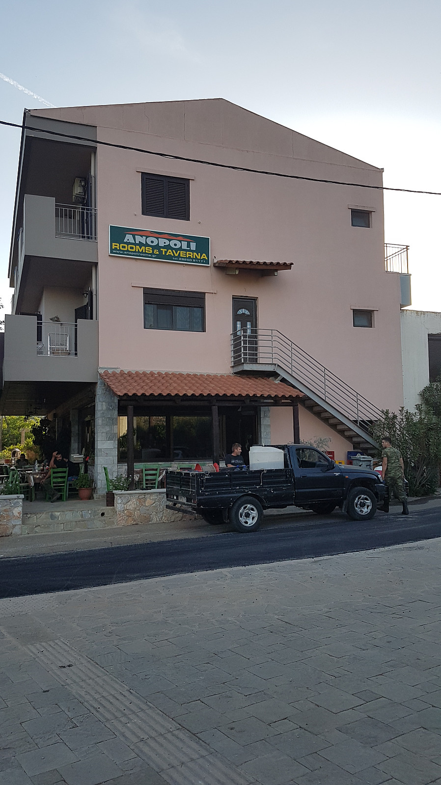
Anopoli is a natural starting point for a hike to the White Mountains and Pachnes, and by providing transportation by an appropriate vehicle, the area can be made much more accessible than I had imagined; in late summer maybe a drive to app. 1800-1900m asl is possible; making this a quite easy hike (It is possible to make an appointment of being picked up at some desired altitude on the descent if so preferred) It is of course also possible for the most athletic ones to start the hike from Anopoli, and make both the ascent and descent to Pachnes via the gorge north of Anopoli, but this will make a hike of more than 30km in length and almost 2000 vertical meters up and down.. The family running the tavern, and perhaps others; can be hired for transport missions, and the tavern can provide lodging for those wanting to have an early start or just to dwell in the charming village of Anopoli. In spring/early summer walking sticks, good shoes, and possibly crampons or an ice axe can be useful in the case of unfavorable snow conditions.


Benutzerkommentare
Fantastisk Stig!
Geschrieben von knutsverre 03.06.2019 23:30Tre ultratopper på fire dager, og en så flott og hyggelig avslutning med lokalbefolkningen! Det er slike overraskelser som gjør at det er så fantastisk å gå i fjellet og å oppdage steder og folk som dette! Vår kjære Løvstakken blir en bagatell i slike sammenhenger!
Sv: Fantastisk Stig!
Geschrieben von Stigun 04.06.2019 09:15Takk for hyggelig kommentar Knut! Ja, det var fantastiske turdager på Kreta, og man blir rett og slett glad og oppstemt av å møte slike hyggelige, hjelpsomme og gjestfrie mennesker. Kreta anbefales på det varmeste!