
Via Storaskjenet to Sangoltshornet (17.03.2019)

Geschrieben von HHauser (Helwig Hauser)

| Startpunkt | Skogsvågen (30m) |
|---|---|
| Endpunkt | Skogsvågen (30m) |
| Tourcharakter | Bergtour |
| Tourlänge | 4h 15min |
| Entfernung | 12,7km |
| Höhenmeter | 702m |
| GPS |
|
| Besteigungen | Bullåsen (121m) | 17.03.2019 |
|---|---|---|
| Kona (168m) | 17.03.2019 | |
| SØ for Langavatnet (135m) | 17.03.2019 | |
| Mannen (173m) | 17.03.2019 | |
| Sangoltshornet (186m) | 17.03.2019 | |
| Storaskjenet (175m) | 17.03.2019 | |
| Besuche anderer PBE | Børneskogen parkering (55m) | 17.03.2019 |

Trip Summary
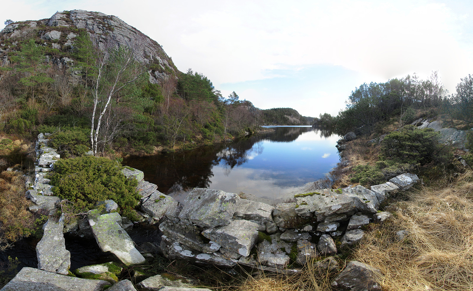
I took the car to Sotra and there to Sund kommune (on road 555 first). Near Hammarsland, I turned left (towards Klokkarvik), following road 198 for a bit. Near the northern-most point of Dommedalsvatnet, I parked and started my hike from there. I first headed towards Ormadalen and up through it (mostly without any trail). A little higher up there, I then connected to the main path towards Storaskjenet. Shortly later, I found myself on Storaskjenet: a substantial cliff (towards the west). After enjoying the views from there (and taking some photos), I continued in southern direction along the ridge. The path, which the map shows, is not easy to find and I ended up improvising most of the "way" along this ridge (no problem). Near Tveitahøgda, I reconnected to the path, which leads down to Langavatnet there. Walking a little northwards on the eastern side of the nothern-most part of Langavatnet, I found a good place for stepping over to the other (eastern) side: two large stones formed something like a bridge of the stream that comes out of Langavatnet there. I then had in mind to continue along the eastern side of Langavatnet southwards, but found myself (not planned) on Vassneset, i.e., a little peninsula that extends into Langavatnet from the north. Since I already was there, I decided to first visit the southern-most point on this peninsula (and to take some photos there), before returning and rounding Vassvika in the north (clearly, I was not in the mood for any swimming!). I then walked along Langavatnet southwards, following every now and then a path. Near the southern part of Langavatnet, I did not recognize, when my "path" turned upwards along the hillside, and thus continued without a path (and through some pretty boggy area!). At some point, I then understood that I had passed the southern end of Langavatnet and decided to try a traverse across the ridge in the east to get over towards Mannen/Kona (my next goal). I first headed back up into Langevassleitet (from the south then) and observed the ridge to my right (east) carefully to see, whether it would offer any opportunity to get up and over (this ridge, even though not very high, is steep towards the west, and it is by no means clear, where to ascend). Near the saddle point, however, I got the impression that it would be possible and indeed, I could find a narrow passage that enabled me to get up (steep terrain). Once on the ridge, I decided to first walk a little along it (for shooting another photo of Langavatnet from above). To do so, I followed some deer tracks. After having shot the planned photo, I turned eastwards, again. Descending through the forest was straight-forward even without any path. This brought me to the saddle towards Bullåsen (again steep on its western side). Also there, after a few minutes of walking along the hillside, I found an opportunity for get up to Bullåsen. Once on Bullåsen, I found the other side heavily transformed by some major forest work (quite brutal, what this does to the forest!). I managed to descend further towards the east (more difficult in an area with heavy forest work than in the intact forest!) and down to road 198. Near Nordra Sundstjørna, I finally connected with the road and walked along it for a bit to find the gravel road which would take me further towards Mannen. A little bit too early, I followed some track to the right. This brought me to the north of Breivika (nice view!). I then walked back (a bit) to reconnect to the path to Mannen. I then followed this trail (VERY wet!) until a saddle, where the path turns to the left and from where one has a nice view down to Raunefjorden. I then left the path and ascended directly to Kona along its eastern ridge (do only follow me on this part, if you know, what you are doing -- this ridge is not 100% trivial to ascend). The view from Kona is really wonderful -- better than from Mannen (and one can get up to Kona very easily, following the path, in fact!). From Kona, I continued to Mannen -- here the view towards west is most spectacular (steep cliff underneath). Instead of returning, I continued along the ridge over Mannen in northern direction until I found the saddle from which a trail leads downwards to Blågjerddalen. There, I decided to include Sangoltshornet, before returning to the car. I thus first ascended through Blågjerddalen, before I then found the path that leads further towards Sangoltshornet (the path is west of Snutane). Reaching Sangoltshornet before the end of this hike was a nice additional highlight! :-) I then followed the main trail northwards (one needs to go back, a little, from the top of Sangoltshornet, first, since the norther cliff of Sangoltshornet is too steep). Passing by Bringebærfjellet (on its eastern side), I connected to Sangoltsvegen near Stemhaugen. From there, I followed the road back to the car. All in all, this hike was nice (and a little wild) and it was wonderful to get out into the fresh air for a few hours! :-)
Photos
Selected photos are available as Google photo album.
Useful Resources
See also the related FB-page Hiking around Bergen, Norway.
Petter Bjørstad has a useful page about Sangoltshornet.
Web page UT.no from the Norwegian Trekking Association recommends a hike, which is similar to the first half of mine.


Benutzerkommentare