
Tomasjordtinden (17.03.2019)


Written by Skippy (Innika De Rosa)
| Start point | Laksvatn |
|---|---|
| Endpoint | Laksvatn (876m) |
| Characteristic | Randonnée/Telemark |
| Duration | 3h 42min |
| Distance | 8.8km |
| Vertical meters | 913m |
| GPS |
|
| Ascents | Tomasjordtinden (879m) | 17.03.2019 |
|---|
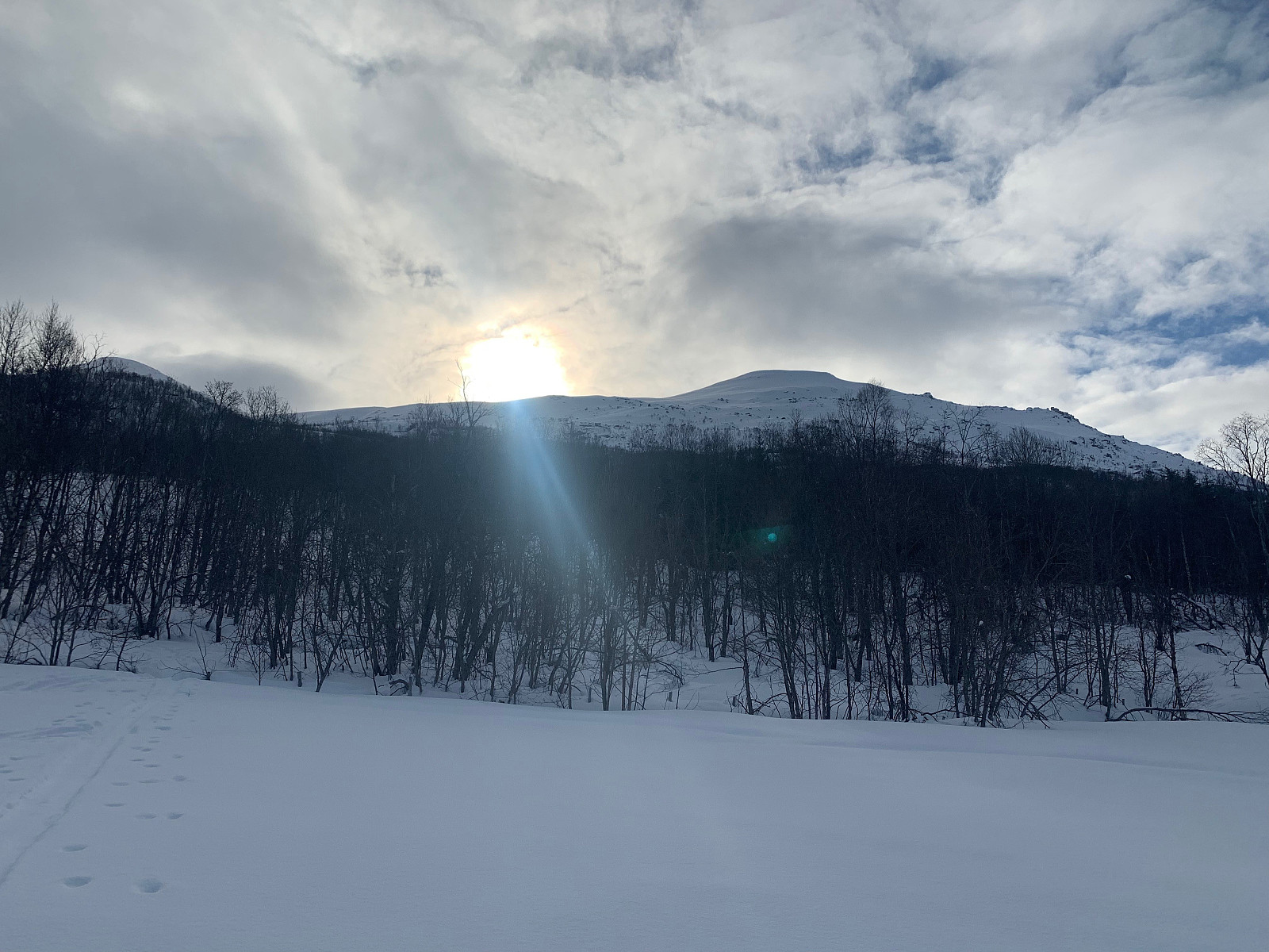
Some tight trees that thankfully didn’t persist for too long and soon we were over the tree line. We were walking in the shadow side the whole way up so it was a lot colder than expected. The terrain changed to big slopes covered in really nice, fluffy powder so we were getting excited for the trip down.
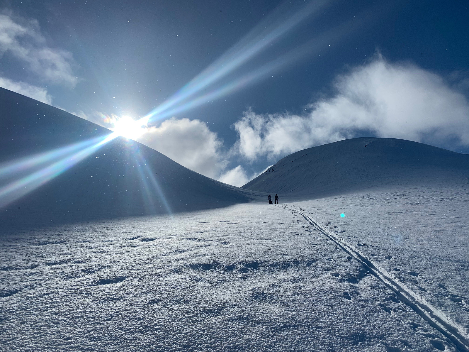
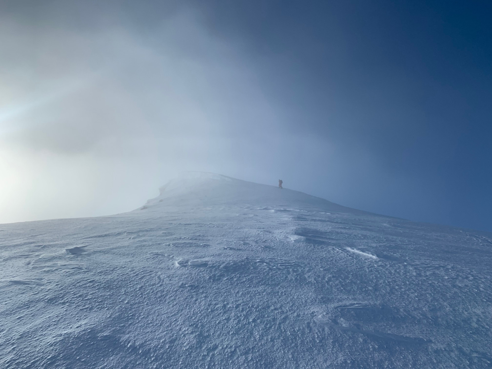
After a small hot chocolate break we headed right along the ridge towards the summit. It started getting pretty windy and soon we were completely in the clouds. Unfortunately we got no view on top and changed as quick as we could ready for the trip down. Paal thought needed to walk a few meters further to reach the true summit but we couldn't see anything so were not too sure.
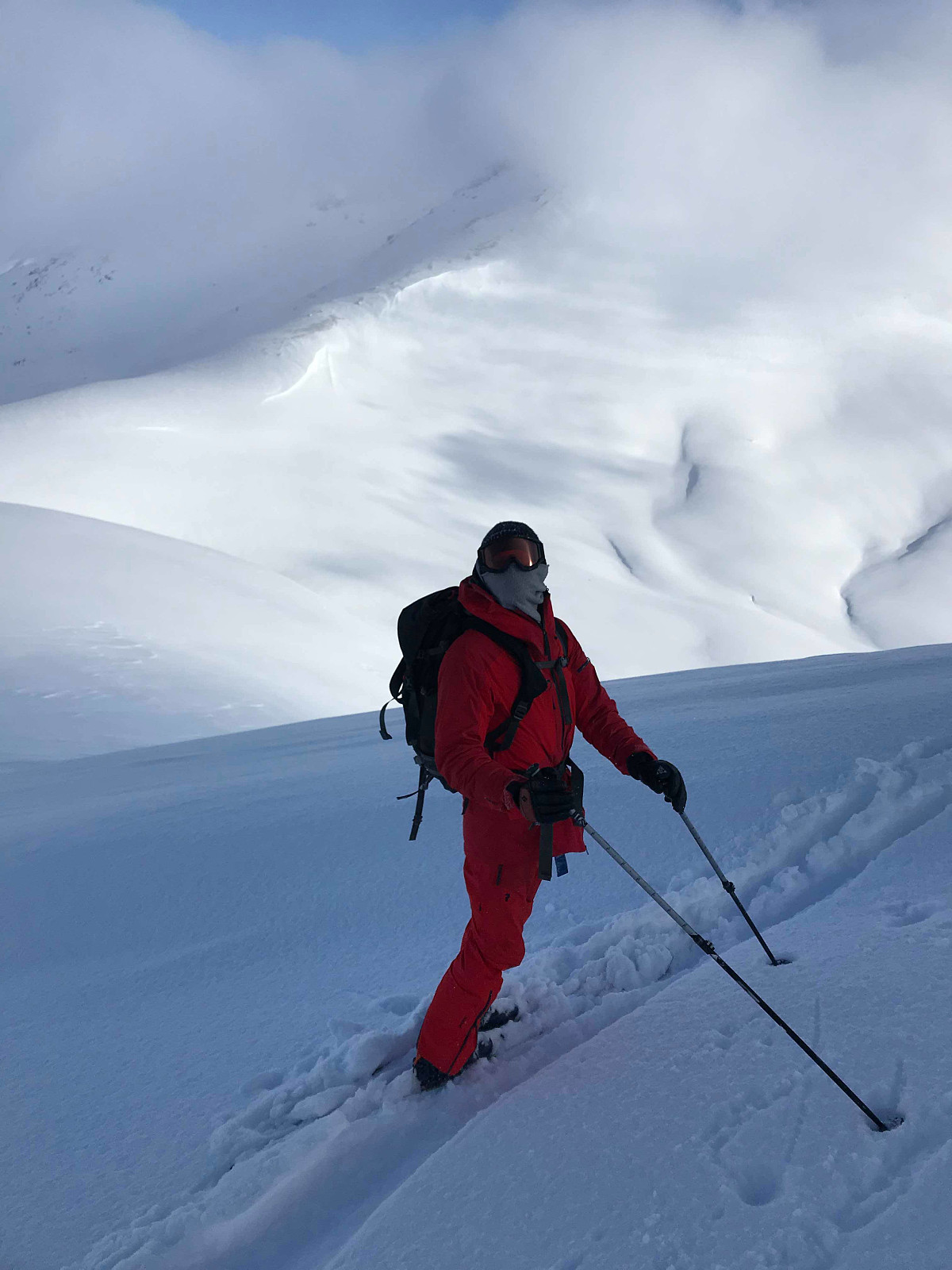
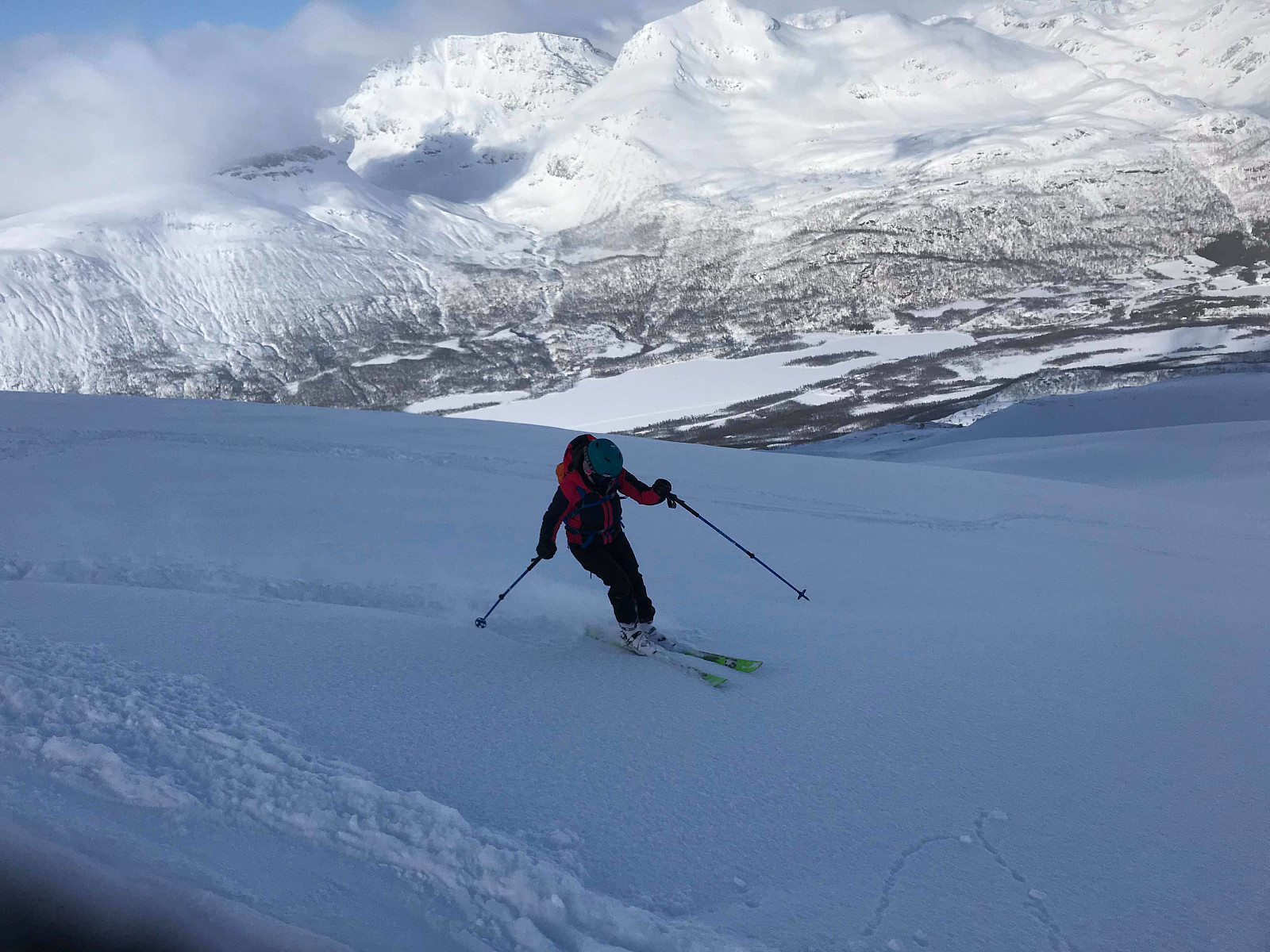
After a few careful turns on the way down from the summit watching out for the small snow lip on the right, we soon started getting some nice swings in really nice powder all the way down to the tree line. Stoked! The skiing was a bit more questionable down through the trees but remarkably I didn’t hit a tree or fall down once on the whole trip! Of course the sun was shining and påskestemning var på plass as soon as we got down to the car.
My watch ran out of battery on the way down so the gps track isnt complete for the return trip. Takk for turen uglefisk (Paal Andre Lund) �


User comments
Missing title
Written by uglefisk 18.03.2019 00:56pudderqueen ;)