
Sjurstonipa (17.02.2019)

Skrevet av HHauser (Helwig Hauser)

| Startsted | Arna stadion (80moh) |
|---|---|
| Sluttsted | Arna stadion (80moh) |
| Turtype | Fjelltur |
| Turlengde | 2t 00min |
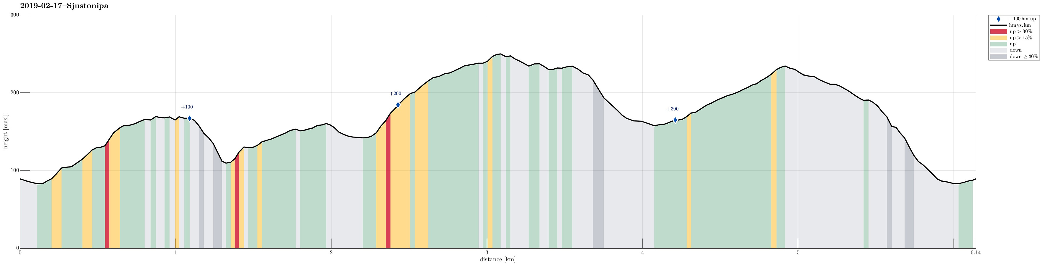
| Distanse | 6,1km |
| Høydemeter | 380m |
| GPS |
|
| Bestigninger | Osen (172moh) | 17.02.2019 |
|---|---|---|
| Sjurstonipa (252moh) | 17.02.2019 | |
| Spåkefjellet (236moh) | 17.02.2019 | |
| Sætrefjellet (162moh) | 17.02.2019 | |
| Andre besøkte PBE'er | Arna Stadion p-plass (90moh) | 17.02.2019 |
| Osen utsiktspunkt (167moh) | 17.02.2019 | |
| Lavvo Sætrefjellet (133moh) | 17.02.2019 |
Trip Summary
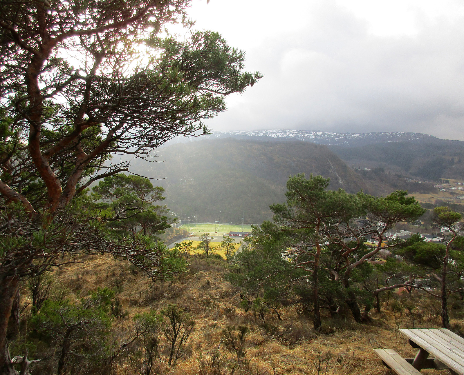
We took the car from Bergen via Åsane to Gaupås and parked right at Arna stadion. Our first goal was to visit Osen (via Gamsevegen) and to check whether one indeed has a nice view from up there -- and, yes, the view, for example across Gaupåsvatnet, is quite nice! :-) From there, we wanted to connect to Sjurstonipa. But instead of taking the nice path back, which we used to get up to Osen, we descended along a stone wall that runs towards the east from Osen. At the lower end of this descent (near Kvernaskaret), the terrain is quite a bit steep and choosing ones steps carefully was advised (no problem, though, to get down to the saddle). On the other side, we then ascended to the Lavvo place near the upper houses of Ytre Arna. Instead of entering Ytre Arna, we continued across the "top", walking near the upper-most houses. At one point, we had to take care to not "automatically" descend towards Gamsvegen again -- soon, we had understood this and reconnected to the path that leads further (down) to Gamsebotstjørna. There, on the northern side of Gamsebotstjørna, we easily found the path that connects over to the ridge, leading further up to Sjurstonipa. Once on the ridge, it was easy and straight-forward to follow the path up to the top, Sjurstonipa. Right there, a little exposed, we were hit by some very heavy winds so that keeping one's stand was nontrivial. :-) From there, we then descended towards Stemmevatnet. But instead of walking further into the south (along Stemmevatnet), we found the path that brought us into Sjurstodalen. We then hiked Sjurstodalen up until we were right underneath Sjurstonipa. There, we turned left and followed another path up to the "top" of Spåkefjellet. Instead of going back from there, we continued along a path that was meant to lead to Spåkevatnet. But near Ørnareiret, this path split and followed the northern route down to Arna stadion. All in all, this was a nice little hike and we also snapped a bit of sunlight! :-)
Photos
Selected photos are available as Google photo album.
Useful Resources
See also the related FB-page Hiking around Bergen, Norway.
Petter Bjørstad has a useful page about Beitelen.
Web page UT.no from the Norwegian Trekking Association recommends a similar hike.
On Bergentopp 200 there is a page (in Norwegian) about Sjurstonipa.


Kommentarer