
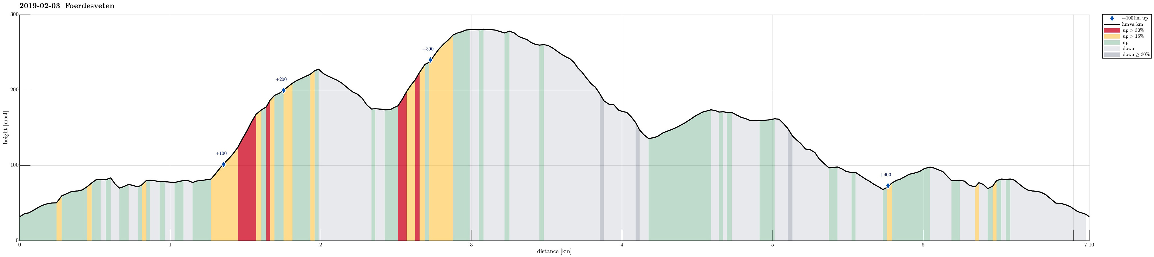
Førdesveten from Stranda (03.02.2019)

Skrevet av HHauser (Helwig Hauser)

| Startsted | Stranda school (32moh) |
|---|---|
| Sluttsted | Stranda school (32moh) |
| Turtype | Fjelltur |
| Turlengde | 2t 45min |
| Distanse | 7,1km |
| Høydemeter | 450m |
| GPS |
|
| Bestigninger | Førdesveten (284moh) | 03.02.2019 |
|---|---|---|
| Storevarden (230moh) | 03.02.2019 | |
| Andre besøkte PBE'er | Gigantgitaren (50moh) | 03.02.2019 |
| Minnesmerke etter flystyrten i 1948 (275moh) | 03.02.2019 | |
| Stranda skole parkering (45moh) | 03.02.2019 |
Trip Summary
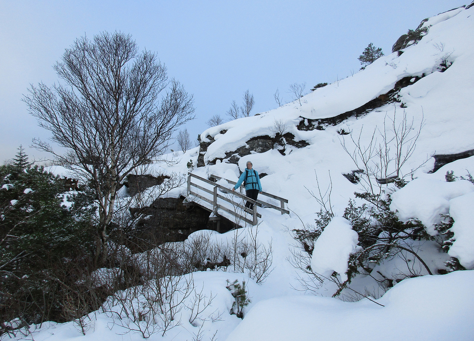
We took road 555 towards Sotra and then further south to Sund. At the Stranda school we parked, starting our hike from there. We first followed a well-visible path over Lamhusfjellet in order to get into Kleppadalen. Also there, the path was easy to follow and we continued along it into the direction of Førdesveten. From Kleppadalen, we then ascended in northeastern direction towards a saddle, where another path comes down from Ramnaberget in the southeast. Instead of immediately continuing towards Førdesveten, we decided to quickly ascend Storevarden (in the northwest of the saddle). There were no steps to see in the snow, but proceeding to the top was nonetheless quite OK. At Storevarden, one can appreciate an impressive stone wall that probably was built to confine sheep towards the one or other side. From Storevarden, we descended along in the steps that we had made on our way up and connected back to the saddle, where we had left the more visible path towards Førdesveten. Following this path then across Vetadalen brought us to the southeastern end of Førdesveten and ascending to the top was straight-forward along its western edge. Before reaching the very top, we also paid a short visit to the plate in memory of a tragic plane crash with 13 of 15 passengers not dying back then in 1948. We then continued over the top of Førdesveten (in northern direction). There, we found another path that should lead us towards Liavarden (across Grindamyren). At Liavarden, we were a bit shocked about the brutal way someone had cut down the forest there -- really not nice to look at! Passing by Katthaugane, we crossed then Heiane and got back into Kleppadalen (and from there back to our car across Lamhusfjellet).
Photos
Selected photos are available as Google photo album.
Useful Resources
See also the related FB-page Hiking around Bergen, Norway.
Web page WestCoastPeaks.com provides useful information about Førdesveten.


Kommentarer