
Snow-covered Liatårnet from Li (27.01.2019)

Skrevet av HHauser (Helwig Hauser)

| Startsted | Haugane (50moh) |
|---|---|
| Sluttsted | Haugane (50moh) |
| Turtype | Fjelltur |
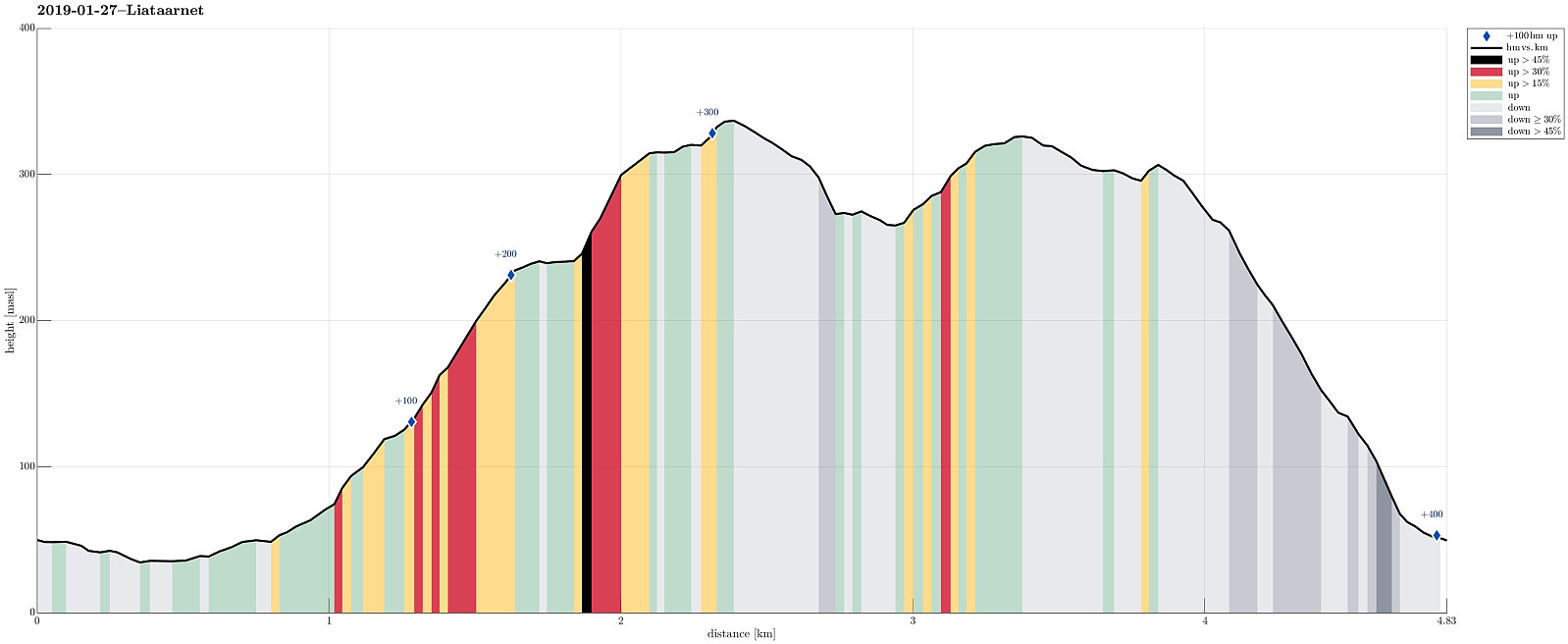
| Turlengde | 2t 15min |
| Distanse | 4,8km |
| Høydemeter | 394m |
| GPS |
|
| Bestigninger | Liatårnet (341moh) | 27.01.2019 |
|---|---|---|
| Pyttane søndre (330moh) | 27.01.2019 |
Trip Summary
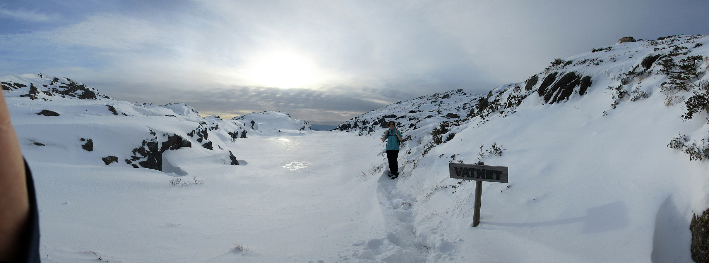
Considering the snow-covered landscape outside and comparably good weather, it was not too difficult to decide for a nice Sunday hike. We took our car towards the west (Sotra) and there to Li (on the east-side of Liatårnet). Near Haugane, we parked and continued along Liaskjervegen walking until we came to Hola, where we found Hølo (a short road up to the west from F206). Pretty much at the top end of this short road, we then found the path to Liatårnet (and were positively surprised that it was easy to find!). Since someone had gone there already, it was even easy to step up the snow-covered path. Furthermore, we got the impression that rather recently a substantial effort must have been put into this path (with a few signs here and there, a proper stone bridge across a small stream, etc.). Nice! :-) Without much delay, we ascended towards Liatårnet and enjoyed the snow-covered landscape and some nice views over Raunefjorden. At Liatårnet, we then started to head towards Pyttane and we followed a path that we had used before. This time, however, it was completely covered in deep snow and progressing was slow and a bit challenging also (in particular the part down towards Tårnavatnet). Once by Tårnavatnet, we reconnected with a path that someone had gone before and proceeding further to Pyttane was straight-forward, again. We stopped at the larger radar tower for a moment, before starting our search of the path down to Li. We first walked a little along the road (not as far as where the other road leaves up to the smaller radar tower). Then, without any visible path and through the snow (at times deep snow), we headed in southern direction. Once we passed the little lake, which also is visible from the road above, we crossed over to (and over) Stykkhaugen. Even though the path was not visible due to the snow, we managed to follow it down towards Snikhaugen (more or less). Further down, we could then find a few markers next to the path, so completing this hike along this (minor) path down to Haugane was well doable. Eventually, we came down to F206 very close to where we had parked. All in all, this hike through the snow-covered landscape was really nice and we returned very satisfied back home afterwards.
Photos
Selected photos are available as Google photo album.
Useful Resources
See also the related FB-page Hiking around Bergen, Norway.
Web page WestCoastPeaks.com provides useful information about Liatårnet
and also Petter Bjørstad has a useful page about Liatårnet.


Kommentarer