
Storskaret and Ebbesvikfjellet on Litlesotra (28.12.2018)

Geschrieben von HHauser (Helwig Hauser)

| Startpunkt | Svartabergje (60m) |
|---|---|
| Endpunkt | Svartabergje (60m) |
| Tourcharakter | Bergtour |
| Tourlänge | 2h 00min |
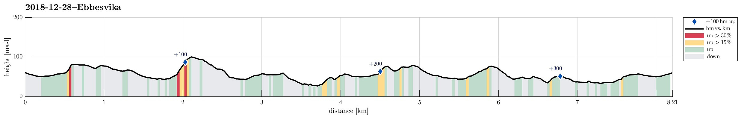
| Entfernung | 8,2km |
| Höhenmeter | 343m |
| GPS |
|
| Besteigungen | Ebbesvikfjellet (104m) | 28.12.2018 |
|---|
Trip Summary
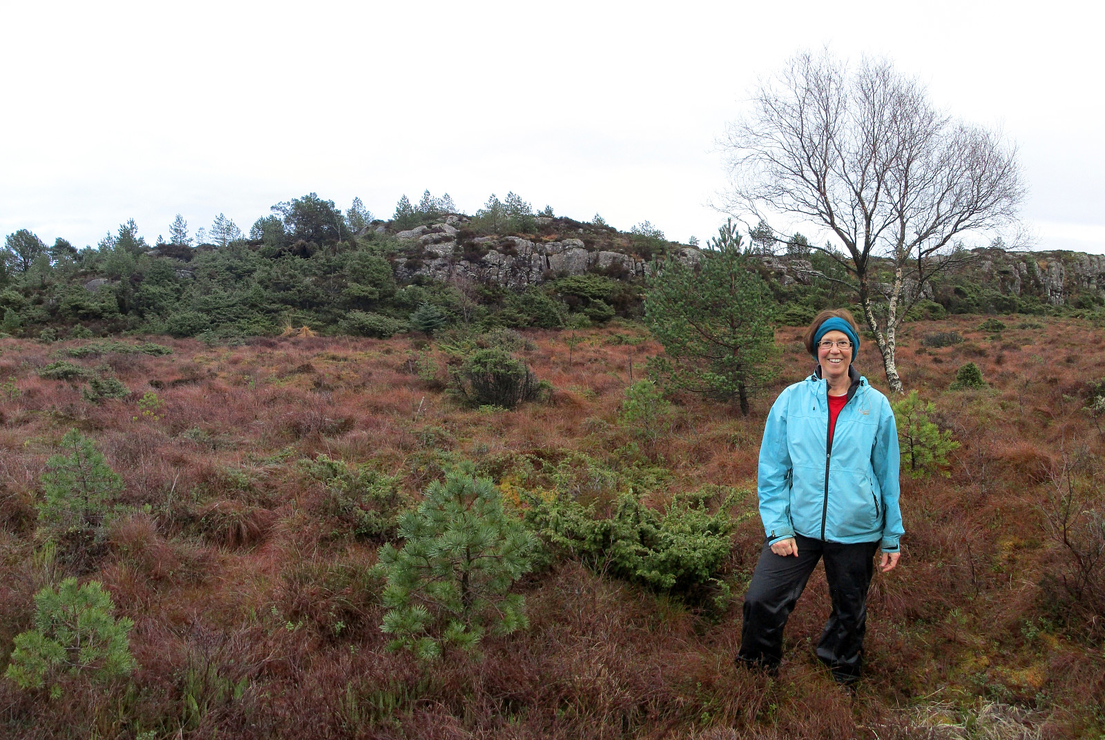
Since we had plans to buy a few things at a shop at Straume, we decided to use a bit of time for getting some fresh air nearby. While driving to Litlesotra, we repeatedly changed our minds in terms of which road to follow, ending up in Straumsfjellvegen, eventually. Understanding that his road would not let us drive further into the south of Litlesotra, we decided to park at a southern spot along Svartabergje and to walk from there. We used a connection for pedestrians to get down to Arefjordvegen first, before following this street in eastern direction a bit (until a rather large roundabout right next to Storskaret). Looking at the rather steep northern flank of Storskaret, we got a bit unsure concerning the idea to climb up to it (instead of following some more streets). We still gave it a try and managed to find a spot, where ascending upwards was possible. Once on Storskaret, we followed some minor paths through the forest in southern direction, soon connecting to a proper path that then brought us further south quickly and easily. Very near to Ebbesvikvatnet, we connected to a nice gravel path that is part of a larger area with nice paths that are easy to follow (even in the dark, since lights are set up along these paths, too). We followed the gravel path for a little, rounding Ebbesvikvatnet in the north and getting to its west-side, this way. Once we were near to Ebbesvikfjellet (in its northeast), we left the gravel path, which continues along Ebbesvikvatnet, and found a path that leads up to Ebbesvikfjellet. Only a few minutes later, we arrived at the "top" of Ebbesvikvatnet. From there, we followed another path (now in southeastern direction), bringing us near to some houses that are built at the southern end of Ebbesvikfjellet. We found a simple path in the east of these houses, leading down to the gravel path, which we had left earlier. Only a few meters after we reconnected to the gravel path, we came out to street Ebbesvikvegen. But instead of continuing along this street, we crossed over it and continued along a simple path that is leading further south between the hills. We passed by Midtfjellet (in its west) and came into a "valley" that generates an impression of a "lost" or "forgotten" place, almost mystical in a way! :-) A little further south, we came close to a pretty large stone wall (running east--west there). Instead of crossing over it and continuing further south, we decided to follow this wall a little (starting in eastern direction and on the norther side of the wall). After a few turns (and still impressed about this wall!), we ended up in a neighboring "valley", this time with a bit of a stream running through it (in southern direction). Instead of heading further south, we decided at this point that it was enough of an exploration and that daylight would cease soon. We thus started to head north, again, following this "new valley". After a bit of an ascent, we used a minor saddle to our right (east) in order to get further up (and out of the "valley"). Even though there was no path, we still crossed over the "heights" of the south-north oriented ridge to get further north. At the next somewhat major saddle, we reconnected with a path that crosses over there from the southwest to the northeast. This brought us into a pretty wet swamp, southwest of Tomashaugen, which we crossed towards the north (on its western side). On the northern side of the swamp, we ascended a few meters to a minor saddle. There, we found another simple path, which promised to lead up to Holmesfjellet (in the west of us). We followed this path and crossed over Holmesfjellet in our attempt to get even further north. While Holmesfjellet is covered with trees, we soon left the forest again, and stepped out towards some hills north of Holmesfjellet. The next goal was to find a spot, where we could descend to Ebbesvikvegen in a safe way (the western flank of these hills north of Holmesfjellet is quite a bit steep). After a few minutes, however, we found a very good opportunity (one could even call it a path!) and connected back to Ebbesvikvegen. In order to get to the western side of Sauavatnet (and onto one of the nice gravel paths there!), we first walked Ebbesvikvegen a bit into southwestern direction. After only a bit, however, we found an easy way to get over to the nice gravel path and followed this one then (over the small hill between Sauavatnet and Ebbesvikvatnet) in northwestern direction (in direction of Skogavatnet). Once close to Skogavatnet---we had just crossed the short stretch of the path, which we had already used, while approaching Ebbesvikfjellet before---we continued along one branch of the gravel path, which leads first in northern direction (and towards Straume Idrettspark). Once there, we found our way between some soccer fields and other sports places, heading further north and eventually to Idrettsvegen. Following Idrettsvegen (further north) then brought us back to the somewhat larger roundabout (near Storskaret). From there, we basically followed the same path back to the car, which we had already taken in the beginning.
Useful Resources
See also the related FB-page Hiking around Bergen, Norway.
Web page UT.no from the Norwegian Trekking Association recommends a hike along these nice gravel paths, another similar hike that also includes Storskaret, as well as another hike that also includes this "valley" south of Ebbesvikvatnet.


Benutzerkommentare