
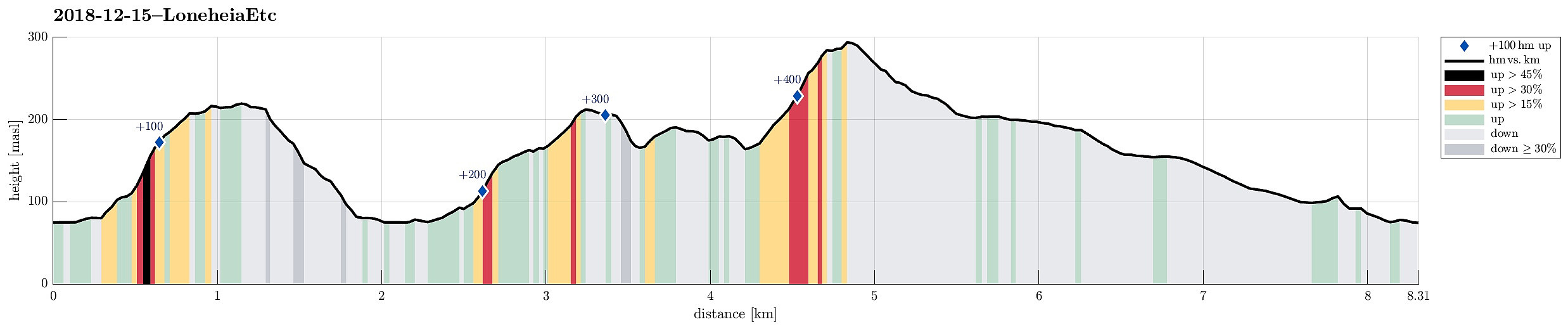
Loneheia, Storoksla, Nesheia, and Vemånen (15.12.2018)

Written by HHauser (Helwig Hauser)

| Start point | Espeland (75m) |
|---|---|
| Endpoint | Espeland (75m) |
| Characteristic | Hillwalk |
| Duration | 2h 00min |
| Distance | 8.3km |
| Vertical meters | 485m |
| GPS |
|
| Ascents | Loneheia (222m) | 15.12.2018 |
|---|---|---|
| Nesheia (193m) | 15.12.2018 | |
| Storoksla (215m) | 15.12.2018 | |
| Vemånen (297m) | 15.12.2018 | |
| Visits of other PBEs | Espeland fangeleir (130m) | 15.12.2018 |
Trip Summary
We took the car into the direction of Arna along road 580 and parked near Espeland, right next to the main road. Our first goal was to ascend to Loneheia on the northern side of the street.
Lonaheia
We crossed the main road, the stream that runs there (from Haukelandsvatnet), and the railroad to get to Lonaleitet. There, we first followed a narrow and steep street upwards between some houses, before we changed over "into the wild" to ascend relatively directly upwards along the south-going ridge of Lonaheia. This way, we quickly arrived at the "top" of Lonaheia, also enjoying some nice views! On our way back, we followed another ridge (a bit to the east of the main ridge) and connected back to the narrow, steep street between the houses.
Storoksla
Our next goal was Storoksla, on the other, southern side of the main road. We thus headed back and crossed the main road, again, finding our way to street Moldahaugane. After rounding some cliffs, we found the spot near Neskvolven, where one finds a path from the street and upwards to Storoksla. Hiking up the north-facing ridge of Storoksla, we looked out for a good spot for changing over to the other, parallel ridge (also north-facing, but a bit further to the east), since we were interested in reaching the "very top" of Storoksla. A few minutes later, we actually got there.
Nesheia
From Storoksla, we wanted to continue to Nesheia. We thus descended from Storoksla in southern direction and found the path up to Nesheia without problems.
Vemånen
Our original goal had been to descend from Nesheia in northeastern direction (and towards the street Moldamyrane there). But as we descended from Nesheia, we got the impression that time was still enough to also include Vemånen. We thus found a way down to the saddle between Nesheia and Vemånen. From there, we followed a good path (along Ormarinden) upward to Vemånen. Before reaching the actual top of Vemånen, we came by a nice spot (only a few meters lower than the top) from where one can enjoy some really nice views over Haukelandsvatnet.
Conclusion
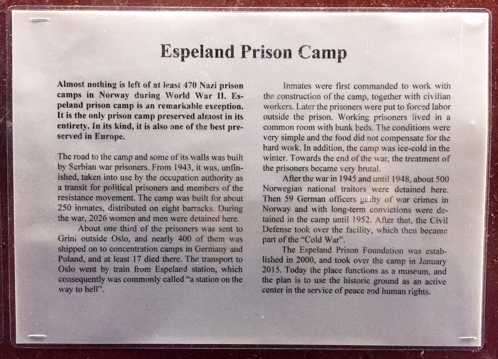
After crossing Vemånen, we descended along the northeastern ridge of it towards street Gullfjellsvegen. Once there, we crossed Skåldalselva and got onto the road Moldamyrane. We then followed this road (in the upper parts a narrow gravel road) "around Skåldalsnipa" in order to get back to Espeland. Walking along Moldamyrane, we also came by the Espeland Prison Camp, which today reminds of many years of very tough imprisonment there. At some other time, when the Camp is actually open for visitors, we should come back and take a closer look at this seemingly significant piece of Bergen history.
Photos
Selected photos are available as Google photo album.
Useful Resources
See also the related FB-page Hiking around Bergen, Norway.
On Bergentopp 200 there is a page (in Norwegian) about Loneheia.


User comments