
Høgafjellet from Osvatnet (11.10.2018)

Written by hbar (Harald Barsnes)

| Start point | Osvatnet parkering (77m) |
|---|---|
| Endpoint | Osvatnet parkering (77m) |
| Characteristic | Hillwalk |
| Duration | 7h 30min |
| Distance | 16.9km |
| Vertical meters | 1,236m |
| GPS |
|
| Ascents | Høgafjellet (868m) | 11.10.2018 |
|---|---|---|
| Visits of other PBEs | Høgafjeldshytta (734m) | 11.10.2018 |
| Osvatnet p-plass (75m) | 11.10.2018 | |
| Øvrebotnen foss (440m) | 11.10.2018 |
Høgafjellet from Osvatnet
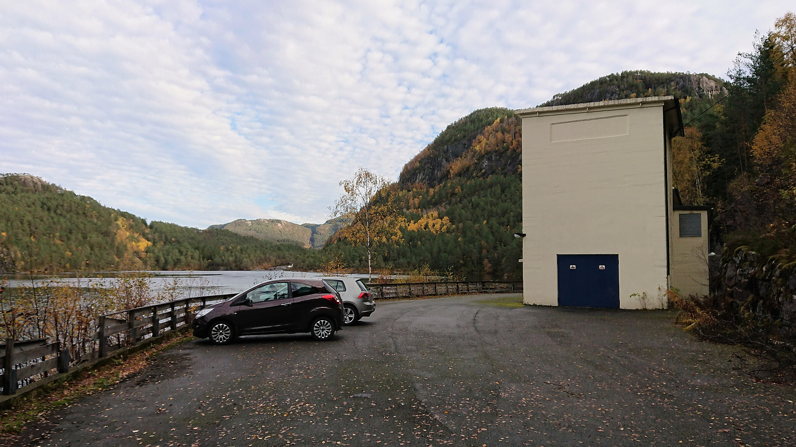
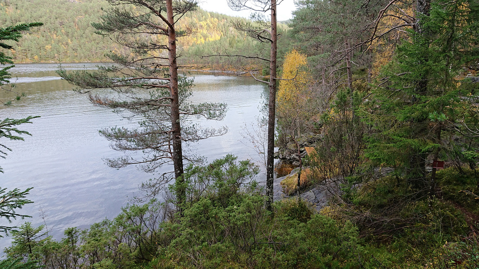
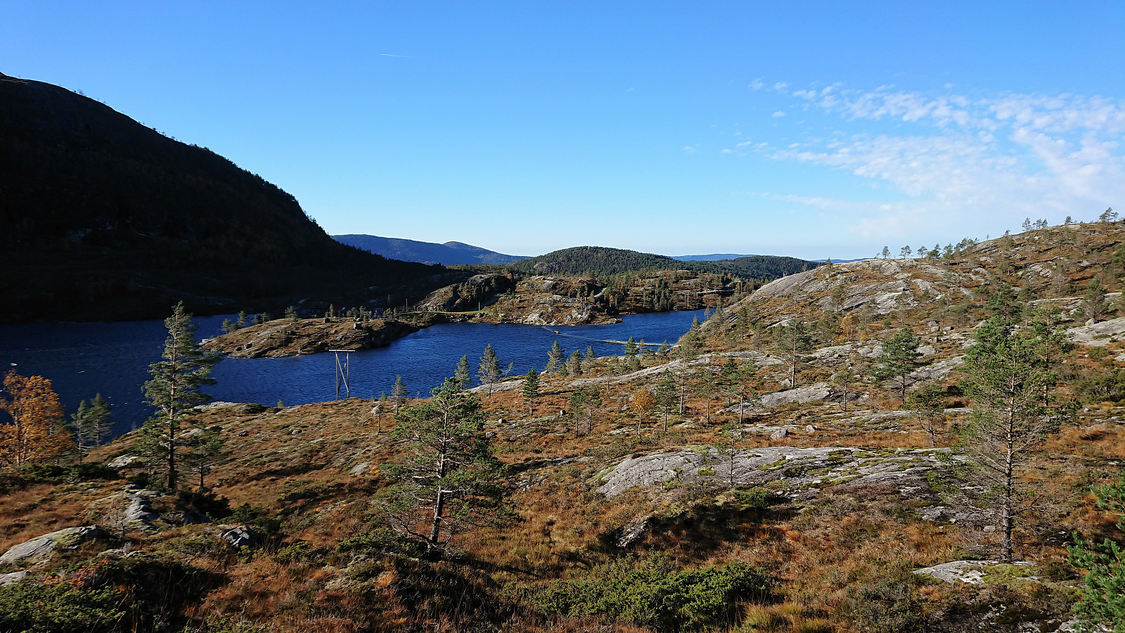
On what would turn out as the warmest October day in Bergen history, me and a colleague of mine started out early in the direction of Osterøy and Høgafjellet. The parking lot at Osvatnet was easily located and so was the marked trailhead starting with a steep staircase directly behind the parking lot. Next, the trail crossed under the pipe, and the old steep discontinued stairs, coming down from Nedre Botnavatnet.
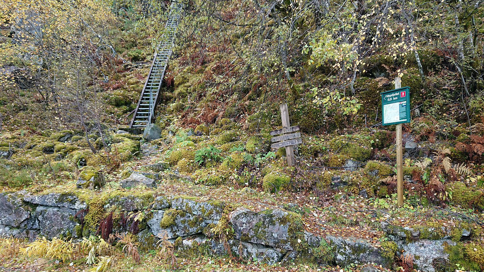
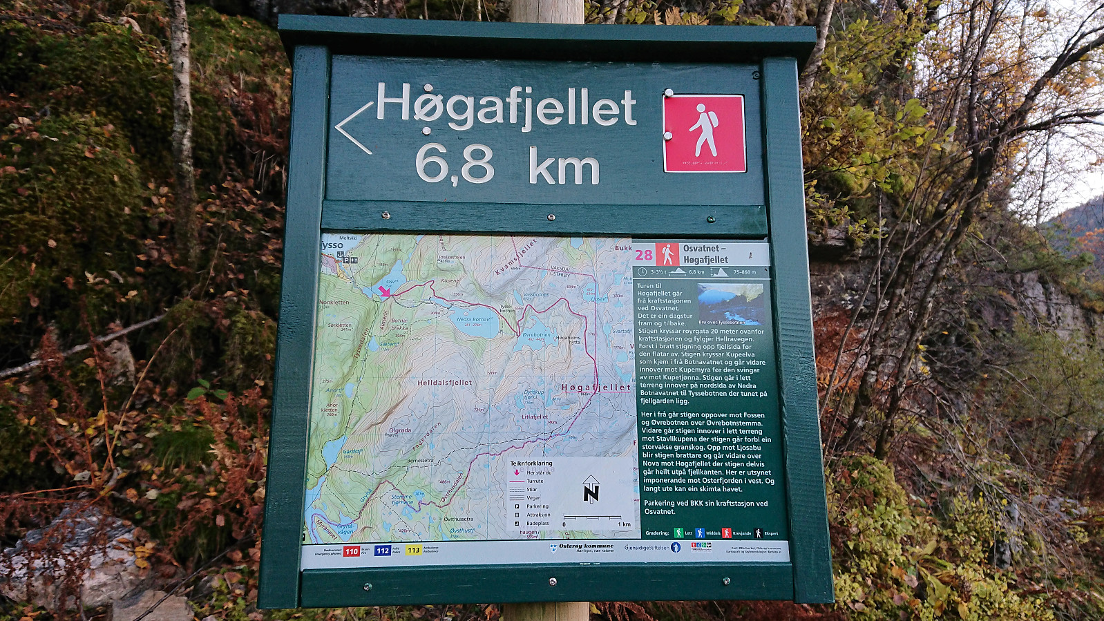
Shortly after, a second steep staircase headed up to the right, while the marked trail continued toward Kupelva. We decided to follow the red plastic markers, assuming these indicated the recommended route. This however turned out to be a mistake, and after almost reaching the river we ended up turning back and returning to the stairs. Apparently we were not the first hikers to make this mistake (https://peakbook.org/tour/192269/Kvamsfjellet+Osterøy.html), so perhaps a sign ought to be put up at this crossroads?
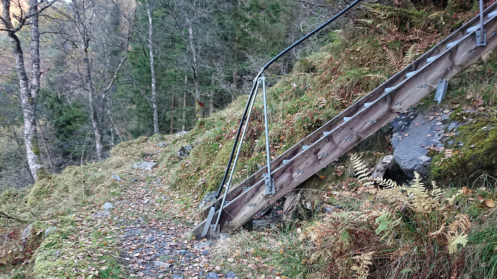
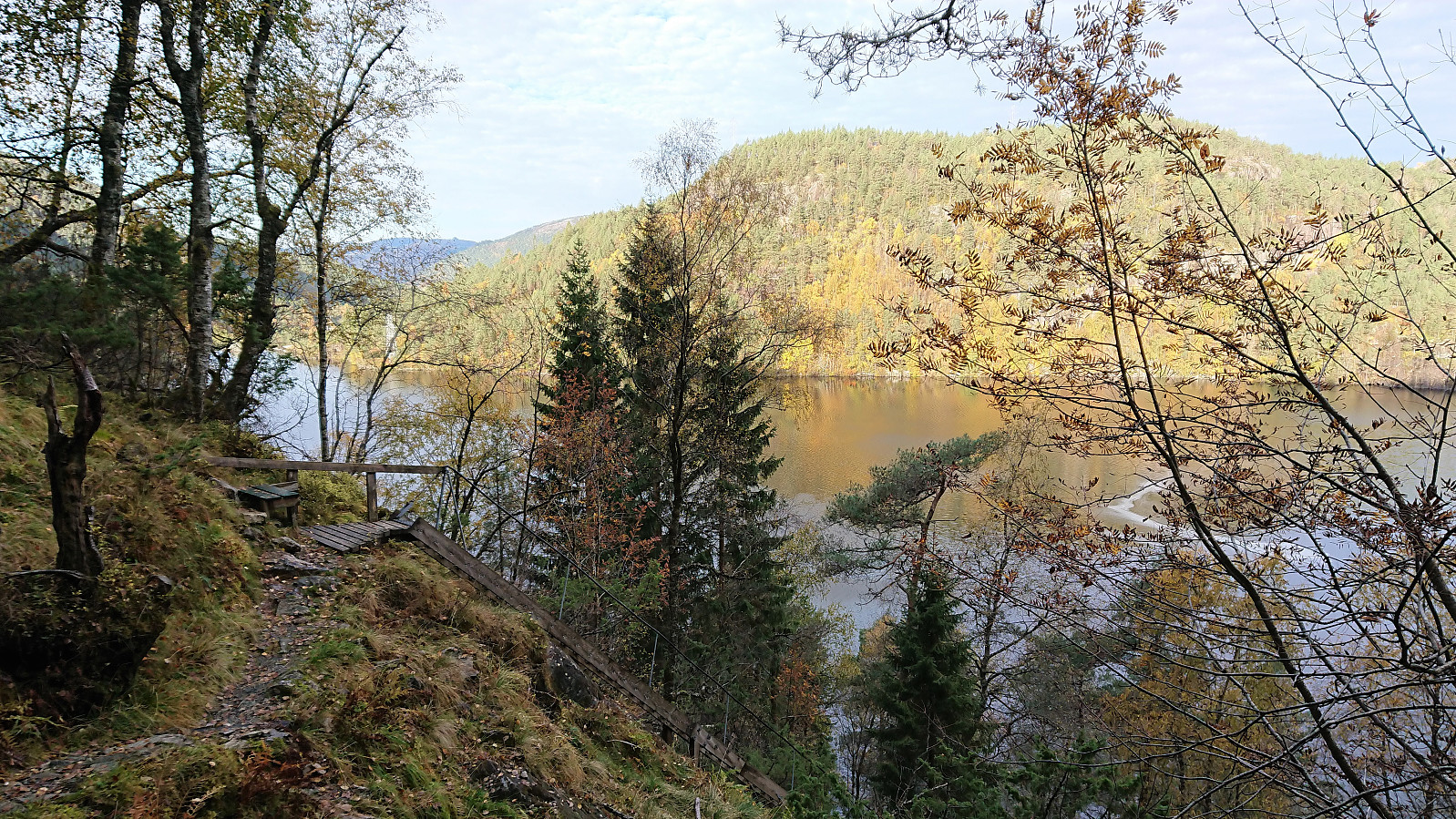
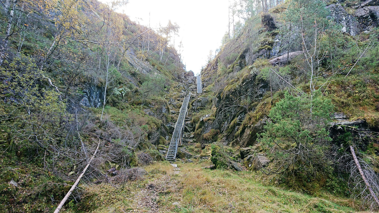
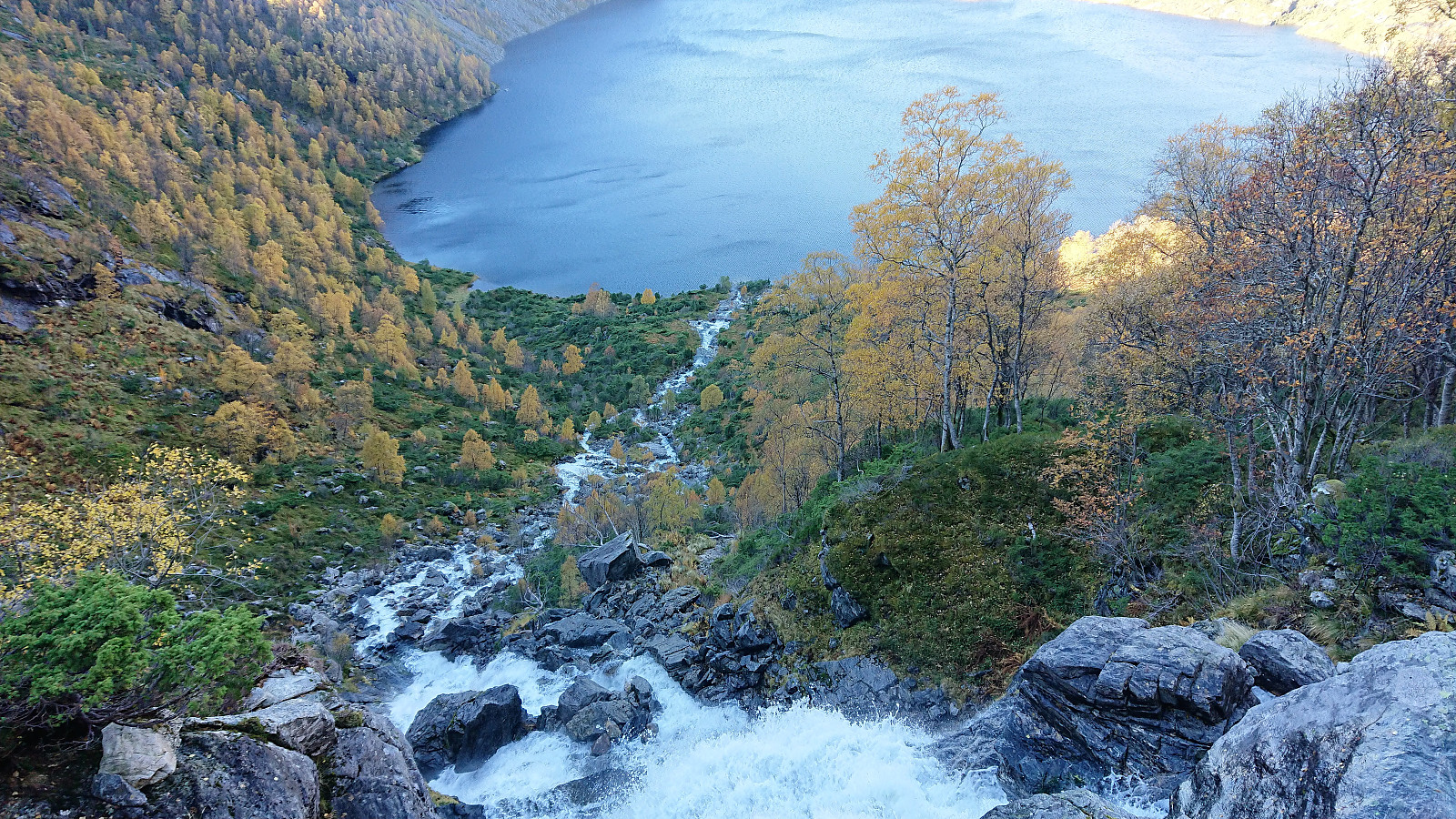
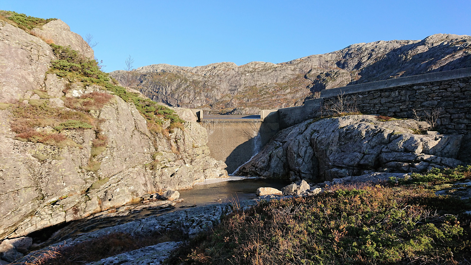
From there on the trail was straightforward to follow, with several additional staircases bringing us up to Nedre Botnavatnet. There was plenty of water in Nedre Botnavatnet, so much that the path/bridge separating Nedre Botnavatnet and Kupetjønna was partly under water. But we were now mainly focusing on the path up to Øvrebotnen and particularly on how we were going to cross the waterfall we could see in the distance.
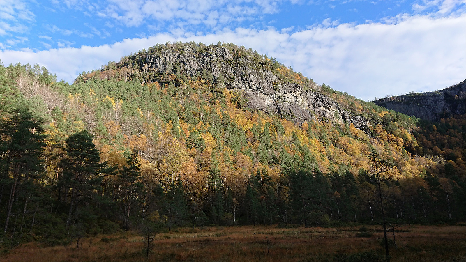
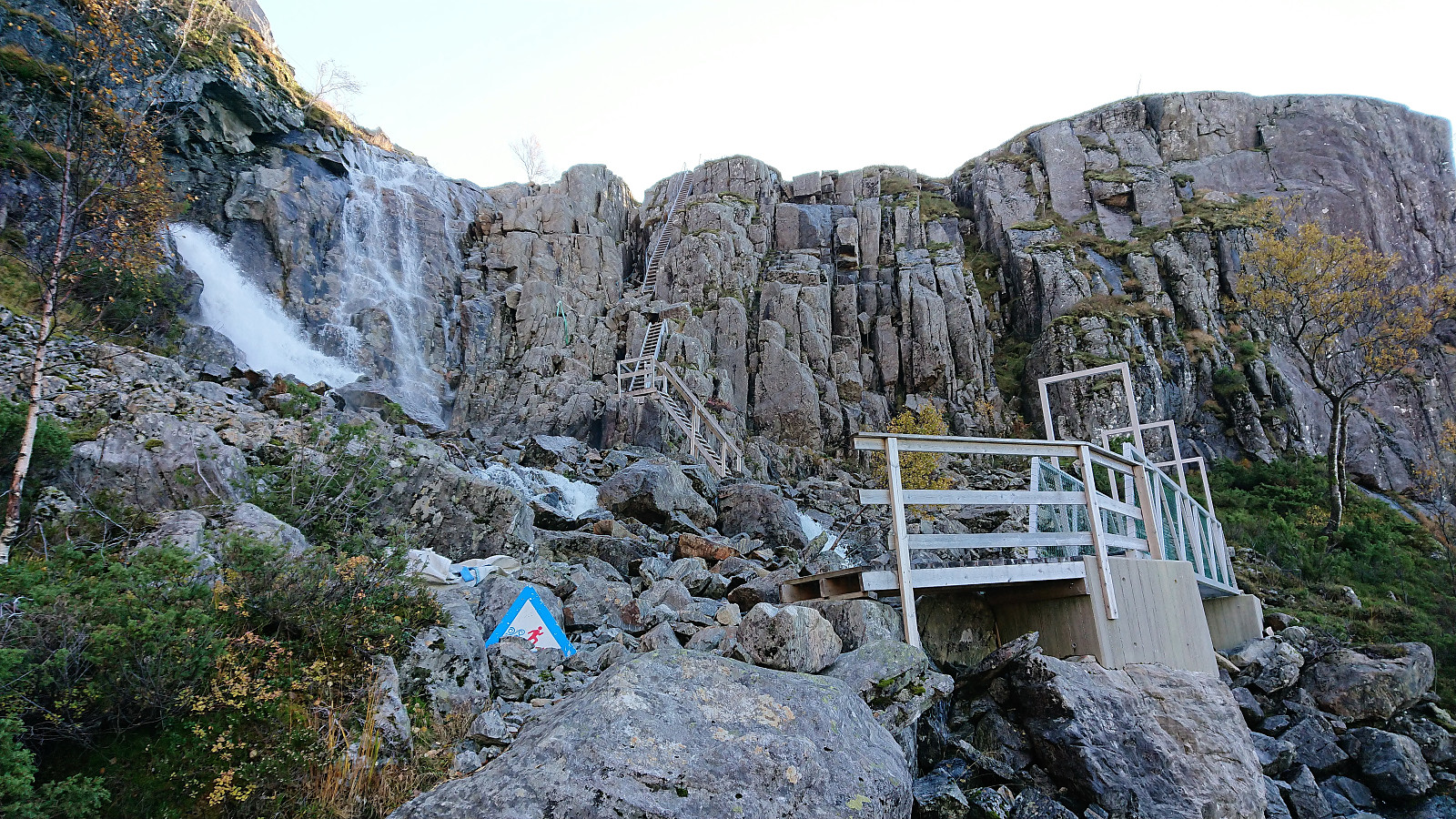
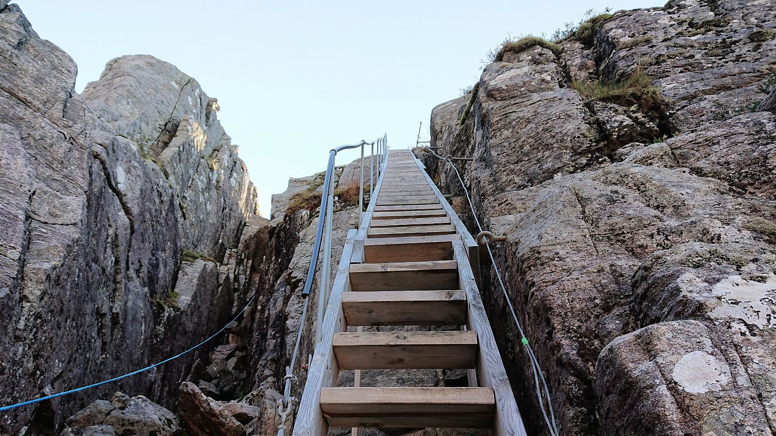
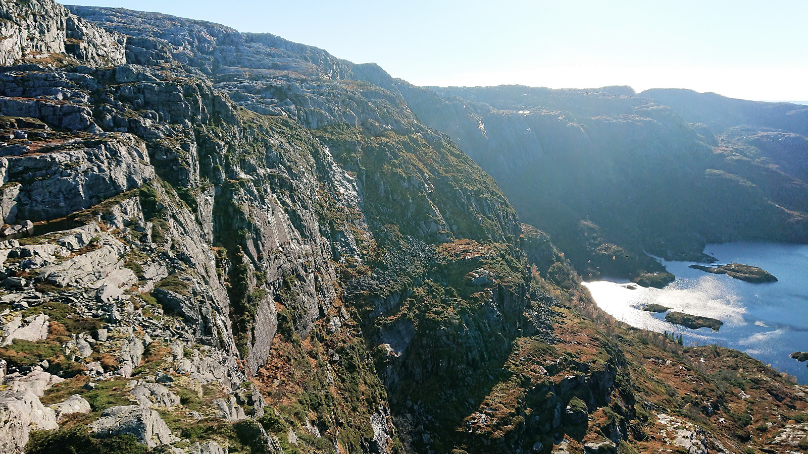
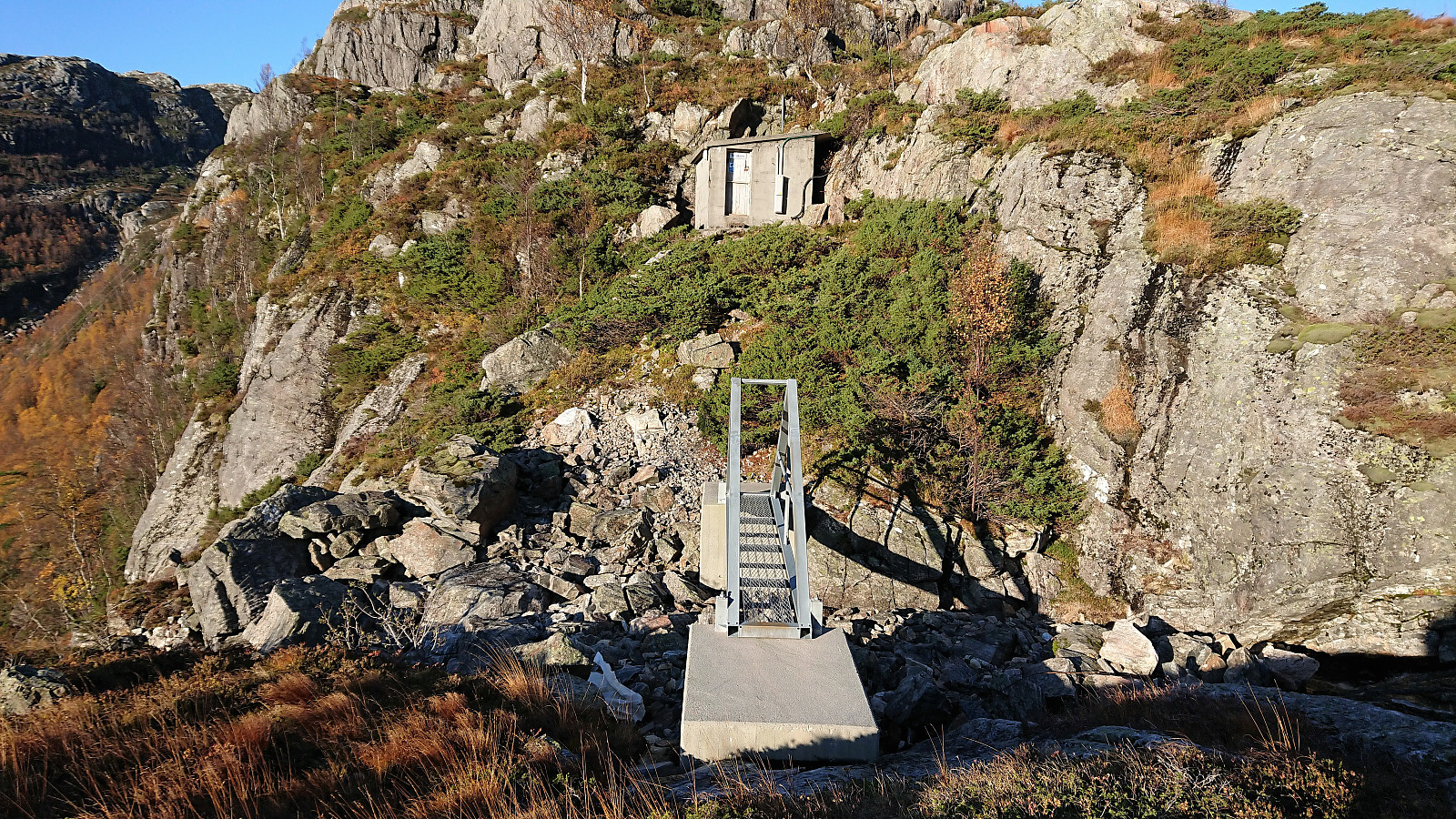
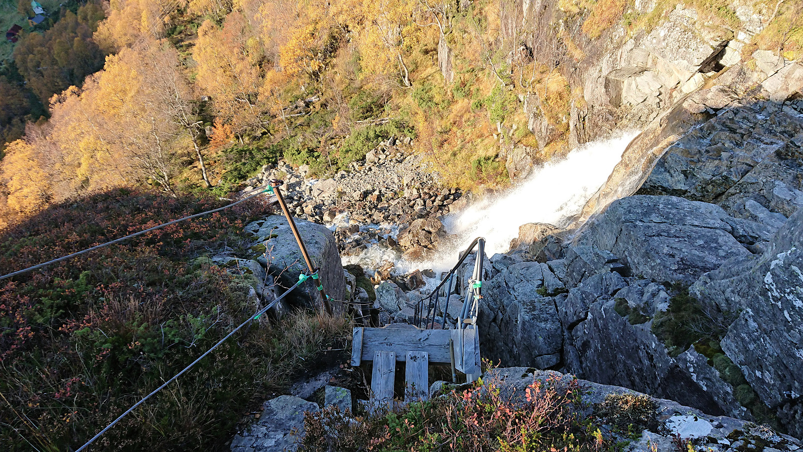
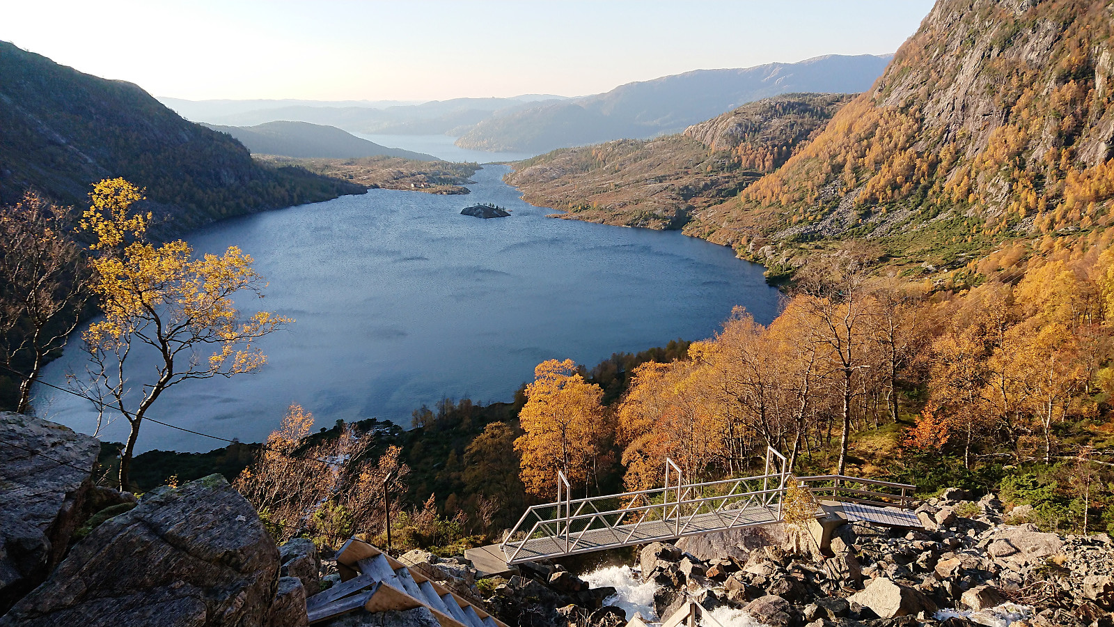
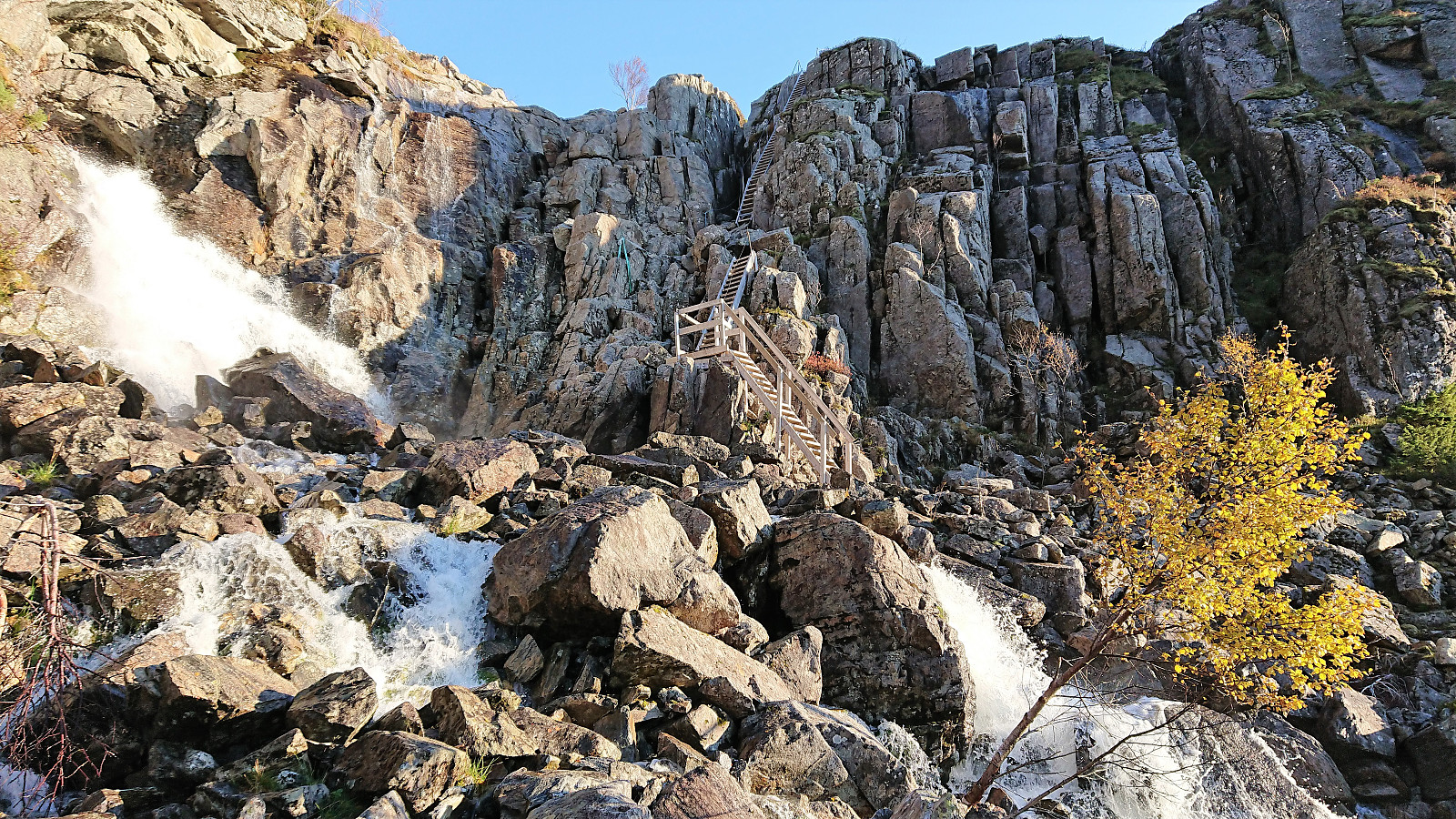
After passing by the farm houses at Tyssebotnen we started the final ascent towards the waterfall, soon arriving at a fairly new metal bridge taking us safely to the other side, followed by some very steep stairs (or perhaps ladder is more correct when stairs are this steep?) taking us up to Øvrebotnen. Here we crossed another small bridge back across the river below the dam as there was too much water coming over the top of the dam to safely cross there.
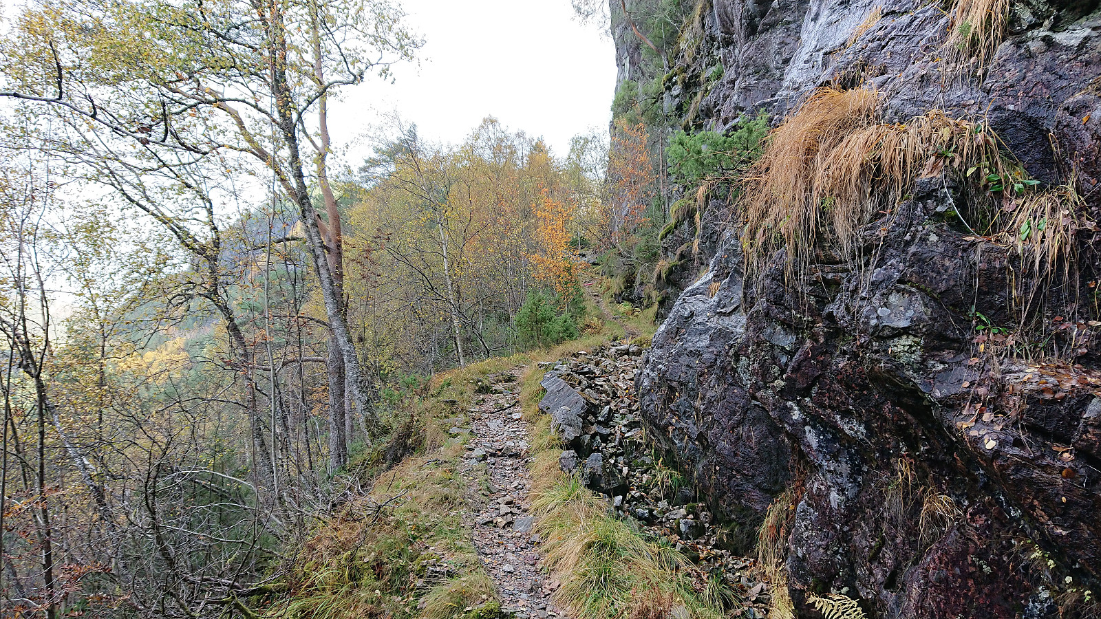
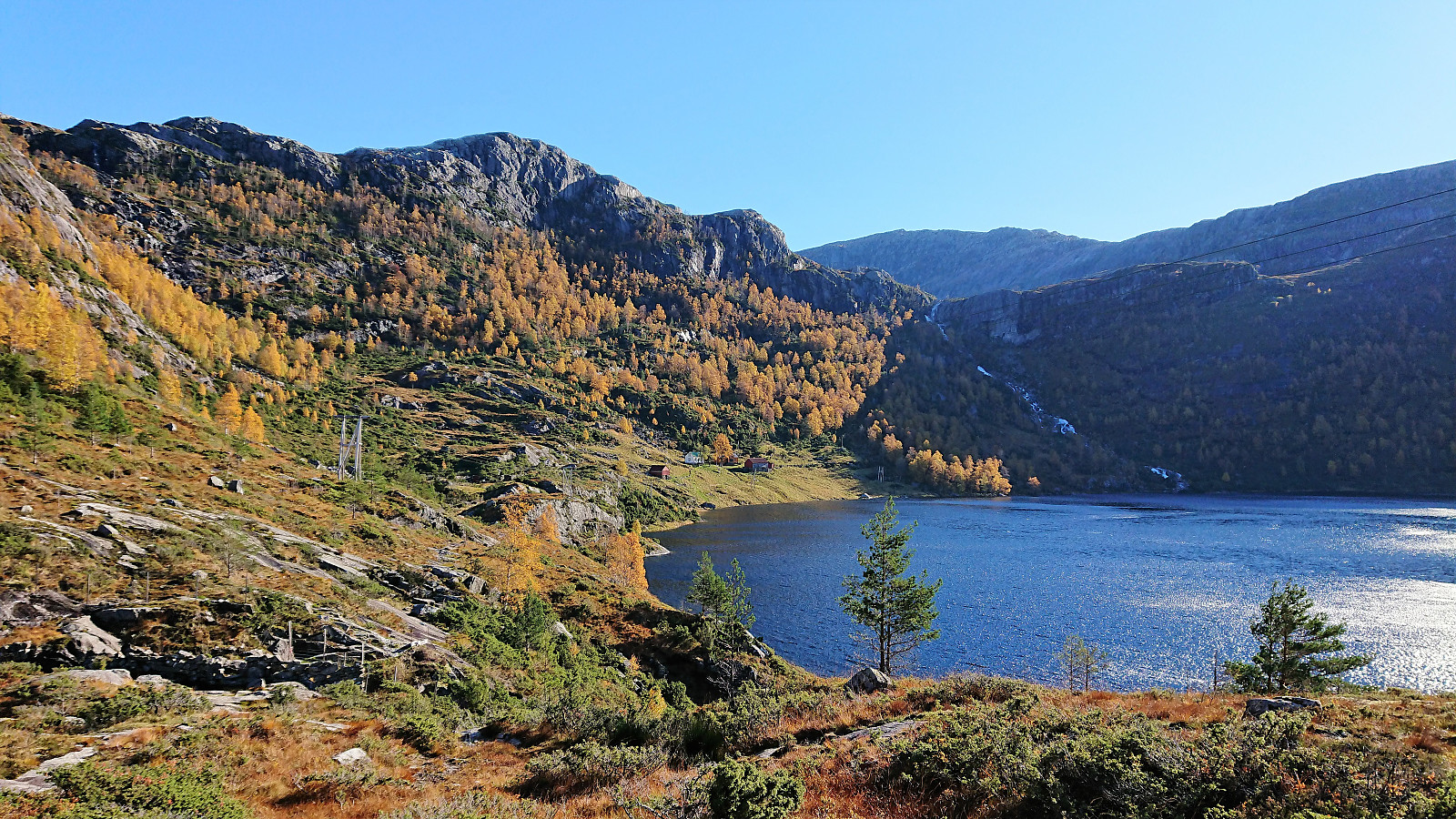
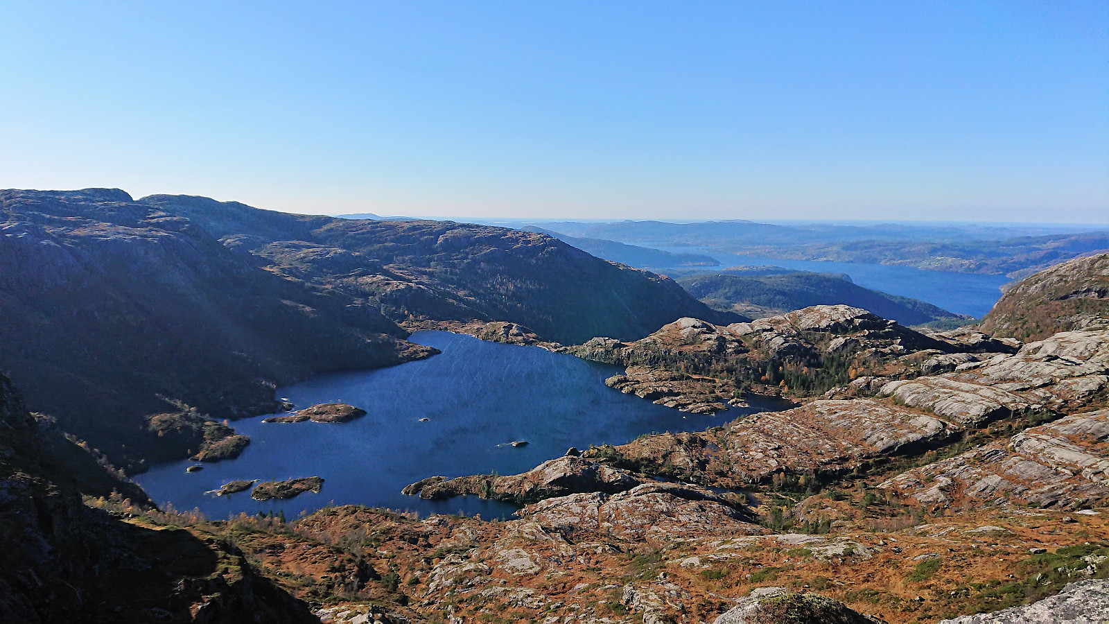
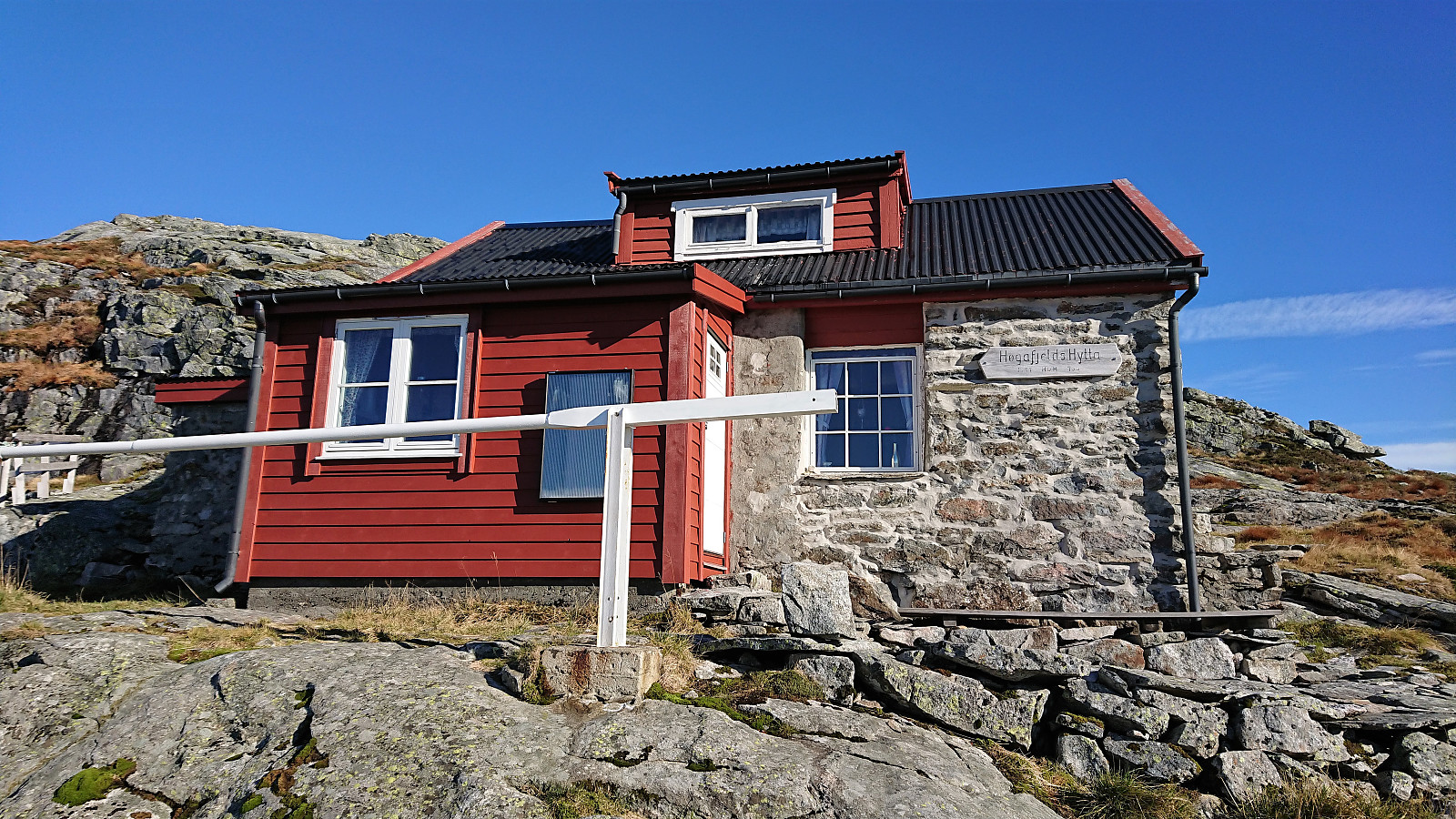
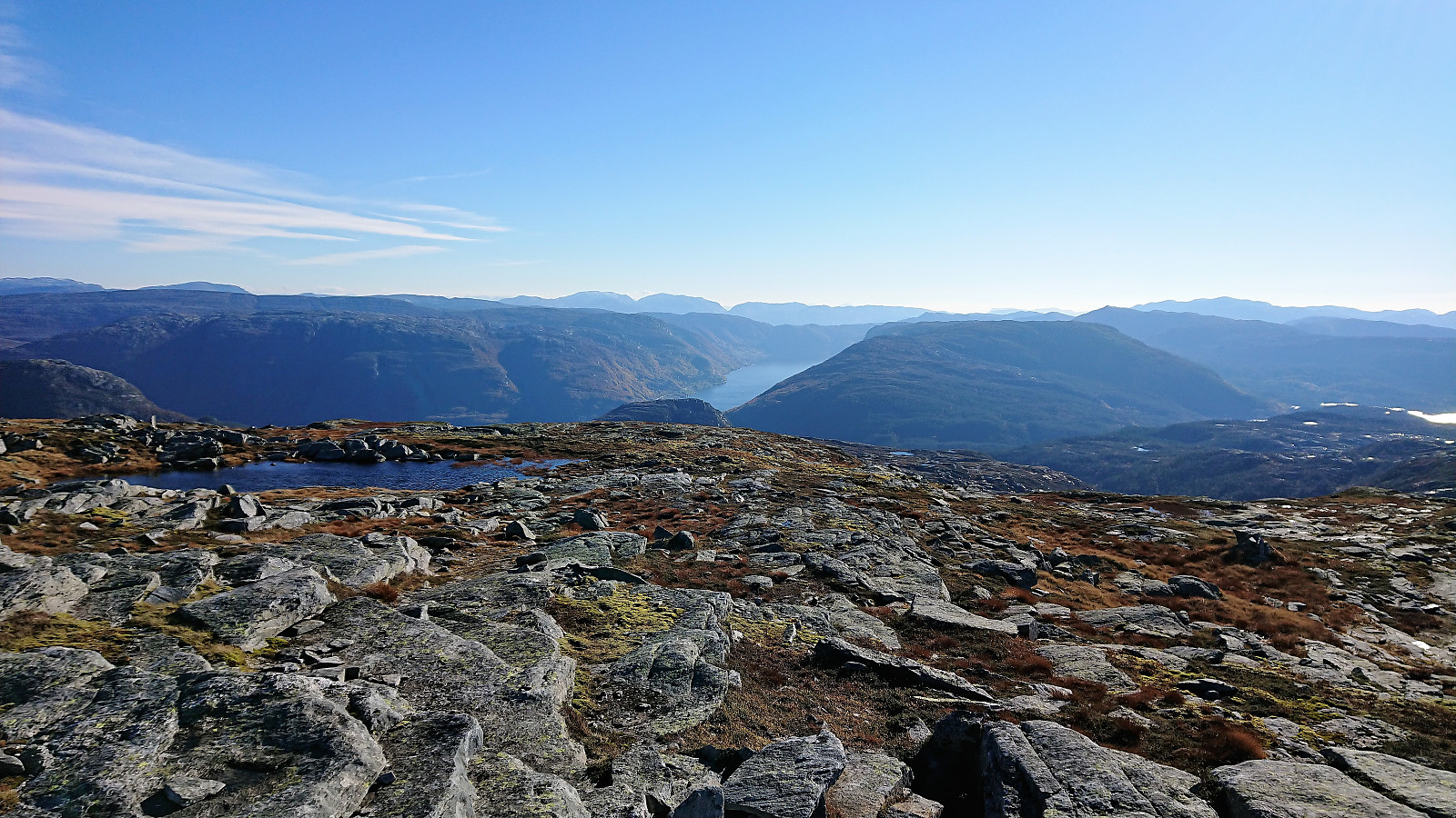
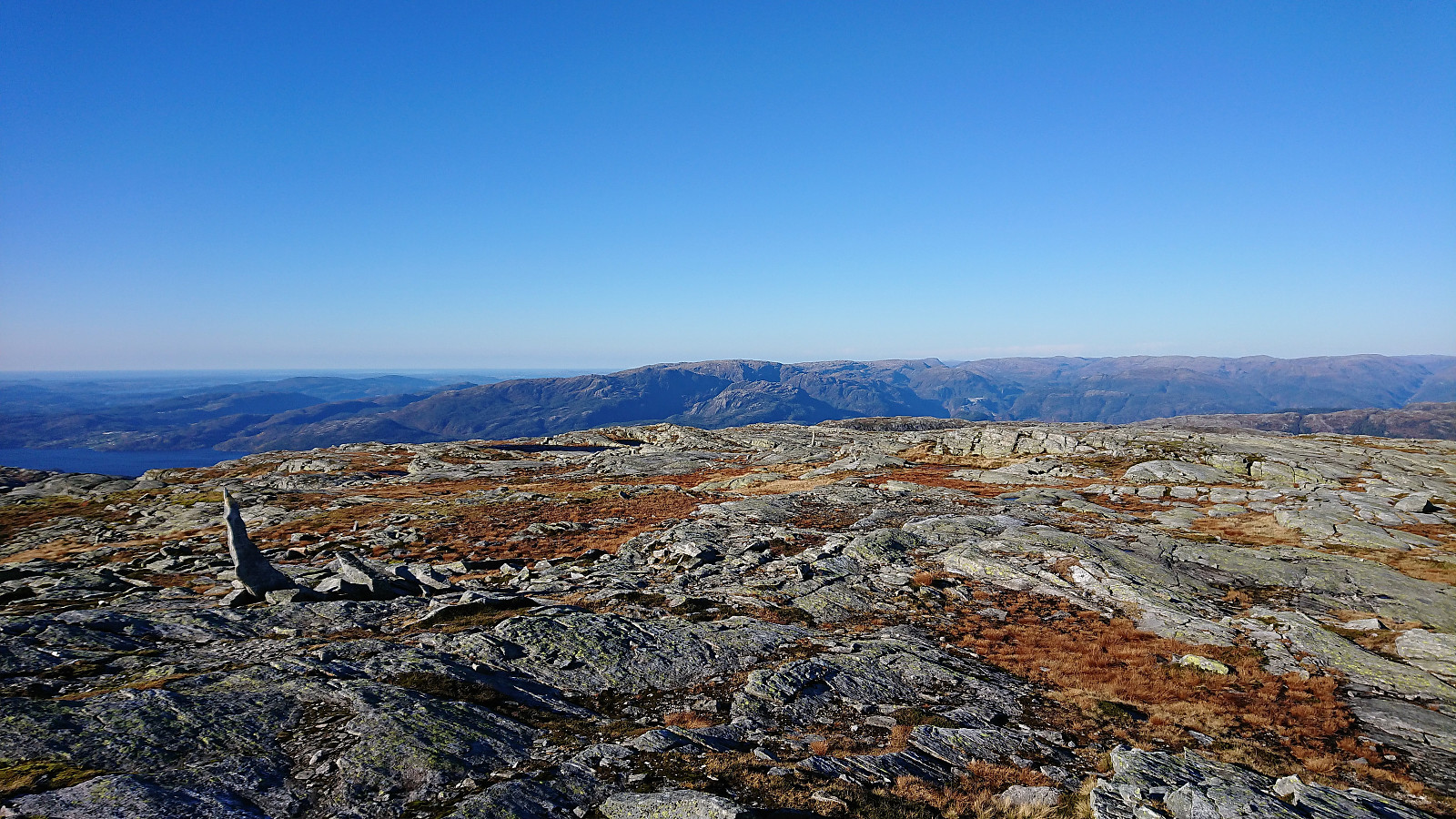
Next we followed the trail around Øvrebotnen, which required some light climbing supported by conveniently positioned ropes. The climbing was more horizontal than vertical though, and the ropes were mainly there for extra safety. Upon reaching the ridge above Øvrebotnen, we turned south towards the summit, passing by the nice Høgafjeldshytta on the way, and also making a minor unnecessary detour toward the edge of the cliff on the way.
The wind had been quite strong for most of the day but now picked up even more as we approached the summit (but thankfully combined with the unusually warm October day with 15-20 degrees). Upon reaching the summit we therefore did not stay long to enjoy the excellent views before starting our descent and the search for a place out of the wind where we could have lunch. We ended up just north of Høgafjeldshytta, where we also had a closer look at the alternative steep descent indicated by elbow (Vegard Magnussen) in his report (https://peakbook.org/tour/59907/Flott+dag+på+Høgafjellet.html). But after the break we decided to go with the safe option and follow the same route as on the ascent.
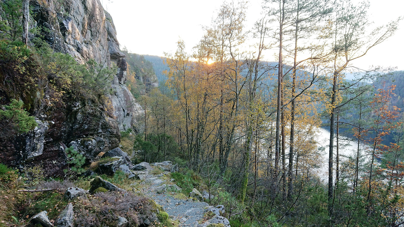
Not much to report from the descent. The most interesting part being the climb down the steep stairs below Øvrebotnen. Clearly not ideally for those afraid of heights! Which may seem to include my GPS, as it stopped tracking just above the steep stairs... But we followed more or less exactly the same route as on the ascent, and hence the trip duration, length and the number of vertical meters have all been adjusted accordingly. In the end we made it back to the parking lot just as the sun was starting to set.
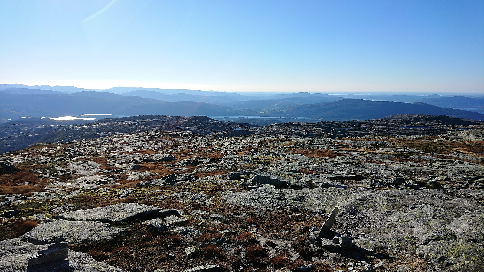
In summary, a spectacular hike that can be very highly recommended! The steep stairs will not be to everyone's liking though, so be sure to check this before bringing other hikers, as there are no alternative routes for this particular area. Probably also very much recommended to do this hike in good weather, as the navigation could otherwise become challenging, especially along the ridge towards the summit.


| Start date | 11.10.2018 10:43 (UTC+01:00 DST) |
| End date | 11.10.2018 16:44 (UTC+01:00 DST) |
| Total Time | 6h 00min |
| Moving Time | 5h 34min |
| Stopped Time | 0h 25min |
| Overall Average | 2.3km/h |
| Moving Average | 2.4km/h |
| Distance | 13.6km |
| Vertical meters | 1,186m |
Note: The GPS stopped tracking at Øvrebotnen on the descent. Distance and total time have therefore been extended to also include the rest of the hike.


User comments