
Loddo and Skaftafjellet (06.10.2018)

Geschrieben von HHauser (Helwig Hauser)

| Startpunkt | Loddo parking (40m) |
|---|---|
| Endpunkt | Loddo parking (40m) |
| Tourcharakter | Bergtour |
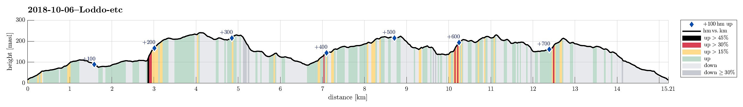
| Tourlänge | 4h 30min |
| Entfernung | 15,2km |
| Höhenmeter | 773m |
| GPS |
|
| Besteigungen | Loddo (243m) | 06.10.2018 |
|---|---|---|
| Skaftefjellet (232m) | 06.10.2018 | |
| Vardfjellet (226m) | 06.10.2018 | |
| Besuche anderer PBE | Loddo parkering (20m) | 06.10.2018 |
Note that the part from Vardfjellet to Skaftefjellet was without trail and partly challenging.
Trip Summary
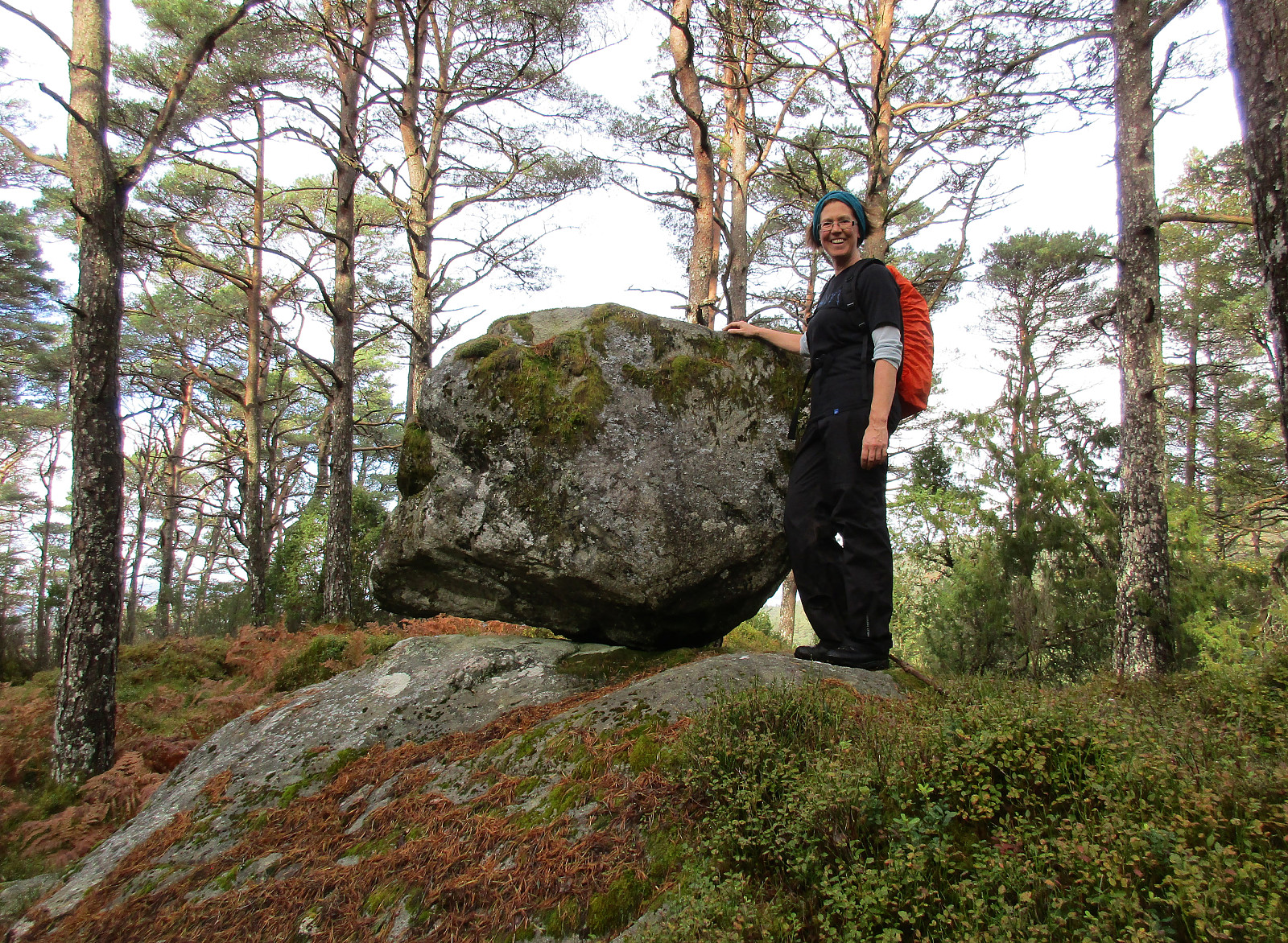
We took the ferry from Krokeide to Hufthammar and drove than along Huftarøy (road 154). Right next to Åkyllaren, there is a well-marked parking place for those, who wish to hike up to Loddo. We followed the main track (in southeastern direction) until we found a sign leading us on a separate track, heading north. Later, it turned out that we had left the main track too early and thus were a little bit too far west (as compared to the "red" track up to Loddo). Near Hestatjørna, we also managed to misinterpret another sign, which would have lead us back to the "red" track and up to Loddo. Instead, we followed the path further north, wondering more and more, where we had ended up! :-) After a while, we found another sign, which promised us a connection to the "blue" track. Since we thought that taking another path up to Loddo would be equally fine, we followed this path, leading us even further north of Loddo. Having followed this path for a while, we came to a point, where nothing was clear anymore (no path further, etc.) and so we decided to improvise. We headed eastwards, first on a side-path, then without a path. Coming close to the northern ridge of Loddo (Hundastegen), we had to traverse a somewhat steep part of the forest, before we found the "blue" track on top of the ridge. Following this one, it was then straight-forward to reach the top of Loddo. On Loddo, a wooden platform is helpful to assume a position that is above the trees and thus providing views in all directions -- nice! :-) From Loddo, we then followed the "white" path (in southern direction), getting back into the valley, which we had started our hike in. But instead of going back to the car, we intended to include another small top on Huftarøy, Skaftafjellet. Very close to the point, where the "red" track to Loddo leaves (in northern direction), we found the well-marked track towards Veten (in southern direction). We followed the well-marked trail (red markers) through the forest and enjoyed the hike very much! :-) At Vardfjellet, we decided to leave the marked trail (which continued in northern direction there) and instead cross over Vardfjellet (seeing some occasional orange dots on a few trees). Descending from Vardfjellet, we got close to Husavikvatnet and enjoyed some nice views there. Soon no orange dots were to be seen anymore and we got the impression that getting to Skaftafjellet would mean to cross through the forest, following an inner map. We stepped around Husavikvatnet (relatively easily) and got down into the valley in which the stream from Husavikvatnet runs southwards. Crossing this valley turned out to be a wet affair, but after exploring the area for a short while, we found a spot, where getting over was possible. On the other side, we first followed the valley in southern direction. After a while, we lost our hope that a path would be found, leading to Skaftafjellet, and so we decided to improvise again. Ascending (steeply) to a small top southeast of Skaftafjellet, we regained some height. Once we were "on top", again, proceeding was again easy, even without a path. We followed the heights and connected to Skaftafjellet. Before actually getting to the "top" of Skaftafjellet, however, we had to cross two rather steep sections (both running north-south, while we were hiking east-west). With a bit of improvisation, though, we soon made it to Skaftafjellet. Once on Skaftafjellet, we reconnected with the red-marked trail. Instead of continuing to Veten, as we had originally thought, we turned back and followed the red-marked trail all the way back. Once we were back to our car, we had hiked (mostly on nice paths!) for 4.5 hours. Given that no top of Austevoll is very high, this trip was still a good one with nice impressions.
Photos
Selected photos are available as Google photo album.
Useful Resources
See also the related FB-page Hiking around Bergen, Norway.
Web page WestCoastPeaks.com provides useful information about Loddo.
Web page UT.no from the Norwegian Trekking Association recommends a hike up Loddo from the same parking place.


Benutzerkommentare