
Løvstakken from Fjøsanger (26.12.2017)

Written by HHauser (Helwig Hauser)

| Start point | Fjøsanger (5m) |
|---|---|
| Endpoint | Fjøsanger (5m) |
| Characteristic | Hillwalk |
| Duration | 2h 30min |
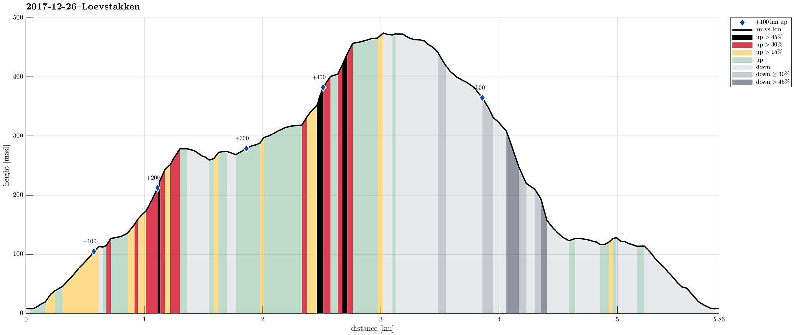
| Distance | 5.9km |
| Vertical meters | 520m |
| GPS |
|
| Ascents | Løvstakken (478m) | 26.12.2017 |
|---|---|---|
| Mindebakkentoppen (283m) | 26.12.2017 | |
| Visits of other PBEs | Olavsbu (125m) | 26.12.2017 |
Trip Summary
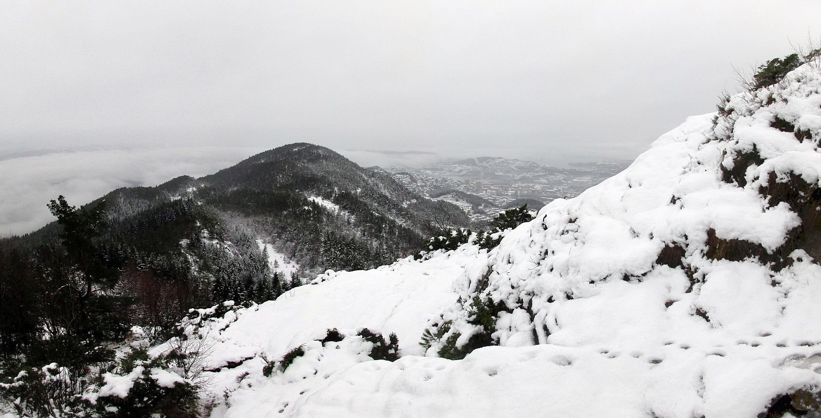
We parked near the supermarket at Fjøsanger and walked first a bit up towards the farm Fjøsanger. Before getting there, we connected to a gravel path that runs mostly parallel to the mountain and walked along this one until the forest starts to open up on the left side. At the very edge of the forest, another path then continues steeply upwards and we used this to get "to the next level" (the still relatively new path which maybe later will be connected with the new Løvstien all around Løvstakken's eastern side). We then walked this path to its current end (there is a little hut for having a break). From there, we then continued through the forest, again, getting up to Mindebakken (a little hill, northeast of Gullsteinen). Since Mindebakken is comparably steep on its western side, we surrounded these cliffs in their south, getting over to the eastern side of Langatjørna. From there, it was basically one of the standard routes up to Løvstakken (just heading north until one gets up to the top of Løvstakken). On our way down from Løvstakken, we again tried out a new route: It first follows the way we had taken up, now in southern direction. Before actually getting to this little hill, almost on the same height as Løvstakken itself, the path leaves towards the left, in eastern direction. It leads down into a little valley on the southeastern side of Løstakken, leading further down (mostly towards south then). The path then gets out of the little valley and turns around the mountain until it heads (almost parallel to the mountain) into northeastern direction. Although we first had thought to continuing further into southern direction (more directly back towards Fjøsanger), we couldn't see the path, given all the snow, and so preferred to follow the visible path (in northeastern direction) instead. After a comparably significant stretch into this direction, we got down into another small valley, which we then followed further down (again mostly in southern direction). The path there was barely visible, but with a little sense of orientation, it was well possible to get down through the relatively steep forest there. We then connected further south passing just above the houses along Grønnestølslien (coming by Kopesteinen), before we were back on the gravel road (the higher level). From there, we basically went back as we came up in the beginning. Altogether, this was a very wet hike (both the weather and the ground, must due to the just melting snow), but it was nice to try out a new route up this mountain that we have explored so much already! :-)
Photos
Selected photos are available as Google photo album.
Useful Resources
See also the related FB-page Hiking around Bergen, Norway.
Web page WestCoastPeaks.com provides useful information about Løvstakken.
On Bergentopp 200 there is a page (in Norwegian) about Løvstakken.


User comments