
Katlaberget (21.10.2017)

Written by HHauser (Helwig Hauser)

| Start point | Ferstadvegen (32m) |
|---|---|
| Endpoint | Ferstadvegen (32m) |
| Characteristic | Hillwalk |
| Duration | 2h 00min |
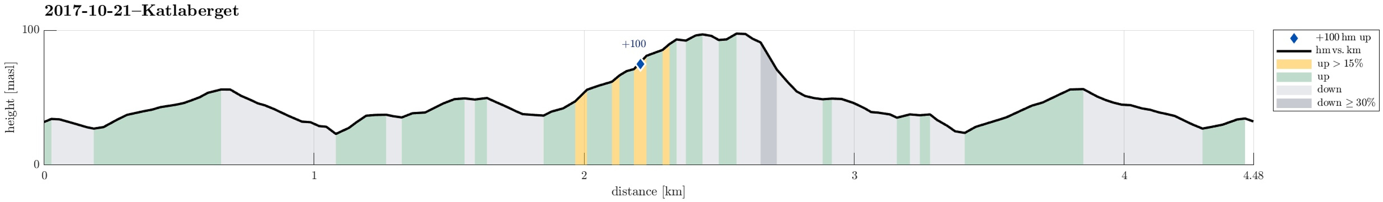
| Distance | 4.5km |
| Vertical meters | 177m |
| GPS |
|
| Ascents | Katlaberget (102m) | 21.10.2017 |
|---|
Trip Summary
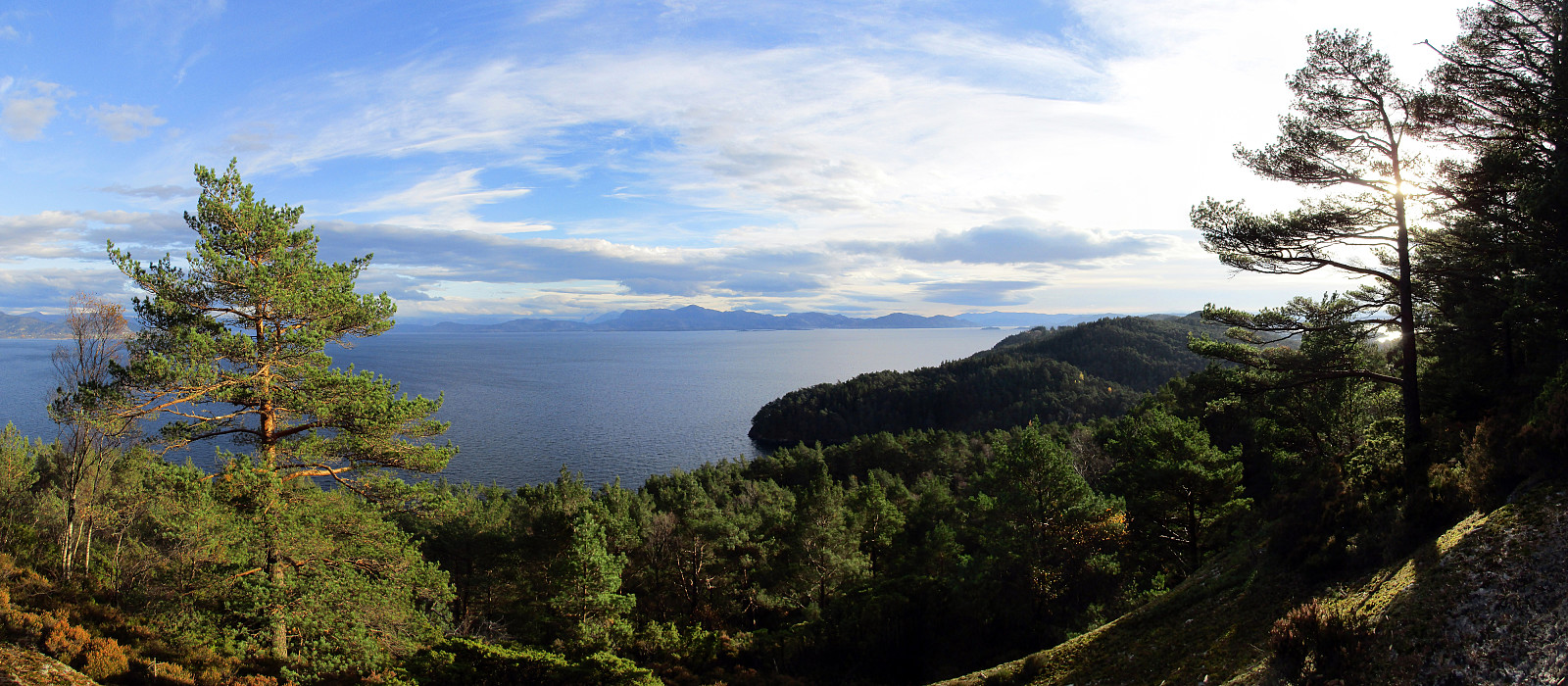
We started this little hike on Ferstadvegen in Os, south of Bergen. First we followed the road, which winds left and right into an overall southeastern direction. After a few turns of the road, one can find the first sign, which invites to leave the road and ascend to Katlaberget on a proper path. After all, this would be the spot, where we later come back to the road after our little round over Katlaberget. To actually make this a round, we first continued on the road even further, now going a bit down towards the sea. About two major turns later, we eventually left the road and followed another path, which also leads to the top of Katlaberget. On Katlaberget, we first enjoyed some views from the actual top, before we then followed "the other" path back. This, actually, brought us to a spot, not far from the top, which offers amazing views over Fusafjorden and beyond. Visiting Katlaberget, one should definitely avoid visiting "only" the top, but make sure that also this spot is included! :-) All in all, this was a short while still very enjoyable hike in nice autumn weather and with great views over Fusafjorden.
Photos
Selected photos are available as Google photo album.
Useful Resources
See also the related FB-page Hiking around Bergen, Norway.


User comments