
Ørnafjellet and Lyderhorn on a lovely autumn day! (18.10.2017)

Geschrieben von HHauser (Helwig Hauser)

| Startpunkt | Gravdalsvatnet (13m) |
|---|---|
| Endpunkt | Gravdalsvatnet (13m) |
| Tourcharakter | Bergtour |
| Tourlänge | 3h 00min |
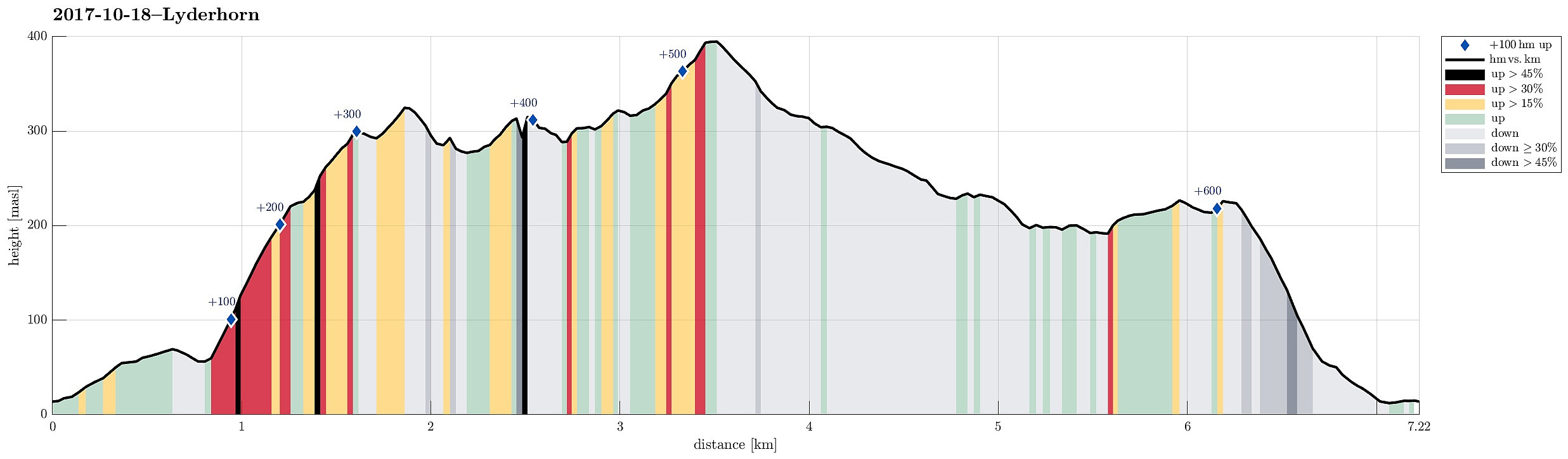
| Entfernung | 7,2km |
| Höhenmeter | 611m |
| GPS |
|
| Besteigungen | Lyderhorn (396m) | 18.10.2017 |
|---|---|---|
| Skjenafjellet (319m) | 18.10.2017 | |
| Ørnafjellet (329m) | 18.10.2017 | |
| Ørnafjellet Nord (304m) | 18.10.2017 |
Trip Summary
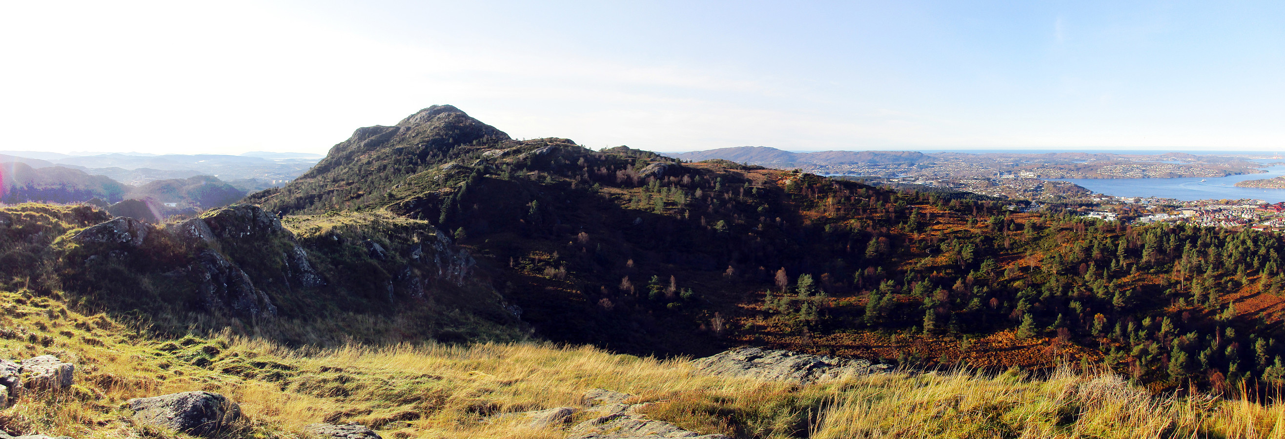
We started at the parking area right next to Gravdalsvatnet and followed first Gravdalsveien upwards in order to find the path that would bring us to Ørnafjellet. After having passed a few new buildings (with an amazing view!), we crossed over some intermediate height to connect to a small place, where a little football field is established. From there, the path upwards to Ørnafjellet starts (in its middle then called "Mørdarbakke"). This path is not used a lot and it is generally wet (and also a bit steep). Quickly, we arrived at the saddle, where we turned left in order to continue to Ørnafjellet. We first crossed over a little hill in front of Ørnafjellet, before we switched over to the northern ridge of Ørnafjellet, ascending to its top along it. Even though Ørnafjellet is not very high (about 330mosl), if offers really nice views in all directions and is recommended as a quick and nice little hike, for example from Gravdal. Since Ørnafjellet has steep cliffs on its western side (crossing them clearly amounts to experimentation, which isn't really recommended in wet conditions and maybe not at all), we went back along the ridge for a short distance, before we then followed the path down and from there then towards Lyderhorn (right underneath the cliffs of Ørnafjellet). Even though one could also go directly to Lyderhorn from Ørnafjellet, we decided to make a small detour to Skjenafjellet first, also because of its nice views from the top of its western cliff (quite respectable cliff also here!). From there, we took a path that lead us more or less directly to Lyderhorn. Once we connected to the "main path" to Lyderhorn (from Kvarven), we also found ourselves among others, who enjoyed this beautiful day, as well. After taking a very short break on the top of Lyderhorn, we then returned along this "main path" and followed it until we came to the dam of Skåleviksvatnet. There, we took the stairs up and continued for a short stretch towards the paved road, which leads up on Kvarven. But instead of getting onto the road, we turned right just before the paved road and instead continued along the ridge, closing our short round on Lyderhorn and getting back to the saddle next to Ørnafjellet from where we descended (more or less) along the same path that we had taken up first. All in all, this was a marvelous autumn hike in perfect weather with lovely views. Nice! :-)
Photos
Selected photos are available as Google photo album.
Useful Resources
See also the related FB-page Hiking around Bergen, Norway.
Petter Bjørstad has a useful page about Lyderhorn and also web page WestCoastPeaks.com provides useful information about Lyderhorn and Ørnafjellet.
Web page SpillBy.com describes Ørnafjellet and
web page FotTurer.com describes a tour up Ørnafjellet.


Benutzerkommentare