
Løvstakken and Strandafjellet (05.06.2017)

Geschrieben von HHauser (Helwig Hauser)

| Startpunkt | Krohnegården parking (160m) |
|---|---|
| Endpunkt | Krohnegården parking (160m) |
| Tourcharakter | Bergtour |
| Tourlänge | 2h 00min |
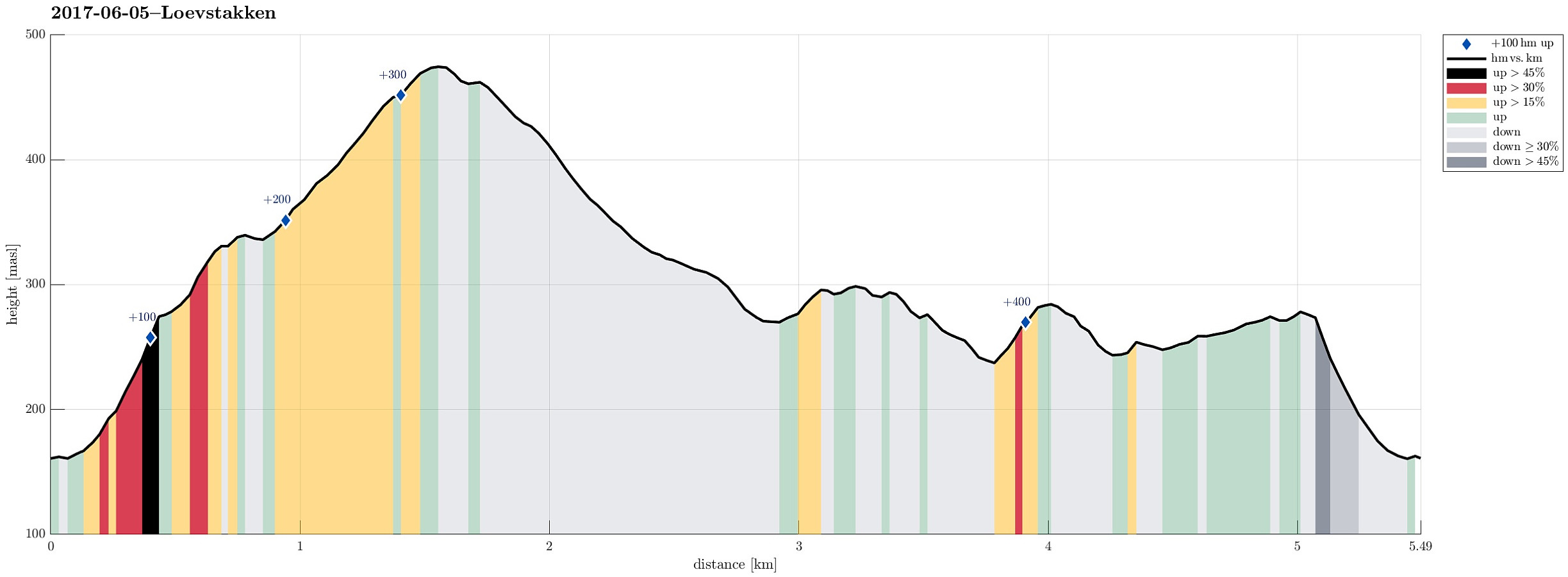
| Entfernung | 5,5km |
| Höhenmeter | 465m |
| GPS |
|
| Besteigungen | Liafjellet nord for Løvstakken (286m) | 05.06.2017 |
|---|---|---|
| Løvstakken (478m) | 05.06.2017 | |
| Strandafjellet (300m) | 05.06.2017 | |
| Besuche anderer PBE | Fjellheim (tuft), Løvstakken (286m) | 05.06.2017 |
| Gyldenprishytten (ruin) (249m) | 05.06.2017 | |
| Kveldsol (tuft), Løvstakken (251m) | 05.06.2017 | |
| Krohnegården p-plass (160m) | 05.06.2017 | |
| Strandafjellet søyle (294m) | 05.06.2017 |
Trip Summary
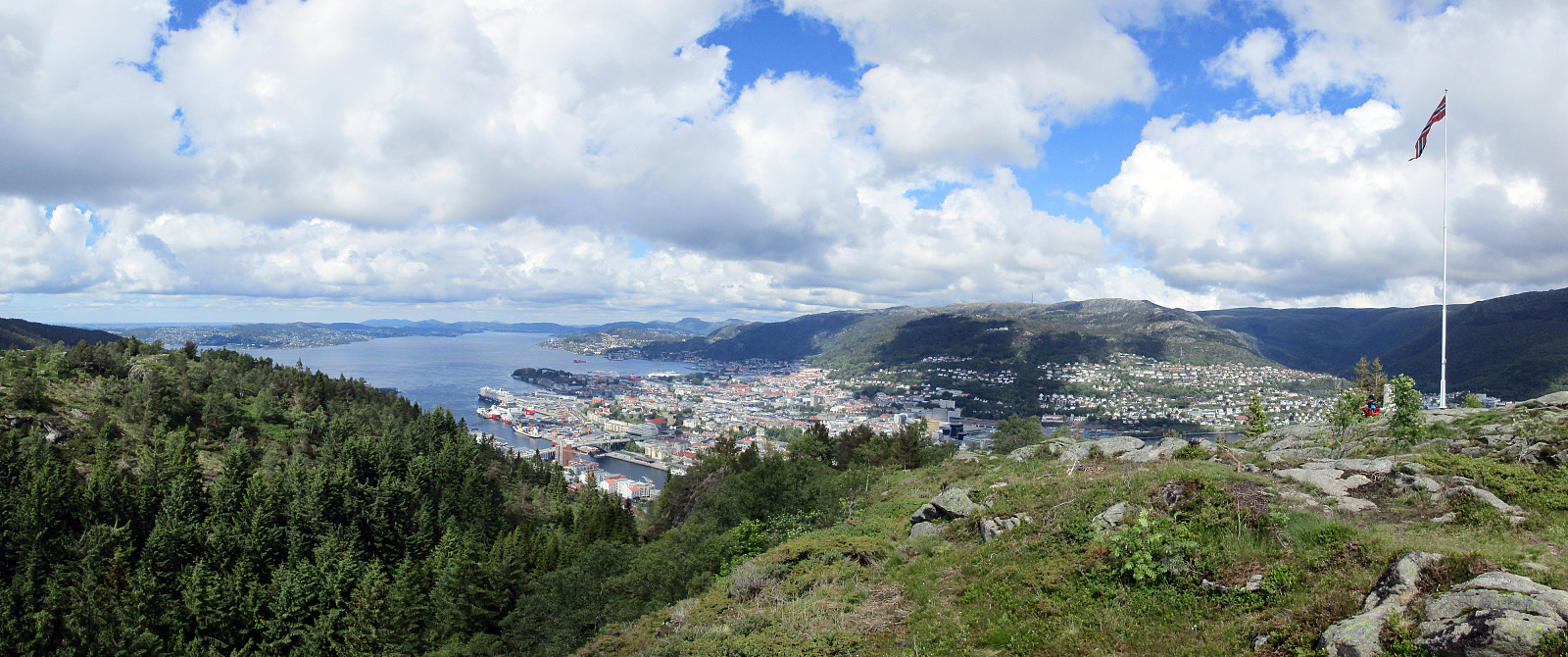
We parked right above Litlavatet up in Fyllingsdalen and started our (usual) ascent to Løvstakken (first towards Ragnefjellet, passing by the little water fall appropriately called Fossen). Once on the heights, we followed the usual route towards Løvstakken (first eastwards, then in southern direction along the ridge). Soon thereafter we arrived at Løvstakken (quite some others there, too). From the top of Løvstakken, we followed the trail downwards (mostly in northern direction), which leads directly to Strandafjellet. Instead of following the main trail further downwards in the direction of Bergen, we did the short ascent to Strandafjellet and enjoyed some nice views there. We then took the same path again down, before then walking around Strandafjellet on its southern side, descending into Juvdalen. But instead of walking Juvdalen down towards Bergen, we stepped up to a little hill between Juvdalen and Skitnedalen. There, again, we had some nice views. From there we descended into Skitnedalen and then walked back.
Photos
Selected photos are available as Google photo album.
Useful Resources
See also the related FB-page Hiking around Bergen, Norway.
Web page WestCoastPeaks.com provides useful information about Løvstakken.


Benutzerkommentare