
Fana-cycling with Fanasåta (28.05.2017)

Skrevet av HHauser (Helwig Hauser)

| Startsted | Varden (45moh) |
|---|---|
| Sluttsted | Varden (45moh) |
| Turtype | Blandet sykling |
| Turlengde | 5t 00min |
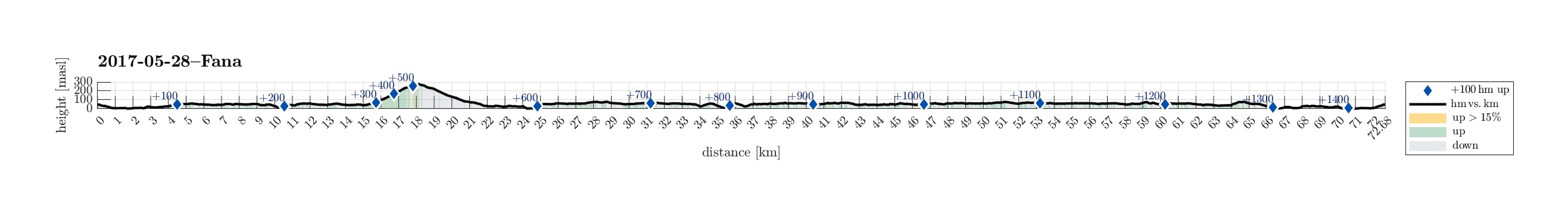
| Distanse | 72,7km |
| Høydemeter | 1456m |
| GPS |
|
| Bestigninger | Fanasåta (284moh) | 28.05.2017 |
|---|---|---|
| Andre besøkte PBE'er | Hordneskogen parkering (51moh) | 28.05.2017 |
| Lysekloster p-plass (50moh) | 28.05.2017 | |
| Lyseklostervegen p-plass (61moh) | 28.05.2017 | |
| Ramberget parkering (170moh) | 28.05.2017 | |
| Ruinene på Lysekloster (53moh) | 28.05.2017 | |
| Stendafjellet p-plass (59moh) | 28.05.2017 | |
| Straume bro (5moh) | 28.05.2017 |
Trip Summary
I took my bike southwards from Varden, Fyllingsdalen, first passing by Søreide into the direction of Hjellestad. After having crossed the street to the airport, I turned sharply left at Blomsterdalen, continuing on the small road #172 towards Fana. At Skeie, I made sure to connect to the even smaller road, which passes by Hordnesskogen. At Stend, I connected with the main road to Fana, #546, coming there from Rådalen. I then cycled by Fana and continued on road #163 up to Fanafjellet. Even though the height difference is not much, this ascent clearly is tougher than cycling on level ground. :-)
Fanasåta
At Fanafjellet, I parked my bike in order to make a short detour to Fanasåta. Right before (north of) the big parking place on the saddle on Fanafjellet, a little forest road leaves to the northeast, leading to some place on Fanasåta, which is guarded by a fence. I first thought that I could get some nice views over Fanafjorden from the northern side of this place and thus I started to walk along the fence. I circled the whole area, without really finding any place, where one could see beyond the trees. Thus, I just continued into the direction of Naknekampen. I found myself in the middle of some wild forest, with trees laying in all directions, etc.---not really a terrain, which was easy to traverse. After a while, however, I found the path, which comes up from the saddle, where I had left my bike, and then everything was quick and easy. A few minutes later, I stood at the "top" of this hill and enjoyed some really nice views from there (almost unexpected!). The walk back to my bike was then quick and easy, following the path, which I had found, back to the forest road.
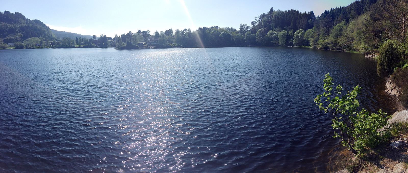
Lyseklosteret
I then continued further southwards, following the road #163. Coming down from Nordstraumen, I crossed a little bridge and continued on road #161 (in northeastern direction, first). This brought me soon to the old ruins of Lyseklosteret, which clearly were attractive to many on this day. I then continued further southwards towards Ulven, where I connected to road #160, cycling into western direction then. I followed this road all the way towards the bridge, which brings on to Strøno, but instead of crossing over this bridge to this little island, I turned around there and started my ride back from there.
Back via Kismul
On my way back, I did not follow the road to Lyseklosteret, but instead cycled further towards Osøro (more towards Ulven, north of Os), where I connected with E39, i.e., the main road between Os and Bergen (and further). Fortunately, there is a split path for pedestrians and cyclists right next to this road (which really isn't any fun to cycle due to all the traffic there). So cycling northwards along E39 is actually quite OK. I came through Søfteland and continued further northwards until I came to this little saddle, where the waters towards Os are separated from Kalandsvatnet. There, I turned left onto a very small road, which leads towards Kismul on the southern side of Kalandsvatnet. After a little on this road, I changed to a path (again split between pedestrians and cyclists), which uses some old train tracks (previously the train to Fana/Stend was going there). This, actually, makes cycling along there a very nice experience, often close to Kalandsvatnet on the right. Where Kalandsvatnet runs over into Klokkarvatnet, one changes from the southern side to the north, further following the previous train track. At Nordheim, I discontinued on this track and took a detour through the nice area of Titlestad, instead. Also this brought me to the former train station Stend/Fana. I then cycled Rådalen northover and passed by Lagunen shortly after that. I then found it difficult to find an appropriate way to connect up to Holtan/Thunesflaten---eventually, I carried my bike up a few steps vis-a-vis the big bus stop right next to Lagunen. Near a kindergarten, or so, I got back on proper cycling terrain, following then road Steinsvikvegen further. This then brought me quickly to Steinsvika (of Nordåsvatnet) and from there I connected back to Varden via Søreide.
Conclusion
This slightly longer cycling trip took me through nice places in wonderful summer temperatures, with Fanafjellet as a little challenge in between. After having returned home, I was very satisfied with this excursion! :-)
Photos
Selected photos are available as Google photo album.
Useful Resources
See also the related FB-page Hiking around Bergen, Norway.
Web page WestCoastPeaks.com provides useful information about Fanasåta.


Kommentarer