
Cycling to Askøy with Folleseåsen (27.05.2017)

Skrevet av HHauser (Helwig Hauser)

| Startsted | Varden (45moh) |
|---|---|
| Sluttsted | Varden (45moh) |
| Turtype | Blandet sykling |
| Turlengde | 3t 00min |
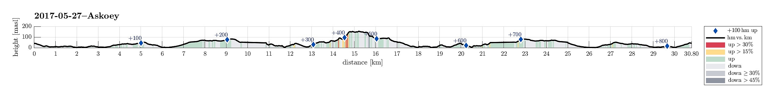
| Distanse | 30,8km |
| Høydemeter | 844m |
| GPS |
|
| Bestigninger | Brenneklubben (166moh) | 27.05.2017 |
|---|---|---|
| Midtfjellet (159moh) | 27.05.2017 | |
| Sørafjellet (156moh) | 27.05.2017 | |
| Andre besøkte PBE'er | Sælen kirke p-plass (15moh) | 27.05.2017 |
Trip Summary
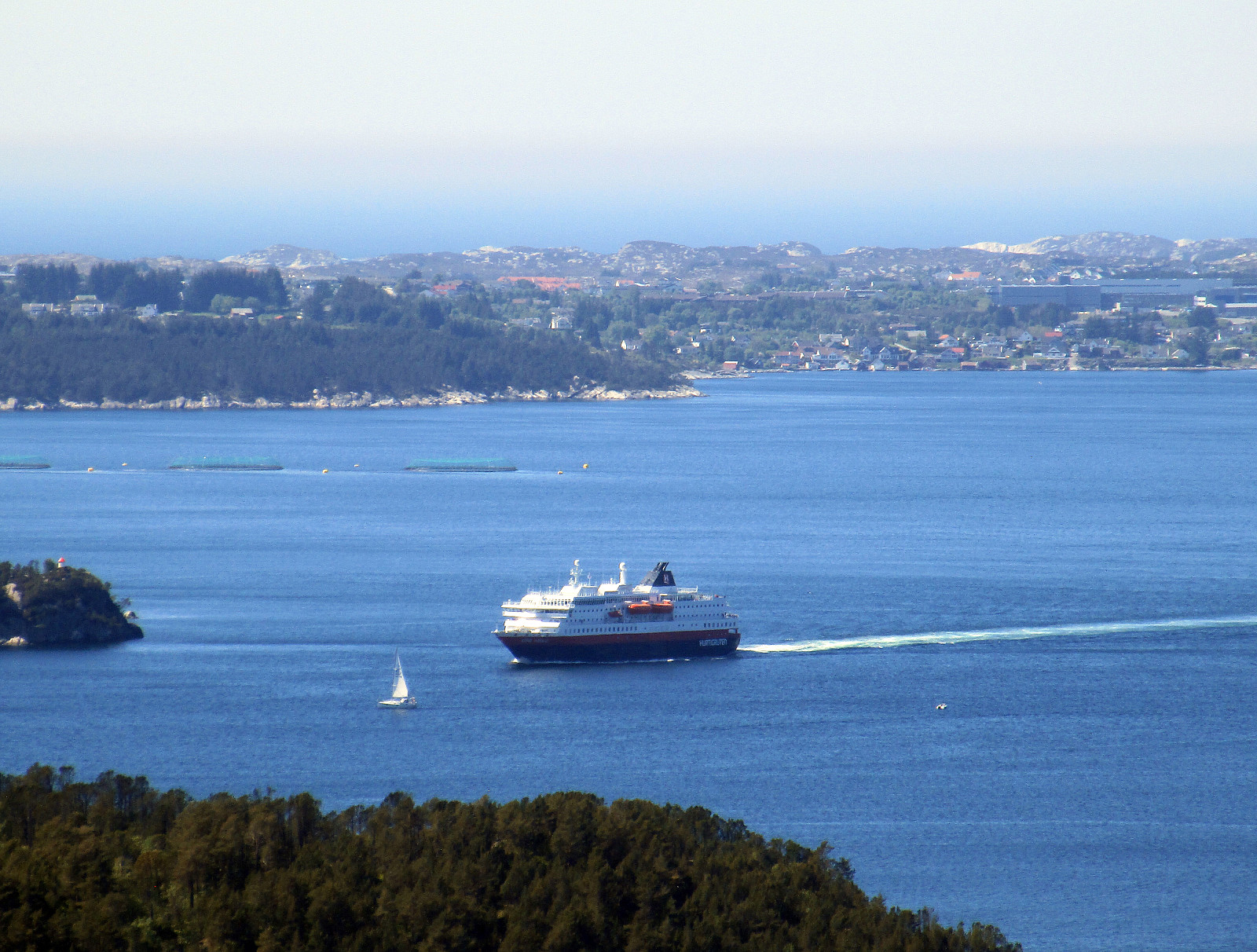
We started our little cycling trip in the south of Fyllingsdalen and took Bjørgeveien towards Loddefjord. From there, we connected to Kjøkkelvikveien and at Nybø, we connected to Sundby Hvorups vei, which brings cyclists (and pedestrians) to the southern end of the large bridge to Askøy (drivers take a tunnel). We crossed over the Askøy-bridge and followed the sidewalk to the place, where a bigger bus-stop is. There, right behind the bus-stop, a steep path is leading downwards to Skarholmvegen. Turning sharply right, once down there, we took Skarholmvegen towards the west on the southern edge of Askøy. We followed this road until we came to Strusshamn, where we continued northover (and upwards), until we got to Follesevegen. There, we continued again westwards (a little), until we parked our bikes next to some larger soccer fields, right north of Follesevegen.
Folleseåsen
From right east of the soccer fields, a small path can be found, which first brings one up to a little ridge, which when leads westwards, passing the soccer fields in their north. This path is easy to follow and it leads up to Folleseåsen conveniently. Once near the top, the situation becomes a little less clear. There is a little top, Sørafjellet, at the southern end of Folleseåsen, which offers nice views towards the south. The "highest" point on Folleseåsen, however, seems to be more to the west of it. From there one can enjoy nice views towards the west (Sotra, etc.). From there, a first promising path leads northwards (marked red), only to turn left (and westwards) later, which clearly was the wrong direction. The connection back to the east of Folleseåsen became thus a bit of an improvisation (through the forest, bushes, etc.). Shortly later, another path came into sight (marked blue), leading northwards, again, but this time on the eastern edge of Folleseåsen. This path brings one down into some wet, swampy area (north of the soccer fields). Connecting back to the start point through this area was OK, but wet, of course (not really with a path, then).
Back
Back on our bikes, we first made a little detour (down Skiftesvikvegen to Skiftesvik and then along Lyngneset back to Strusshamn). From Strusshamn, we basically followed the same track back as we took in order to get to Askøy. All in all, this was a nice little biking trip in wonderful warm summer weather. Nice! :-)
Photos
Selected photos are available as Google photo album.
Useful Resources
See also the related FB-page Hiking around Bergen, Norway.
Petter Bjørstad has a useful page about Folleseåsen.


Kommentarer