
Home via Løvstakken (06.03.2017)

Written by HHauser (Helwig Hauser)

| Start point | Bergen (5m) |
|---|---|
| Endpoint | Varden (45m) |
| Characteristic | Hillwalk |
| Duration | 2h 45min |
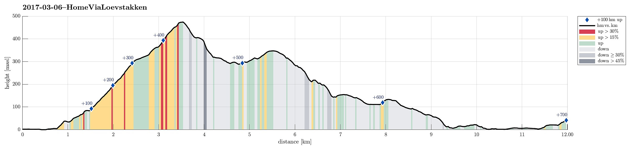
| Distance | 12.0km |
| Vertical meters | 697m |
| GPS |
|
| Ascents | Gullsteinen (352m) | 06.03.2017 |
|---|---|---|
| Løvstakken (478m) | 06.03.2017 | |
| Visits of other PBEs | Bøneshallen p-plass (110m) | 06.03.2017 |
| Gullstølen (ruin) (282m) | 06.03.2017 | |
| Gulsteinen (305m) | 06.03.2017 | |
| Jesus Lever-steinen (133m) | 06.03.2017 | |
| Speiderly (285m) | 06.03.2017 |
Trip Summary
After a day with an important deadline (and the according stress) as well as teaching in the afternoon, I decided that it was time to get out into the fresh air. Even though already 16h30 in the afternoon, I thought that walking home via Løvstakken could be an option!
Ascending to Løvstakken
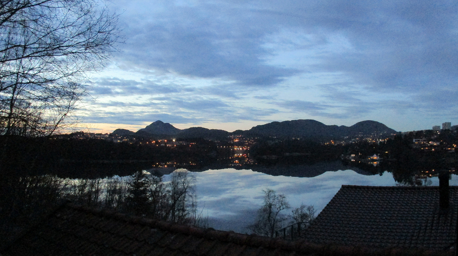
I left Høyteknologisenteret in Bergen, crossed the new pedestrian bridge "Småpudden", and then headed for a quick connection to Løvstien. Following Damsgårdsveien a bit into southeastern direction brought me to a place, where some stairs lead upwards (to Michael Krohns gate). Crossing Michael Krohns gate, I found new stairs on the other side, leading further upwards (first to Lien and then to Nordre Skogveien). There (on Nordre Skogveien), I had to walk back (in southeastern direction) a little, before entering a street that leads up (and almost connecting to Skoglien). A few stairs brought me up to Skoglien and from there I went to Solheimslien. There, I got myself behind one of the major blocks and up the hill to Løvstien (still very new). Now, I was almost at the place, where I wanted to be, i.e., where a paved path leave upwards from Løvstien, going somehow diagonally upwards to towards Løvstakken. All this is still relatively new and one could get the impression that more work will be done, making this path even nicer. At about 220mosl, near a new resting place, a narrow path guided me into the woods and further upwards. Shortly after, I found myself on a ridge, which brought me further towards Løvstakken (mostly in southern direction). There, I met a lot of snow and ice on the ground, but using a pair of brodders made it easy and quick to continue my ascent. Shortly after, I found myself on the top of Løvstakken and enjoyed the evening view in all directions! :-)
Towards Fyllingsdalen via Gullsteinen
From Løvstakken, I decided to descend towards Fyllingsdalen via Gullsteinen. I first went down to the little lake, south of Løvstakken, before continuing down the steep southern ridge of Løvstakken into the direction of Gullsteinen. The sun was about to set, so I did not loose time and went with a good pace in order to avoid getting stuck in the dark. I passed Gullsteinen and then Gullstølen and continued further in southwards direction, ending up at the upper end of Nils Langhelles vei. There, I thought that I could still cross over Knultrane in order to get to Bønes. From up there, I enjoyed the last view towards the setting sun in the west. Once down to Bønes, I passed by the school in Fjellsdalen in order to get further down towards Straume. Following Våkleelvbakken and Torvdalsveien, I ended up near Fagernes Yacht Club. To get back to Varden, I decided to round Straumshaugen on its northern side, via President Christies vei. This brought me to Bjørgeveien, which I followed (already in the dark) to Søreide and then Varden.
Conclusion
It was really a good idea to exploit the nice weather and do this walk home via Løvstakken. A lot of fresh air and some distance from the deadline madness at work! :-)
Photos
Selected photos are available as Google photo album.
Useful Resources
See also the related FB-page Hiking around Bergen, Norway.
Web page WestCoastPeaks.com provides useful information about Løvstakken.


User comments