
Løvstakken via Nova (01.01.2017)

Written by HHauser (Helwig Hauser)

| Start point | Parking near Krohnegården (160m) |
|---|---|
| Endpoint | Parking near Krohnegården (160m) |
| Characteristic | Hillwalk |
| Duration | 1h 15min |
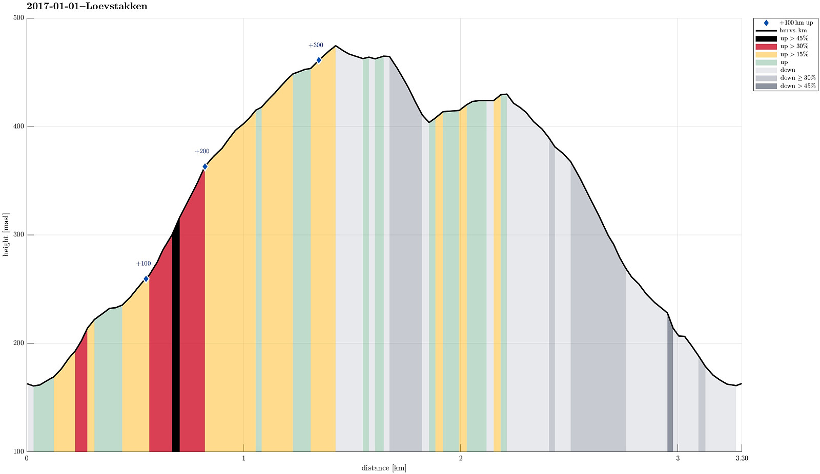
| Distance | 3.3km |
| Vertical meters | 360m |
| GPS |
|
| Ascents | Løvstakken (478m) | 01.01.2017 |
|---|---|---|
| Storhaugen 470 (470m) | 01.01.2017 | |
| Visits of other PBEs | Fossen (200m) | 01.01.2017 |
| Krohnegården p-plass (160m) | 01.01.2017 | |
| Nova (388m) | 01.01.2017 |
Trip Summary
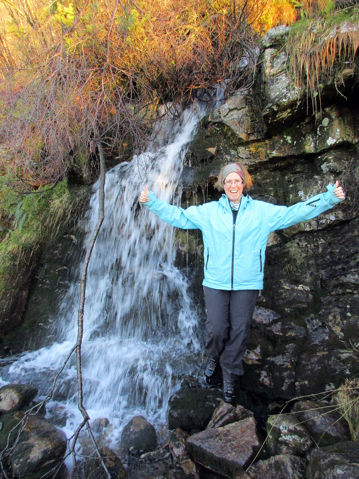
We parked the car at the parking place right above Litlavatnet (along Krohnegården street in upper Fyllingsdalen) and had the plan to try out a new route up Løvstakken. And so we did! :-) We started along the usual path, which leads firmly upwards (in northeastern direction towards the saddle between Ravnefellet and Løvstakken). After having past the little waterfall on our right, we found the right spot, where a less used path leaves to the right. We followed this minor path, which makes a comparably large half-circle around the waterfall (and above it), turning into a southward direction. Right above the waterfall, one needs to expect wet terrain; so good shoes are helpful, when choosing this alternative. From there, we then continued to ascend (following the kind of diagonally oriented path) to an intermediate height (a bit below Løvstakken on its western, steep side) called Nova. It is then also about there, where the path joins with the other path, which leads steeply upwards to Løvstakken from Rosenlundveien. From the point, where these two paths come together, it is then only a few meters to the top of Løvstakken. Really a valuable alternative route up Løvstakken; surprising, actually, that it took almost 10 years, before we started to explore this opportunity! :-) From the top of Løvstakken, we then made a small detour to the southern end of the top-"plateau" of Løvstakken, where we rounded the little water that is found just a short distance south of the top of Løvstakken. We stepped up to the small ridge on the western side of this little water, finding a path up there, which connected us back to Nova. From there, we basically followed the same path down, which we had taken up, first. All in all, this route is really a fine alternative to the other much more used path up to Løvstakken. :-)
Photos
Selected photos are available as Google photo album.
Useful Resources
See also the related FB-page Hiking around Bergen, Norway.
Web page WestCoastPeaks.com provides useful information about Løvstakken.


User comments