
Ljosvollsvarden (27.12.2016)

Written by HHauser (Helwig Hauser)

| Start point | Near Fjellbirkeland (150m) |
|---|---|
| Endpoint | Near Fjellbirkeland (150m) |
| Characteristic | Hillwalk |
| Duration | 1h 00min |
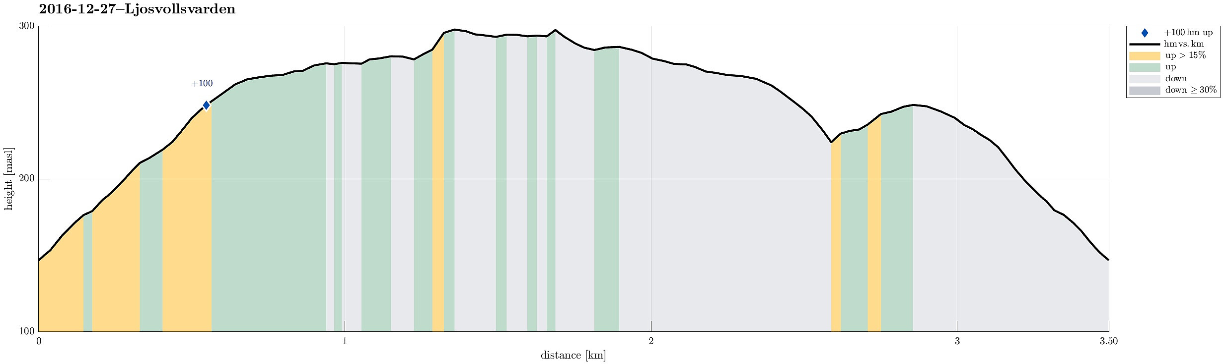
| Distance | 3.5km |
| Vertical meters | 193m |
| GPS |
|
| Ascents | Ljosvollsvarden (301m) | 27.12.2016 |
|---|
Trip Summary
We left home in slight rain and no indication that the weather should clear up any time soon, driving via Midtun to the street, which leads up to Totland (road #183). We passed by Myrdalsvatnet and continued further upwards. Before we came to Fjellbirkeland, we parked right next to the road (at about 5.401°E/60.305°N).
Getting started, finding the trail
From there, we took a forest road, which leads steadily upwards (in southwestern direction). Soon the light rain turned into light snowfall (a bit nicer, after all). Once we came up and the terrain became comparably flat, we left the forest road and entered the forest in order to find a connection to the "top" of Ljosvollsvarden.
Through thick forest to the top
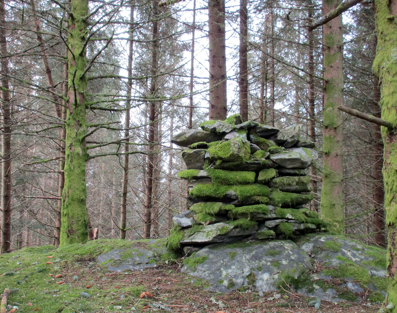
We started (in the thick forest!) in southwestern direction, before we reached the end of the forest. There, we turned right (now in southwestern direction) and approached Ljosvollsvarden, again through the thick forest. After a few minutes, we came to the "top" of Ljosvollsvarden, in the middle of the forest (but with a cairn!). We then continued a little bit further into southwestern direction and reached a second cairn not long after.
Back on "real" paths
There, we turned around and started our way back---this time following some reasonable paths (instead of fighting ourselves through the thick forest, again). Roughly half way down (the same forest road, which we had taken up), we followed another path, that left to the left (in northwestern direction). We walked along this path until we were somewhat half the way up to Birkelandsfjellet, before we turned around, again. In order to get back, we then took a shortcut that brought us back to the forest road, which then lead us back down to our car.
Summary
All in all, it is quite likely that this little "top" will not remain among our most popular hiking goals---instead, it is much more likely that we will not come back to Ljosvollsvarden any time soon.
Photos
Selected photos are available as Google photo album.
Useful Resources
See also the related FB-page Hiking around Bergen, Norway.
Web page WestCoastPeaks.com provides useful information about Birkelandsfjellet (Ljosvollvarden).
On Bergentopp 200 there is a page (in Norwegian) about Ljosvollsvarden.


User comments