
Skogafjellet (04.12.2016)

Geschrieben von HHauser (Helwig Hauser)

| Startpunkt | Skogavika (45m) |
|---|---|
| Endpunkt | Skogavika (45m) |
| Tourcharakter | Bergtour |
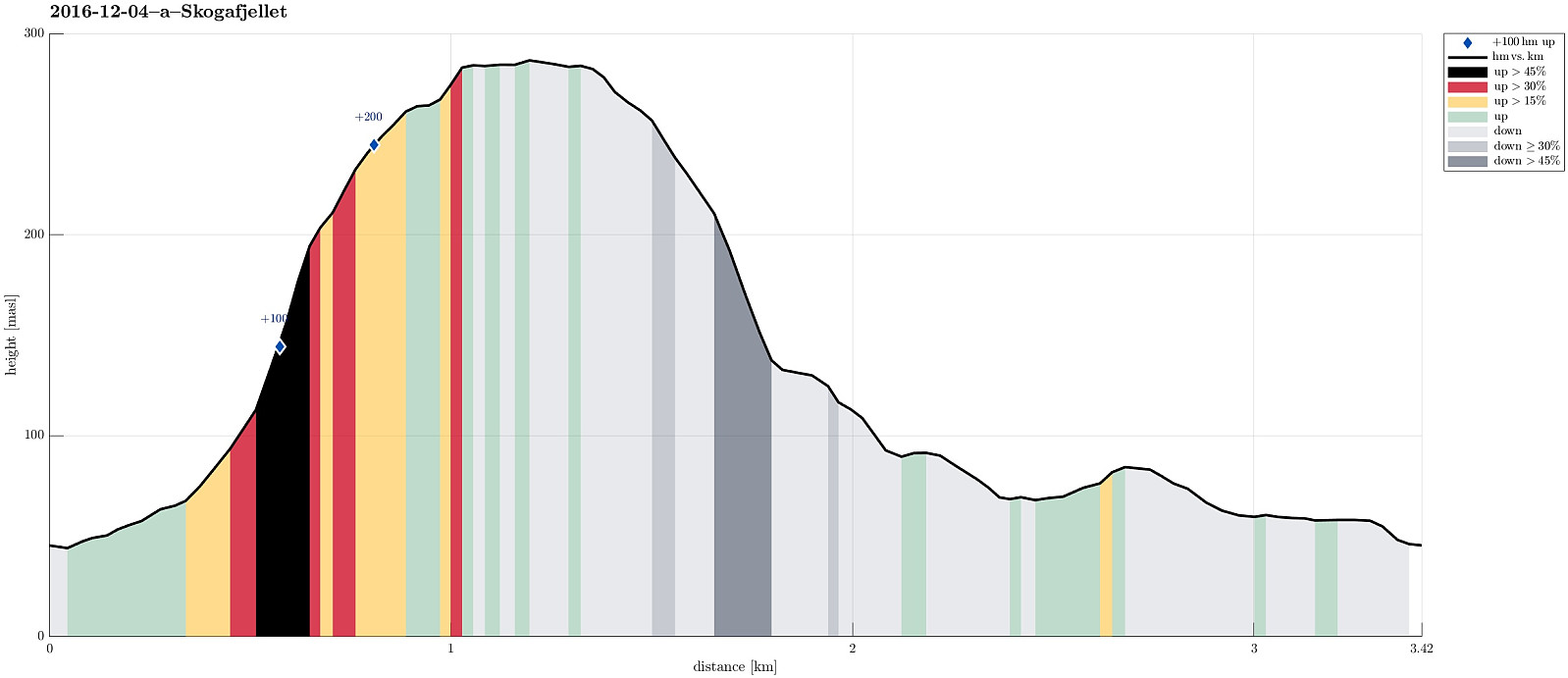
| Tourlänge | 1h 30min |
| Entfernung | 3,4km |
| Höhenmeter | 269m |
| GPS |
|
| Besteigungen | Skogafjellet (289m) | 04.12.2016 10:00 |
|---|
Trip Summary
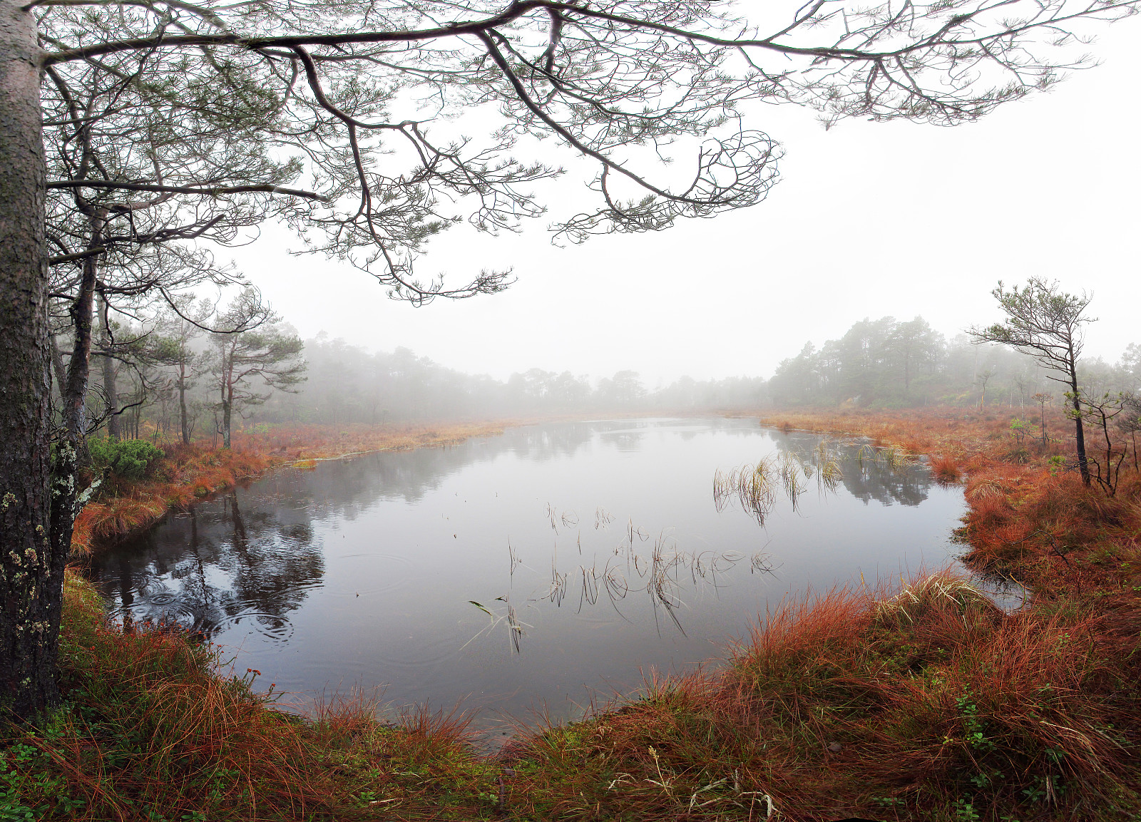
I took E39 southwards from Bergen, driving towards Os. Before coming to Ulven, near Os, I passed by Skogavika (a part of Hetleflotvatnet), lying right next to the road on the eastside. At about N60.2144, E5.4432, I left E39, turning to the right (westwards). Only few meters up this small road, I parked and started walking. I first followed a small, paved road in southern direction (in parallel to E39), which soon turned upwards and westwards (away from E39). Turning left, again, I ended up on a simple gravel road that didn't really seem to lead very far. Instead, I left this road, crossed a few meters of grass and some water, finding an old and overgrown forrest road, leading upwards (steeply) and, first, in southwestern direction (towards Skogafjellet), before soon chaning into a southern direction. This forrest road, which hasn't been used in quite a while, leads steeply upwards in a little valley, which separates a small hill (in the east) from Skogafjellet (in the west). Before reaching the saddle at the upper end of this small valley, I decided to leave the forrest road and ascend towards Skogafjellet on a more direct route (to the west, very steep). A few minutes later, I reached a ridge at the upper end of the small valley, which I had started with, and I followed this ridge further upwards and into the direction of the "top" of Skogafjellet. All this, obviously, without any trail or path. Near the top of Skogafjellet, I came by a little lake, which provided me with at least one nice view (otherwise, the hike was mostly wet and in the midst of the low-hanging clouds). From there, I continued in southern directiton, crossing over several "tops", each of which a candidate for "the top" of Skogafjellet (it's pretty unclear, where the highest top of Skogafjellet really is---in particular, when in the middle of many tress in all directions and no clear gradient to follow!). After circeling around "the top" of Skogafjellet for some minutes, I decided to get back to the car. From the beginning, it had been my plan to somehow walk a round (not to get back the same way as up), so therefore I chose to descend northwards (a bit to the west of where I had stepped up). I descended into a simple valley with some little stream in the middle, leading me downwards in a northern direction. Even though there was no path in all of this, it still was relatively easy to proceed (the northern slope of Skogafjellet is way less steep than its eastern side). I remembered from reading the map at home that I should hit another forrest road in the north of the mountain, when following this little stream, and so it was! :-) Then it was only to walk out this forrest road, passing by the still relatively new water facility at Hetleflåten, and getting back to the car from the northern side. All in all, this hike was refreshing, but due to the wheather and also the fact that all of Skogfjellets top is covered with trees, more exciting trips can be imagined than this one! :-) One thing can be of interest, though: Due to the lack of hiking paths, etc., the likelihood of seeing some interesting wildlife is higher on Skogafjellet, I guess (at least I could see two large deers while hiking through the wild). :-)
Photos
Selected photos are available as Google photo album.
Useful Resources
See also the related FB-page Hiking around Bergen, Norway.
Web page WestCoastPeaks.com provides useful information about Skogafjell and also Petter Bjørstad has a useful page about Skogafjellet.


Benutzerkommentare