
Knappskogfjellet (02.10.2016)

Geschrieben von HHauser (Helwig Hauser)

| Startpunkt | Fjæreide (40m) |
|---|---|
| Endpunkt | Fjæreide (40m) |
| Tourcharakter | Bergtour |
| Tourlänge | 2h 00min |
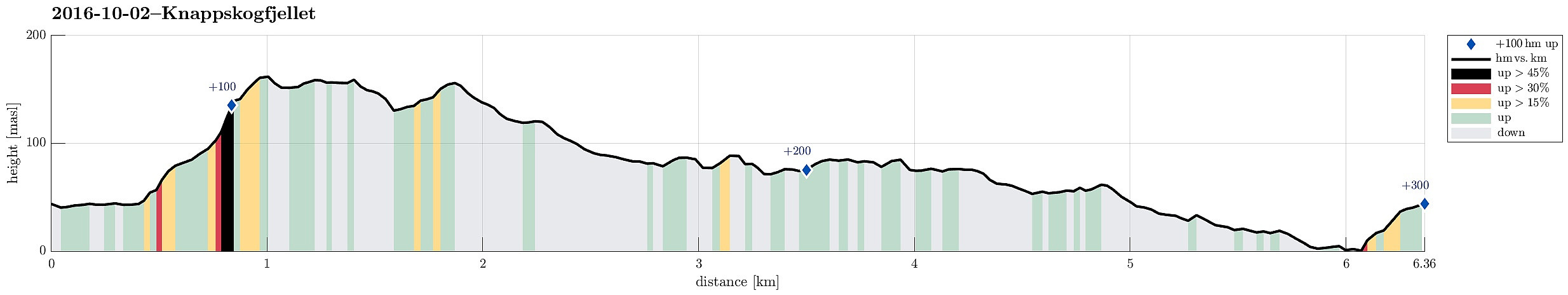
| Entfernung | 6,4km |
| Höhenmeter | 299m |
| GPS |
|
| Besteigungen | Knappskogfjellet (164m) | 02.10.2016 |
|---|---|---|
| Besuche anderer PBE | Fjæreide parkering (30m) | 02.10.2016 |
Trip Summary
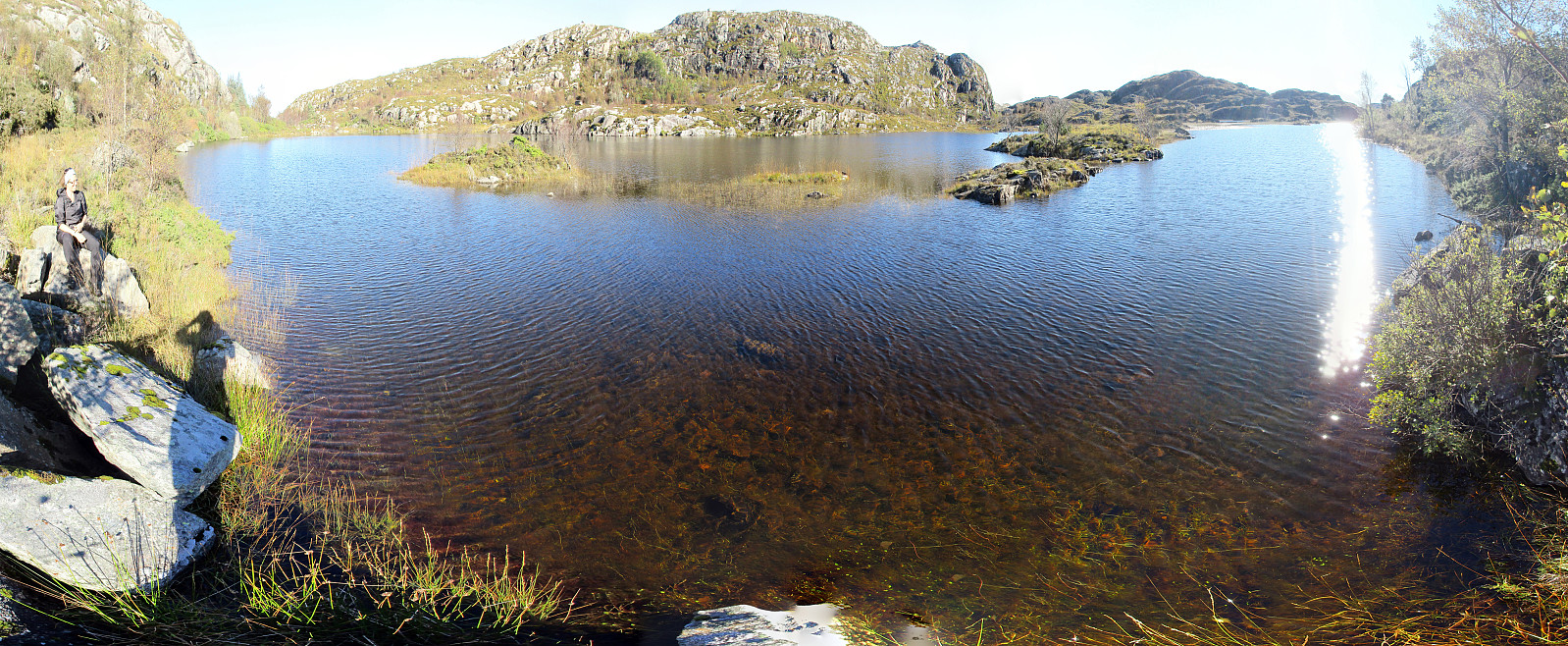
We drove to Sotra and turned right (northwards) after Kolltveittunnelen. We continued on road 561 northwards until we came to Knappskog. There, we turned left and followed a narrow road to Fjæreide. We parked right next to the cross, where one enters Dalane (in southern direction). We first wished to get to a path at the southern end of Dalane, but when we got close, a man (the owner of house #194?) informed us that we were not supposed to continue, but return and aim at another path that connects to Knappskogfjellet on the eastern side of Dalane. About half the path back to the main road, we detected this path and used it to get up above Dalane and towards Knappskogfjellet. Proceeding towards Knappskogfjellet was then straight-forward (partially steep, but easy to climb up). On Knappskogfjellet we enjoyed the views in all directions, before we continued along the high line in southern direction. At Fjellskaret, one needs to step down into a narrow valley. Following this valley upwards (in northeastern direction) leads one to a point, where it becomes easy to get up to the heights on the southern side of the small valley, leading further up to Skjenet. Continuing further south (towards Stølshaugen), one comes to a simple hut very near to a path that leads down in eastern direction. At this point, we left the path and continued in western direction, instead. We passed by Rotabekksvatnet (in the north of us), crossed over Djupebotnen, and connected to Rotabekksmyra. We walked along the southern edge of Rotabekksmyra, trying to avoid getting all-too-wet shoes, and arrived at Brakeidet, where we found a simple path (as expected). Then, we followed this path, on the western side of Midtfjellet, in northern direction. After a while, we arrived at the southern end of Stemmevatnet, along which we continued northwards on its western side. Once we had passed Stemmevatnet, we arrived at the road, which connects to Knappskog. Instead of walking back to our car on this road, we continued on this road into the other direction and arrived at the spot, where the bus turns around, after only a few minutes. From there, we then walked down towards the sea. At the very end of the road, where a small river comes down from above, we found a convenient path upwards, bringing us back to the road above and to the place, where we had parked our car. All in all, we enjoyed this easy hiking in beautiful autumn weather very much! :-)
Photos
Selected photos are available as Google photo album.
Useful Resources
See also the related FB-page Hiking around Bergen, Norway.
Petter Bjørstad has a useful page about Knappskogfjellet.


Benutzerkommentare