
Skardalsfjellet via Brattlandsfjellet (11.09.2016)

Written by HHauser (Helwig Hauser)

| Start point | Parking near Dyngelandsvatnet (75m) |
|---|---|
| Endpoint | Parking near Dyngelandsvatnet (75m) |
| Characteristic | Hillwalk |
| Duration | 3h 30min |
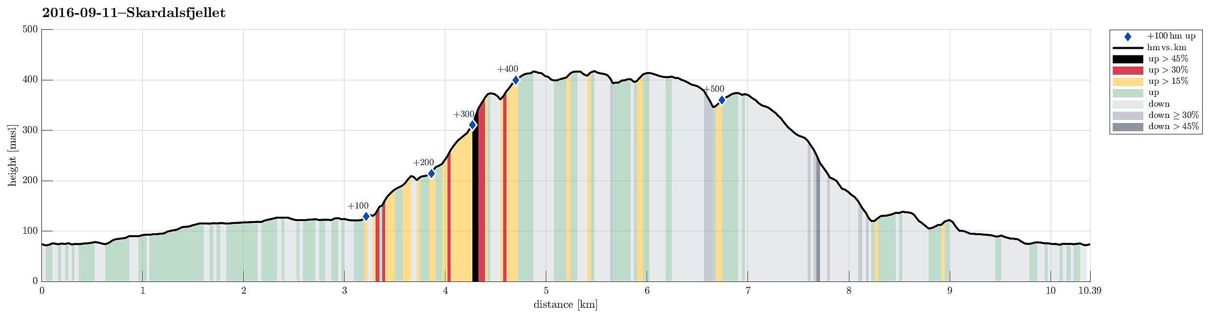
| Distance | 10.4km |
| Vertical meters | 573m |
| GPS |
|
| Ascents | Brattlandsfjellet i Fana (376m) | 11.09.2016 14:00 |
|---|---|---|
| Flåfjellet, Bergen (418m) | 11.09.2016 14:00 | |
| Nordre Skavdalsfjellet (419m) | 11.09.2016 14:00 | |
| Søre Skavdalsfjellet (420m) | 11.09.2016 14:00 | |
| Stordalsfjellet (376m) | 11.09.2016 14:00 | |
| Visits of other PBEs | Johnsahytta (ruin) (138m) | 11.09.2016 14:00 |
Trip Summary
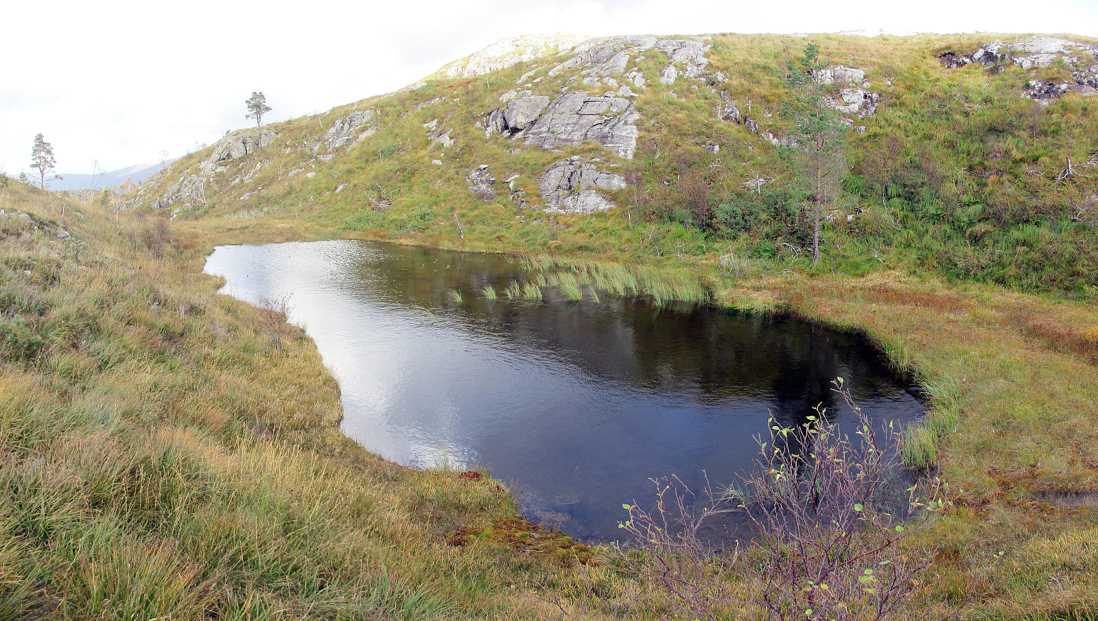
We parked near Dyngelandsvatnet along Dyngelandsvegen and walked along the private road that passes south of the lake (Dyngelandsvatnet) and then leads further to Myrdalsvatnet, where it turns left, continuing then in mostly northern direction from there towards Langavatnet, west of Flåfjellet. In a pretty wet area, where lots of water is coming down from high above (from between Stordalsfjellet and Flåfjellet), the gravel road ends and one continues along the valley on something that is largely a underwater hiking path. One passes Langavatnet on the west, following more or less along the water line. At the northern end of this lengthy lake, we crossed over to the other, eastern side---connecting to the place, where we had come down during an earlier hike. Now, we ascended through the wild---right underneath the steep cliffs of Flåtfjellet---in northeastern direction and up into Øvre Skavdalen. Even though we could not see any path in this area (I assume that there are no paths there, basically) and even though the terrain is moderately wild (partially steep, uneven ground, etc.), we still found some connection through the jungle, leading us further up and towards Brattlandsfjellet. We made most of this stretch close to the valley-bottom, but when we approached Brattlandsfjellet, we decided to break out of the valley in northern direction and ascended Brattlandsfjellet this way. From Brattlandsfjellet, we could enjoy some nice views, for example, towards Haukeland and beyond, but also to Byfjellene on the other side. From there, we then turned southwards, crossing a wet saddle, and ascended Skardalsfjellet from there. Above the tree line, walking was a bit easier (but wet and muddy at times!). On Skardalsfjellet, we crossed over a few heights, which all could be the top of this mountain ridge (all about the same height), before we then connected to Flåfjellet. Up there, we enjoyed new views, both in western and in eastern direction! Walking over Flåfjellet (in southern direction) was straight-forward and easy, but when we approached its southern end, the question of how to get over to Stordalsfjellet became interesting. The map had suggested that directly at the western end of the small lake, that lies quite a bit down between the two heights (Flåfjellet and Stordalsfjellet), a crossing may be reasonable and indeed it was possible and OK to do it there (it seems, in fact, that attempting such a crossing further west should be considered dangerous, or at least risky). We then walked over Stordalsfjellet, following a longer chain of cairns that lead to the southern end of this top. From there, we then connected to a simple path the leads downwards towards gravel roads northeast of Myrdalsvatnet. One down there, we entered these gravel roads on their northermost turn, following it westerwards. Only a few meters along this road, right at the next saddle, we found a suitable hiking path that would bring us back to Dyngelandsvegen. Once there, we quickly walked Dyngelandsvegen (the private gravel road) back to our car. All in all, the following is impressive: Even though Skardalsfjellet is very close to the town of Bergen, one gets the strong impression that not many hike this mountain or its surrounding. In particular, Øvre Skavdalen, right below the northern end of Flåfjellet, is a secret spot, where rarely ever hikers get to.
Photos
Selected photos are available as Google photo album.
Useful Resources
See also the related FB-page Hiking around Bergen, Norway.
Web page WestCoastPeaks.com provides useful information about Skardalsfjellet and also Petter Bjørstad has a useful page about Skardalsfjellet.
On Bergentopp 200 there is a page (in Norwegian) about Skardalsfjellet.


User comments