
Gåssand (27.08.2016)

Geschrieben von HHauser (Helwig Hauser)

| Startpunkt | Gåssand (45m) |
|---|---|
| Endpunkt | Gåssand (45m) |
| Tourcharakter | Bergtour |
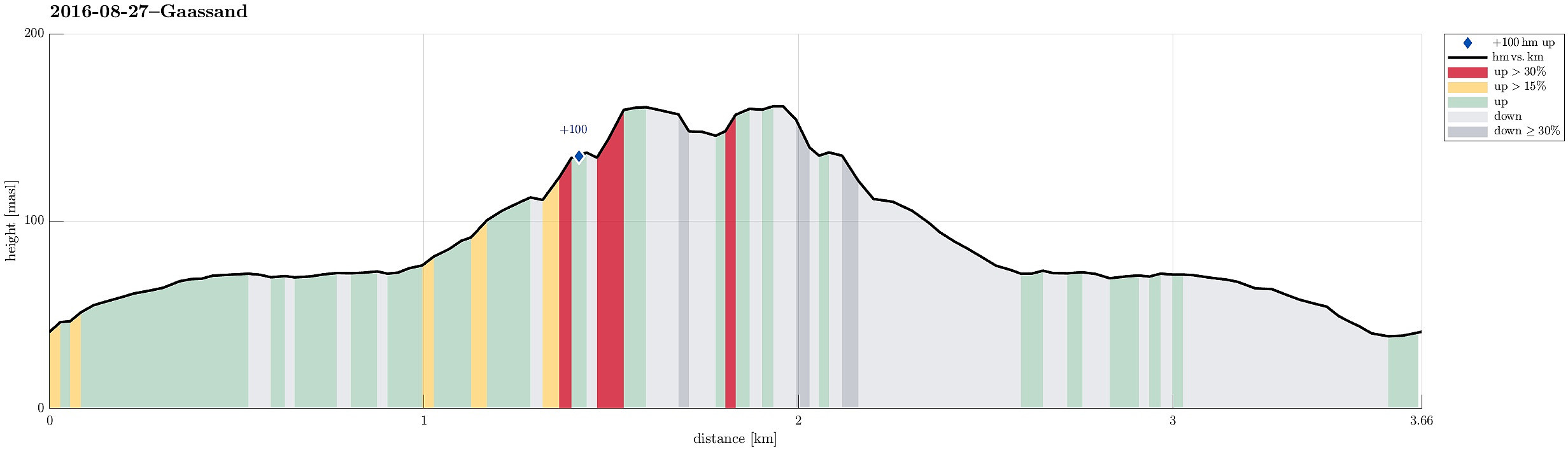
| Tourlänge | 1h 30min |
| Entfernung | 3,7km |
| Höhenmeter | 167m |
| GPS |
|
| Besuche anderer PBE | Krokvatnet demning (143m) | 27.08.2016 |
|---|
Trip Summary
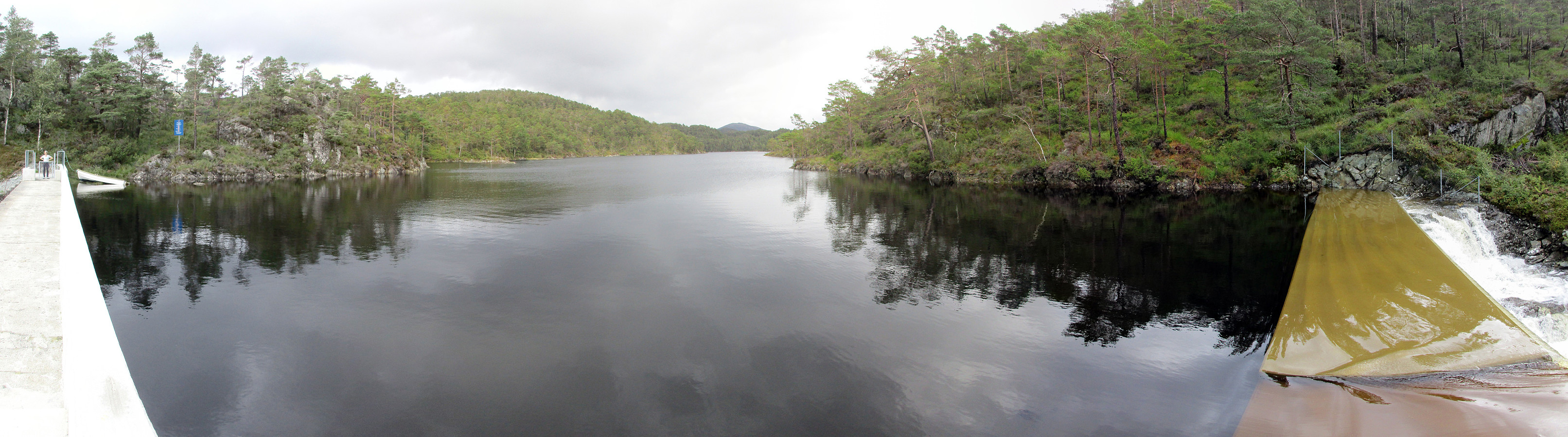
We used E39 towards Os from Bergen, taking a small road, Gåssandvegen, to the left, right before Søfteland. We then followed this narrow road to Hatlelia, where the road is taking a sharp turn to the right, crossing Nordelva there and then leading back to a farm that lies near Gåssandvatnet (where Sagelva comes down). We parked near to the lake and started to hike from there, following a forrest road that parallels Sagelva. After only a few steps, this forrest road passes Os El-verk, before it becomes a litte more steep. Eventually, we came over a small saddle with Krokvatnet right beneath us. We followed the pretty new road down to the dam, which holds back Krokvatnet, just to learn that there was no way to cross over the dam as we had planned. The southeastern side of this dam is overflown by the waters from Krokvatnet such that it would have been way to dangerous to attempt any crossing there. Since corssing over the river underneath the dam also was impossible (without swimming), we decided to abort our hiking and return---not often that we are hitting a dead end so early on a hike! :-)
Photos
Selected photos are available as Google photo album.
Useful Resources
See also the related FB-page Hiking around Bergen, Norway.


Benutzerkommentare