
Liafjellet from Moberg (14.08.2016)

Skrevet av HHauser (Helwig Hauser)

| Startsted | Moberg (65moh) |
|---|---|
| Sluttsted | Moberg (65moh) |
| Turtype | Fjelltur |
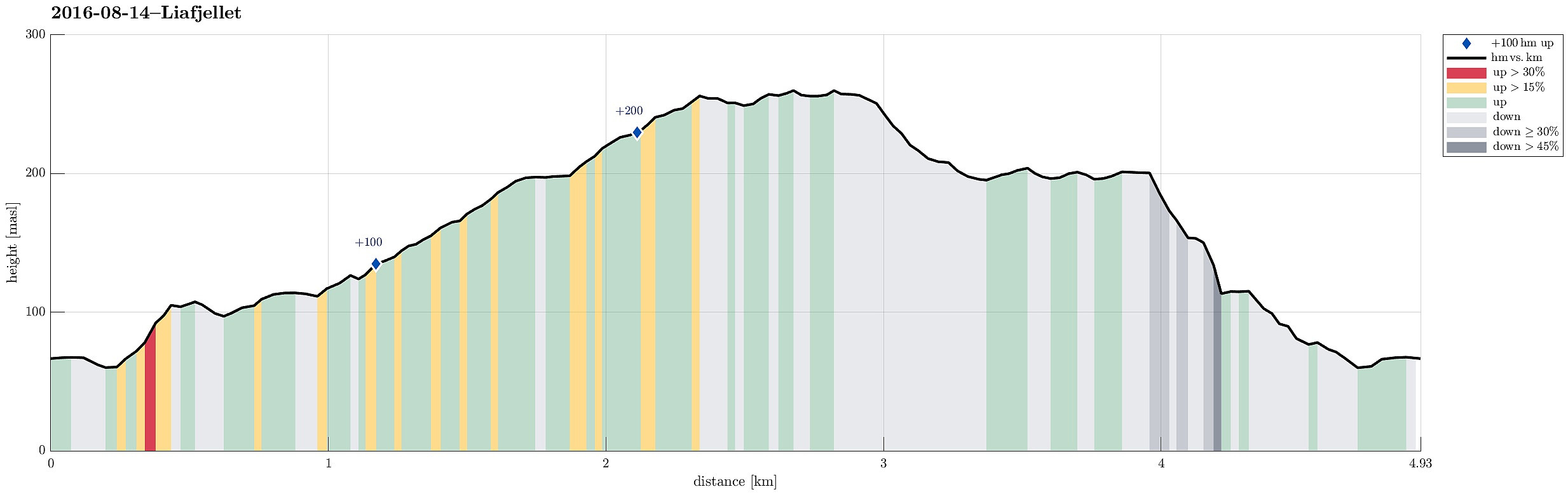
| Turlengde | 2t 00min |
| Distanse | 4,9km |
| Høydemeter | 281m |
| GPS |
|
| Bestigninger | Liafjellet (260moh) | 14.08.2016 |
|---|
Trip Summary
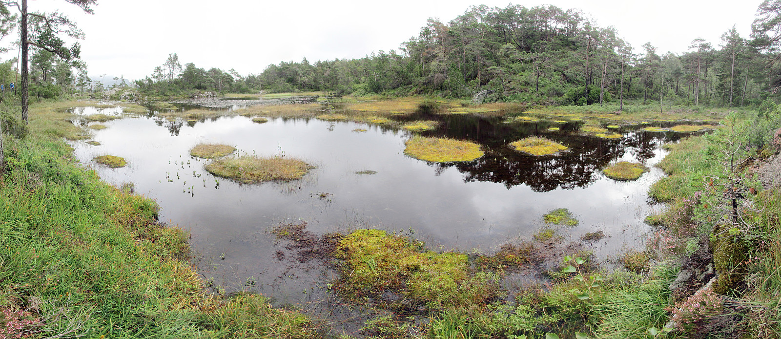
South of Bergen, we crossed Ulvenvatnet near Os on the E39 and drove off it near Os Brannstasjonen in Moberg, right after coming through Liafjellstunnelen. We parked right next to the firestation and started to walk from there. Due to some construction work there, we could not use Halhjemsvegen, where it meets Mobergsbakken. Following a substitution path (leaving Mobergsbakken between Halhjemsvegen and Olavegen), we surrounded the construction site and connected to Liafjellstunnelen. When coming there, right in the beginning of this hike, we did not understand that crossing the E39 first on the lower gravel road (and turning left doing so) leads one to another forrest road that brings one back to the top of Liafjellstunnelen. We therefore ascended Liafjellstunnelen directly, connecting back to the path only shortly after and on the top of Liafjellstunnelen. There, one has two choices of how to continue and we decided to take the longer route up (which first heads north, mostly, before then turning around the mountain and back in a southern direction). We then found and followed this path that first extends in northwestern direction for quite a bit, before turning back into a southern direction. At about 200mosl, we passed by Havrheitjørna---a lovely small lake about half way up towards the top. From there, we followed the path further (mostly in southern, southwestern direction) to reach Storevarden on Liafjellet shortly after. At a nice vista-point, a large stone pile is marking the trip-goal to this day. Going back from there, we departed from the path up only a few meters from Storevarden, walking down towards Moberg along a more direct route. At about 210mosl, the path splits and we took the left connection (in northeastern direction from there). Shortly after, the main connection leads down (to the right, in southeastern direction and out of the forrest)---we left the main trail there, continuing in northeastern direction (and staying mostly on the same height), instead. We followed a path along the hill side, turning a bit more left, after all, heading mostly towards north. When we started to see the firestation more or less directly under us (in eastern direction), we turned right and found a simple path that lead us down (through pretty steep terrain) and over to the spot on top of Liafjellstunnelen, where we had been already in the beginning. We then followed the forrest road in southern direction from Liafjellstunnelen and crossed the E39, after having turned left very sharply. From there back, we walked like we had done in the beginning. All in all, Liafjellet seems to be a pretty popular hiking place with many different paths and lots of opportunities to make different rounds (also with quite some people up there). From Bergen, however, it's maybe a bit too much driving for not really any major hiking, after all. :-)
Photos
Selected photos are available as Google photo album.
Useful Resources
See also the related FB-page Hiking around Bergen, Norway.
Web page WestCoastPeaks.com provides useful information about Liafjellet and also Petter Bjørstad has a useful page about Liafjellet.
Web page UT.no from the Norwegian Trekking Association recommends a hike via Grønhaugen.


Kommentarer