
Hiking up Teischnitztal (16.07.2016)

Written by HHauser (Helwig Hauser)

| Start point | Spøttling-Taurer (1,500m) |
|---|---|
| Endpoint | Spøttling-Taurer (1,500m) |
| Characteristic | Hillwalk |
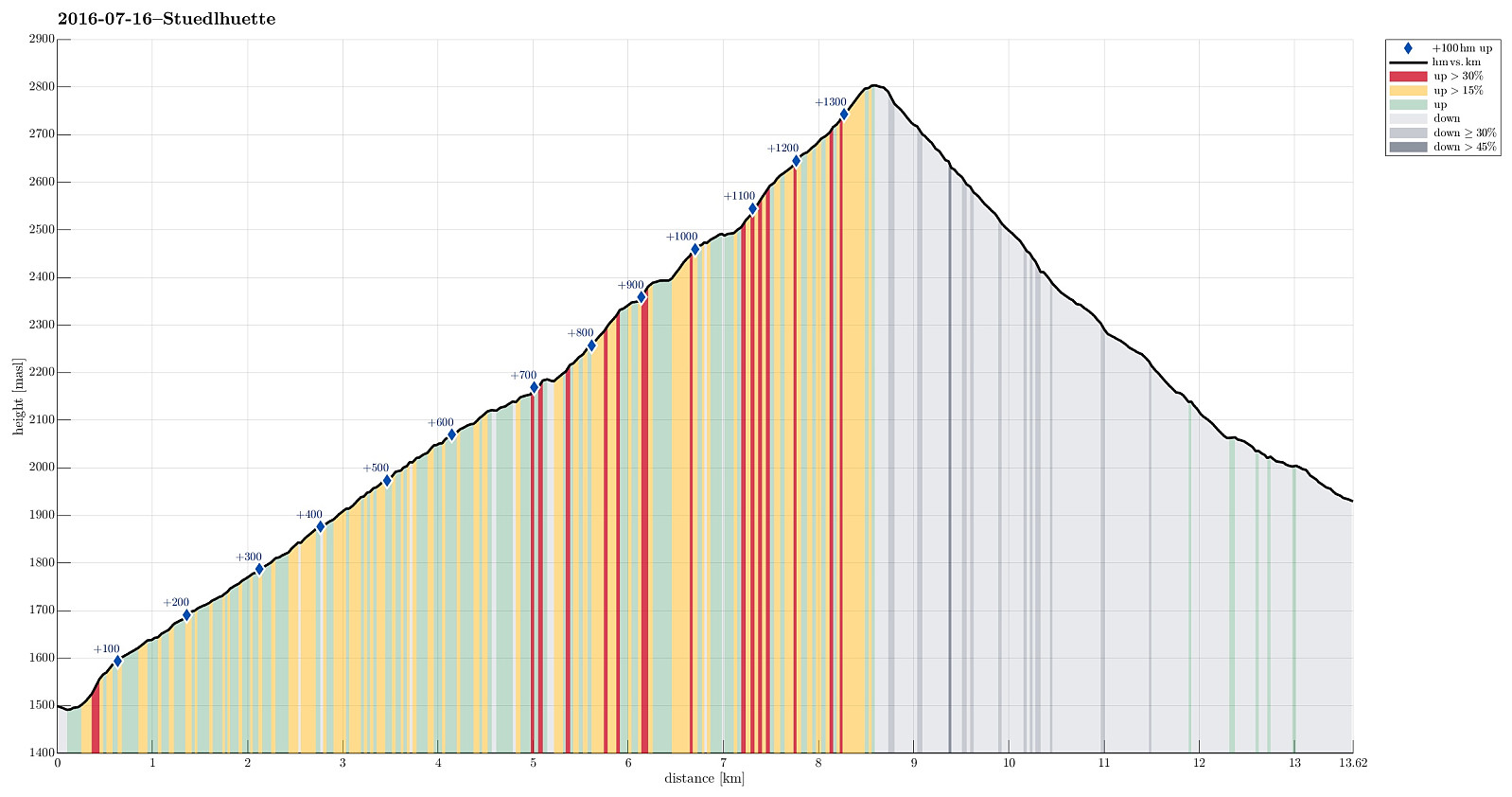
| Duration | 5h 00min |
| Distance | 13.6km |
| Vertical meters | 1,389m |
| GPS |
|
| Visits of other PBEs | Lucknerhaus (1,918m) | 16.07.2016 |
|---|---|---|
| Lucknerhütte (2,241m) | 16.07.2016 | |
| Stüdlhütte (2,802m) | 16.07.2016 |
Trip Summary
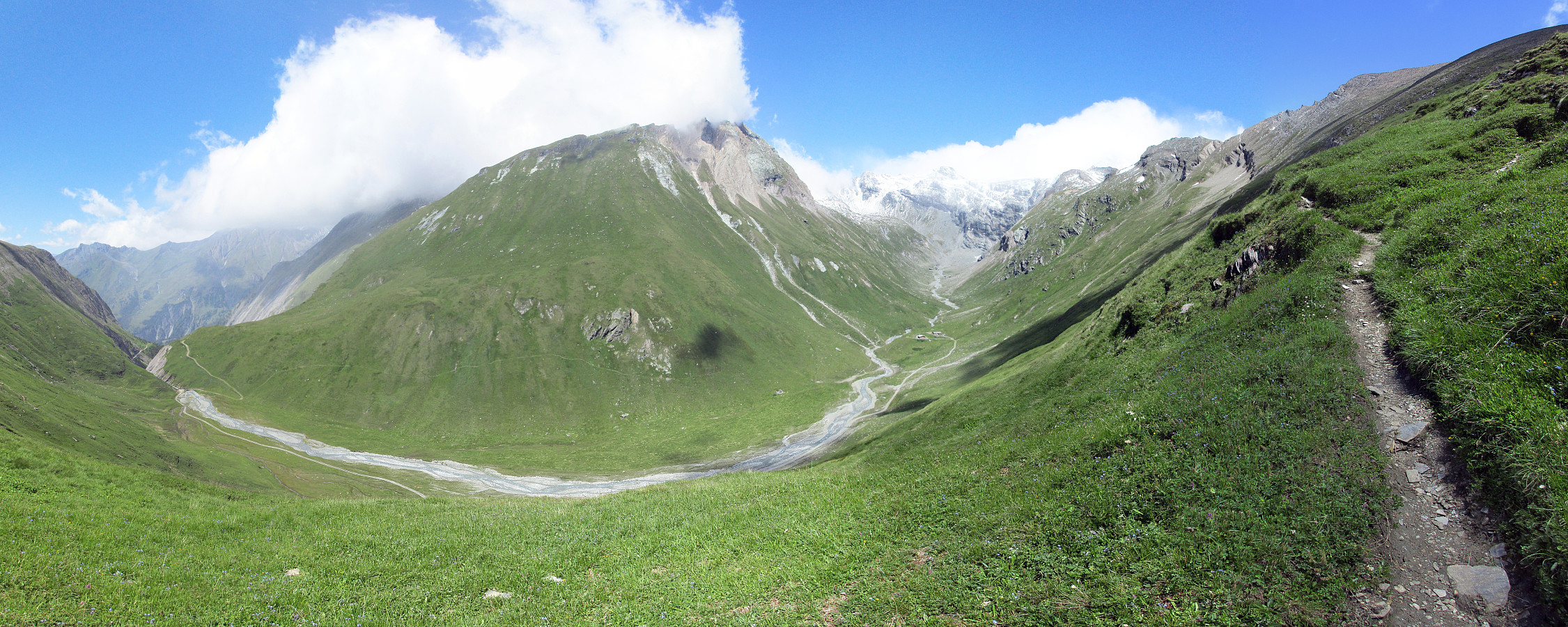
We started from the Spöttling-Taurer houses at the upper end of Kals am Grossglockner and headed for Teischnitztal from there. After only a few minutes, one connects to the road that leads further to Moaalm. Instead of following this road for long, we turned right just before crossing Teischnitzbach, and took a forrest road that winds upwards at the slopes of Tschenglkopf. When stepping out of the forrest at about 2100m sea-level, a dramatic canyon opens in front, leading to the upper parts of Teischnitztal. We continued on the forrest road also through this canyon until the place, where the valley opens up at the end of the canyon (there is also a small bridge that connects to the other, western side of this valley from there). Just before getting to this bridge, actually, we turned right and started to follow a hiking path that leads upwards on the eastern side of Teischnitztal. This, indeed, is really lovely! The upper Teischnitztal is one of the nicest places in the vicinity of Kals that we have seen and walking along it (ascending step-by-step across the slopes of Foledischnitz, first, then Freiwandspitze, and Fanatkogel, later) is definitely a should-do experience in this area. All along this path, we enjoyed terrific views, mostly towards the west, with the Hoher Guldanoa and the Kreuzwandspitze prominently in our view. Once reaching the slopes of Fanatkogel, we completed the ascent to Stuedlhuette. Approaching the saddle, we really had to fight very strong winds (against us) and we appreciated to enter the hut, once we have reached it. We enjoyed our soup in the hut, before continuing into Koednitztal from there. We took the standard route down, passing by Lucknerhuette, first, and then reaching Lucknerhaus, after a while. All in all, it is definitely highly recommended to hike through Teischnitztal---what an amazing place, really! :-)
Photos
Selected photos are available as Google photo album.
Useful Resources
See also the related FB-page Hiking around Bergen, Norway.
Web page Glocknerspur.at describes a similar hike up to Stuedlhuette through the Teischnitztal.
Weg page Kals.at advertises Teischnitztal as a romatic experience.
Web page Hikr.org describes another hike into Teischnitztal.
Web page Bergwelten.com describes another hike into Teischnitztal, as well.
Web page Bergfex.at describes a mountain biking trip into Teischnitztal.


User comments