
Blauspitze near Kals am Grossglockner (12.07.2016)

Geschrieben von HHauser (Helwig Hauser)

| Startpunkt | Spøttling-Taurer (1.500m) |
|---|---|
| Endpunkt | Spøttling-Taurer (1.500m) |
| Tourcharakter | Bergtour |
| Tourlänge | 8h 00min |
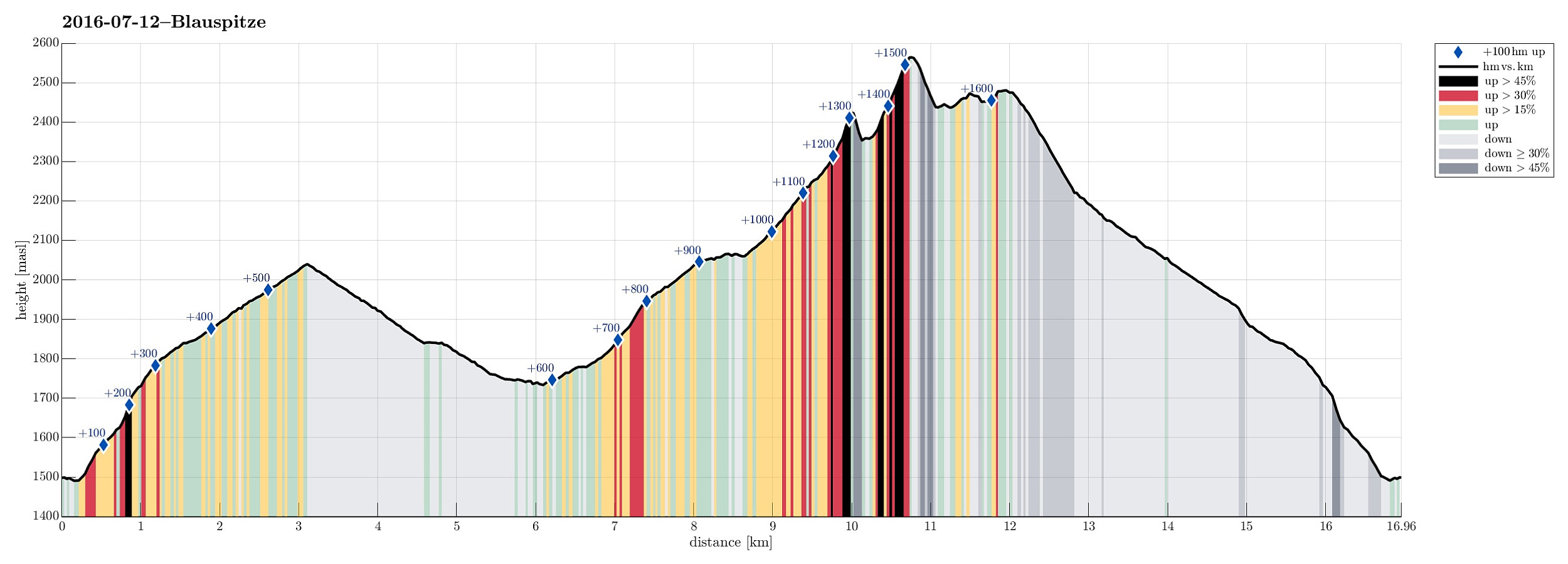
| Entfernung | 17,0km |
| Höhenmeter | 1.659m |
| GPS |
|
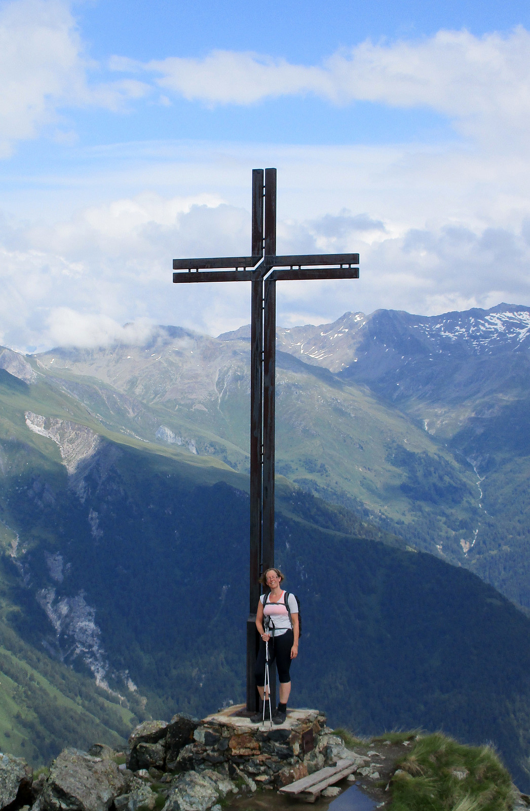
| Besteigungen | Blauspitze (2.575m) | 12.07.2016 |
|---|
Trip Summary
We started from Spöttling-Taurer in the upper end of Kals am Grossglockner, crossed over the Kalserbach there to the western side of the valley, and ascended from there along the Mitterbach-valley towards Kereralm. From there, we continued upwards towards the Hohes Tor. At about 2000m sea-level, we ended up in a thunderstorm and started to feel somewhat uneasy, exposing us too much to the bad weather. We therefore turned around and descended, again, following a forrest road southwards from Kereralm (at about 1800m sea-level). We connected to the place, where a lift comes up from Grossdorf, connecting to Ganotzalm, further up. We continued on the forrest road, which leads up to the hut Glocknerblick on about 1950m sea-level. There, we had a nice rest and filled up some energy (unfortunately, the weather did not allow any views over to Grossglockner as the name of the hut would suggest). While two of us descended from there, returning to Spöttling-Taurer, the two others of us continued upwards from there, heading for Blauspitze. We found a nice hiking path that crosses over a little stream northwards, just a bit above Glocknerblick. This path then leads upwards along a relatively steep ridge (which is easy to walk, however!). At about 2300m sea-level, we found a place, which was marked as the entry point of a direct route up Blauspitze, continuing along the (more and more steep) ridge. We started to ascend along this track, but found out after a while that it was not responsible to continued without any climbing equipment. We found a way back down on the hiking path, which goes around Blauspitze on a lower level, directly connecting to the Hohes Tor from there. At about half of this connection, slightly above 2400m lea-level, a hiking-connection to Blauspitze splits off to the left (southwards). This was our chance to make it up Blauspitze and we enjoyed great views from the top shortly afterwards! We then descended back along the same path, got back onto the connection to the Hohes Tor, and followed this one, reaching the Hohes Tor soon after. From there, we headed back downwards towards Kereralm, and eventually also back down towards Spöttling-Taurer, from where we had started earlier this day, following the same path that we had taken up. All in all, this was a longer hike with quite some height meters and intermixed impressions from the weather, including a thunderstorm, some rain, but also very nice hours with great views---at least within the nearer surroundings! :-)
Photos
Selected photos are available as Google photo album.
Useful Resources
See also the related FB-page Hiking around Bergen, Norway.
Web page Hikr.org describes a different route up Blauspitze and also web page Glocknerspur.at describes the same route.
Web page Osttirol.com describes the climbing route, which we started, but discontinued and also web page Bergsteigen.com describes this climbing route.


Benutzerkommentare