
Livarden from Unneland (wild!) (25.06.2016)

Geschrieben von HHauser (Helwig Hauser)

| Startpunkt | Li near Unneland (85m) |
|---|---|
| Endpunkt | Li near Unneland (85m) |
| Tourcharakter | Bergtour |
| Tourlänge | 3h 00min |
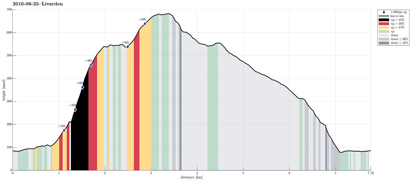
| Entfernung | 7,8km |
| Höhenmeter | 681m |
| GPS |
|
| Besteigungen | Livarden (683m) | 25.06.2016 |
|---|---|---|
| Besuche anderer PBE | Rambjørga (543m) | 25.06.2016 |
| Unnelandsvegen parkering (75m) | 25.06.2016 |
Trip Summary
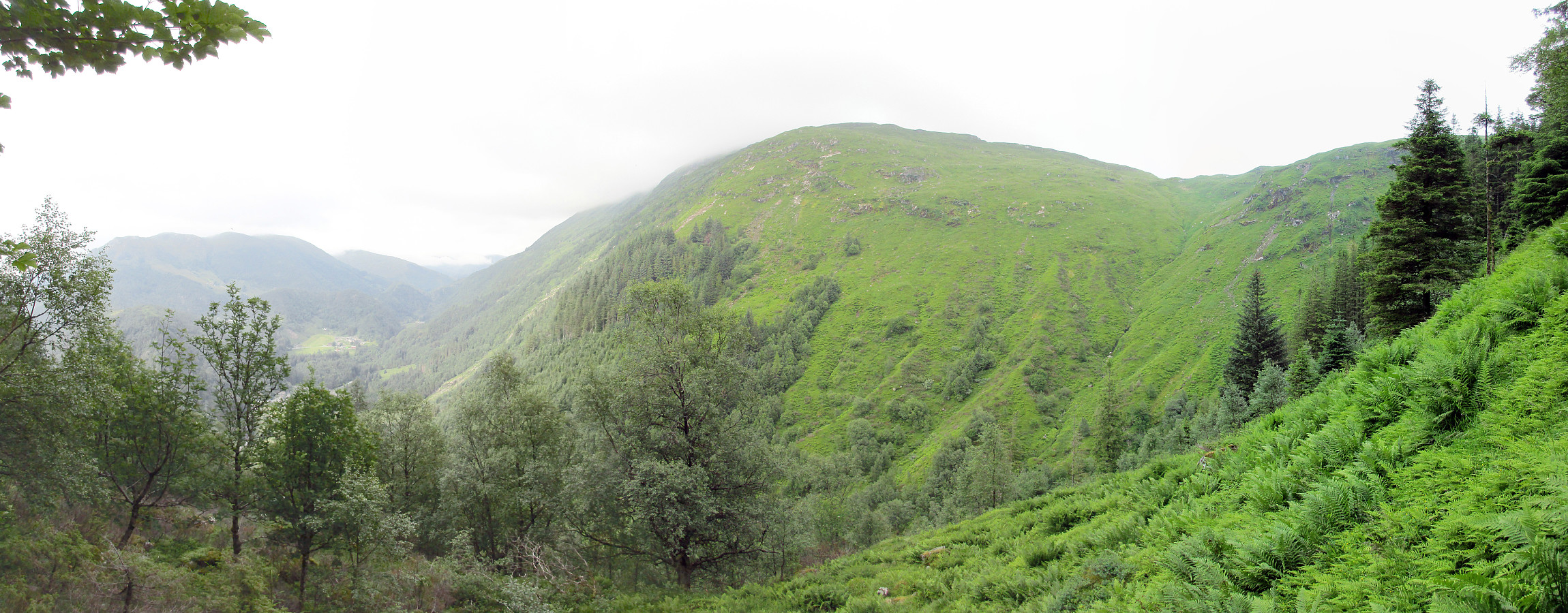
We parked near Li, Unneland, and continued, walking, along Unnelandsvegen until we came to Gullfjellsvegen. We followed this road just for a few meters (around the corner, basically), before we stepped over the little water, which comes down from Seterdalen. After a little forth and back, we found what looked like the path up towards Rambjørgsgjelet (in southern direction). At Glisningane, this path gets very close to Rambjørgselva, which jumps down through Rambjørgsgjelet. We followed this path as much up as we could, until it ended for sure at about 200m above sealevel. There it was pretty unclear of how to proceed best (through the wild). Remembering, what the map looked like (roughly), we decided to step over Rambjørgselva to the other (western) side and ascend (steeply!!) towards Rambjørga---leaving Rambjørgsgjelet basically straight up on its western side. This part of the hike was very steep and without any path---it was possible to step up this slope, yes, but it clearly was challenging and one should carefully consider whether to attempt to ascent, or not. Once we had reached the ridge of Rambjørga, hiking became straight forward, again (but still without any path). From the top of Rambjørga, we enjoyed great views towards Slettegga (with its top in the clouds), to Rambjørgvatnet, to Livarden (also with its top in the clouds), and over Haukeland and Espeland. We then crossed over Storamyra (on its very northern end) and continued ascending towards Livarden from there (no path, but easy to hike). The final ascent to Livarden is just over a gentle ridge (from the north). Once at the top, we followed the Rett Vest path that descends from the top of Livarden towards west (not following the main trail, southwards following the ridge, towards Riple). From there, it basically is always along this Rett Vest path, but one needs a bit of patience, sticking to this path, and not being mislead towards north, for example, on Karvestølen. In fact, one first needs to descend quite a bit into southwestern direction (down to the saddle that connects Livarden with Totlandsfjellet), before turning right and north from there. The path down to Unneland from there is (relatively) easy to find. One comes down right where Klubbaelva runs into Nygardsvika (part of Haukelandsvatnet). From there, it was only a few meters along the road back to our parked car. All in all, a nice and adventurous evening hike (adventurous mostly because of the ascent through Rambjørgsgjelet)! :-)
Photos
Selected photos are available as Google photo album.
Useful Resources
See also the related FB-page Hiking around Bergen, Norway.
Web page WestCoastPeaks.com provides useful information about Livarden
and also Petter Bjørstad has a page about Livarden.
On Bergentopp 200 there is a page (in Norwegian) about Livarden.


Benutzerkommentare