
Tarløysa (22.07.2009)

Geschrieben von Andyt (Andy Tomkins)
| Startpunkt | Nysetra |
|---|---|
| Endpunkt | Nysetervegan |
| Tourcharakter | Wanderung |
| Karte |
|
| Besteigungen | Tarløysa (1.086m) | 22.07.2009 |
|---|
I caught the 9.50 am Molde bus for the last time on this trip, and got the driver to drop me off at Nysetervegen in Sandnes. I started walking up the road, which led to the huts at Nysetra, and I stuck my thumb out when a car came along. In a few minutes a bloke stopped and drove me to the top of the road. He owned one of the huts and he dropped me off at the end of the road, where it was being extended and new huts were being built. He then led me across the churned up mud created by the road building and pointed out a path, unmarked on the map, which he said led to the top of Tarløysa.
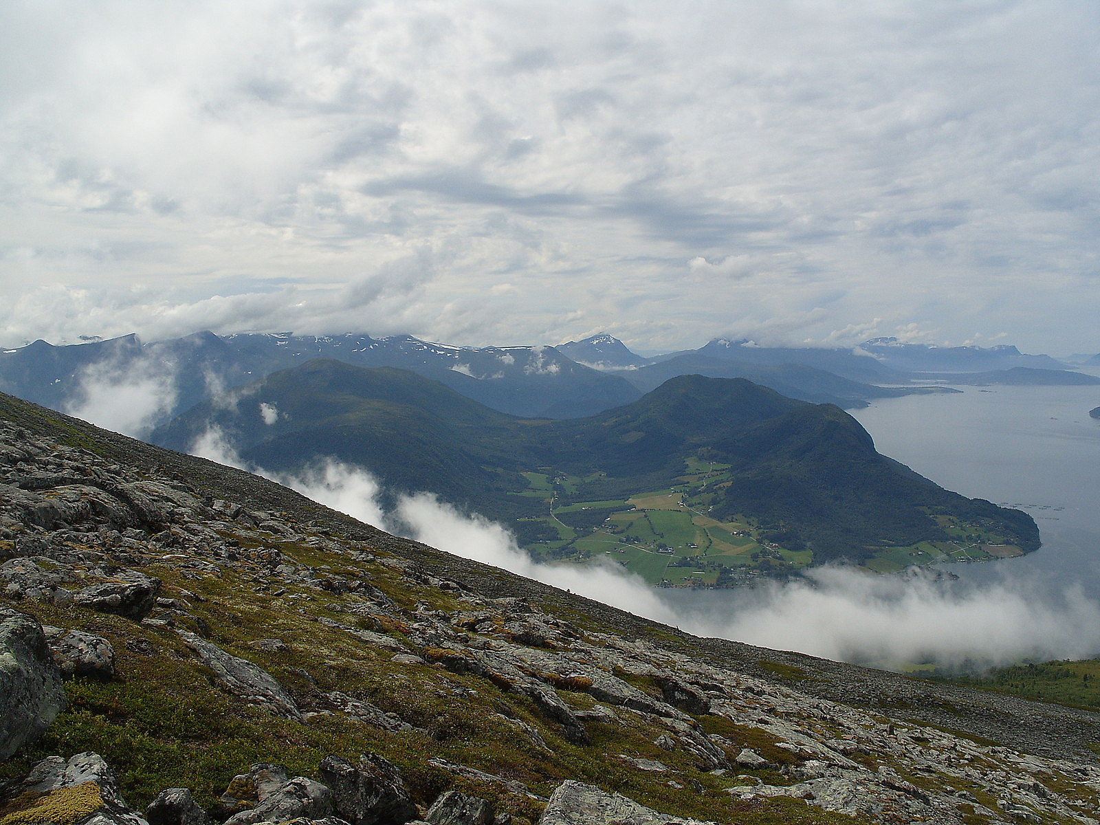
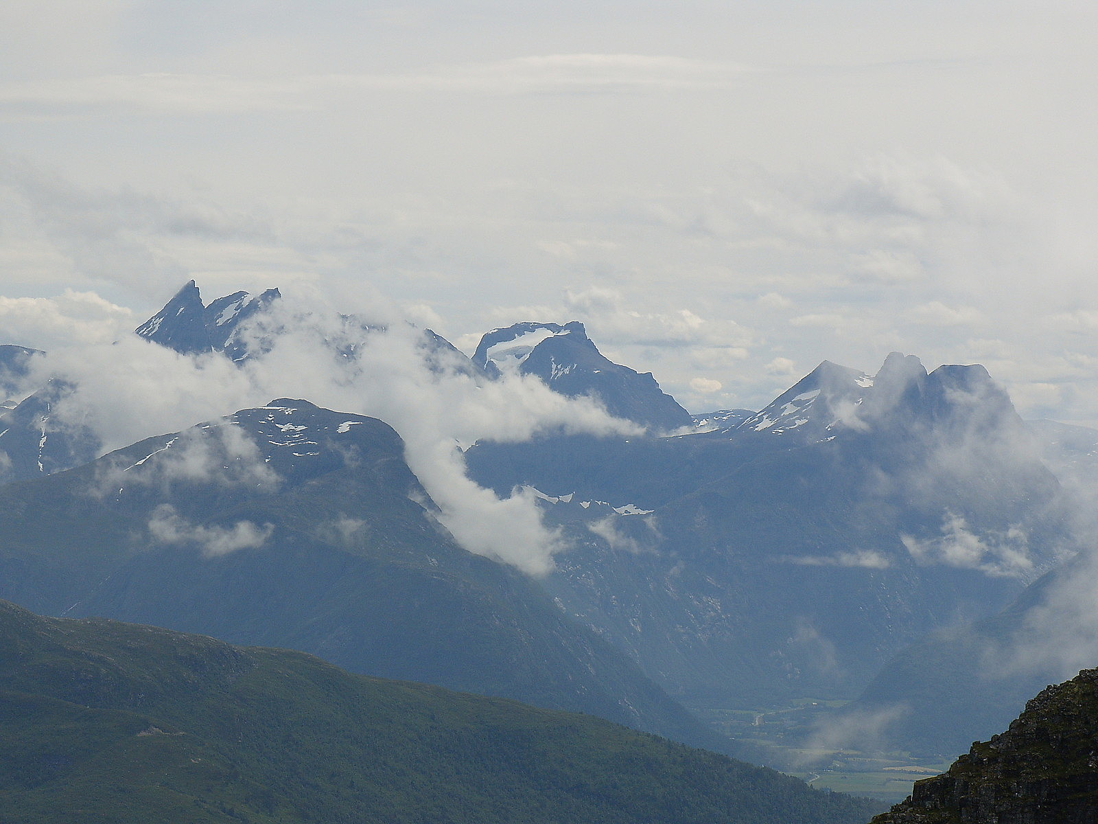
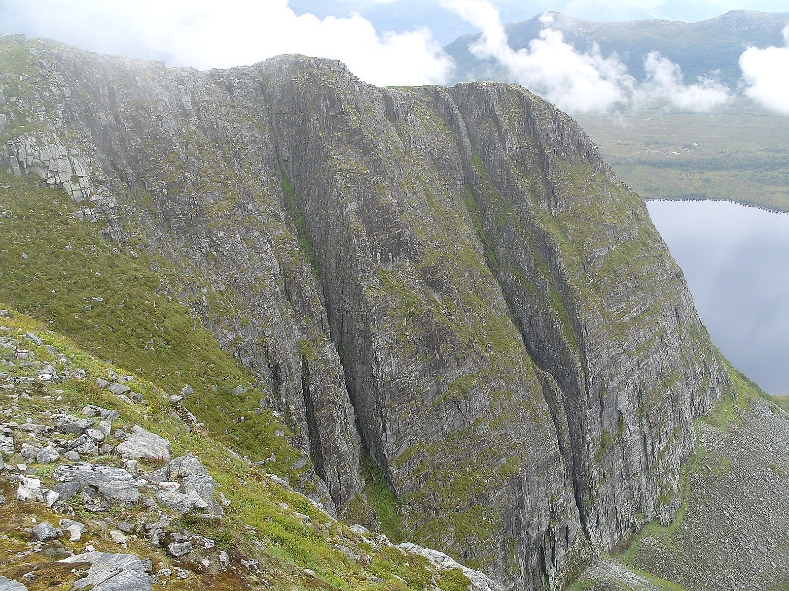
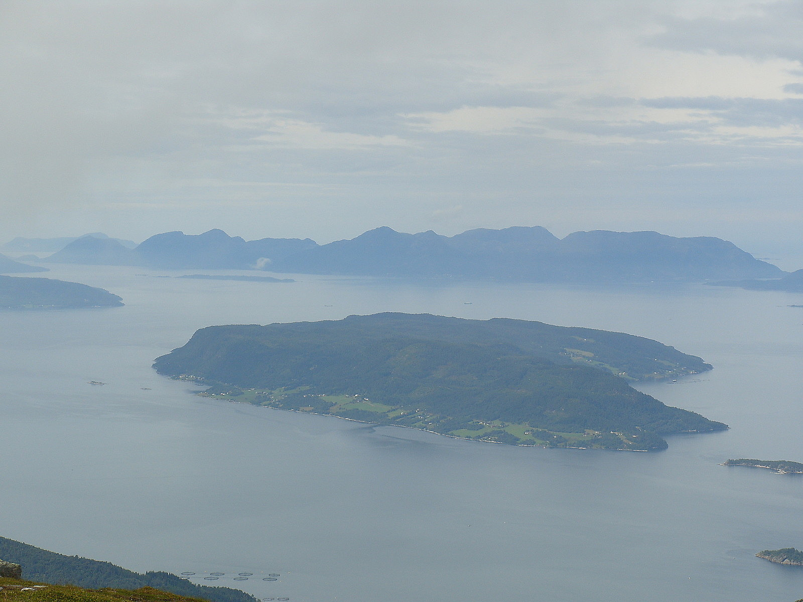
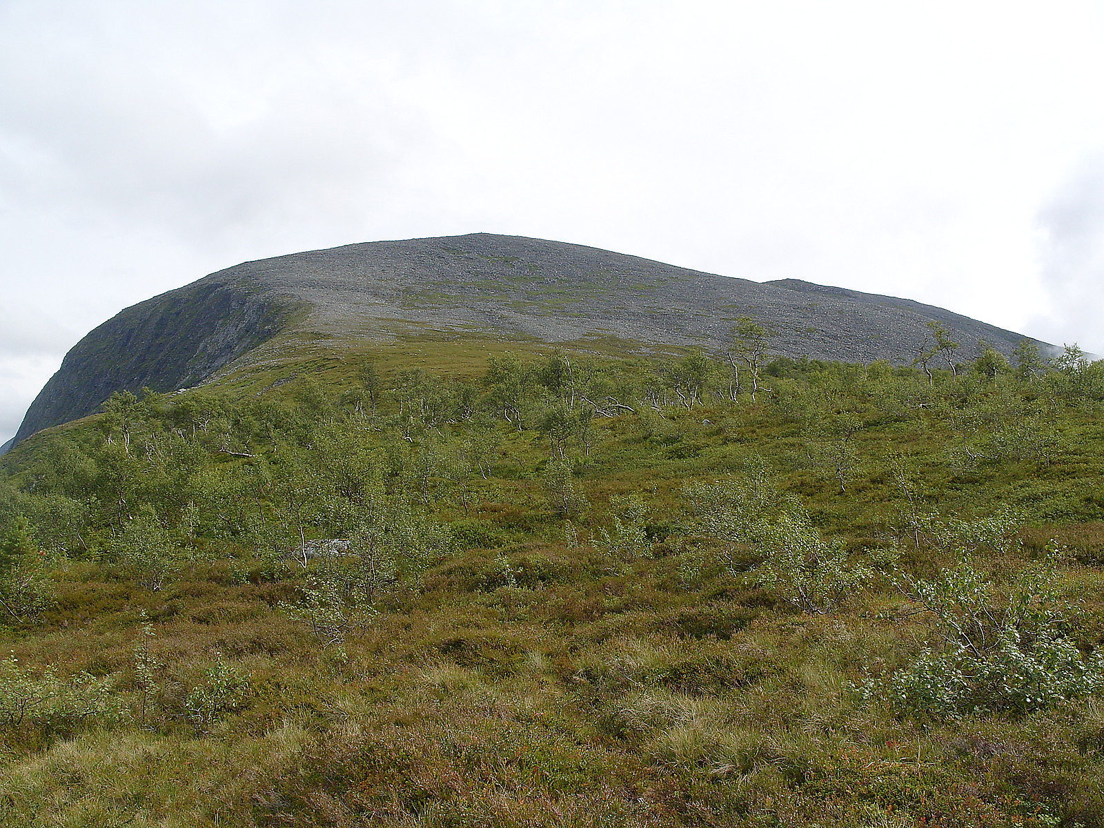
It was a cloudy morning with fog hanging over the valleys and fjords. At 400m it was completely foggy and it was rather ghostly and ethereal walking through the birch trees and bilberry on the clear and boggy path. The mist would clear from time to time, revealing Torvløysa rising above me, Romsdalsfjorden with Blåstolen, and Skåla (1128m) and Skarven (835m), either side of Langfjorden. The got above the last of the trees and at about 800m the slope steepened and I had to climb through an awkward boulderfield. Much of the mist had cleared and there were beautiful views to Skåla, Molde, Otrøya, Rødvenhalvøya, and the mountains along Romsdalsfjorden. There were traces of a path through the boulderfield but it still needed careful negotiation. I got up to the summit ridge, called Midtryggen on the map, and there were great views of the cliffs of the east facing corries. I reached the top after 2 hours. Although the actual summit was unmarked, there was a summit book and a hut which slept 4-5 people on the summit area. I stayed for 40 minutes and ate lunch and waited for the mist to clear. Eventually it cleared sufficiently to give fleeting glimpses of Skarven (1048m), Kvassetinden, and of the Romsdal giants.
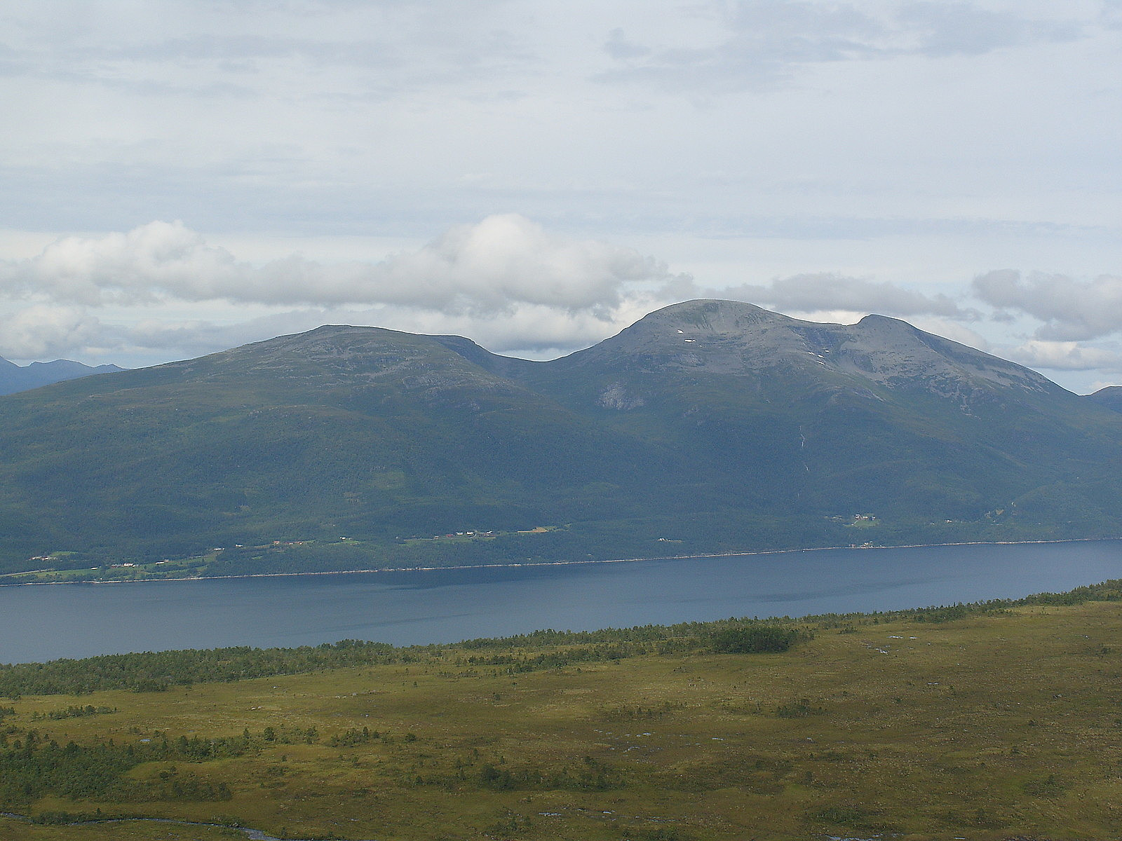
After lunch, I descended the way I came. Most of the mist had cleared and the sun was shining, making for a pleasant descent. The views were really beautiful, particularly out to the sea and across to Molde, Otrøya, Skåla and Rødvenhalvøya. Skåla (1128m) looked a fine hill, as did Kvitfjellet (833m) and Skåla (667m) on Rødvenhalvøya. Below the boulderfield the terrain became flatter and wetter and I lost the path for a while, before regaining it. I got to Nysetra after a 2 hour descent and walked down the road, enjoying the warm sunshine, to the main road and the bus stop. Just above Rv 64 I had an unexpected nosebleed but managed to get the 5 pm bus, ending my last walk of the trip.


Benutzerkommentare