
Around Jordalen (13.02.2016)

Skrevet av HHauser (Helwig Hauser)

| Startsted | Storbotn (110moh) |
|---|---|
| Sluttsted | Storbotn (110moh) |
| Turtype | Fjelltur |
| Turlengde | 6t 45min |
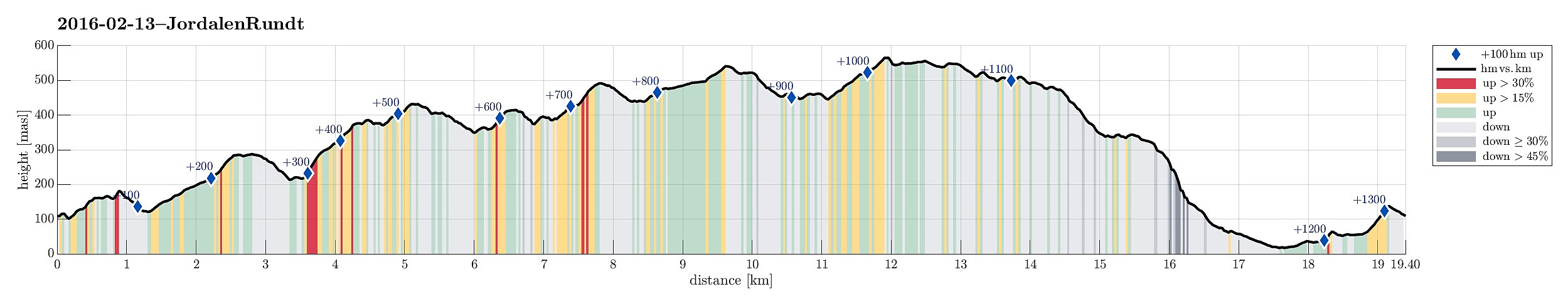
| Distanse | 19,4km |
| Høydemeter | 1313m |
| GPS |
|
| Bestigninger | Emanuel Mohns utsikt (480moh) | 13.02.2016 |
|---|---|---|
| Lavet N (513moh) | 13.02.2016 | |
| Lavet SØ (526moh) | 13.02.2016 | |
| Orretua SØ (350moh) | 13.02.2016 | |
| Raunfjellet (389moh) | 13.02.2016 | |
| Rollandsoksen (186moh) | 13.02.2016 | |
| Rundemanen (568moh) | 13.02.2016 | |
| Rundemanen Vest (557moh) | 13.02.2016 | |
| Ulskebjørnen (446moh) | 13.02.2016 | |
| Øst for Stangelifjellet (418moh) | 13.02.2016 | |
| Andre besøkte PBE'er | Bergen Radio Maskinhus (552moh) | 13.02.2016 |
| Bergen Radio Stasjonsbygning (553moh) | 13.02.2016 | |
| Dræggehytten (433moh) | 13.02.2016 | |
| Dyrhovda (543moh) | 13.02.2016 | |
| Eidsvågshytten (452moh) | 13.02.2016 | |
| Gutenberghytten (ruin) (479moh) | 13.02.2016 | |
| Hus vest for Rundemansmasten (546moh) | 13.02.2016 | |
| Kvitebjørnen (482moh) | 13.02.2016 | |
| Kåken (511moh) | 13.02.2016 | |
| Nødkjelke, Hyttelien (446moh) | 13.02.2016 | |
| Orretua (329moh) | 13.02.2016 |
Trip Summary
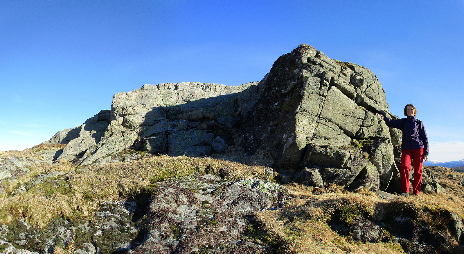
Having delivered our son in Tertnes, we parked very near at Storbotn (where Den Trondhjemske Postvegen comes by). We walked first along Den Trondhjemske Postvegen towards northeast, before we departed to the left and up Eikhøyen (and from there to the top of Rollandsoksen---not really a big hill, but with a nice view over Tertnes!). From there, we hiked down to Kolåsen, from where we took Rollandsvegen up to where a path leaves, leading to the southeast. We ascended to the saddle (near Steindalen), right below Litlanipa, from there. Instead of following the main route (via Stornipa and Nukane to Storsåta), we crossed the saddle to the other side, descending into Traudalen. Near two masts of the power line which runs through this valley, we crossed Nedgardselva and continued (along the hillside, only slightly ascending) in mostly southern direction. Before the terrain became steeper, at the edge of a forrest, we found the path the leads upwards to Rantelhøyen. We took this path, passed Rantelhøyen, and ascended further towards Raunfjellet, rounding it almost halfway as we went (the last meters up to the top, we came from southeastern direction). We enjoyed the views from there, before continuing to Storsåta from there (not far). From Storsåta, we continued along the long ridge towards Byfjellene, passing by Setervatnet first (on the heights) and getting Stangelifjellet from there. High above Vinddalen, we made a short break, before we continued further towards Byfjellene. On Ørnafjellet, we decided to make a short detour to Ulskebjørnen, from which we enjoyed the views of Jordalen and Vinddalen. From there, we continued in southeathern direction (but in parallel to the main path that leads along the eastern side of these heights). We headed directly for Dyrhøgda, where we enjoyed, again, terrific views in all directions. From there, we connected to Byvegen, crossed Jordalsskaret, and continued to Rundemanen on the other side. From Rundemanen, we followed the high ridge towards northwest (via Kvitebjørnen towards Ørretua). From Ørretua, we descended (steeply!) to Den Trondhjemske Postvegen, again. We crossed Eidsvåg, walked over Forkleiva and Glasskaret back to our car. After almost seven hours of hiking, we returned satisfied (and our feet were quite glad to be relaxed in the car :-)).
Photos
Selected photos are available as Google+ photo album.
Useful Resources
Web page WestCoastPeaks.com provides useful information about Storsåta, Raunfjellet, Nukane, and Slettafjellet as well as Rundemanen and Blåmanen.
Web page UT.no from the Norwegian Trekking Association recommends another hike around Jordalen.
On Bergentopp 200 there are pages (in Norwegian) about Slettafjellet, Nukane, Storsåta, Stangelifjellet, Rundemanen, Kvitebjørnen, and Ørrtua.


Kommentarer