
Engeset and Dyngelandsåsen (30.01.2016)

Geschrieben von HHauser (Helwig Hauser)

| Startpunkt | Dyngelandsvegen (65m) |
|---|---|
| Endpunkt | Dyngelandsvegen (65m) |
| Tourcharakter | Bergtour |
| Tourlänge | 1h 30min |
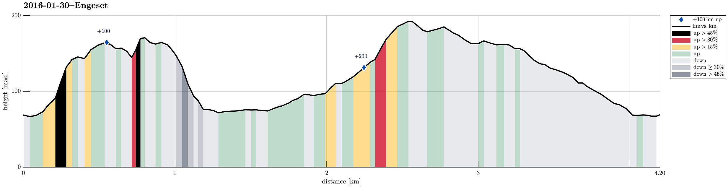
| Entfernung | 4,2km |
| Höhenmeter | 282m |
| GPS |
|
| Besteigungen | Dyngelandsåsen (196m) | 30.01.2016 |
|---|---|---|
| Floråsen (172m) | 30.01.2016 | |
| Besuche anderer PBE | Tårnnebben (168m) | 30.01.2016 |
Trip Summary
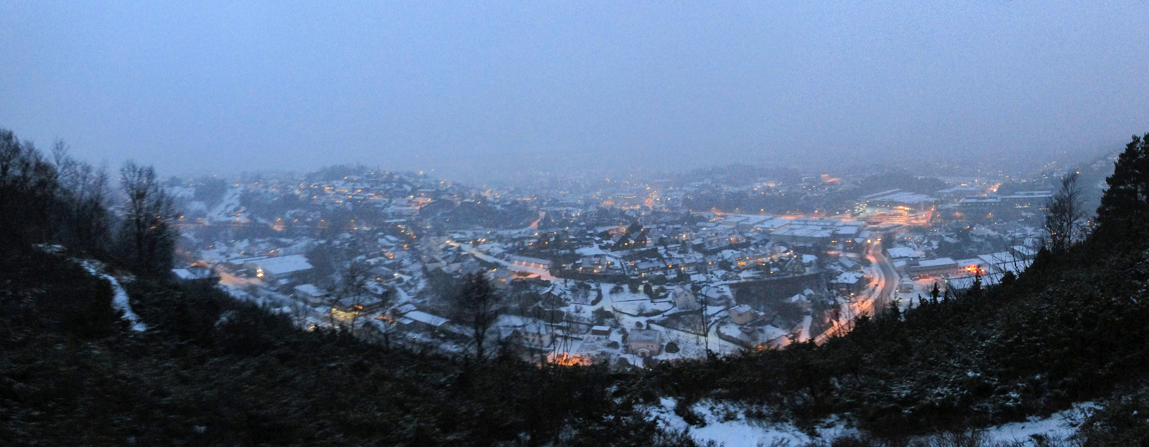
I parked the car at the very end of Dyngelandsvegen (where it meets Totlandsvegen) and crossed the bridge (on Totlandsvegen) towards southeast (only a few meters from the parking place). Right after the bridge, I turned left (without any path, however), because I hoped to find a reasonable spot for climbing Engeset from there. After only a few steps, it became clear that this was not easy---first of all, moving forward in horizontal direction was difficult, because of fallen trees, big stones, etc.; then, getting up to Engeset also turned out to be challenging (this side of Engeset, its northwestern side, is really very steep and in most places it is simply impossible to get up)! After proceeding a bit towards northeast, I finally found a place, where I assumed that ascending to Engeset could be possible. I tried it and managed indeed to get up there---still, it's not recommended to repeat this (I won't do it again, I guess!). Once, I had reached the ridge, moving on became significantly easier and I was able to travers all of Engeset, walking along the ridge all the time, basically. Only at one point, when I crossed over the top-end of Floråsdalen, proceeding became a little challenging, again---also there because of steep terrain. Descending from Engeset on its northen side was uneventful and I reached Dyngelandsåsen, before it was too late (in the evening). Therefore, I decided to follow my original plan and proceeded towards Dynglandsåsen on the other side of Dyngelandsvegen. I followed the road for a few meters (in northeastern direction), before I turned left at Nedrebø. There, I followed a narrow road that leads upwards in northern direction. I past the last house next to this simple road, continuing on a forrest road---at least for a short while. Next to some small stream, coming down from Dyngelandsåsen (basically right underneath a power line that is easy to spot), it started to be a little more steep. Shortly before reaching the ridge of Dyngelandsåsen, the continuation of the path became unclear---I therefore left the small valley and ascended on its left side up to the ridge. I followed the ridge further upwards (in southwestern direction), reaching the top of Dyngelandsåsen quickly (also called Oksla?!). From there, I continued in southwestern direction, basically always following the ridge. I came by Tårnnebben, from where I enjoyed some nice view over the nearby city parts (at this time, it already was dark---not completely dark, fortunately---the snow helped!). From there, it was only a few further steps (following the ridge), before I got to the highest houses of Byskarbakken (and from there, following Engesetvegen, back to the car). All in all, this was more of an adventure than expected (steep terrain, dark in the end, etc.)---still it was good to get some fresh air on this short round! :-)
Photos
Selected photos are available as Google+ photo album.


Benutzerkommentare