
Olsnesnipa (16.01.2016)

Written by HHauser (Helwig Hauser)

| Start point | Parking on Trollskaret (350m) |
|---|---|
| Endpoint | Parking on Trollskaret (350m) |
| Characteristic | Backcountry skiing |
| Duration | 4h 00min |
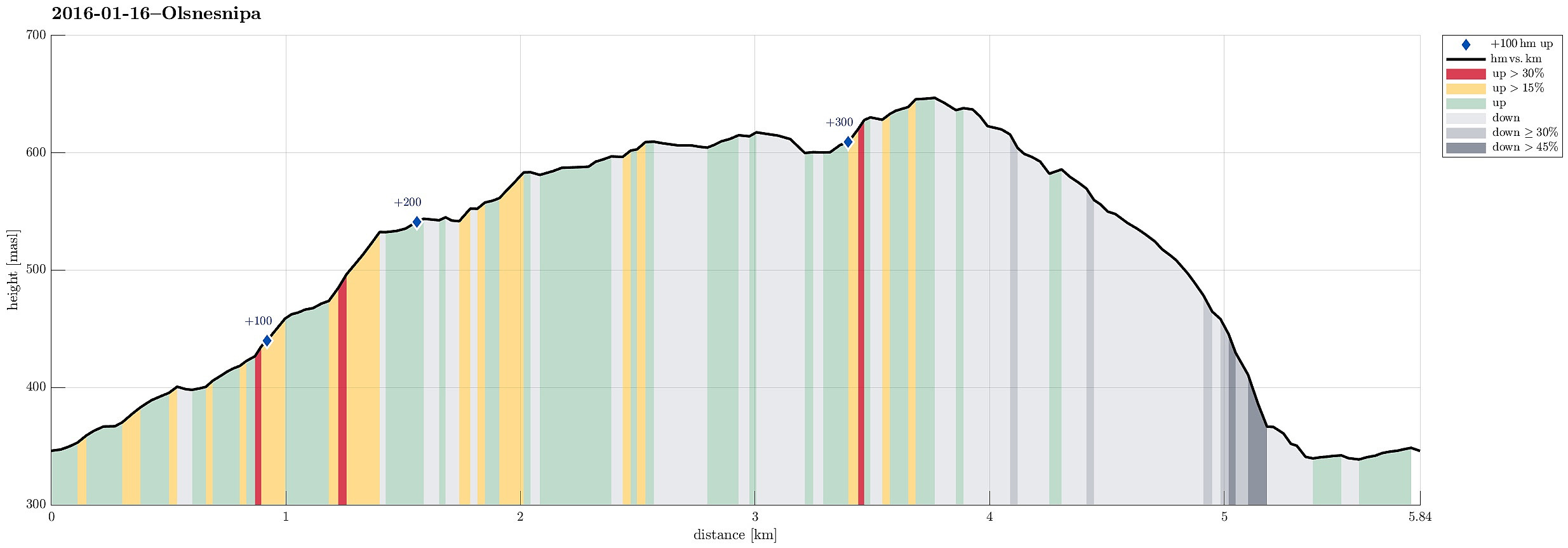
| Distance | 5.8km |
| Vertical meters | 364m |
| GPS |
|
| Ascents | Olsnesnipa (653m) | 16.01.2016 |
|---|---|---|
| Visits of other PBEs | Båtaleitet p-plass (350m) | 16.01.2016 |
Trip Summary
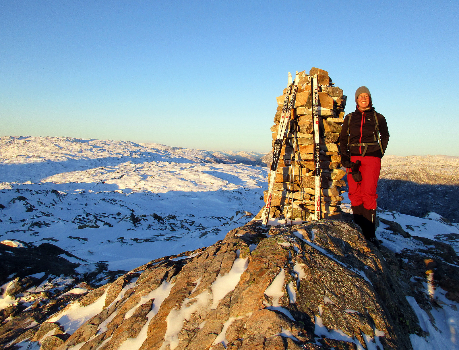
We parked at the parking on saddle Trollskaret, right about Bruvik on the southeastern "corner" of Osterøy (after crossing the bridge, you turn right right away to get to Bruvik). From the parking place, we stepped into the terrain at once, skiing into an Eastern direction, first. We ascended to Sethaugen and then continued along a gentle ridge towards Olsnesnipa. It's interesting that this is "only the other Olsnesnipa" up there, with the more prominent one being close, at "the Southern end" of the mountain range, which is most prominently marked by Rispingen in the north. This other, more prominent Olsnesnipa is also called Olsnessåta. From the one Olsnesnipa that we had come by, we continued towards Skarvenipa, first, before then turning right (bascially at the spot, where an according sign is set up). We then skied over the top of this mountain range, mostly southwards, first. We came by an impressive crevice, before crossing over to a small top, which stands out nicely from the surrounding, but which seemingly does not have a name---at least, I could not find any (even when searching for a quite a while). Or maybe the label Galnanipa belongs to this top?? Here in Peakbook, it's (also!) called Olsnesnipa---a third one?? From there, we continued, firth in southern direction, before then turning right, more and more. We skied down the mountain, eventually in a Western direction, then. At one point, pretty far down, already, it became too steep to continue skiing and also trees and vegetation became too dense to get through easily. That marked the point, where we mounted our skies on my backpack and descended the remaining meters on foot. We ended up crossing a very narrow small valley (the one, which we had surrounded on the mountain above), and then finding our way to the street. Once we came close to the street, we followed it upwards for a few meters to get back to our car. All in all, this was a beautiful skiing tour on wonderful Osterøy. With our cross-country skies, it took us longer than what we had expected, so it was almost completely dark, when we had returned to our car.
Photos
Selected photos are available as Google+ photo album.
Useful Resources
Web page WestCoastPeaks.com provides useful information about Rispingen, Raudskredbruni, and Olsnesnipa (Olsnessåta)
and also Petter Bjørstad has a useful page about Rispingen.
Web page UT.no from the Norwegian Trekking Association recommends another hike up Rispingen.


User comments