
Around Spåkevatnet (06.12.2015)

Geschrieben von HHauser (Helwig Hauser)

| Startpunkt | Arna Stadion (90m) |
|---|---|
| Endpunkt | Arna Stadion (90m) |
| Tourcharakter | Bergtour |
| Tourlänge | 2h 30min |
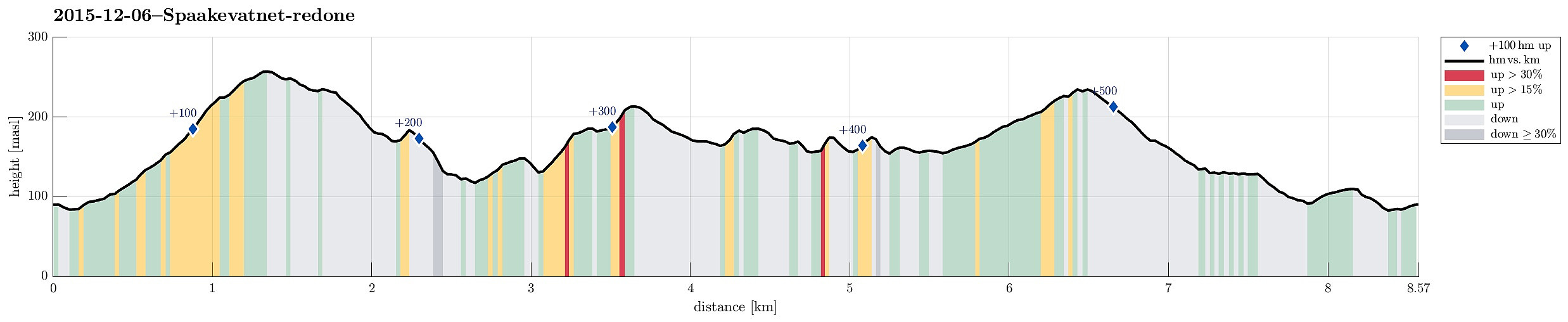
| Entfernung | 8,6km |
| Höhenmeter | 548m |
| GPS |
|
| Besteigungen | Beitelen (259m) | 06.12.2015 |
|---|---|---|
| Ulvaberget (219m) | 06.12.2015 | |
| Nystemhaugen (187m) | 06.12.2015 | |
| Spåkefjellet (236m) | 06.12.2015 | |
| Sør for Beitelen (185m) | 06.12.2015 | |
| Besuche anderer PBE | Arna Stadion p-plass (90m) | 06.12.2015 |
| Arna stadion parkering (88m) | 06.12.2015 |
Trip Summary
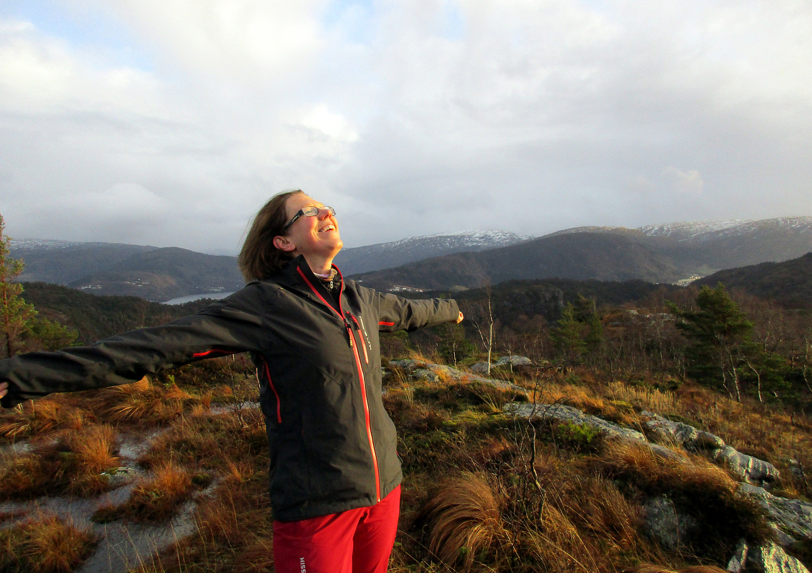
We parked near Arna Stadion and crossed Spåkelva where the sports flat covers a part of it in the southwest. A few meters up from there and we came to Spåkevegen, which lead us a short bit towards south, along Spåkelva, before a sign helps to find the ascent to Beitelen (departing from Spåkevegen to the right). A well visible path leads up a gentle ridge that leads to a small top just underneath Beitelen---from there, one enjoys a good overview over Spåkevatnet. From there, it's only a few meters to the top of Beitelen---actually, one first gets to a saddle and if one really needs to visit the very top of Beitelen (not that great, however), then one would first turn right at this saddle. We reached the top quickly, mostly in order to see, whether there would be nice views northwards from there (which there aren't---mostly, because of trees that obstruct these views). From there, we returned to the small saddle and continued from there southwards along the high ridge that leads down from Beitelen (towards the south). We followed this ridge (with a few small sub-tops along it) all the way to its southern end (at Stokkelei)---there, the path meets a better path that connects back to Spåkevatnet. Before actually reaching Spåkevatnet, we turned right, however, crossing a little stream (with a lot of water) and heading for Lydarnipa (a not very high, but nicely shaped sub-top at the southern end of Spåkevatnet). From there, we aimed northwards to find a way to connect to Spåkefjellet. What seemed to be a path first, quickly turned out to be more the "path" of animals. When the terrain became steep, we turned right and sourrounded Kolbot on a moderately high level, mostly eastwards and in the direction of Stemmevatnet. Back on the ridge, there, we followed it northwards (on a simple path, also!). At the western end of Stemmevatnet, the path ended up crossing the stream that runs off Stemmevatnet---deeply submerged in the large amounts of water that streamed off Steemevatnet (yes, there was a lot of rain, recently!). Not 100% excited to step deeply into the ice-cold water, we turned back and thought that we could find another way northwards---only to find out a short while later that Stemmevatnet is shaped like an upside-down "U" (with the eastern part leading much more south than its western end). Having found out this and not willing to go a comparably large extra-round, we got back to the submerged part and crossed the water there (yes, with dripping wet and ice-cold shoes!). From there, we continued northwards on easy-to-find, but wet paths that brought us upwards in Sjurstodalen (the original plan was to follow the high ridge on the east of Sjustodalen, but for that we would have had to go a little back (along Stemmevatnet), which we didn't. Up on the saddle, we decided to quickly make the small top of Spåkefjellet, before heading back to Arna Stadion. Having several options for getting down and back, we not necessarily took the shortest path there. Still, we got back well and satisfied after a refreshing nice little hike in the back-yard of Bergen! :-)
Photos
Selected photos are available as Google+ photo album.
Useful Resources
Petter Bjørstad has a useful page about Beitelen.
On Bergentopp 200 there is a page (in Norwegian) about Beitelen, one about Lydarnipa, and one about Spåkefjellet.


Benutzerkommentare