
Liatårnet and Høgafjellet (15.11.2015)

Written by HHauser (Helwig Hauser)

| Start point | Fjell Festning parking (60m) |
|---|---|
| Endpoint | Tellnes (30m) |
| Characteristic | Hillwalk |
| Duration | 2h 45min |
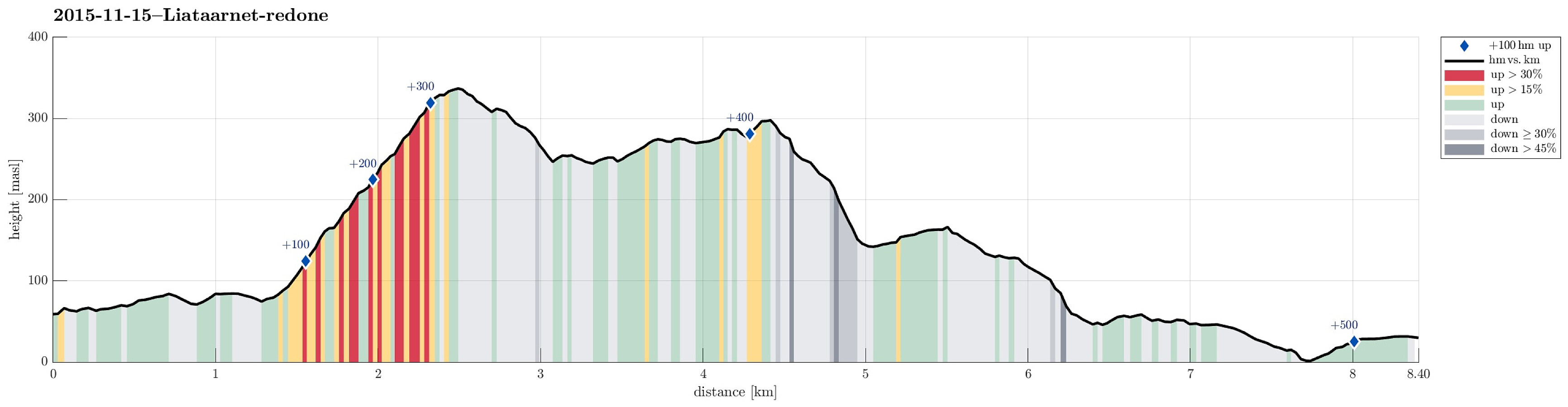
| Distance | 8.4km |
| Vertical meters | 509m |
| GPS |
|
| Ascents | Høgafjellet Nord (299m) | 15.11.2015 |
|---|---|---|
| Liatårnet (341m) | 15.11.2015 | |
| Visits of other PBEs | Haganesfjellet p-lomme (54m) | 15.11.2015 |
| Høgafjellet Sør (300m) | 15.11.2015 | |
| Liatårnet parkering (55m) | 15.11.2015 |
Trip Summary
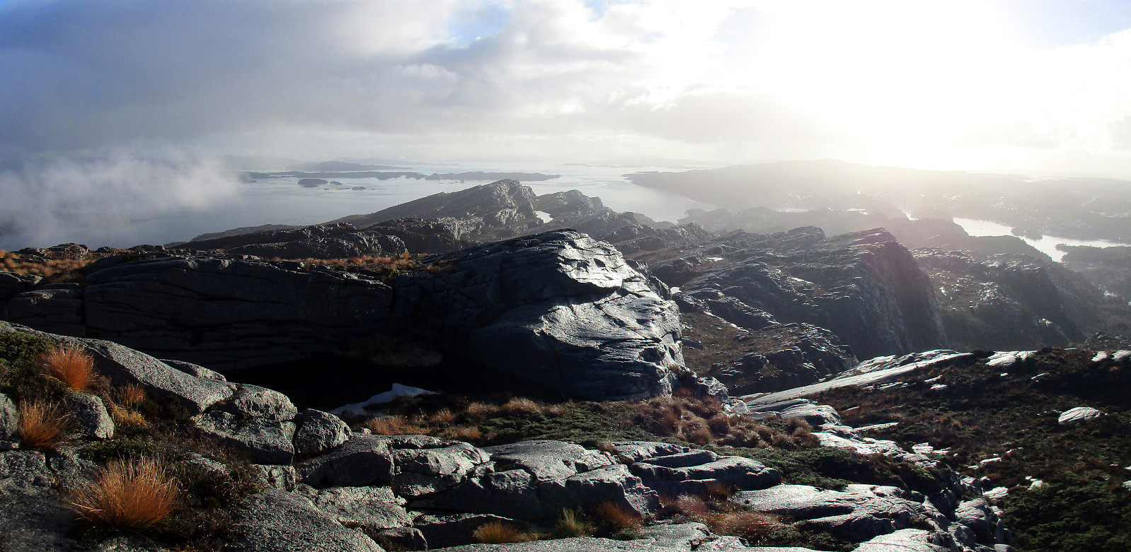
We parked south of Fjell, where a road departs, leading to Fjell Festning. We followed this road for a bit, before we continued towards Liatårnet (to the right). Someone has put significant efforts into putting signs up and marking the path, so it's really straight forward now to find the path up Liatårnet. :-) From Liatårnet, we enjoyed nice views in all directions, before we continued southwards towards Høgafjellet. After the first descent, we probably followed an older path, before we connected back to the blue-marked path towards Høgafjellet. The path from Liatårnet to Haganes, via Høgafjellet, is really very nice with great views and rough, wild romantic impressions. Before walking out towards the road near Haganes, we descended to a half-high level. We were wondering, whether it would not have been possible to connect from this level back to the parking, but even though we looked carefully, no path could be found. Once on the road, we started to walk back to our parked car along the road. After several minutes, we were picked up and shortened thereby our return to the parked car.
Photos
Selected photos are available as Google+ photo album.
Useful Resources
Web page WestCoastPeaks.com provides useful information about Liatårnet
and also Petter Bjørstad has a useful page about Liatårnet.


User comments