
Kvigedalsegga (23.08.2015)

Geschrieben von HHauser (Helwig Hauser)

| Startpunkt | Tretteneset (10m) |
|---|---|
| Endpunkt | Tretteneset (10m) |
| Tourcharakter | Bergtour |
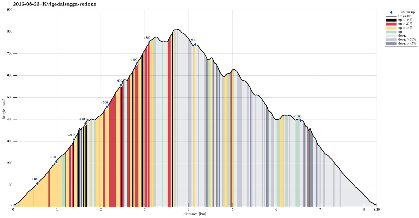
| Tourlänge | 4h 30min |
| Entfernung | 8,3km |
| Höhenmeter | 1.036m |
| GPS |
|
| Besteigungen | Kvigedalsegga (813m) | 23.08.2015 |
|---|---|---|
| Besuche anderer PBE | Dalseidstølen (407m) | 23.08.2015 |
| Dalseidstølen p-plass (40m) | 23.08.2015 |
Trip Summary
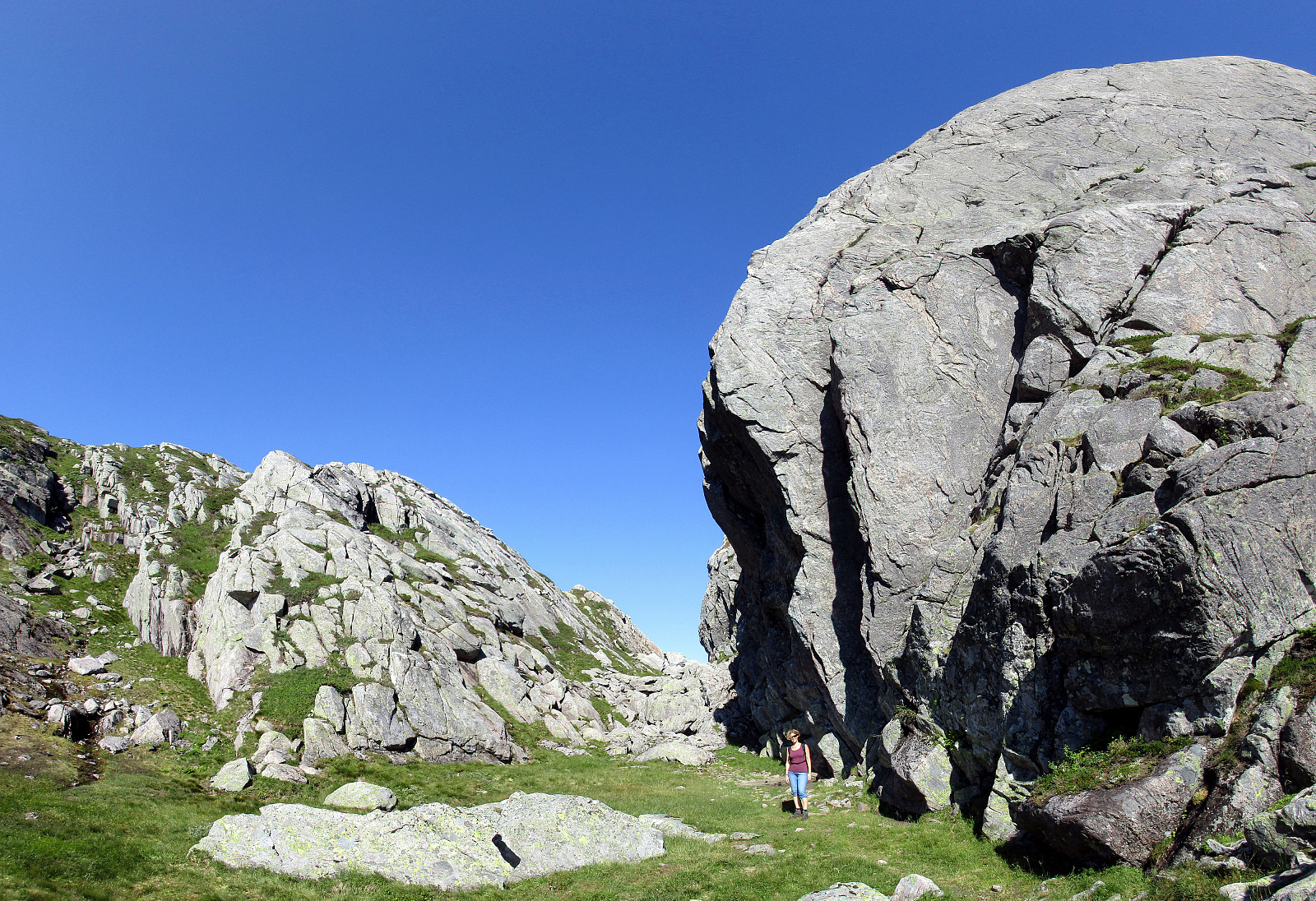
Taking E16 from Bergen into the direction of Voss, we passed by Dale and turned left in Dalseid, shortly after. We then came through five very short tunnels along the fjord, before parking next to the road, right before Tretteneset. From there, we first walked up a forest road, which quickly ascends through Dalseidmarkåna. At about 260 masl, the forest road turns left and connects to Sæterdalen, while we continued in Dalseidmarkåna, right underneath the steep and high northern cliffs of Stølsberget (while it is easy to see, where to leave the forest road, it isn't 100% easy to then find the path further upwards -- keeping as close to the cliffs and as high above the stream as possible, on the southern side of it, seems to be a good rule to find the simple path, though). At about 400 masl, the valley opens up a bit and one gets to Dalseidstølen -- a nice little cabin "ruling" over this middle-high mountain valley. From there, first went a few more steps towards the west, before then turning right and ascending steeply up to the ridge, which separates Dalseidstølen from the next valley, Straumsmarkåna. We found our way up to this ridge without any path (likely there isn't any, really) and it was quite OK -- still, it should be noted that at times this ascent is very steep and a little bit of climbing was also necessary (just a few meters, though). At the ridge, we continued upwards, enjoying nice views in all directions -- the area there is really impressive and nice to look at! Before getting all the way up to Kvigedalsegga, we first reached a smaller top just a bit north of Kvigedalsegga -- from there we had the first very nice view down to Nedre Krokavatnet (west of Kvigedalsegga). We then continued to Kvigedalsegga, being even more impressed of the views (Øvre and Nedre Krokavatnet, etc.). From there, we continued southwards, into the saddle right below Kvigedalsegga. Massive rock formations are impressive to look at, there. From there, we thought that going back towards Dalseidstølen (eastwards) should be possible. After descending a good bit into the valley, we understood that the terrain became very steep -- too steep, actually, to simply descend into the valley underneath (I suspect that it may have been possible to turn left, again, and surround the very steep part on its northern side). Instead, we found a place, where we could cross the crevasse, getting around some cliffs to the right. We came to a rather flat and swampy plateau and first followed the little stream which drains this area -- hoping to follow it further down into the valley below. Quickly, however, it became clear that this was no option -- the stream started to jump down a many meters high vertical cliff, leaving us with a wonderful view over the valley on top! :-) Consequently, we changed direction, again, and went southeastwards in order to search for another place to descend. This worked better and we found another stream that lead us down a good bit (steep, but OK). While the stream continued through a narrow crevasse, again, we followed the ridge above it (on its eastern side, now), finding ourselves again at the upper end of high cliffs (now facing Kvigedalsegga to the west). Still, we could descend on the other side, towards Sæterdalen. Before arriving at the swampy areas right west to Stølsberget and right underneath the cabin Dalseidstølen, we turned left again and found a very nice small pool (a natural pool, of course), where we enjoyed a short and refreshing dip! :-) From there, we basically descended back to our car along the path that we also had taken up. All in all, this was a marvelous hike through wonderful nature and with excellent views -- the matter of fact that most of it was without any path made it a bit longer than originally anticipated (but we had time and enjoyed it nonetheless).
Photos
Selected photos are available as Google+ photo album.
Useful Resources
Web page WestCoastPeaks.com provides useful information about Høgenipa, Knutstignovi, Hestafjellet, Kvigedalseggi, Slåttenovi, Harafjellet, Nipa.


Benutzerkommentare