
Sveåsen from Kismul (05.08.2015)

Written by HHauser (Helwig Hauser)

| Start point | Kismul (60m) |
|---|---|
| Endpoint | Kismul (60m) |
| Characteristic | Hillwalk |
| Duration | 2h 00min |
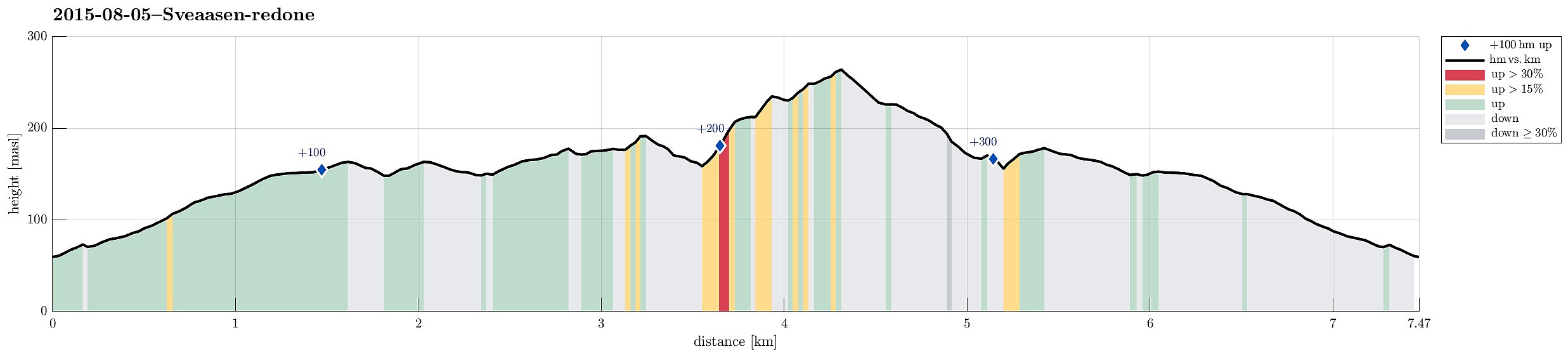
| Distance | 7.5km |
| Vertical meters | 329m |
| GPS |
|
| Ascents | Sveåsen (266m) | 05.08.2015 |
|---|---|---|
| Visits of other PBEs | Kismul p-lomme (90m) | 05.08.2015 |
Trip Summary
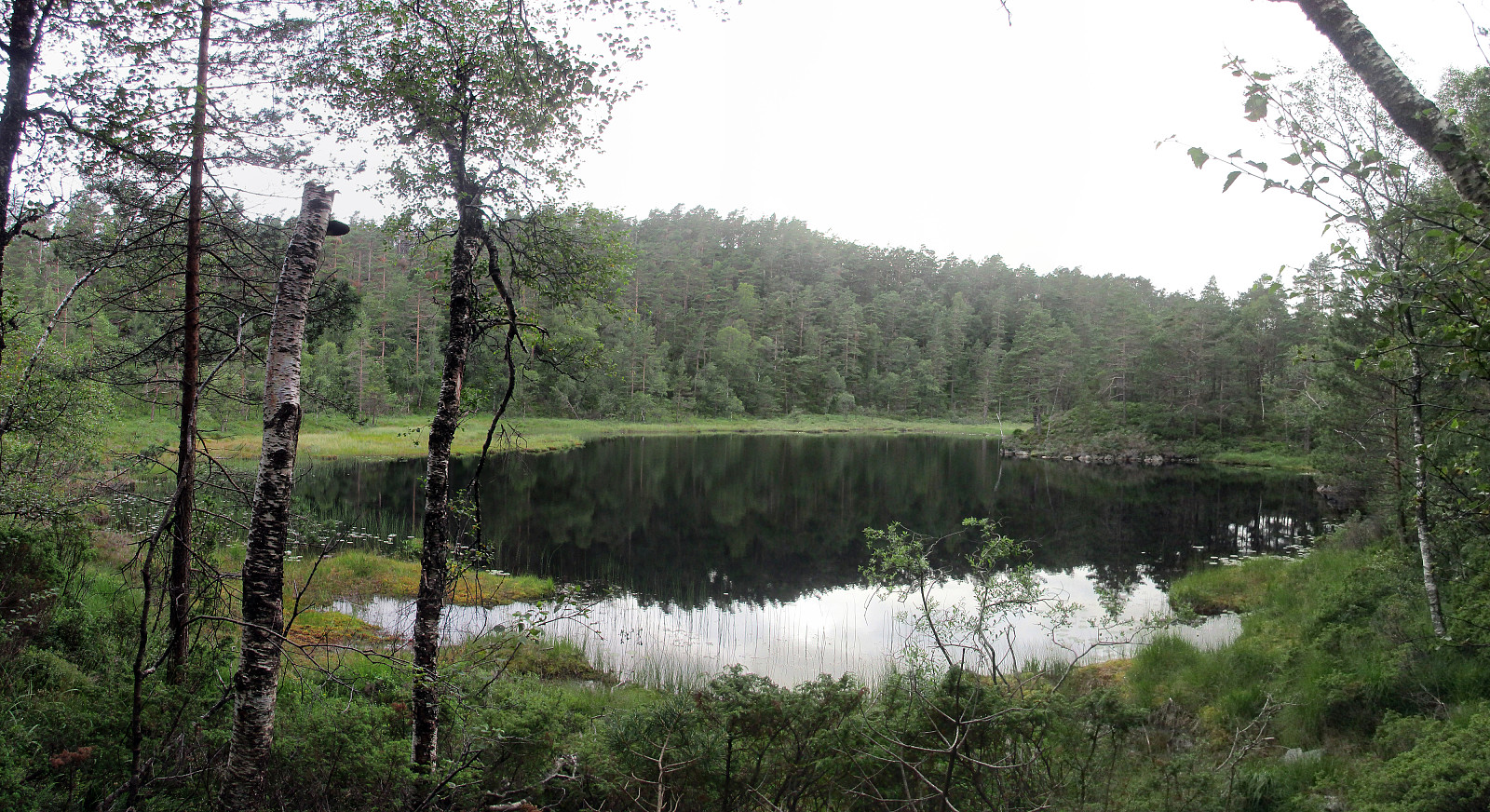
We parked at Kismul, right next to the small street, which leads around Kalandsvatnet, and right next to a partially legible note that informed (more than informs) that earlier the train would also stop there at Kismul (this explains, also, why there is a quite nice cycling path, in extended stretches parallel to the street), and walked up Kismulvegen first. Shortly after passing the last (of very few) houses, a forest road branches to the right and gently upwards. Following this road, one gets up to Svartevatnet with a very easy and relaxed walk. The vegetation next to the path is very varied and it is very enjoyable to walk this forest road! After first walking all the (not very long) way straight ahead towards Svartevatnet (at the lake, we clearly had the impression that the water level was very high -- probably already for a longer time -- as a number of trees were standing in the water, not looking very healthy anymore), we then went back, again, to further follow the forest road, which swings to the right after getting close to the water in another place. Following the forest road northwards, next to Sveåsen, we saw a sign that invited us on a small path (the sign said "marked path to Sveåsen", in Norwegian). We followed this path, which basically lead back (southwards) and along Svartevatnet, again. At one point, we wondered whether the marked path would lead upwards (to Sveåsen) and it's possible that it does so, but we continued along the lake (on a nicely visible path, also). When getting down to Ulvvassbotn, where a somehow bigger stream comes down from the higher terrains underneath Sveåsen, we decided to leave the path and head upwards, right next to the stream (on its left side, East of the stream). Easily we got up to the heights, from where the water comes: an area with several small lakes, called Hamretjørnane. We circled the cliffs, which were to our right, when ascending to this area, and quickly got up to the heights south of Sveåsen. From there, we crossed a moor on the heights, basically where the power line crosses Sveåsen, and ascended to Sveåsen, then back on a clear path. From Sveåsen, we descended, following this path (to the north), until we connected back to the forest road that we had left earlier. Our way back followed this forest road, again -- basically the same path that we had taken in the beginning up. All in all, this was a very nice (and not too long) evening hike. At times (before getting all the way up to Sveåsen), we did not follow any path and the terrain was wet (surprise, surprise!).
Photos
Selected photos are available as Google+ photo album.
Useful Resources
Web page SpillBy.com has a page about Sveåsen.


User comments