
Grøntua (15.03.2015)

Geschrieben von HHauser (Helwig Hauser)

| Startpunkt | Brønnedalen (110m) |
|---|---|
| Endpunkt | Brønnedalen (110m) |
| Tourcharakter | Spaziergang |
| Tourlänge | 1h 00min |
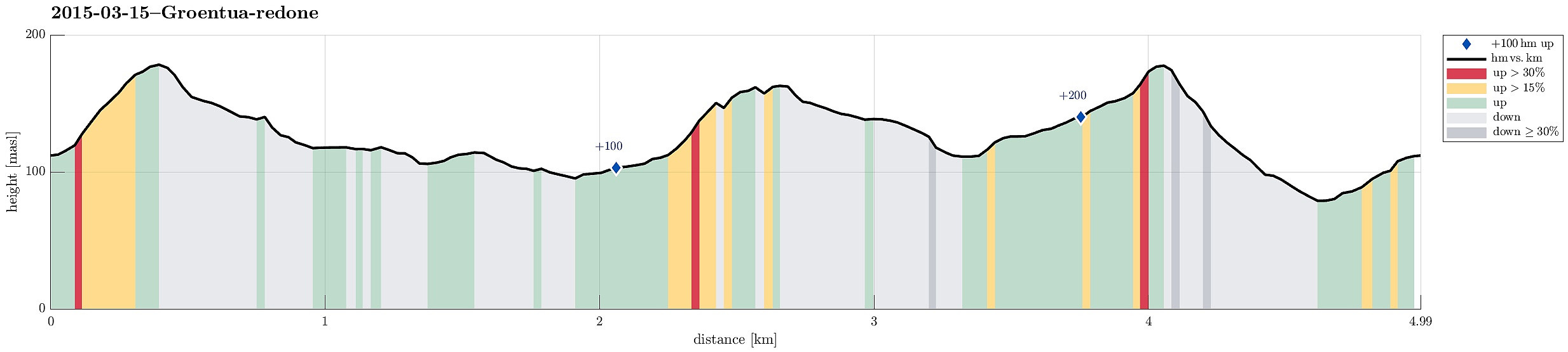
| Entfernung | 5,0km |
| Höhenmeter | 272m |
| GPS |
|
| Besteigungen | Festeråsen (164m) | 15.03.2015 |
|---|---|---|
| Grøntua (181m) | 15.03.2015 | |
| Besuche anderer PBE | Festeråsen søyle (160m) | 15.03.2015 |
| Olsvik kirke p-plass (145m) | 15.03.2015 |
Note that this track has been created a posteriori, i.e., from memory, not automatically recorded.
Trip Summary
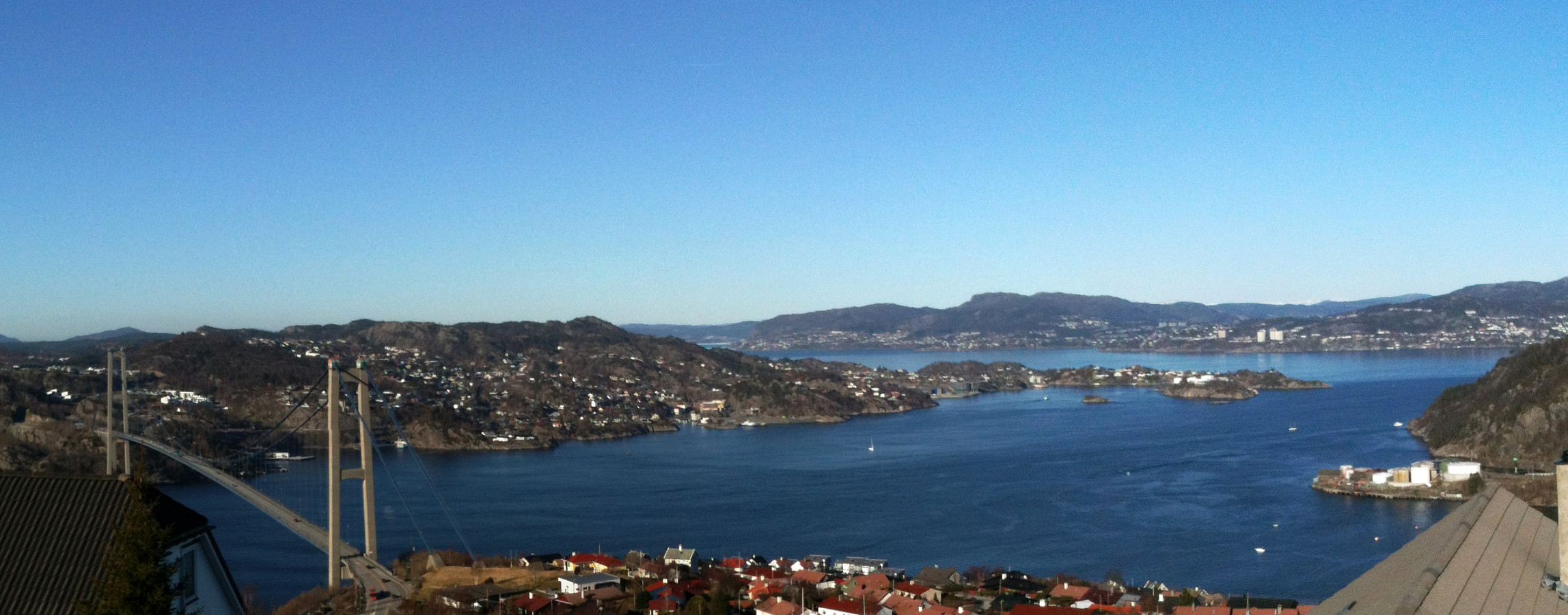
Starting from Brønndalen, we quickly ascended to Grøntua -- a small top west of Lyderhorn with a nice view! :-) From there, via Olskvikåsen, a school, and Olsvik (another school), we first descended to Olsvikstallen, from where we ascended to Festeråsen, where still ruins from WWII are visible. From there we went back, once again passing over Grøntua. All in all, a very relaxed Sunday afternoon walk (in great spring weather).
Useful Resources


Benutzerkommentare