
Storsåta from Eidsvåg (14.03.2015)

Skrevet av HHauser (Helwig Hauser)

| Startsted | Eidsvåg (20moh) |
|---|---|
| Sluttsted | Eidsvåg (20moh) |
| Turtype | Fjelltur |
| Turlengde | 3t 30min |
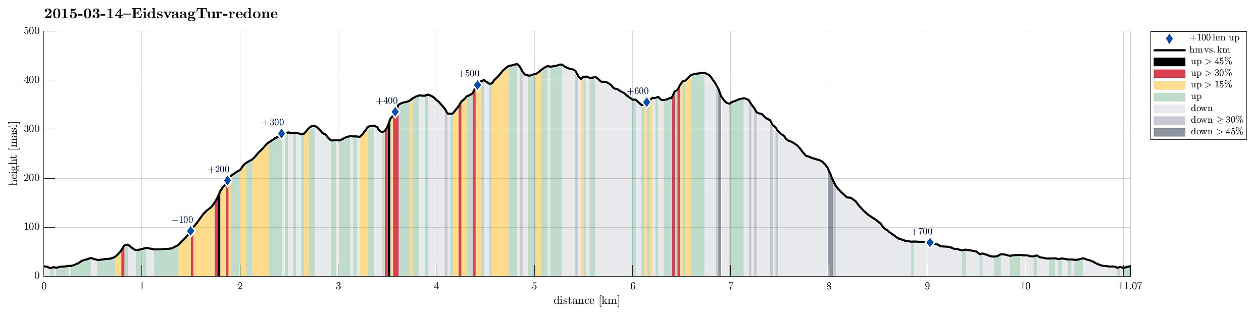
| Distanse | 11,1km |
| Høydemeter | 736m |
| GPS |
|
| Bestigninger | Litlanipa (310moh) | 14.03.2015 |
|---|---|---|
| Nukane (373moh) | 14.03.2015 | |
| Slettafjellet (310moh) | 14.03.2015 | |
| Stangelifjellet (372moh) | 14.03.2015 | |
| Stornipa (343moh) | 14.03.2015 | |
| Storsåta (434moh) | 14.03.2015 | |
| Øst for Stangelifjellet (418moh) | 14.03.2015 | |
| Andre besøkte PBE'er | Vinddalsveien p-lomme (160moh) | 14.03.2015 |
Trip Summary
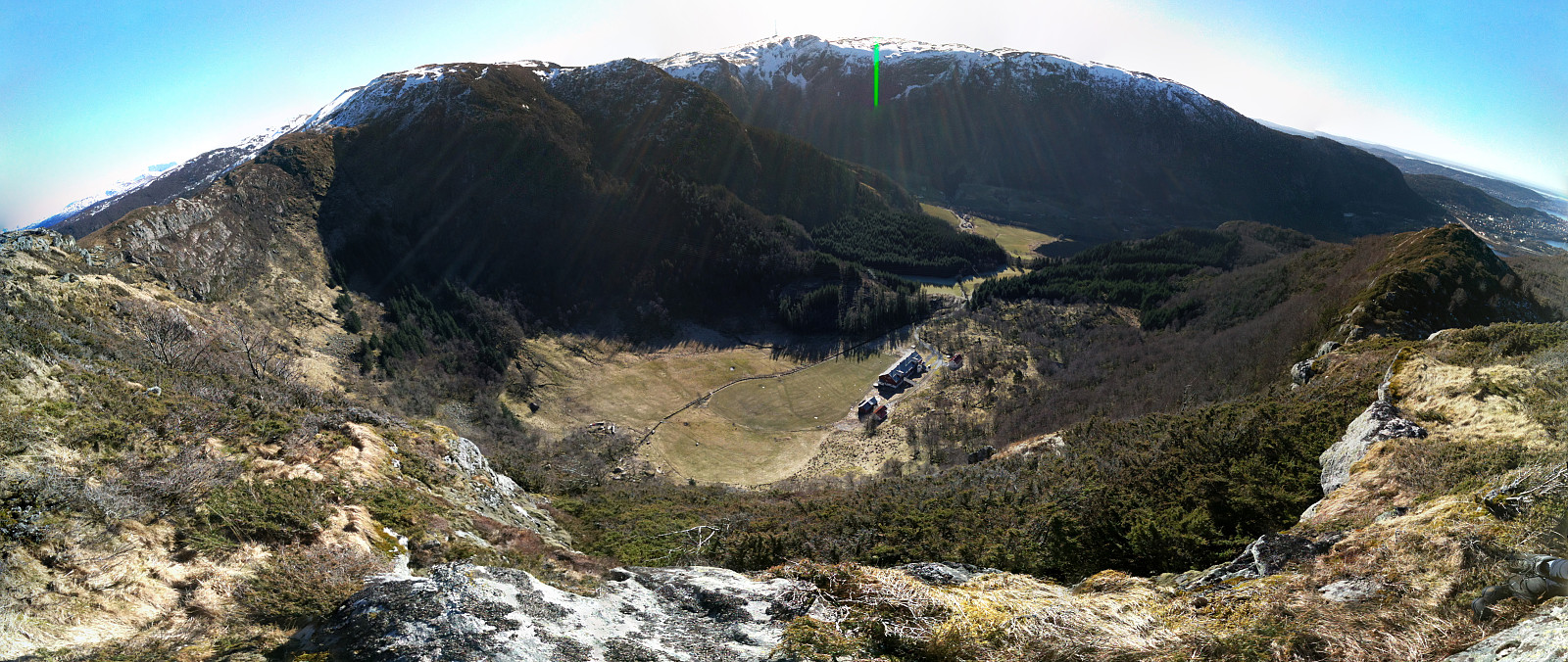
Starting from Eidsvåg, we first followed the old postal path (den trondhjemske postvei), before we turned to the right (at Glasskaret), ascending to Slettafjellet. After having visited Fosshøyen, we crossed over to Litlanipa. From there, it only is a few step, before one ascends to Nukane, passing by Stornipa. Passing over Nukane, we got down into Ullskargjelet, before ascending, again -- this time to Storsåta (the highest top on this hike). Continuing, we passed over Gråbeinryggen and Grønabrekkene, looking down to Setervatnet to our right. At Stangelifjellet, we left the main path and descended over a nice ridge, which separates Setervatnet from Vinddalen, first down to the dam of Setervatnet, before then descending through Kløvet to Vinddalsveien. Then, we simply walked down the road and back to the parking spot, where we had started. All in all, a very nice hike (in beautiful spring weather!)!
Photos
Selected photos are available as Google photo album.
Useful Resources
Web page WestCoastPeaks.com provides useful information about Storsåta, Raunfjellet, Nukane, and Slettafjellet.


Kommentarer