
Liatårnet (18.10.2014)

Geschrieben von HHauser (Helwig Hauser)

| Startpunkt | Nordre Ekrhovda (35m) |
|---|---|
| Endpunkt | Nordre Ekrhovda (35m) |
| Tourcharakter | Bergtour |
| Tourlänge | 1h 30min |
| Entfernung | 5,8km |
| Höhenmeter | 320m |
| GPS |
|
| Besteigungen | Pyttane søndre (330m) | 18.10.2014 |
|---|---|---|
| Besuche anderer PBE | Pyttane/Nordre Stølen p-lomme (40m) | 18.10.2014 |
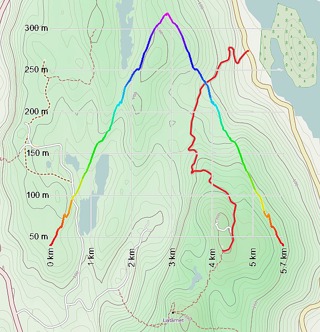
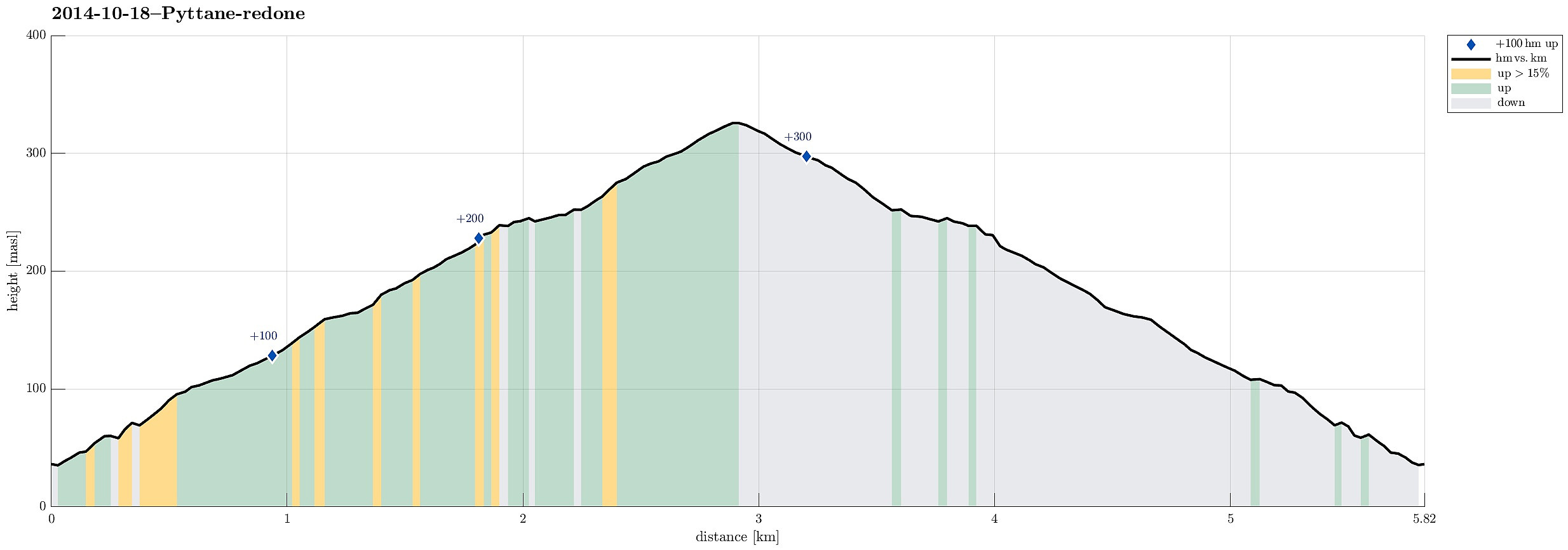
Note that this track has been created a posteriori, i.e., from memory, not automatically recorded.
Trip Summary
Evening walk, almost in the dark, and in the middle of windy clouds (but with less rain than expected!) -- it's always nice to walk up and down Pyttane, especially, if there's limited time! :-)
Useful Resources
Web page WestCoastPeaks.com provides useful information about Liatårnet
and also Petter Bjørstad has a useful page about Liatårnet.


Benutzerkommentare