
Skjerjavasshovden October 2014 (13.10.2014)

Geschrieben von Stigun

| Startpunkt | 300 m N for Beinhellervatnet (755m) |
|---|---|
| Endpunkt | N for Beinhellervatnet (755m) |
| Tourcharakter | Bergtour |
| Tourlänge | 3h 30min |
| Höhenmeter | 790m |
| Karte |
|
| Besteigungen | Skjerjavasshovden (1.264m) | 13.10.2014 17:07 |
|---|

Skjerjavasshovden is HP in Vaksdal kommune; as such a cathegory of priority to me.. A visit to this mountain had for this reason for some time been a wish, and a few weeks ago I was on my way. But, a forecasted High did not appear, and instead I climbed Lønahorgi 1409 m asl in dense fog, 1200 vertical meters from Bavallen. After an extended weekend, with Skogshorn Saturday 11. and Kyrkjinøse at Filefjell 12.10., another High was forecasted 13. October. As many times before, also this High dit not appear; but now it was due time for Skjerjavasshovden anyway.
It turned out to be one of those hikes where the car drive to the starting point became more time-consuming than the actual mountain hike itself...
Skjerjavasshovden had been googled, and lot of funny stuff was written about this mountain on the IN, but I was unable to find what I needed; a report describing a useful route..
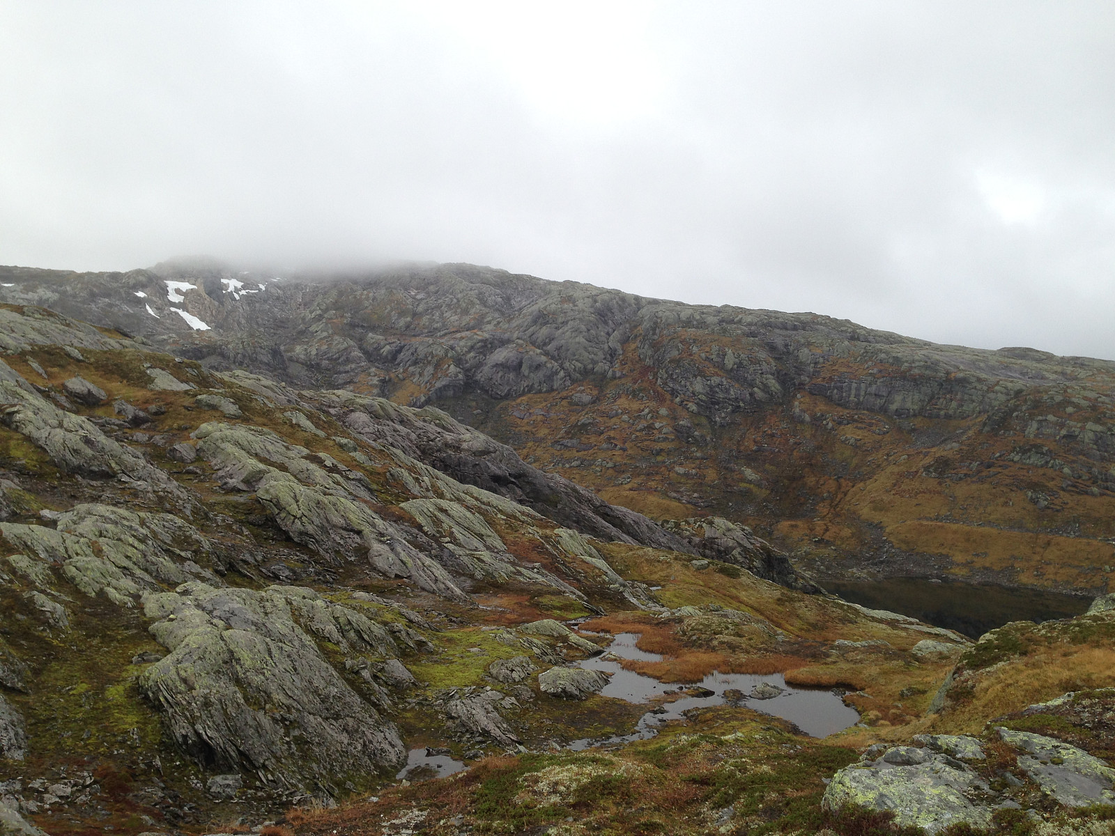
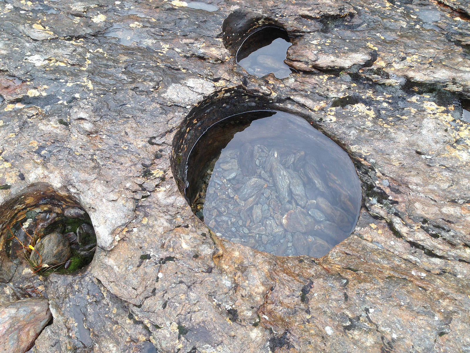
I left E16 at Evanger, driving towards Eksingedalen; crossing over Nesheimfjellet. A few hundred meters after the small municipality Trefall there is a gravel road on the left(north). Driving up here I parked my car just above the small lake Beinhellervatnet, then crossing the creek with many fine pot holes in the rock close to the creek. Heading straight west I reached the col Heimsta Belaskardet. Descending about one hundred vertikal meters I reached a small lake(964 m a.s.l) connected to Lonevågen; a bay in Skjerjavatnet proper. At the present water level of the lake Skjerjavatnet it was possible to walk or wade between Lonevågen and the small 964 lake. From here I headed to the NE Ridge of Skjerjavasshovden. To the east this is quite steep, but by climbing some steep, grassy ledges it was quite easy to get access to the NE Ridge. The NE Ridge was then followed in a SSW direction in easy, rocky terrain. In dense fog the upper 100 vertikal meters, I walked straight onto the big, nice cairn. Inside the cairn I detected an empty glass with a(wet, partly disintegrating..) summit list. According to this, Skjerjavasshovden is quite infrequently visited; two other persons had written their names on the list for the last two months. Made my hike back to the car the same way; blessed with an abundance of sweet delicious blueberries...Despite the blueberry "frenzy", total time spent was some 3 1/2 hours.


Benutzerkommentare