
Siggjo (20.05.2013)

Geschrieben von HHauser (Helwig Hauser)

| Startpunkt | Idlestigen (75m) |
|---|---|
| Endpunkt | Idlestigen (75m) |
| Tourcharakter | Bergtour |
| Tourlänge | 2h 00min |
| Entfernung | 5,1km |
| Höhenmeter | 457m |
| GPS |
|
| Besteigungen | Siggjo (473m) | 20.05.2013 |
|---|---|---|
| Besuche anderer PBE | Siggjo p-plass (85m) | 20.05.2013 |
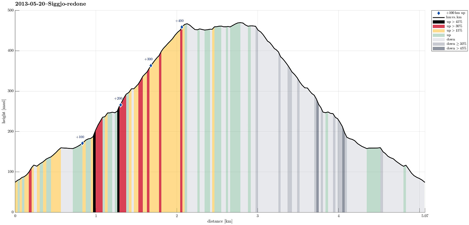
Note that this track has been created a posteriori, i.e., from memory, not automatically recorded.
Trip Summary
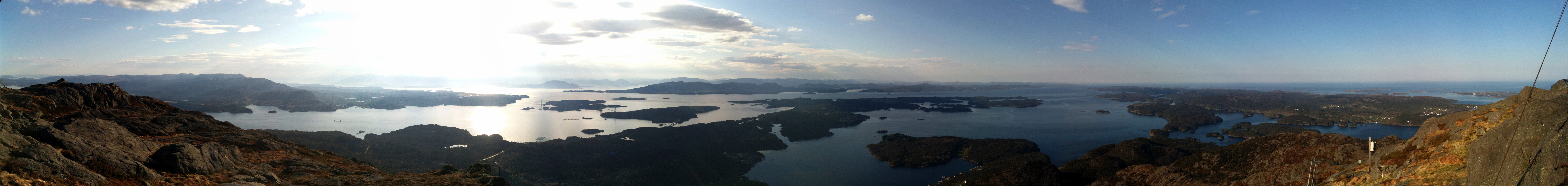
Very nice morning hike (from Idlestigen up Siggjo and down again) -- really a nice mountain (standing quite alone and prominent)!


Benutzerkommentare