Archiv - Nach Datum
Archiv - Nach Aktivität
-
Andere Tour (4)
- Kayaking (3)
- Fußtour (26)
-
Klettern (2)
- Alpinklettern (2)
-
Skitour (7)
- Langlauf (1)
- Randonnée/Telemark (5)


Joggetur rundt Nesje
- Datum:
- 28.04.2020
- Tourcharakter:
- Jogging
- Tourlänge:
- 1:55h
- Entfernung:
- 14,1km
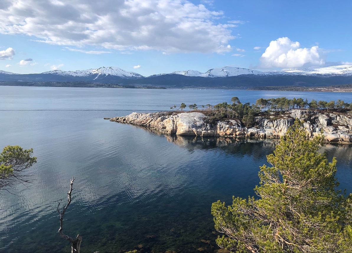 Joggetur, delvis må nye stier. Anbefales!
Skredin og Kjerringlia
- Datum:
- 22.09.2019
- Tourcharakter:
- Bergtour
- Tourlänge:
- 5:07h
- Entfernung:
- 12,7km
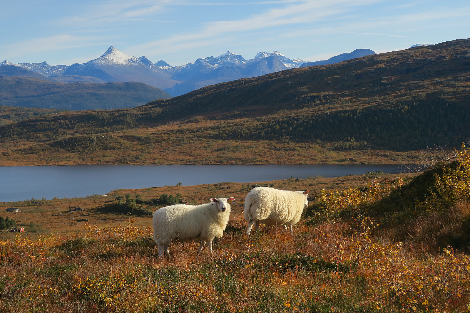 Flott høstdag i fjellområdet mellom Nesset og Gjemnes, med utsikt til både Molde, Kristiansund, Trollheimen, Eikesdalsfjella og Romsdalsfjella.
Gammelseteraksla
- Datum:
- 08.08.2019
- Tourcharakter:
- Wanderung
- Tourlänge:
- 1:58h
- Entfernung:
- 2,8km
Tustnastabban
- Datum:
- 10.07.2019
- Tourcharakter:
- Jogging
- Tourlänge:
- 11:01h
- Entfernung:
- 36,2km
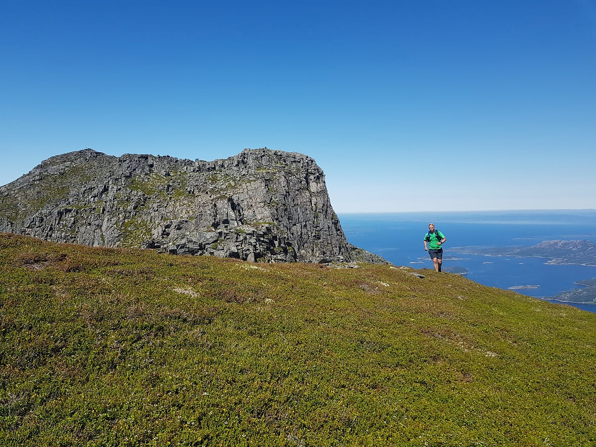 Turen over alle sju Tustnastabban på øyene Tustna og Stabblandet er populært kalt "Seven Peaks Nightmare" om den tas i løpet av et døgn. Den omfatter følgende topper: Knubben (680 moh), Jørgenvågsalen (857 moh) og Skarven (896 moh) på Tustna. Stabben (827 moh), Innerbergsalen (908 moh), Storøra (905 moh) og Litleøra (627 moh) på Stabblandet.
Om det er riktig å kalle den "nightmare" kan sikkert diskuteres. Med forholdene vi fikk, ville kanskje "daydream" være mer dekkende? Men for all del, det er snakk om en real styrkeprøve, så det er ingen grunn til å ta lett på turen. Jeg har tenkt på turen lenge, og i fjor var det nære på, men jeg trengte turkamerat knutio (Knut Inge Orset) for å faktisk realisere det i år. Han var pådriver også denne gangen. Jeg fungerte som >>>
Turen over alle sju Tustnastabban på øyene Tustna og Stabblandet er populært kalt "Seven Peaks Nightmare" om den tas i løpet av et døgn. Den omfatter følgende topper: Knubben (680 moh), Jørgenvågsalen (857 moh) og Skarven (896 moh) på Tustna. Stabben (827 moh), Innerbergsalen (908 moh), Storøra (905 moh) og Litleøra (627 moh) på Stabblandet.
Om det er riktig å kalle den "nightmare" kan sikkert diskuteres. Med forholdene vi fikk, ville kanskje "daydream" være mer dekkende? Men for all del, det er snakk om en real styrkeprøve, så det er ingen grunn til å ta lett på turen. Jeg har tenkt på turen lenge, og i fjor var det nære på, men jeg trengte turkamerat knutio (Knut Inge Orset) for å faktisk realisere det i år. Han var pådriver også denne gangen. Jeg fungerte som >>>
Romsdalshorn
- Datum:
- 31.08.2018
- Tourcharakter:
- Hochtour
- Tourlänge:
- 18:23h
- Entfernung:
- 7,6km
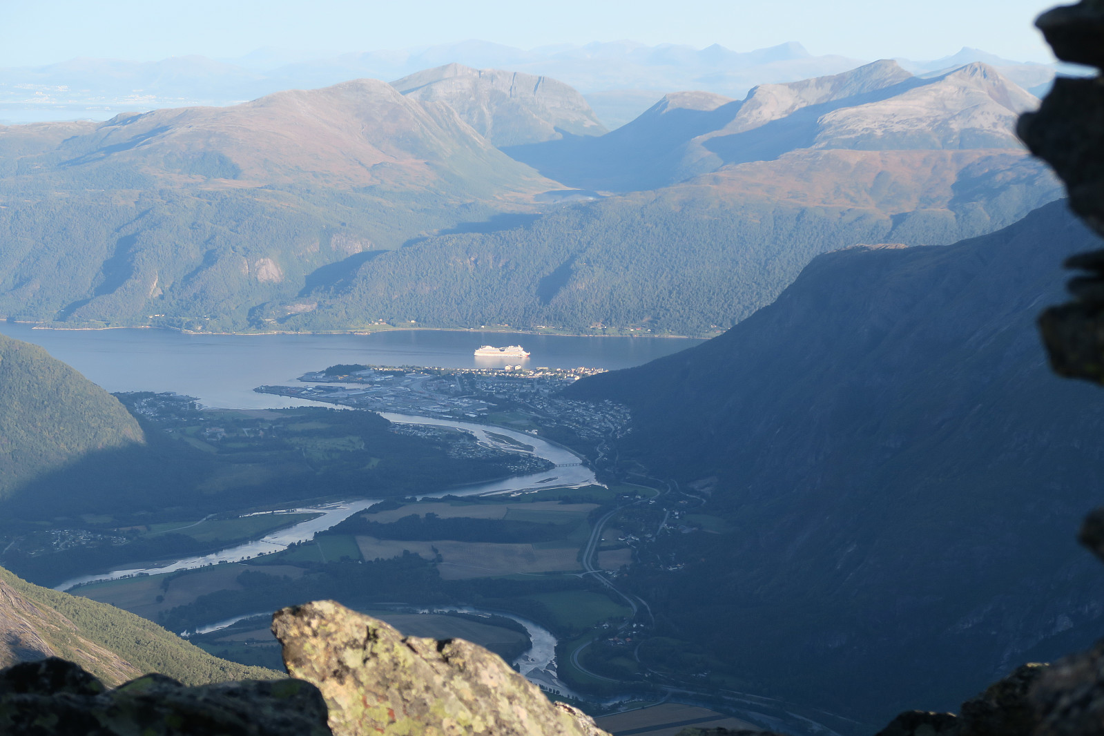 Det er snart 25 år sidan første turen, og sikkert meir enn ti år sidan sist. No var det på tide med ein ny tur til Romsdalshorn. Denne gangen vart det ein tur etter jobb. Det var ikkje mykje dagslys igjen, så vi måtte skunde oss litt oppover til innsteget. Vi gjorde unna dei to første taulengdene før skumringa seig på. Deretter grei klyving i blåtime og lett tussmørke den siste biten. Ned att neste morgon. Kjekt å treffe på tidlegare Nordfjord-elevar både på veg opp og ned. Samt ein verdsmeister og ein kvadruppel norgesmeister i langrenn på toppen.
Kirkjufell
- Datum:
- 16.08.2018
- Tourcharakter:
- Bergtour
- Tourlänge:
- 2:57h
- Entfernung:
- 5,7km
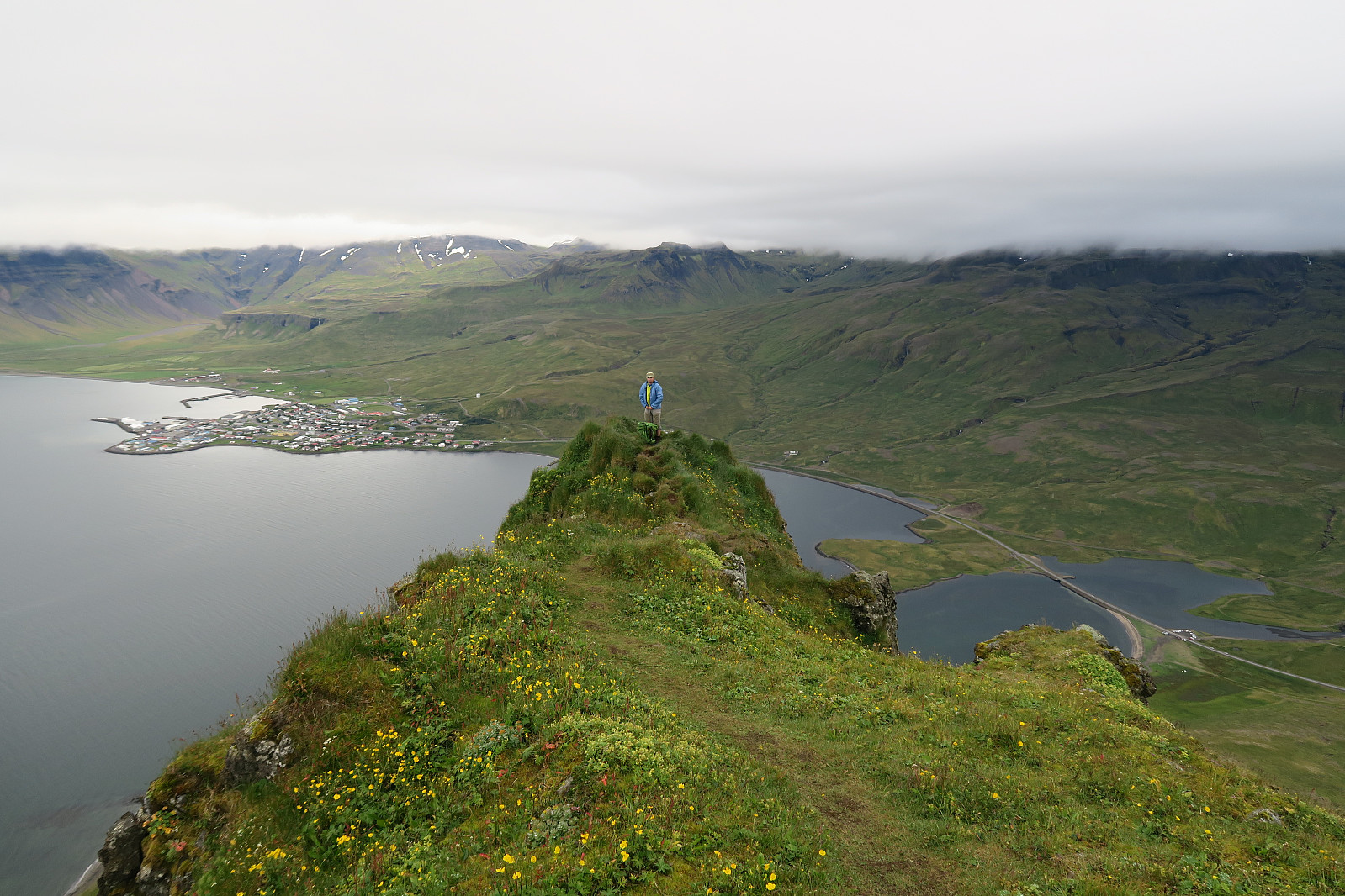 Having travelled along the Ring road for some days, climbing Kirkjufell (m a.s.l) seemed to be a natural thing to do before heading further around the Snæfellsnes peninsula. A good warm-up was to take a better meal at at the excellent Bjargarsteinn Mathús with a good view towards the mountain) the evening before – and to camp at the campground in Grundarfjörður (also with a view).
Kikjufell is for many known as the Arrowhead Mountian in the Game of Thrones series (season 6 and 7).
We parked at the parking for Kirkjufellsfoss since the more natural choice at Háls was marked with a "no parking" sign. From there we hiked about 100 m along Snæfellsvegur (54) up to Háls, and continued on the left side of a fenced pasture.
Some writers claim that the route to up Kirkjufell is a bit difficult to find and that one easily >>>
Having travelled along the Ring road for some days, climbing Kirkjufell (m a.s.l) seemed to be a natural thing to do before heading further around the Snæfellsnes peninsula. A good warm-up was to take a better meal at at the excellent Bjargarsteinn Mathús with a good view towards the mountain) the evening before – and to camp at the campground in Grundarfjörður (also with a view).
Kikjufell is for many known as the Arrowhead Mountian in the Game of Thrones series (season 6 and 7).
We parked at the parking for Kirkjufellsfoss since the more natural choice at Háls was marked with a "no parking" sign. From there we hiked about 100 m along Snæfellsvegur (54) up to Háls, and continued on the left side of a fenced pasture.
Some writers claim that the route to up Kirkjufell is a bit difficult to find and that one easily >>>
Námafjall
- Datum:
- 14.08.2018
- Tourcharakter:
- Wanderung
- Tourlänge:
- 0:43h
- Entfernung:
- 2,8km
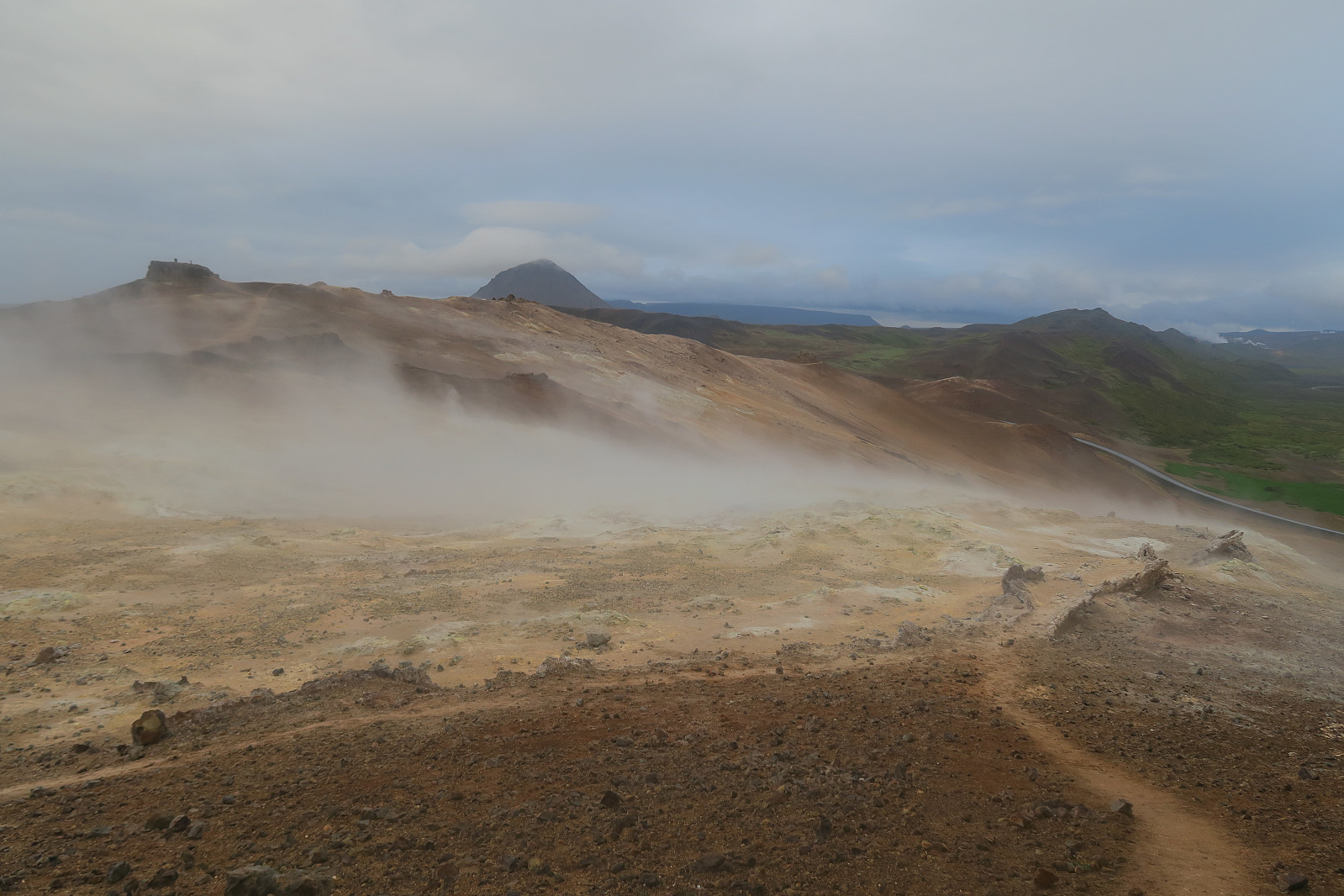 Short hike to Námafjall between the Myvatn nature baths and Hverir geothermal area. We started from Ring Road 1 in the Namaskard pass. In this area there are many solfataras and boiling mud pot. A very special experience. Like walking or the moon - or something else that is very different from all other known places.
Dyrfjallstindur
- Datum:
- 13.08.2018
- Tourcharakter:
- Bergtour
- Tourlänge:
- 4:54h
- Entfernung:
- 10,7km
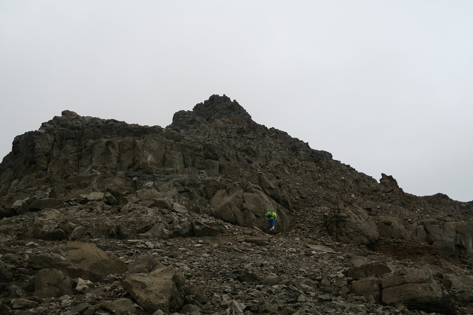 Afternoon climb to the easiest of the three summits of the Dyrfjöll mountain range in the minicipality of Borgarfjörður in Eastern Iceland. We started in the village Bakkagerði and hiked the mountain from the eastern side.
Dyrfjöll (meaning the Door Mountains) are the highest mountains (1136 m) on the Borgarfjordur Bay. They consist of Ytra-Dyrfjall (also called Súla), Fremja-Dyrfjall and Dyrfjallstindur (this mountain). Their name is derived from a prominent mountain pass called Dyr (the Door) at 856 m above sea level. We stayed at the campground Bakkagerði, and through Google and visual impression, Dyrfjallstindur seemed to be the only one possible to climb with out climbing equipment. We still don´t know for sure if this is true, so any comments or local information is welcomed.
We drove 1,0 km into Hólalandsvegur >>>
Afternoon climb to the easiest of the three summits of the Dyrfjöll mountain range in the minicipality of Borgarfjörður in Eastern Iceland. We started in the village Bakkagerði and hiked the mountain from the eastern side.
Dyrfjöll (meaning the Door Mountains) are the highest mountains (1136 m) on the Borgarfjordur Bay. They consist of Ytra-Dyrfjall (also called Súla), Fremja-Dyrfjall and Dyrfjallstindur (this mountain). Their name is derived from a prominent mountain pass called Dyr (the Door) at 856 m above sea level. We stayed at the campground Bakkagerði, and through Google and visual impression, Dyrfjallstindur seemed to be the only one possible to climb with out climbing equipment. We still don´t know for sure if this is true, so any comments or local information is welcomed.
We drove 1,0 km into Hólalandsvegur >>>
Nordre Trolla fra Litlnebba til Snøskar
- Datum:
- 02.08.2018
- Tourcharakter:
- Hochtour
- Tourlänge:
- 33:17h
- Entfernung:
- 19,7km
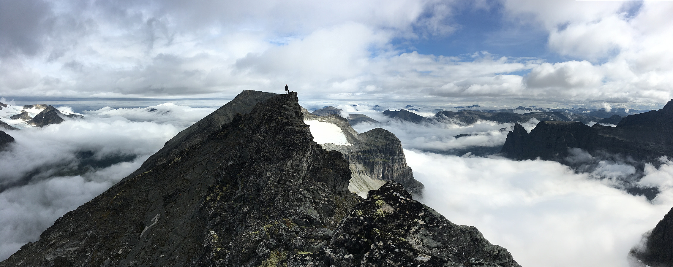 Opp til Fossbotnin
Litlnebba
Nordre Trolla
Nordryggen
Snøskar
Returen
Opp til Fossbotnin
Litlnebba
Nordre Trolla
Nordryggen
Snøskar
Returen

