Archive - Date
Archive - Activity
- Bike trip (2)
-
Climbing (8)
- Alpine climbing (7)
- Mixed climbing (1)
-
Other trip (1)
- Expedition (1)
-
Other winter trip (10)
- Snowshoe trip (10)
-
Ski trip (49)
- Randonnée/Telemark (49)
-
Trip by foot (240)
- Alpine trip (65)
- Hike (70)
- Hillwalk (92)
- Jogging (11)


Ukończone listy
-
Romsdal ≥ 100m pf.
(137/301)
 45%
-
Sunnmøre ≥ 100m pf.
(82/531)
15%
-
Norges 1000 største fjell målt i primærfaktor
(56/1000)
5%


Visiting Mount Lauparen and Mount Grytavasstinden
- Data:
- 10.07.2016
- Rodzaj aktywności:
- Alpine trip
- Czas trwania:
- 9:00h
- Dystans:
- 19.5km
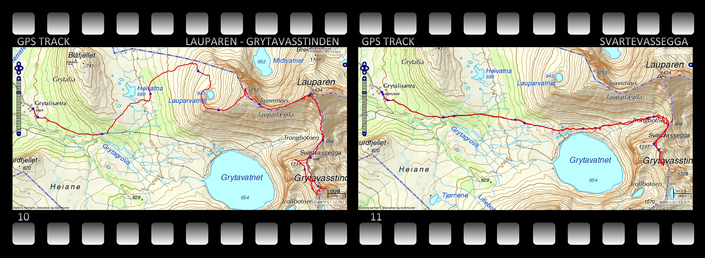 On this day I climbed up to the summits of Mount Lauparen and Mount Grytavasstinden. I started out from the parking lot at Grytalisetra (see map), and followed the regular trail for climbing these mountains for about 1,5 km, and then I took left towards the foot of Mount Sunnmørslauparen, which isn't actually a real mountain by itself, but rather a huge westward going ridge on Mount Lauparen. I climbed up the mountain side and at about 950 m.a.m.s.l., I reached a plateau on which a lake called Lake Lauparvatnet is located. From the Lake I continued up a huge mountain ridge to a new plateau, where you actually find the spot that is called Sunnmørslauparen [1254 m.a.m.s.l.] here on Peakbook. From there i continued up another mountain ridge towards the summit of Lauparen. This ridge got steeper >>>

Hiking to Mount Skjerdingen and Two Beautiful Lakes
- Data:
- 28.05.2016
- Rodzaj aktywności:
- Alpine trip
- Czas trwania:
- 5:13h
- Dystans:
- 13.6km
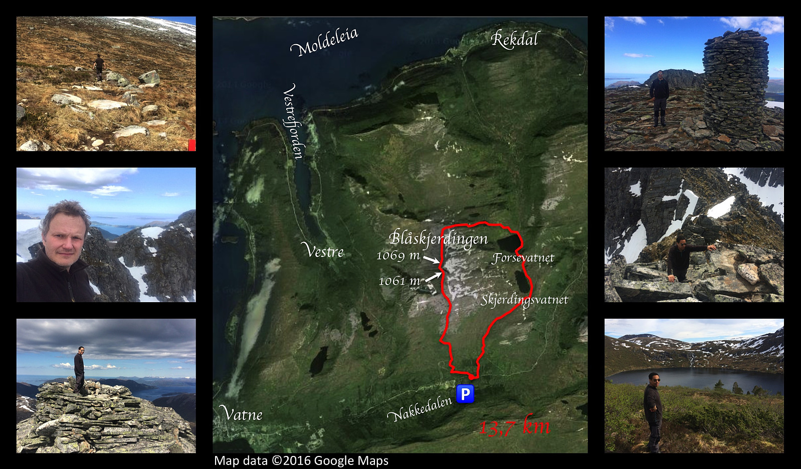 On this occasion, my son Dag and I went hiking to the mountain Blåskjerdingen . This mountain has a deep cleft that runs right through the top of the it; giving it two separate summits and a quite characteristic appearance that makes it easy to spot, even from a pretty long distance. We parked our car in a nearby valley called Nakkedalen, and made our climb to the first summit of Blåskjerdingen, which has an altitude of 1061 m.a.m.s.l. From there you look straight across the deep cleft onto the other summit, not even 50 meters away from you, and with an elevation of 1069 m.a.m.s.l. [Note: The names Skjerdingen and Blåskjerdingen are used interchangeably by many, but the local population in the villages at the foot of the mountain tend to refer to the higher (northern) summit as Blåskjerdingen, >>>
Hiking to Mount Tverrbotshornet with my son Dag
- Data:
- 07.05.2016
- Rodzaj aktywności:
- Alpine trip
- Czas trwania:
- 3:18h
- Dystans:
- 9.6km
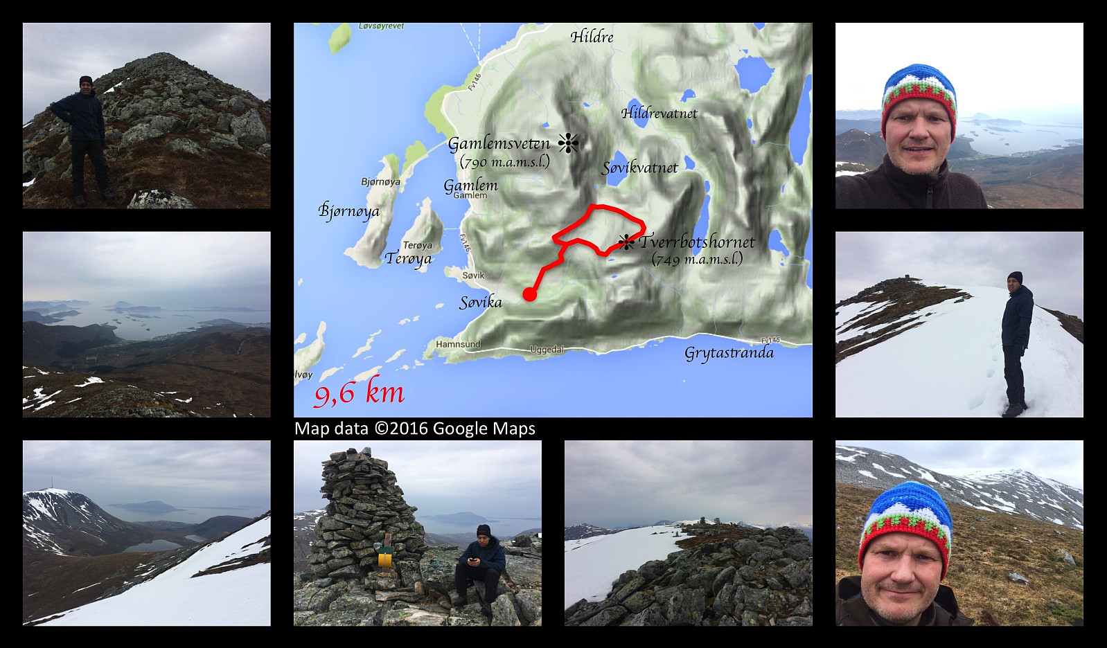 Hiking to the top of the mount Tverrbotshornet along with my son Dag. We drove to Søvika in Haram municipality, and parked at a parking lot in the valley called Søvikdalen. It's the same parking lot we've been using when visiting Mount Gamlemsveten. The first 1.5 km is the same as when you ascend Gamlemsveten, but then we took off to the right from the Road that climbs Gamlemsveten, crossed a marsh; and then started climbing up along a mountain ridge that leads up to the summit of the mountain. The ridge is quite stony, but otherwise not difficult to climb. The elevation of this mountain is 752 meters above main sea level, and we soon reached the summit. From there we continued about 400 meters in a north east direction, and then made our descent from the mountain in a north west direction >>>
Remmemstinden - opp nordøstryggen og ned Brastadryggen
- Data:
- 24.10.2015
- Rodzaj aktywności:
- Alpine trip
- Czas trwania:
- 4:39h
- Dystans:
- 12.2km
 Dette var en tur jeg var nødt til å ta, fordi tanken på den var blitt til en besettelse inne i hodet mitt. Jeg og eldstesønnen hadde gått oppover Heia og et godt stykke oppover nordøsteggen på Remmemstind tidligere på året en gang. Da gav vi oss på det, for det var i bratteste laget. Imidlertid klarte jeg aldri helt å gi slipp på tanken på nå toppen via denne ruta, og denne helgen var jeg tilbake.
Jeg var nå begynnt å bli såpass kjent i området, at jeg tok stien direkte fra Hellandseter opp mot Heia. Det som lokalt kalles Heia, er ikke et eget fjell, men bare en slags forlengelse av Remmemstinds nordøst-rygg nedover mot Hellandseter og Remmemseter. Det stikker frem et par knauser på denne ryggen, men ingen av dem har primærfaktor på mer enn en meter eller så, og derfor >>>
Hiking to the mountains Vardfjell and Bjørnetua
- Data:
- 22.08.2015
- Rodzaj aktywności:
- Alpine trip
- Czas trwania:
- 6:02h
- Dystans:
- 14.1km
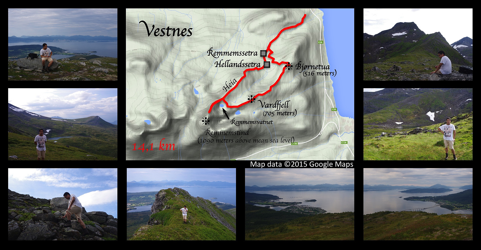 On this day Dag and I went to Vestnes, the village where my father grew up, and went hiking in some of the mountains of that area. We parked Dag’s car beside my grandfather’s old summer cowshed, which is still there; and started walking through the forest heading for the mountain. We reached the mountain peaks called Vardfjellet and Bjørnetua (705 and 516 meters above sea level, respectively), but the real summit of the area, called Remmemstind (1090 m.a.m.s.l.), we saved for another time; because that climb is really steep. To be honest, we actually did follow the northeast ridge of Mount Remmemstind up to about 1000 m.a.m.s.l. (Mount Remmemstind is 1090 m.a.m.s.l). At this point the ridge became too steep for us to climb since none of us had any real climbing experience at the time. >>>


