Introduction
Djuptjernkampen is the highest peak in the municipality of Nord-Aurdal in Oppland fylke.
Getting there
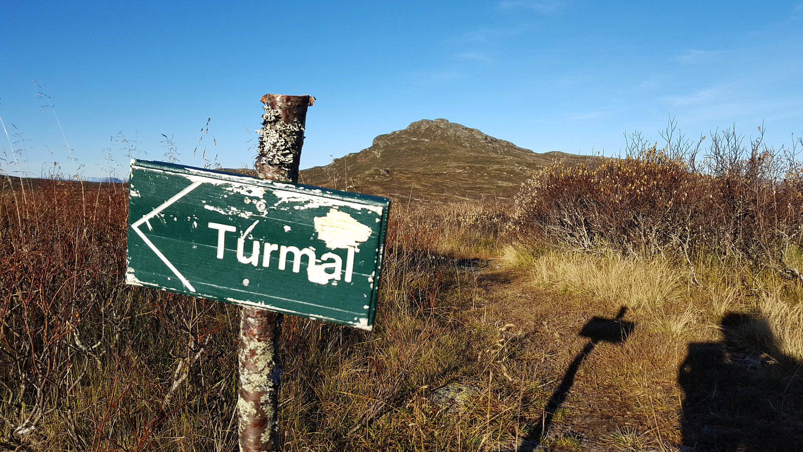
Drive public road approx. 2 km north-northeast of Lenningen. There are good parking space on the eastern side of the road. Follow private (closed by gate) gravel road towards Tronhus a good kilometer in a western direction. At the Tronhus pasture you will find the trailhead of a marked track leading up the forest to the north-northwest. Follow the track until approx. 1.5 km east of the summit where you leave it. Just walk in the terrain or follow unmarked path up the eastern ridge to the summit. Easy walk.
Phenomenal view from the summit.
Pictures
Starting points
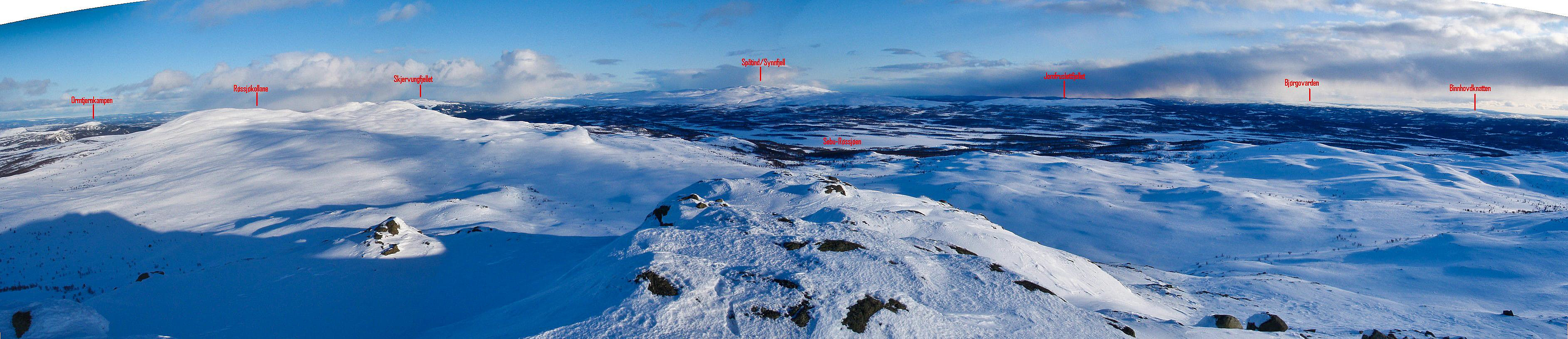
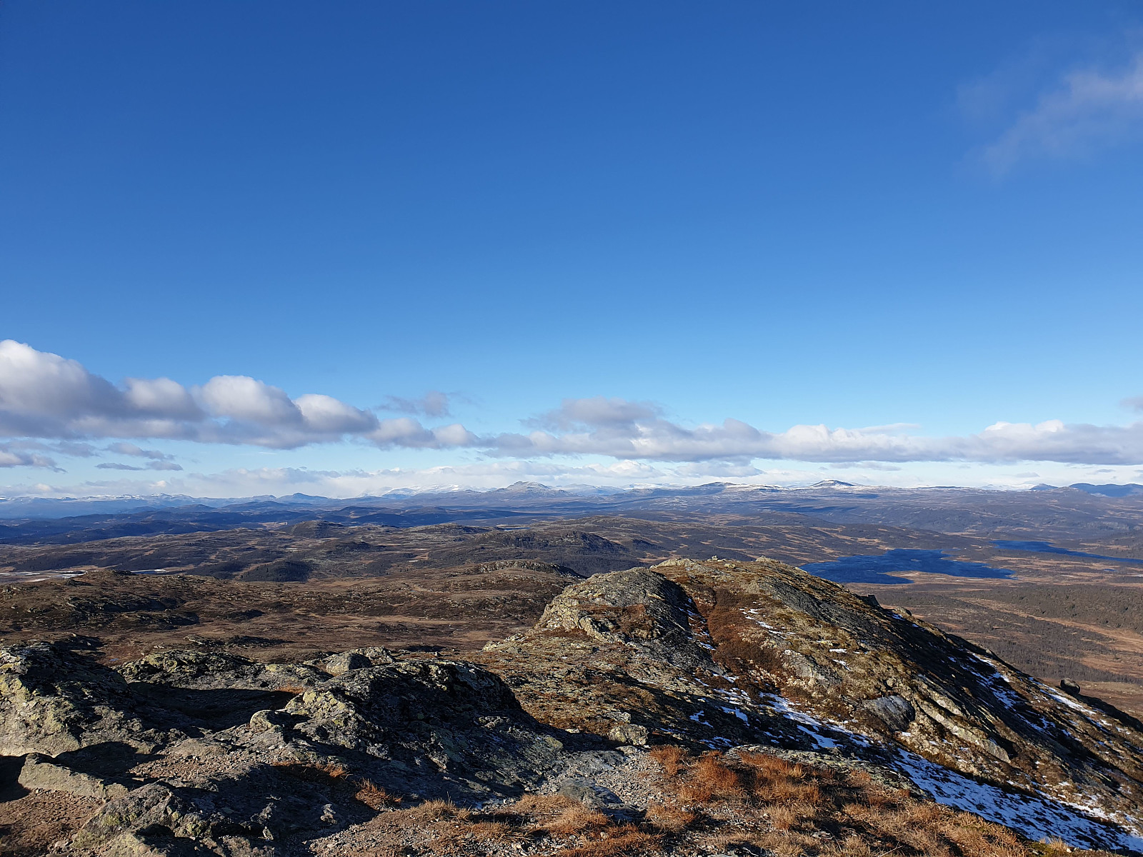
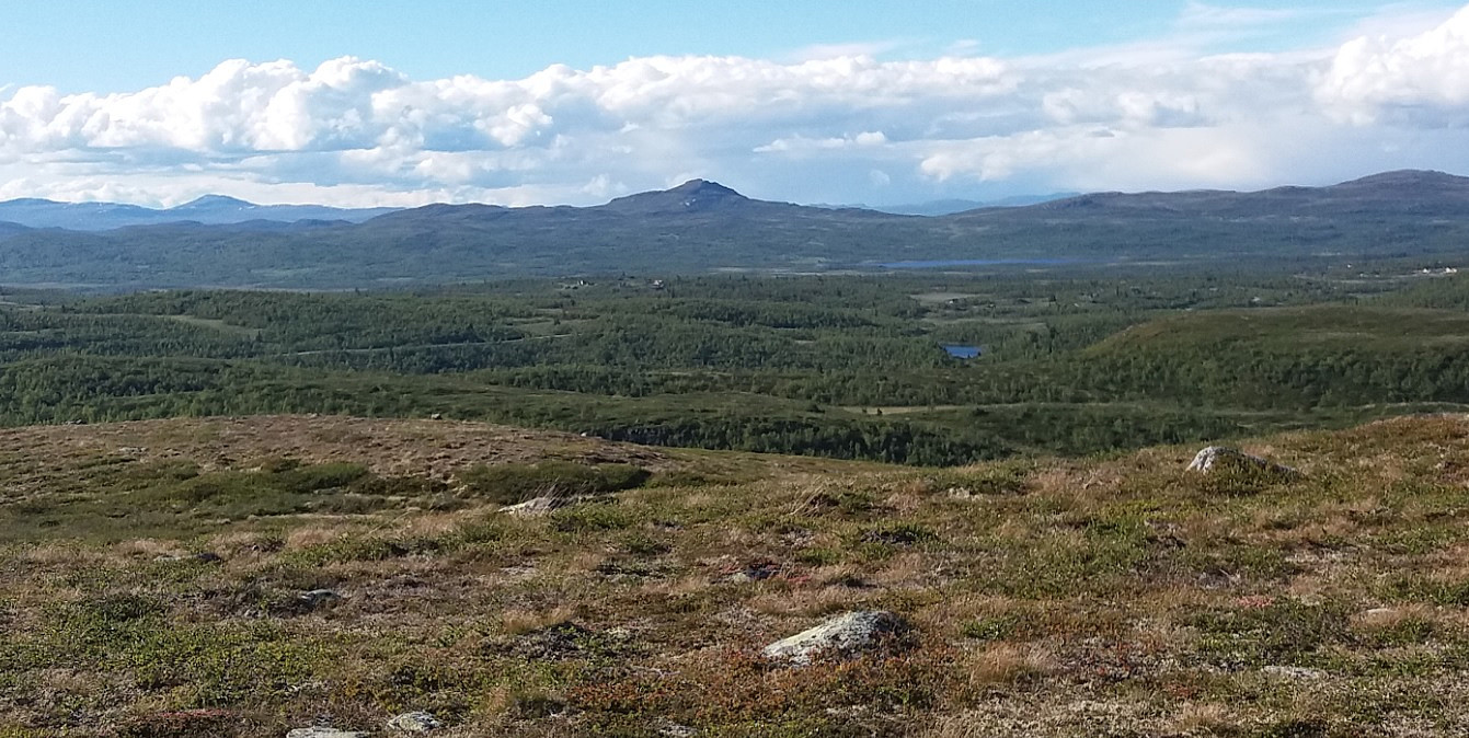
Panoramic image from the summit towards east-south-west.
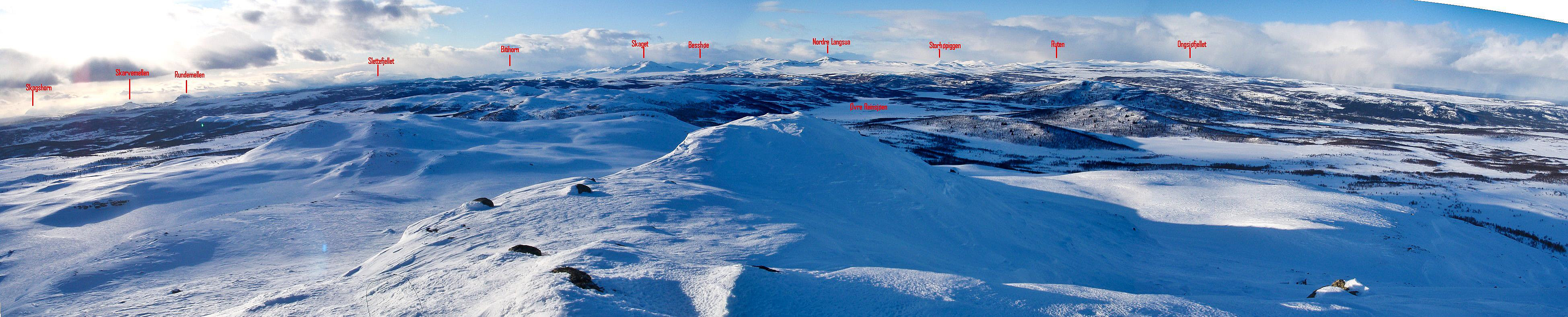
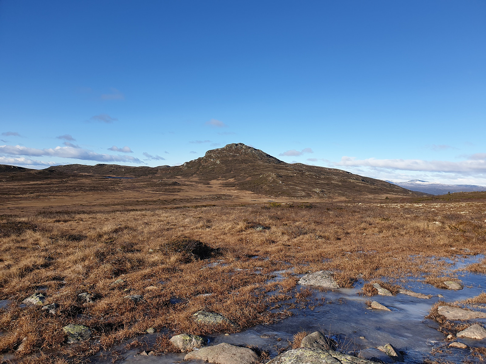
Panorama image from the summit towards west-northeast.
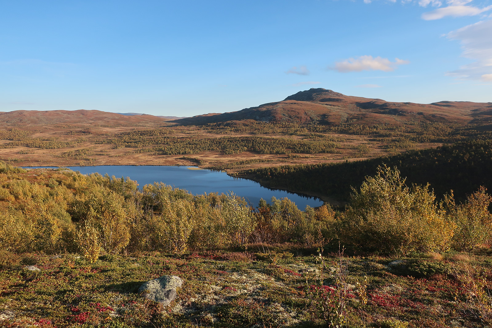
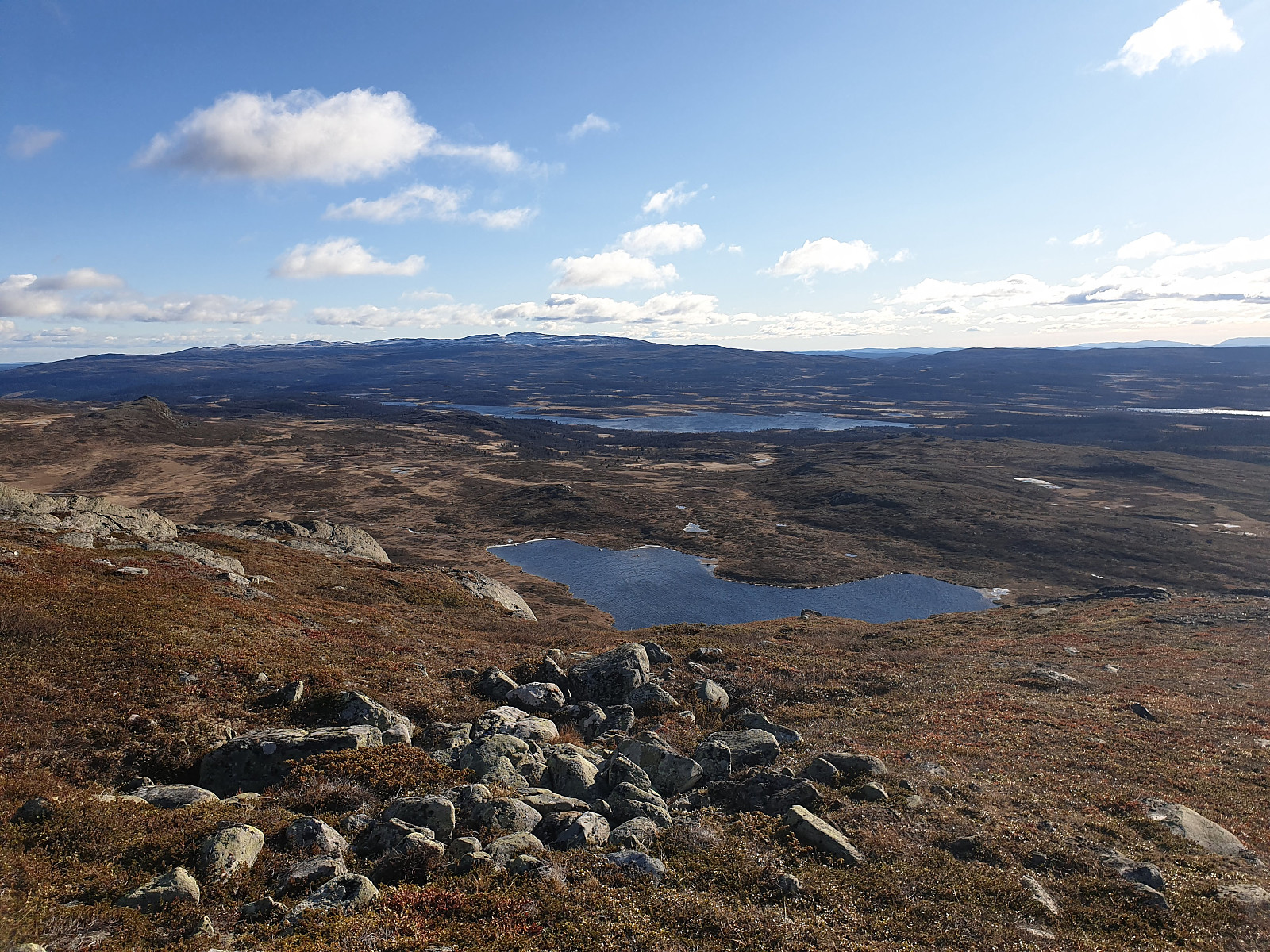
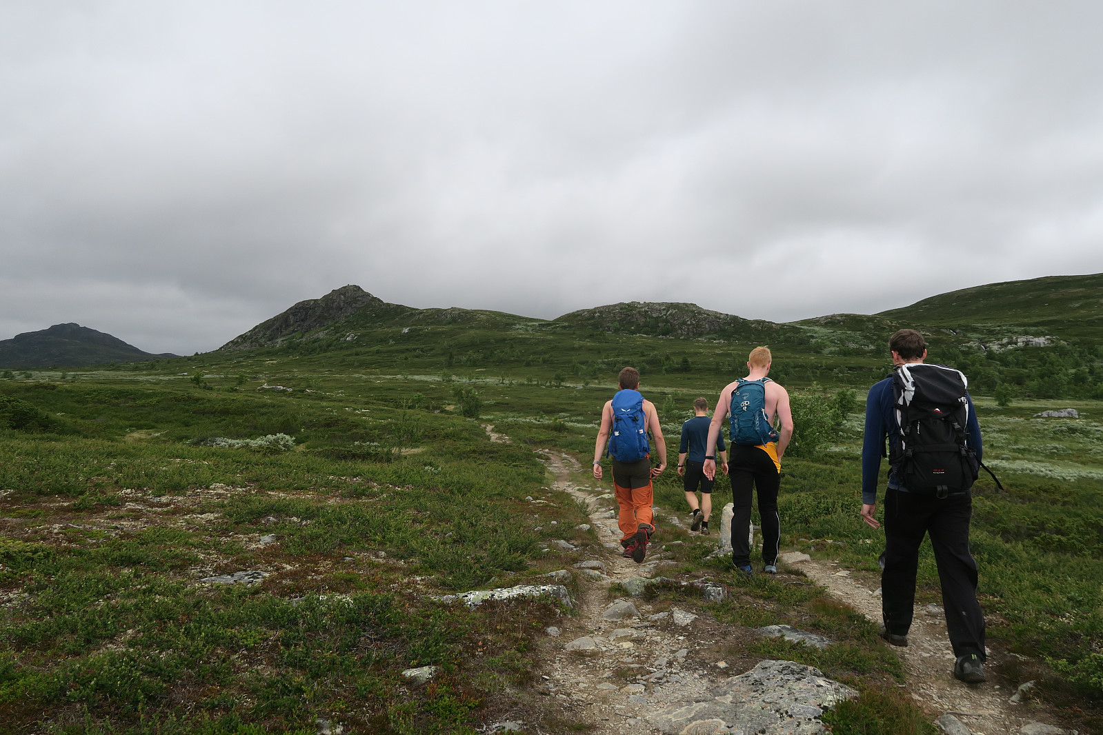
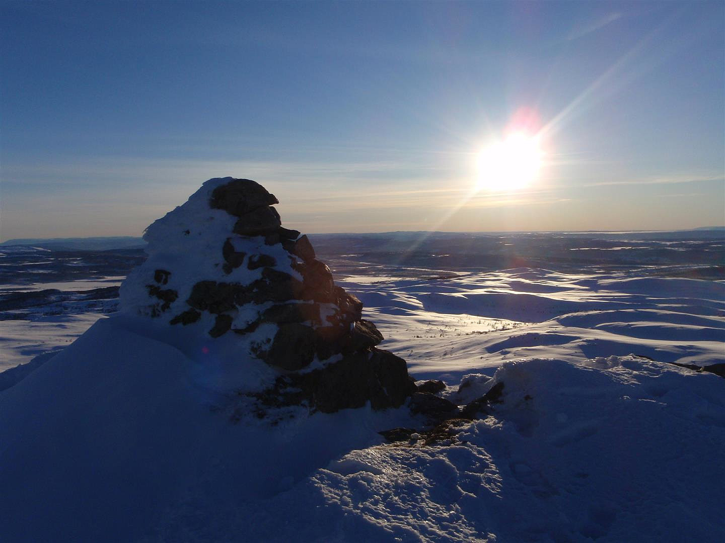
Other pictures
© Anja Prestvik
© Marius Meland
© Marius Meland
© Marius Meland
© Fredrik Gedde-Dahl
© Svein Eirik Aune
© Hans Thorvald Nygaard
© Ånund Sigurd Kvambekk
Trip Reports
16.10.2025 - Djuptjernkampen - vinter på gang , written by Atomsilda
19.09.2025 - Djuptjernkampen og Solskiva , written by Atomsilda
21.07.2025 - Røssj og Djup med Marit og Helge , written by repelo
12.07.2025 - Topptrimmen Røssjøkollane , written by AndersNM
12.07.2025 - Røssjøkollane og Djuptjernkampen , written by anneg
14.06.2025 - Topptrim Røssjøkollane, og Djuptjernskampen , written by repelo
08.04.2025 - Nydelig mot Djuptjernkampen , written by Atomsilda
11.06.2024 - Djuptjernkampen og Røssjøkollane , written by Atomsilda
28.08.2023 - Djuptjernkampen og Skjellbreidskampen , written by Line
08.07.2023 - Djuptjernkampen , written by Atomsilda
07.03.2023 - Med fjellski til Djupjernkampen , written by Atomsilda
12.11.2022 - Djuptjernkampen , written by Atomsilda
22.07.2022 - Djuptjernskampen, topptrim , written by repelo
14.06.2022 - Gjørmetur i regn til Djuptjernkampen , written by TRefsnes
14.09.2021 - Djuptjernskampen og Røssjøkoller , written by repelo
03.08.2021 - Djuptjernkampen og ringsrudåsen , written by Vebjørn93
13.09.2020 - Djuptjernkampen - kommunetopp i Nord-Aurdal , written by Dag1
13.09.2020 - Idyllisk høsttur til Nord-Aurdals høyeste , written by Fjellsamleren
29.08.2020 - Kommunetopp - Djuptjernkampen 1325m, Nord-Aurdal, Innlandet , written by josokbakke
29.08.2020 - Djuptjernkampen-en flott runde , written by Atomsilda
18.07.2020 - Djuptjernkampen, høyest i Nord-Aurdal , written by gedded
22.06.2020 - Fjelltur i Langsua nasjonalpark , written by Furusethmotorsport
07.04.2020 - Djuptjernkampen , written by alexw
06.09.2019 - Langtur med overnatting i Tapptjerndalen , written by MarianneB
14.06.2019 - Kremtoppjakt til Djuptjernkampen og Skriulægerknatten , written by Olepetter
11.10.2018 - Djuptjernkampen, Topptrimmen , written by sinyg
14.09.2018 - Djuptjernkampen , written by FjellEggen
02.09.2018 - Djuptjernkampen , written by NJK500
05.08.2018 - Topptrim Djuptjernskampen , written by repelo
10.06.2018 - Topptrimmen i Gausdal - tre topper , written by anneg
09.06.2018 - Telttur med Tind i Langsua nasjonalpark , written by Hannes
20.11.2017 - Djuptjernkampen, Nord-Aurdal , written by Elementmannen
13.08.2017 - Topptrimturer i Gausdal Vestfjell , written by anneg
18.07.2017 - Djuptjernkampen, Topptrimmen , written by sinyg
14.07.2017 - Djuptjernskampen, topptrim , written by repelo
06.10.2016 - Djuptjernkampen Kommunetopp i Nord-Aurdal , written by aask
26.09.2016 - Djuptjernkampen (Nord-Aurdal) m/Ole-Petter , written by knutsverre
24.07.2016 - Tur til Djuptjernkampen - med sjelden flora , written by Stigun
04.07.2016 - Røssjøkollane og Djuptjernskampen , written by KristineL
04.07.2016 - Røssjøkollane og Djuptjernskampen , written by Hansi
07.05.2016 - Vårskitur i varmt vær , written by anneirik
07.05.2016 - Ein av dei siste skiturane i år , written by bakken59
07.11.2015 - Kinnkjølen og Djuptjernkampen , written by arne
25.10.2015 - Djuptjernkampen , written by mortenh
25.10.2015 - Djuptjernkampen med Helgesen , written by bergtatt
18.10.2015 - Djupkjernkampen , written by grolyseng
18.10.2015 - Djuptjernkampen , written by marius
18.10.2015 - Djuptjernkampen , written by Herman
16.10.2015 - Djuptjernkampen, Solskiva og vardebygging på "Lilleviseren" , written by Olepetter
03.10.2015 - Førstemann på toppen! , written by Sjutten
03.04.2015 - Fullmånetur til Djuptjernskampen :) , written by venkekristin
20.02.2015 - Vindfullt på Djuptjernkampen , written by Olepetter
21.07.2014 - Topptrimmen 2014 Djuptjernkampen , written by sinyg
12.07.2014 - Djuptjernkampen og Spåtind , written by haky
18.10.2013 - Skjelbreidskampen og Djuptjernskampen , written by Hansi
18.10.2013 - Djuptjernskampen og Skjelbreia , written by repelo
02.10.2013 - Djuptjernkampen , written by linntherese
24.08.2013 - Djuptjernkampen - Nord-Aurdal, 117/404 , written by Sola19
21.08.2013 - Djuptjernkampen , written by NJK500
27.07.2013 - Årets første bad , written by LivogKristen
12.07.2013 - Hugs fjellsko , written by bergteken
28.06.2013 - 81 Nord-Aurdal: Djuptjernkampen , written by morsor
10.08.2012 - Kosetopp , written by AnneliH
02.08.2012 - Djuptjernkampen , written by Tomis
16.07.2012 - Djuptjernskampen , written by Hansi
16.07.2012 - Djuptjernskampen 16/7 2012 , written by repelo
29.11.2011 - Her kommer vintern , written by Esau
16.10.2011 - Flott rundtur nord for Lenningen , written by 19topper
20.07.2011 - Flott fjellområde , written by Annar
13.06.2011 - Djuptjernkampen-flott tur i lett terreng , written by Atomsilda
13.03.2010 - Djuptjernkampen og Ringsrudåsen , written by 500fjell
31.01.2009 - Årets første kommunetopp , written by Sea2Summit
05.07.2008 - Djuptjernkampen , written by TERJES
26.10.2007 - Djuptjernkampen , written by Olepetter
02.07.2007 - Lett terreng innover. , written by innerdal
31.07.2006 - Djuptjernkampen , written by JoSo
17.07.2005 - Lett og fin tur , written by bigmob
27.05.2005 - Kommunetopptur til nedre Oppland , written by Snilen
05.08.2002 - Tronhus - Grytsetra 5/8 2002. , written by repelo
26.08.1973 - Djuptjernkampen 26/8 1973 , written by repelo


User comments