
Vassberget, Kvamsfjellet, and Tveitavarden (28.02.2026)

Skrevet av HHauser (Helwig Hauser)

| Startsted | Lindåsvegen (100moh) |
|---|---|
| Sluttsted | Lindåsvegen (100moh) |
| Turtype | Fottur |
| Turlengde | 4t 00min |
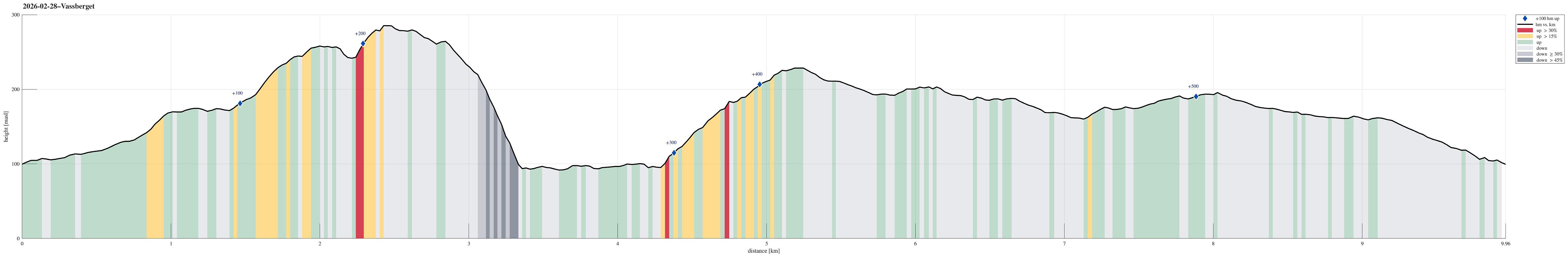
| Distanse | 10,0km |
| Høydemeter | 524m |
| GPS |
|
| Bestigninger | Kvamsfjellet (230moh) | 28.02.2026 |
|---|---|---|
| Tveitavarden (196moh) | 28.02.2026 | |
| Vassberget (288moh) | 28.02.2026 | |
| Andre besøkte PBE'er | Erstadvegen parkering (162moh) | 28.02.2026 |
| Litlevassberget (260moh) | 28.02.2026 | |
| Svarthamrane (200moh) | 28.02.2026 |
Trip Summary
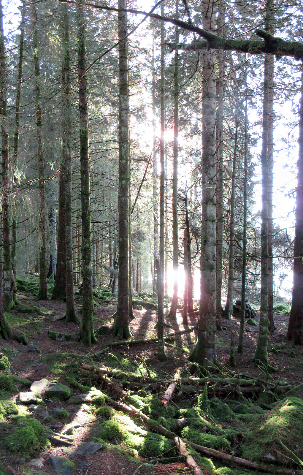
We expected a nice day and wished to make a nice, moderate hike with a chance to catch some sun, also. After first looking at Tveitavarden, Kvamsfjellet, and Vassberget, north of Knarvik, we then found a description of a hike over these hills, but in reverse order, providing additional motivation to explore this part of Alver. After driving there from Bergen, we parked right next to Lindåsvegen, where Årdalen comes down from the northwest. Walking up Årdalen, we then found the trail head for Vassberget, which is nicely marked with a sign. Following this trail, we quickly made it up the ridge in the southwest of Kråkstidalen, but instead of crossing over this valley (as the main trail does), we continued further northwards on the ridge (into the direction of Litlevassberget). At times and with some phantasy, one could imagine that at some time in the past there even was a trail, also. Towards the southeastern slopes of Litlevassberget, it gets a tiny bit wilder, but we still managed to ascend up to Litlevassberget without any major bush war. The views (mostly towards the west) from the highest point on Litlevassberget are actually very nice! We then needed a way to get "back up" to the southern ridge of Vassberget. The western slopes of Vassberget are very steep and you probably need to climb in several places, if you'd attempt any direct ascent. Instead, we aimed (via the saddle between the two tops) towards the east, i.e., towards a point south of the top of Vassberget. While the slope there is also significantly steep, we still found a suitable "diagonal" passage upwards and without a few minutes we arrived a secondary ridge south of Vassberget (and west of the main ridge). Following this ridge all the way up to Vassberget was then straight-forward. Clearly, Vassberget also offers very nice views; in particular towards the north (across Fossevatna naturreservat). We then followed the trail further northwards (and down) until we connected to another trail, leading "back" towards Årdalen, in the east of Storavatnet. Via this trail, we then passed by the nature reserve in its southeast. On the other side of Årdalen, we then hiked up to Årdalsrindane in order to connect to Kvamsfjellet, offering new views towards the west. From there, it was then mainly southwards across the heights until we stepped out and onto Erstadvegen near Varddalen. Following another nice trail from just a few meters further in the west along Erstadvegen, we then walked to Tveitavarden, a bit further south. From there, the main goal was to get back to our car, but we thought that we could try a different route than "just walking back the same trail" to Erstadvegen. On the map, we had seen that we could connect to a forest road that would be a bit further east than the trail. We thus first followed the trail which leads down to Isdalen, before then deviating from it and heading northwards (without any trail). Stepping across the heights there was nice and pleasant, so we just continued further northwards without really searching for the forest road. Eventually, we made it back to Erstadvegen not from from where we first had come down from the north. When then remained was just to follow the road down to Lindåsvegen. Although this hike did not result in reaching significant heights, we still enjoyed nice views repeatedly (and also got some very nice sun)!
Photos
Selected photos are available as Google photo album.
Useful Resources
See also the related FB-page Hiking around Bergen, Norway.


Kommentarer