
Løvstakken and Løvstien (30.12.2024)

Skrevet av HHauser (Helwig Hauser)

| Startsted | Krohnegården (160moh) |
|---|---|
| Sluttsted | Krohnegården (160moh) |
| Turtype | Fottur |
| Turlengde | 3t 00min |
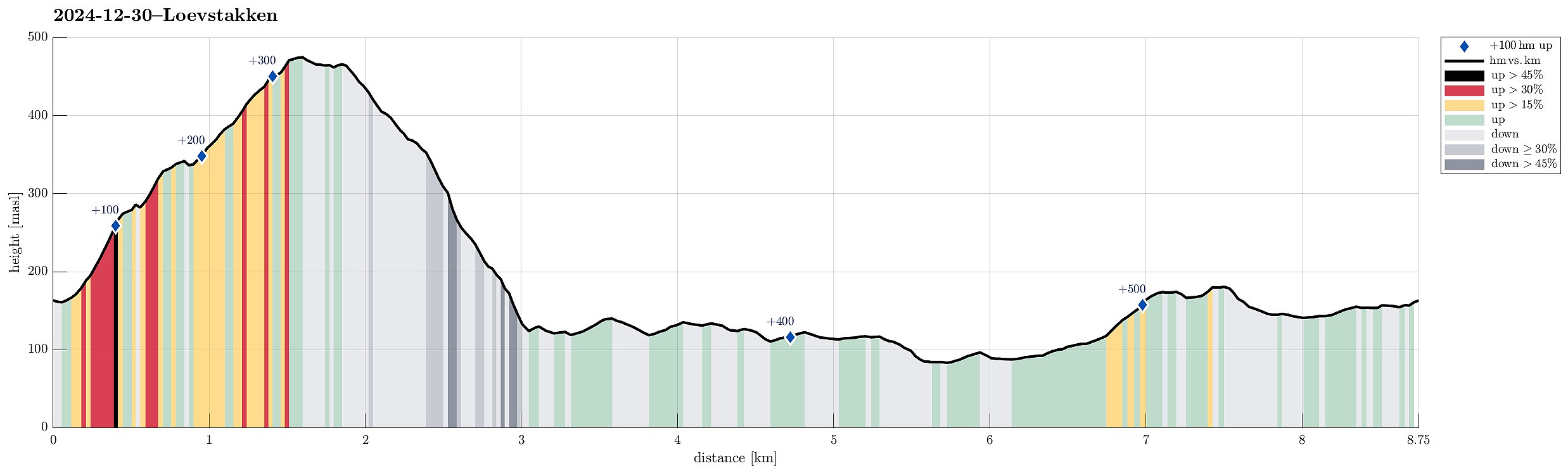
| Distanse | 8,8km |
| Høydemeter | 525m |
| GPS |
|
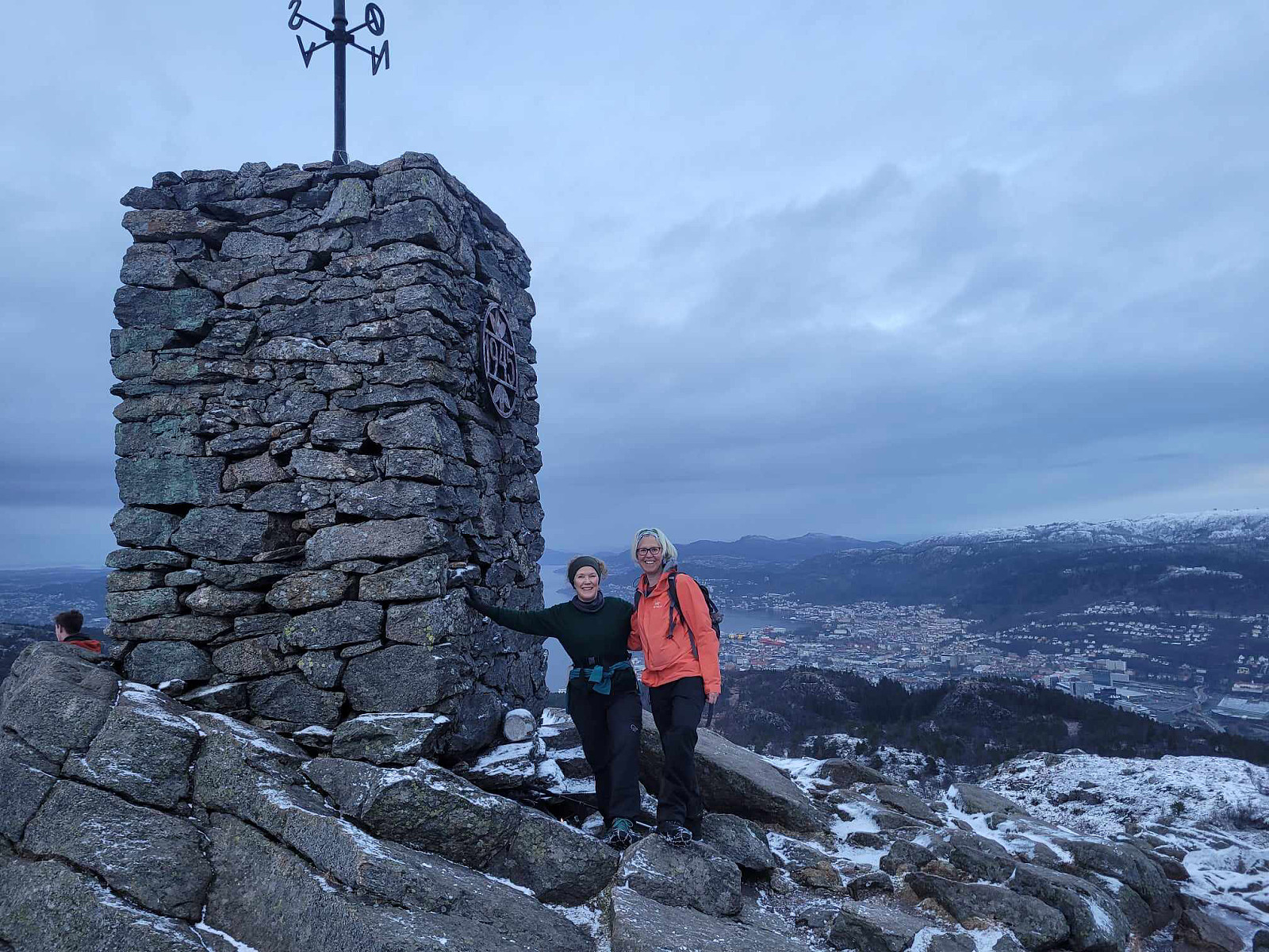
| Bestigninger | Løvstakken (478moh) | 30.12.2024 |
|---|---|---|
| Storhaugen 470 (470moh) | 30.12.2024 | |
| Andre besøkte PBE'er | Krohnegården nord p-plass (152moh) | 30.12.2024 |
| Fossen (200moh) | 30.12.2024 | |
| Krohnegården p-plass (160moh) | 30.12.2024 | |
| Løvstien Nord (80moh) | 30.12.2024 | |
| Minnesmerke bomberaid 1945 Løvstien (125moh) | 30.12.2024 |
Trip Summary
Together with friends, we had decided to use the afternoon for a short hike in the local area. We parked in the east of Litlavatnet in the northeast of Fyllingsdalen and headed up to Løvstakken following the main trail from the parking place. From the top of Løvstakken, we then descended towards the southeast using a minor trail a bit further east than the main trail in the south of Løvstakken. This brought us down to Løvstien, which we then followed (in northern direction) to complete a round back to Fyllingsdalen. Our timing was just right to cross over Løvstakken without any need for head lights -- down on Løvstien, we then took advantage of the installed lights. At the end of the hike, it started to snow, adding a nice touch to the overall experience! :-)
Photos
Selected photos are available as Google photo album.
Useful Resources
See also the related FB-page Hiking around Bergen, Norway.
Web page WestCoastPeaks.com provides useful information about Løvstakken.


Kommentarer