
Tennebekk (01.10.2016)

Skrevet av HHauser (Helwig Hauser)

| Startsted | Spelhaugen (60moh) |
|---|---|
| Sluttsted | Spelhaugen (60moh) |
| Turtype | Fjelltur |
| Turlengde | 1t 30min |
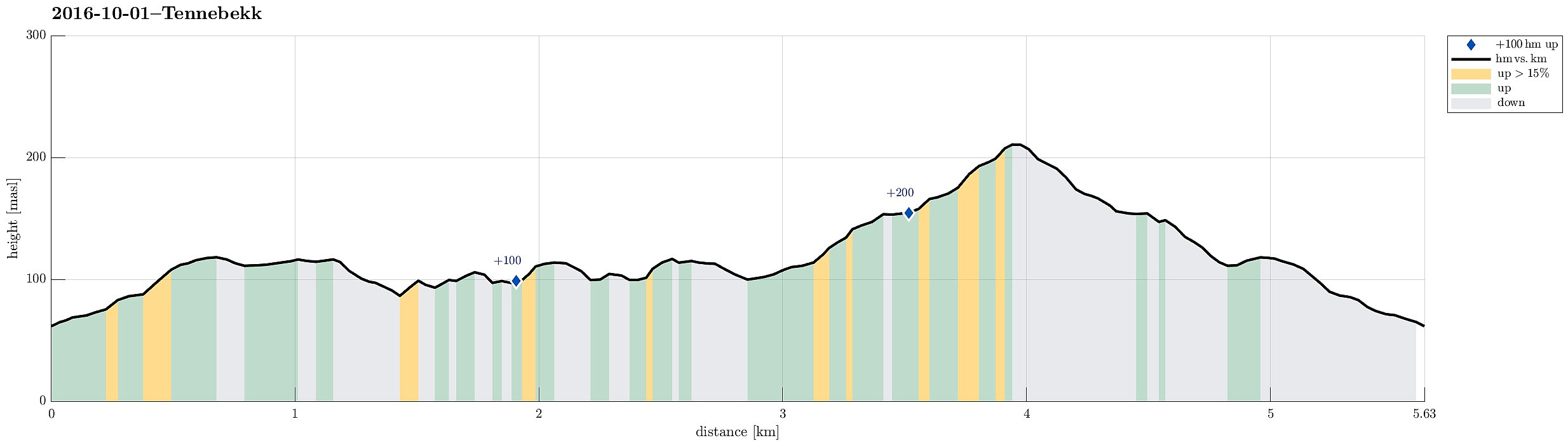
| Distanse | 5,6km |
| Høydemeter | 264m |
| GPS |
|
| Andre besøkte PBE'er | Spelhaugen p-plass (60moh) | 01.10.2016 |
|---|---|---|
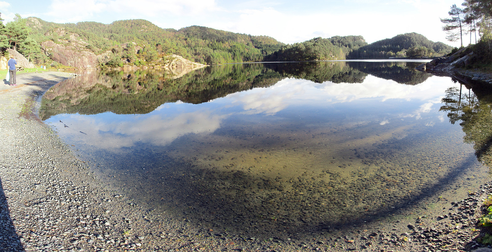
| Tennebekktjernet (95moh) | 01.10.2016 | |
| Tennebekktjørna p-plass (100moh) | 01.10.2016 | |
| Tjørnagrind (96moh) | 01.10.2016 |
Note that this track has been created from memory, i.e., it was not recorded automatically.
Trip Summary
We parked at the northwestern end of Spelhaugen and walked the forrest road up to Tennebekktjørna. We then rounded the little lake (in clockwise direction). When back to Langedalen, after one round, we decided to walk the forrest road, which leads up to Eikelifjellet up and down, before returning to our car.
Photos
Selected photos are available as Google photo album.
Useful Resources
See also the related FB-page Hiking around Bergen, Norway.


Kommentarer