
Furekampane & Skavdalen (21.11.2015)

Skrevet av HHauser (Helwig Hauser)

| Startsted | Dyngelandsvegen (70moh) |
|---|---|
| Sluttsted | Dyngelandsvegen (70moh) |
| Turtype | Fjelltur |
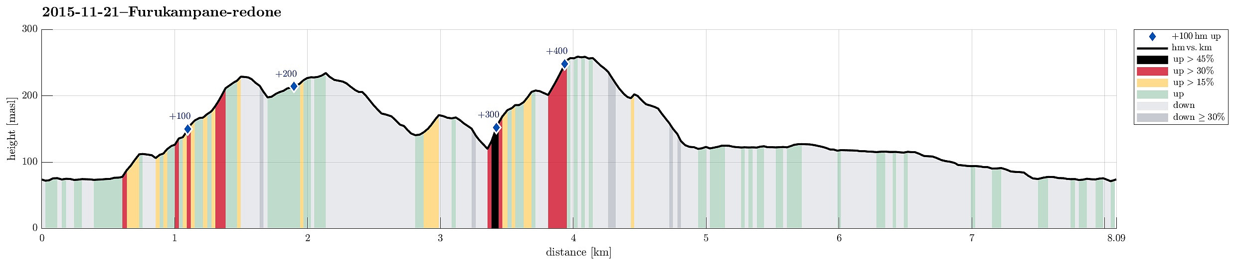
| Turlengde | 3t 00min |
| Distanse | 8,1km |
| Høydemeter | 471m |
| GPS |
|
| Bestigninger | Furekampane (236moh) | 21.11.2015 |
|---|---|---|
| Hånuken (233moh) | 21.11.2015 | |
| Andre besøkte PBE'er | Hånuken utsiktspunkt (233moh) | 21.11.2015 |
| Skavdalen utsikt øst (260moh) | 21.11.2015 |
Trip Summary
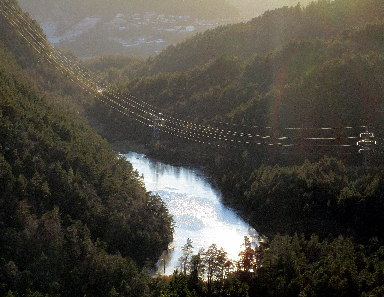
We parked near Dyngelandsvatnet and rounded the small lake on the southeastern side, then ascending to Fjellsenden. From there, we basically walked all over the long ridge of Furukampane. On the other end, at Ravnabrotet, we got to look down on Grimevatnet. From there, we turned right and back, a little, descending into Skavdalen (and crossing it close to the northern end of a small lake which is located right underneath Langavatnet). We climbed up on the eastern side to Øvre Skavdalen and from there further to a small top underneath Brattlandsfjellet. There we turned back, descending again into Øvre Skavdalen and from there back to the small lake (but now to its southern end). From there, it is only a few steps to the northern end of Langavatnet and a path leads along this lake on its western side. From there, we basically walked out Langedalen and to the turn right next to Myrdalsvatnet, turning right there and getting back to our car. Back in Skavdalen, especially up in Øvre Skavdalen, hikers find peaceful nature and get the impression of being far from Bergen (while in fact being not so far from Bergen at all!).
Photos
Selected photos are available as Google+ photo album.
Useful Resources
Web page WestCoastPeaks.com provides useful information about Dyngelandsåsen (Oksla), Hånuken, and Furekampane
and also Petter Bjørstad has a useful page about Furekampane.


Kommentarer