Arkiv - dato
"Peakbookvenner"
Lister jeg samler etter

Hamperokken
- Dato:
- 06.08.2025
- Turtype:
- Fjelltur
- Turlengde:
- 6:00t
- Distanse:
- 11,0km
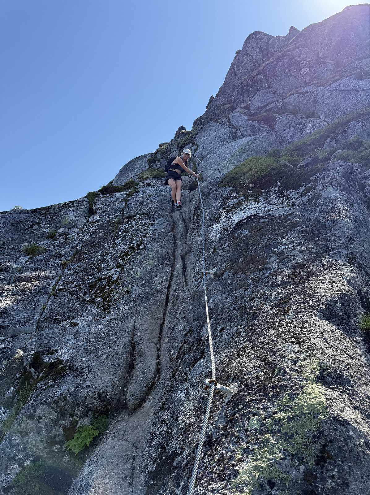
 It had rained overnight and in to the morning, but the forecast said the afternoon would be bright and warm, so we held off deciding on a route until the fair weather manifested. At around midday it became clear that today was the day that we'd attempt the iconic Hamperokken.
Back in April, Alice and I went snowshoeing up Stormheimfjellet; this was our first time driving on the E8 alongside Ramfjorden. Completely oblivious to what was round the corner, our first ever glimpse of the towering mountain, glistening in snow and ice took our breath away as we sat and drove in silence. A quick google search revealed that this mountain was in fact a popular summer hike, incompressible to us in the valley, looking up at its near vertical peak then covered in snow. We made the decision then that we'd >>>
It had rained overnight and in to the morning, but the forecast said the afternoon would be bright and warm, so we held off deciding on a route until the fair weather manifested. At around midday it became clear that today was the day that we'd attempt the iconic Hamperokken.
Back in April, Alice and I went snowshoeing up Stormheimfjellet; this was our first time driving on the E8 alongside Ramfjorden. Completely oblivious to what was round the corner, our first ever glimpse of the towering mountain, glistening in snow and ice took our breath away as we sat and drove in silence. A quick google search revealed that this mountain was in fact a popular summer hike, incompressible to us in the valley, looking up at its near vertical peak then covered in snow. We made the decision then that we'd >>>
Kattanakken
- Dato:
- 13.07.2025
- Turtype:
- Fjelltur
- Turlengde:
- 6:00t
- Distanse:
- 15,0km
 Since we first visited the region last September, Alice and I have felt a sense of awe around the Jostedalsbreen glacier. Back then we had hiked to Flatbrehytta and had looked down upon the cascading Flatbreen glacier, where we had spent at least two hours admiring its frightening beauty; even watching from afar as a large chunk crumbled down the icefall. We'd fancied getting close to Jostedalsbreen again, and bookmarked Kattanakken for our next visit.
We had arrived in Stryn the evening before and were set to enjoy two full days in the area. A heatwave had arrived, bringing daytime highs to the high-twenties in the valley- quite a contrast to where we were heading. Setting off from the huge carpark in Briksdalen, we skirted around the many tourists taking the short walk/buggy ride(!?) up to >>>
Since we first visited the region last September, Alice and I have felt a sense of awe around the Jostedalsbreen glacier. Back then we had hiked to Flatbrehytta and had looked down upon the cascading Flatbreen glacier, where we had spent at least two hours admiring its frightening beauty; even watching from afar as a large chunk crumbled down the icefall. We'd fancied getting close to Jostedalsbreen again, and bookmarked Kattanakken for our next visit.
We had arrived in Stryn the evening before and were set to enjoy two full days in the area. A heatwave had arrived, bringing daytime highs to the high-twenties in the valley- quite a contrast to where we were heading. Setting off from the huge carpark in Briksdalen, we skirted around the many tourists taking the short walk/buggy ride(!?) up to >>>
Store Smørstabbtinden
- Dato:
- 09.07.2025
- Turtype:
- Fjelltur
- Turlengde:
- 5:00t
- Distanse:
- 14,0km
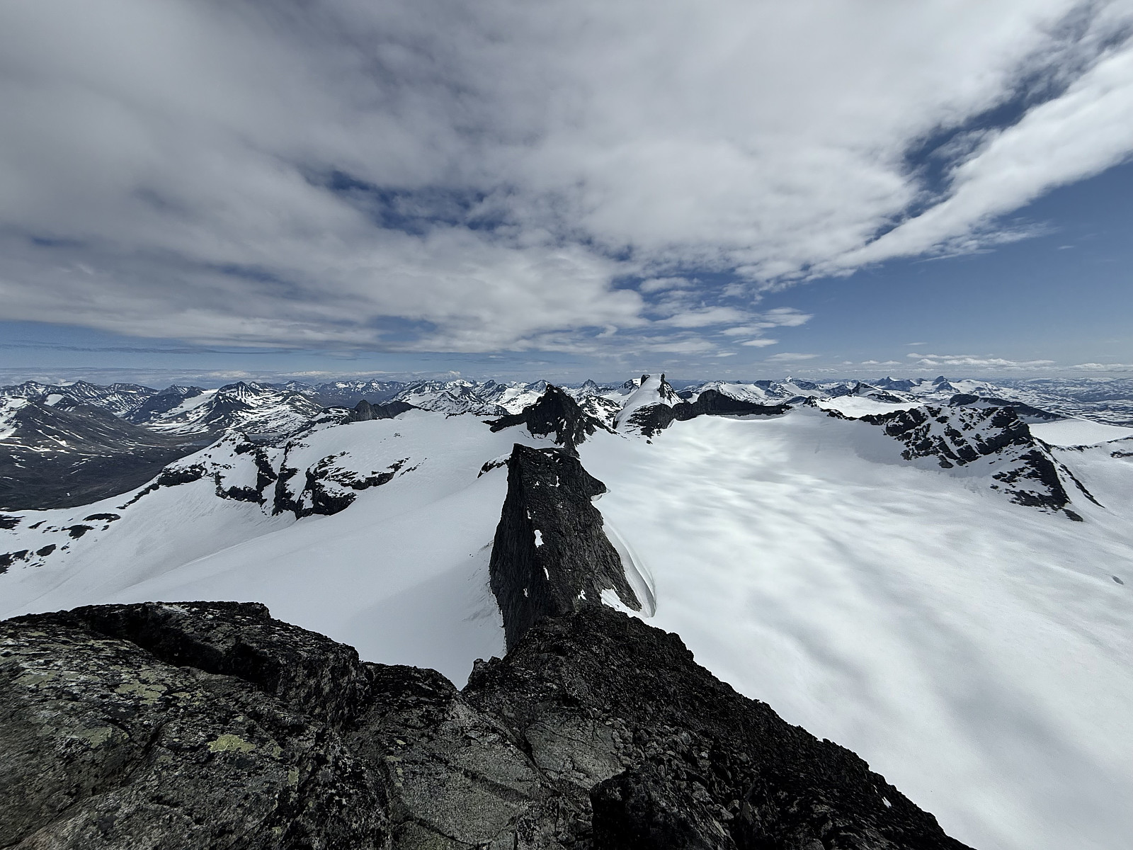 Having climbed Surtningssue the day prior and with the fantastic conditions showing no end, we searched for another 2000m peak in Jotunheimen.
Setting off from Krossbu at 13:00, we hiked the couple of km to the edge of the glacial lake at 1512masl under the magnificent Leirbrean glacier and the horseshoe of jagged fells that surround it. We were surprised by the amount of snow still on the ground: this being our first July in Norway, we were unsure whether or not this was typical for this time of year.
Following cairns and footprints in the snow, we ascended north-east towards Leirvatnet, where we watched two runners glissade down the mountainside ahead. They hopped over a snow bridge over the stream running off the lake as we took our time searching for a shallow way through.
After the lake came >>>
Having climbed Surtningssue the day prior and with the fantastic conditions showing no end, we searched for another 2000m peak in Jotunheimen.
Setting off from Krossbu at 13:00, we hiked the couple of km to the edge of the glacial lake at 1512masl under the magnificent Leirbrean glacier and the horseshoe of jagged fells that surround it. We were surprised by the amount of snow still on the ground: this being our first July in Norway, we were unsure whether or not this was typical for this time of year.
Following cairns and footprints in the snow, we ascended north-east towards Leirvatnet, where we watched two runners glissade down the mountainside ahead. They hopped over a snow bridge over the stream running off the lake as we took our time searching for a shallow way through.
After the lake came >>>
Surtningssue
- Dato:
- 08.07.2025
- Turtype:
- Fjelltur
- Turlengde:
- 5:00t
- Distanse:
- 23,0km
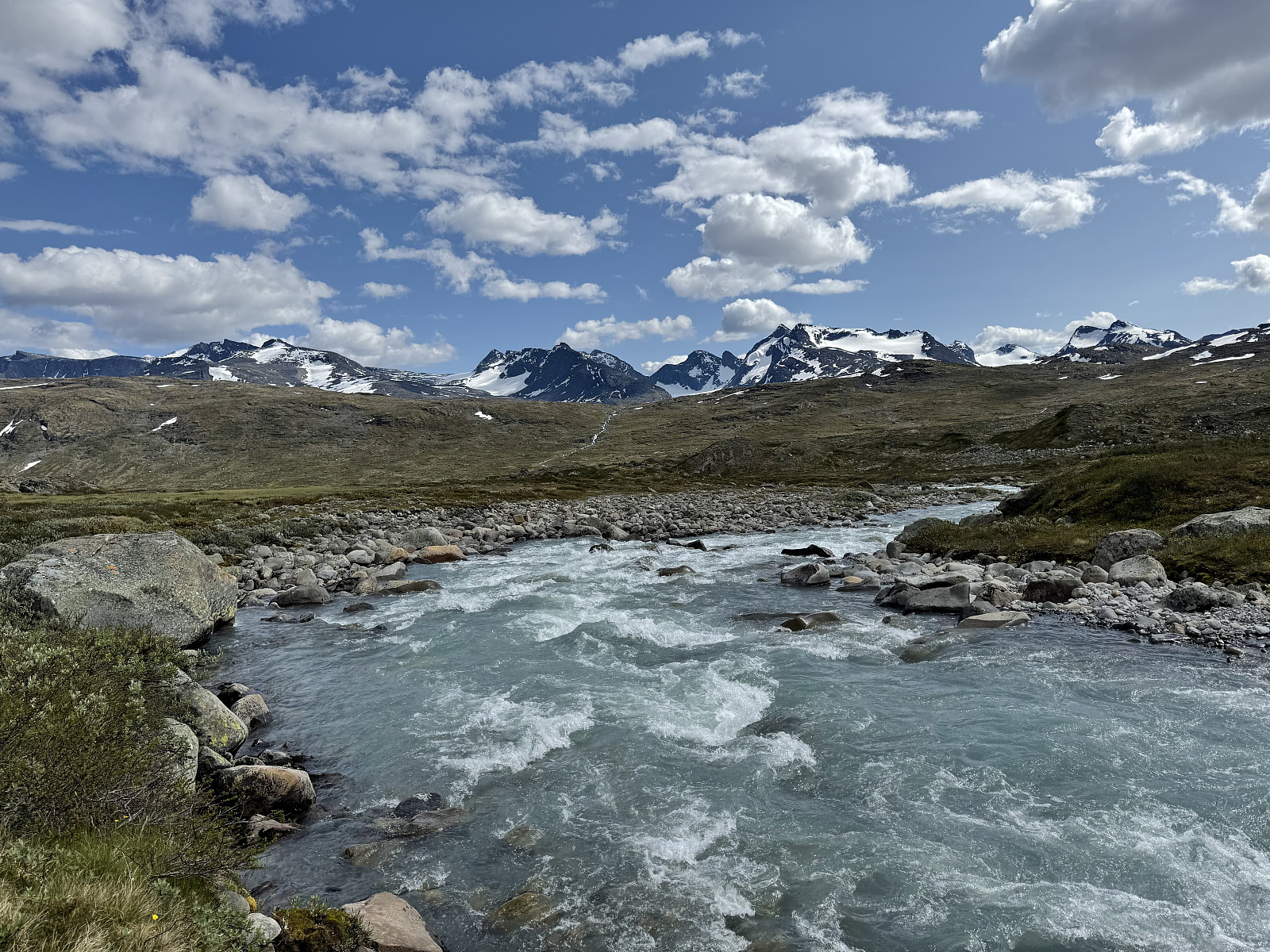 Following yesterday's drizzle, today looked to be the first of a potentially long streak of good weather days (the streak ended up lasting 2+ weeks!). We fancied a trip to Gjende and decided upon a trip up Surtningssue, booking onto the 9:30 Gjendebåten from Gjendesheim to Memurubu.
The smaller of the two ferries took us to Memurubu and was completely full, a testament to the popularity of the Besseggen tour. We were grateful to loose 99% of the crowds upon arriving Memurubu where our path diverged from the masses: Surtningssue 2367moh was written on an impressively large sign. Despite this signage, it looked as though we were the only people from our boat making the journey up the mountain. The route today was circular: we'd approach Surtningssue via the higher-level path towards Raudhamran >>>
Following yesterday's drizzle, today looked to be the first of a potentially long streak of good weather days (the streak ended up lasting 2+ weeks!). We fancied a trip to Gjende and decided upon a trip up Surtningssue, booking onto the 9:30 Gjendebåten from Gjendesheim to Memurubu.
The smaller of the two ferries took us to Memurubu and was completely full, a testament to the popularity of the Besseggen tour. We were grateful to loose 99% of the crowds upon arriving Memurubu where our path diverged from the masses: Surtningssue 2367moh was written on an impressively large sign. Despite this signage, it looked as though we were the only people from our boat making the journey up the mountain. The route today was circular: we'd approach Surtningssue via the higher-level path towards Raudhamran >>>
Nordre Trolltinden
- Dato:
- 05.07.2025
- Turtype:
- Fjelltur
- Turlengde:
- 6:00t
- Distanse:
- 14,0km
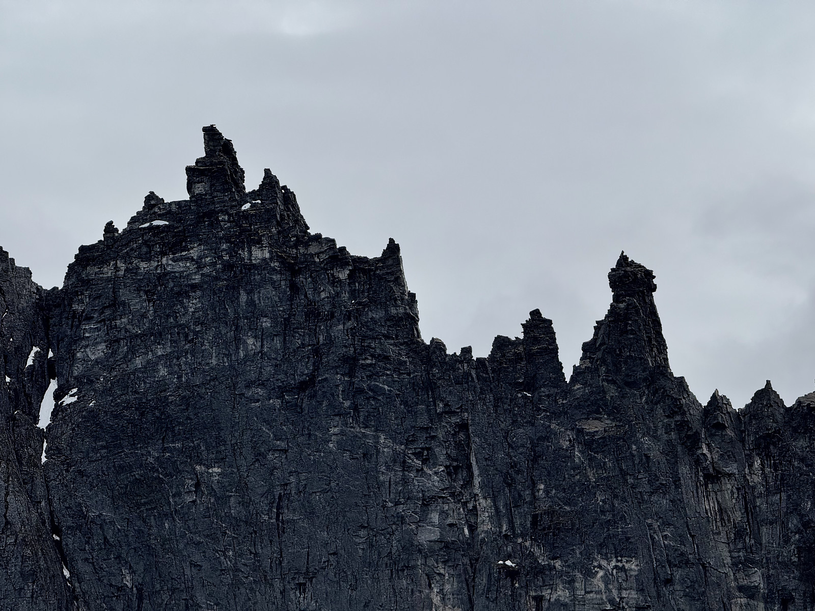 Having spent the previous day on the popular Romsdalseggen and Blånebba, our minds were still occupied with the spectacle of the Trollveggen. We wanted to get a closer look, to really grasp its scale, and with the Trollstigen closed, we had the idea to hike to the Nordre Trolltinden summit.
Given the imposing stature of the Trollveggen, we had some nerves regarding what we might encounter on the way to Nordre Trolltinden. We had consulted Pontus, the owner of our AirBnB, about our prospective route, and he had assured us that the scrambling was more challenging than Romsdalseggen (we did not find this challenging), but the route was clear, manageable and not too exposed.
Blessed with sun, low winds and comfortable temperatures, we began with the steep climb up Norafjellet from Sogge. Winding >>>
Having spent the previous day on the popular Romsdalseggen and Blånebba, our minds were still occupied with the spectacle of the Trollveggen. We wanted to get a closer look, to really grasp its scale, and with the Trollstigen closed, we had the idea to hike to the Nordre Trolltinden summit.
Given the imposing stature of the Trollveggen, we had some nerves regarding what we might encounter on the way to Nordre Trolltinden. We had consulted Pontus, the owner of our AirBnB, about our prospective route, and he had assured us that the scrambling was more challenging than Romsdalseggen (we did not find this challenging), but the route was clear, manageable and not too exposed.
Blessed with sun, low winds and comfortable temperatures, we began with the steep climb up Norafjellet from Sogge. Winding >>>
Laushornet
- Dato:
- 03.07.2025
- Turtype:
- Fjelltur
- Turlengde:
- 4:00t
- Distanse:
- 10,0km
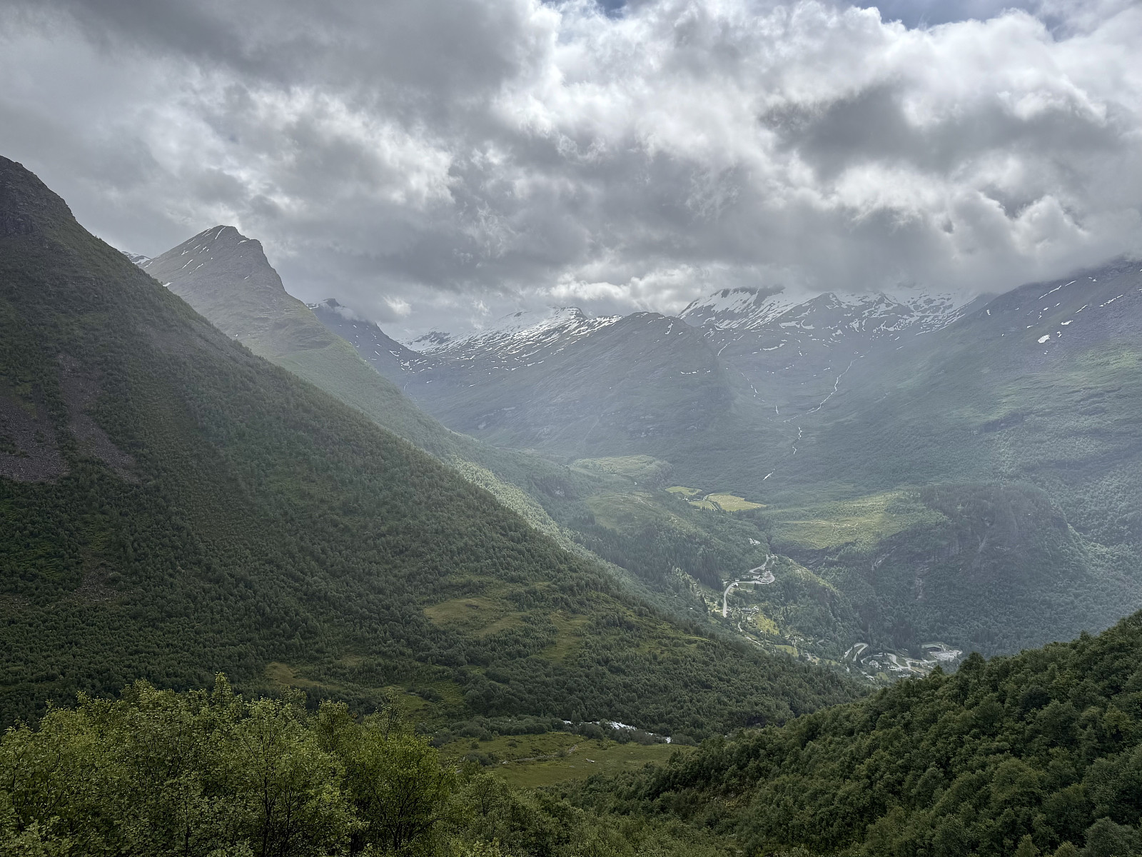 We were travelling from Vågåmo to Åndalsnes and although the Trollstigen was closed, we opted to drive via Geiranger as neither of us had ever seen the famous fjord. Aware of the status Geirangerfjord has amongst tourists, attracting cruiseshipfulls, we searched for a route that'd give us peace and pristine views down the fjord: Laushornet ticked all the boxes.
The weather was mixed: sunny intervals between heavy showers; clag intermittently shrouding the summits. Hoping we'd get views on the summit, we left the small car park at Vesterås and followed the tourist trod towards Storsæterfossen. The path was exceptionally busy, so we opted to explore the waterfall on our return journey. The view towards Vinåshornet (a climb for next time!) and neighbour Grinddalsnibba is satisfying. Humidity >>>
We were travelling from Vågåmo to Åndalsnes and although the Trollstigen was closed, we opted to drive via Geiranger as neither of us had ever seen the famous fjord. Aware of the status Geirangerfjord has amongst tourists, attracting cruiseshipfulls, we searched for a route that'd give us peace and pristine views down the fjord: Laushornet ticked all the boxes.
The weather was mixed: sunny intervals between heavy showers; clag intermittently shrouding the summits. Hoping we'd get views on the summit, we left the small car park at Vesterås and followed the tourist trod towards Storsæterfossen. The path was exceptionally busy, so we opted to explore the waterfall on our return journey. The view towards Vinåshornet (a climb for next time!) and neighbour Grinddalsnibba is satisfying. Humidity >>>

