Arkiv - dato
Arkiv - aktivitet
-
Annen tur (3)
- Kajakkpadling (3)
- Fottur (1894)
-
Kjøretur (9)
- Biltur (9)
-
Skitur (116)
- Fjellskitur (69)
- Langrennstur (47)
-
Sykkeltur (110)
- Blandet sykling (25)
- Gatesykling (85)
Lister jeg samler etter
-
Utvalgte topper og turmål i Bergen
(349/350)
 99%
99% -
Alle topper i Bergen
(393/398)
98%
-
Voss ≥ 100m pf.
(96/98)
97%
-
Opptur Hordaland
(144/159)
90%
-
Stasjoner på Bergensbanen
(33/40)
82%
-
Ulvik ≥ 100m pf.
(28/38)
73%
-
Hordaland ≥ 100m pf.
(622/863)
72%
-
Mjølfjell PF > 100m
(21/31)
67%
-
Jondal ≥ 100m pf.
(15/23)
65%
-
Dagsturhyttene i Vestland
(36/61)
59%
-
Sunnhordland PF >= 100m
(105/186)
56%
-
Hordaland: Hardanger PF>=100m
(194/359)
54%
-
DNT-hytter i Hordaland
(23/45)
51%
-
Kvinnherad ≥ 100m pf.
(40/79)
50%
-
Eidfjord ≥ 100m pf.
(13/42)
30%
-
Sogndal ≥ 100m pf.
(23/81)
28%
-
Gulen ≥ 100m pf.
(15/54)
27%
-
Vik i Sogn ≥ 100m pf.
(10/46)
21%
-
Sogn - Sør for Sognefjorden PF>=100m
(31/159)
19%
-
DNT-hytter i Sogn og Fjordane
(8/47)
17%

Loneggi from Ekse
- Dato:
- 21.06.2025
- Turtype:
- Fjelltur
- Turlengde:
- 2:28t
- Distanse:
- 6,0km
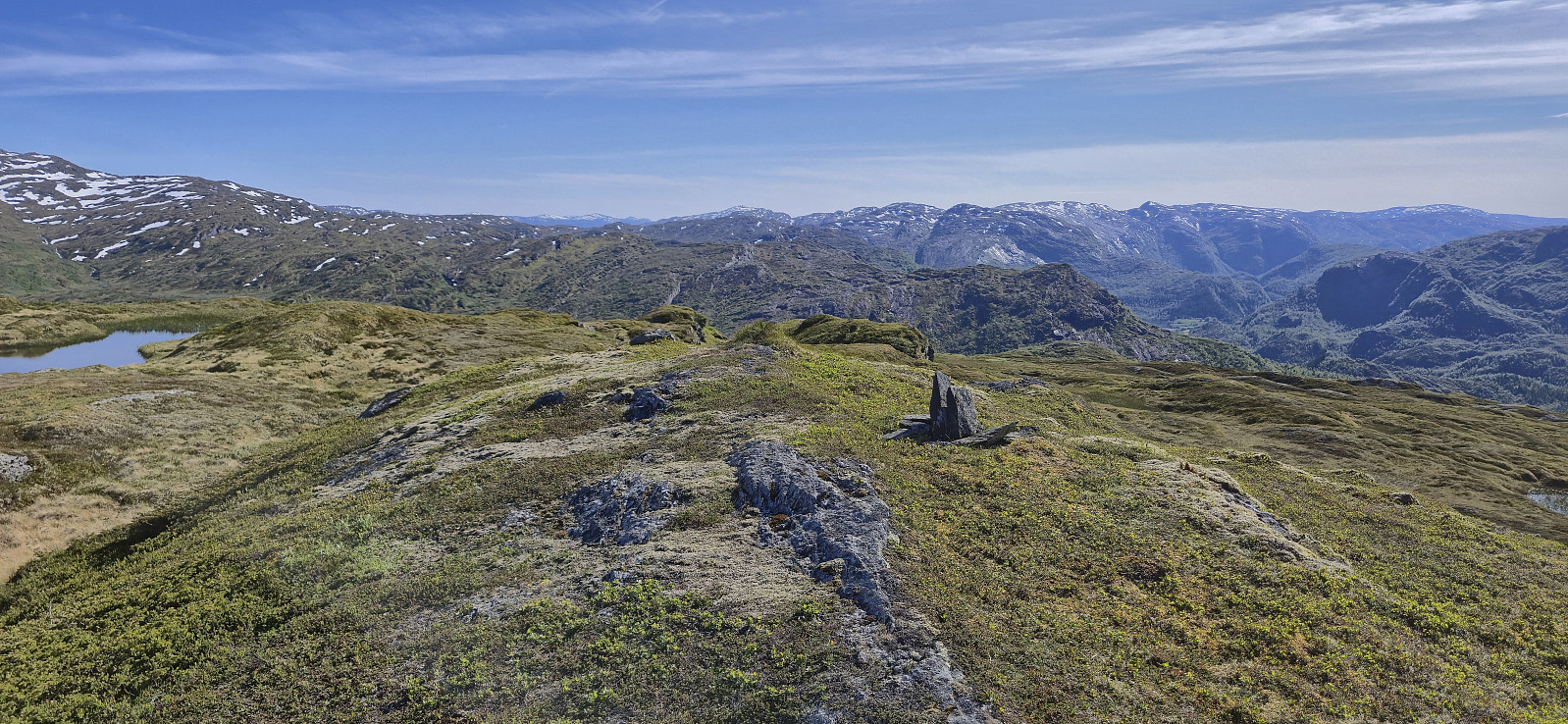 After my solo ascent of Blyfjell , I was picked up by Endre at Gullbrå and we drove the short distance west to Ekse where we found parking next to the suspension bridge across Ekso . The bridge made for easy access to the trail starting on the other side of the river, which we proceeded to follow up Tjørnadalen before later heading off-trail to the summit.
The summit was reached without any issues and provided great panoramic views. Before descending along the same route we had a short break celebrating that I had now completed both Vaksdal ≥ 100m pf. and Nordhordland PF >= 100m !
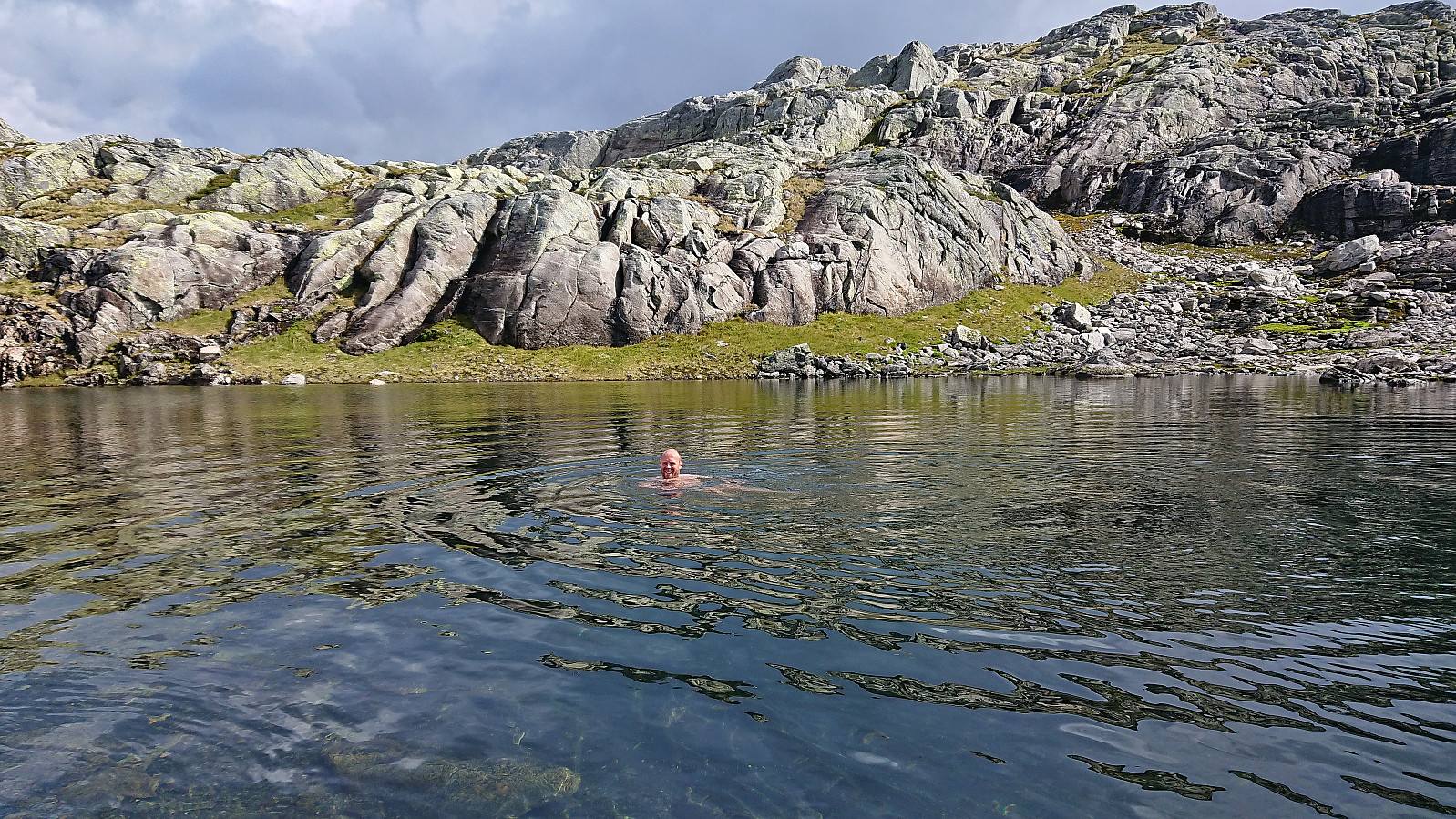
Towards the end of the hike the trail passed by a picturesque small pond and Endre of course could not resist going for a swim. This was apparently not enough however and he also later decided not to use the bridge to get back to the car but rather walk across the river, which he managed with only minor concerns along >>>
After my solo ascent of Blyfjell , I was picked up by Endre at Gullbrå and we drove the short distance west to Ekse where we found parking next to the suspension bridge across Ekso . The bridge made for easy access to the trail starting on the other side of the river, which we proceeded to follow up Tjørnadalen before later heading off-trail to the summit.
The summit was reached without any issues and provided great panoramic views. Before descending along the same route we had a short break celebrating that I had now completed both Vaksdal ≥ 100m pf. and Nordhordland PF >= 100m !
Towards the end of the hike the trail passed by a picturesque small pond and Endre of course could not resist going for a swim. This was apparently not enough however and he also later decided not to use the bridge to get back to the car but rather walk across the river, which he managed with only minor concerns along >>>
Morkafjellet from Verpelstad
- Dato:
- 18.01.2025
- Turtype:
- Fjelltur
- Turlengde:
- 2:56t
- Distanse:
- 7,0km
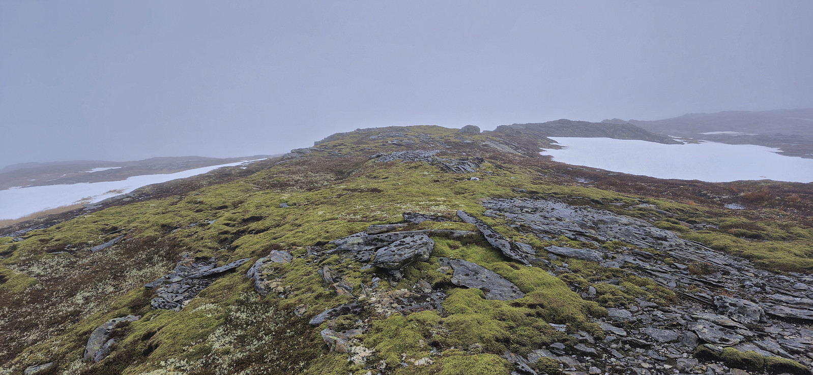 After three days on the couch due to a bad cold, I recovered just in time for a short Saturday hike to Morkafjellet with Petter and Endre . Petter picked me up at my place at 08:00 and we met up with Endre at the surprisingly large parking lot at Verpelstad a bit more than an hour later.
Thanks to an external report we easily located the unmarked trailhead behind the houses just northeast of the parking lot and from there followed a partially marked trail all the way to Verpelstadstølen (except for doing our own "shortcut" just below the cabin when briefly losing the trail, see the return track for the correct route).
From Verpelstadstølen there was a weaker trail up the first steep slope but soon we were simply making our own way towards the summit. There were several large patches of snow that had to be crossed but there was significantly less snow than expected for the middle of >>>
After three days on the couch due to a bad cold, I recovered just in time for a short Saturday hike to Morkafjellet with Petter and Endre . Petter picked me up at my place at 08:00 and we met up with Endre at the surprisingly large parking lot at Verpelstad a bit more than an hour later.
Thanks to an external report we easily located the unmarked trailhead behind the houses just northeast of the parking lot and from there followed a partially marked trail all the way to Verpelstadstølen (except for doing our own "shortcut" just below the cabin when briefly losing the trail, see the return track for the correct route).
From Verpelstadstølen there was a weaker trail up the first steep slope but soon we were simply making our own way towards the summit. There were several large patches of snow that had to be crossed but there was significantly less snow than expected for the middle of >>>
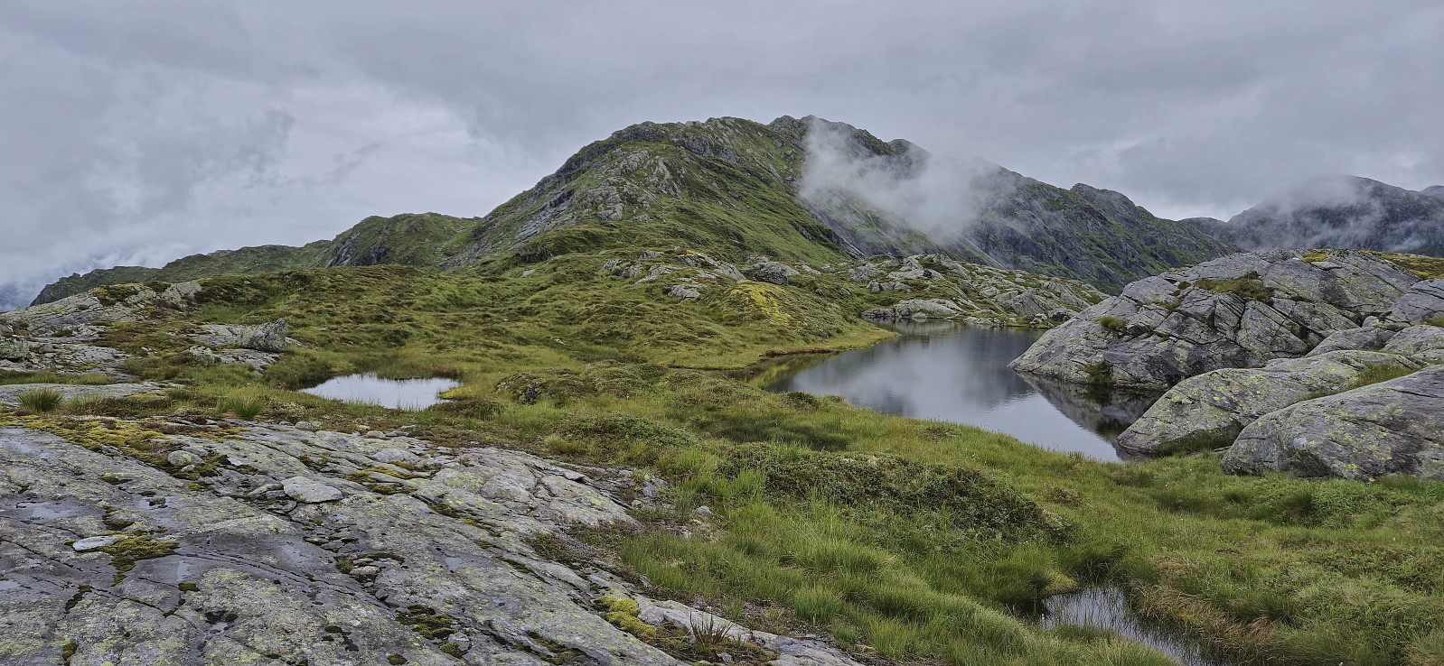
Skjerjavasshovden from Beinhellervatnet (alternative route)
- Dato:
- 07.09.2024
- Turtype:
- Fjelltur
- Turlengde:
- 5:45t
- Distanse:
- 13,5km
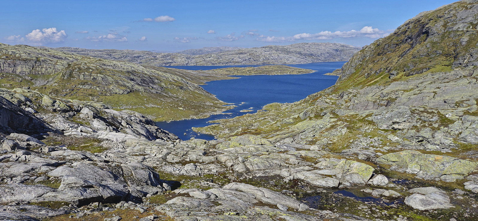 Initially, I had other hiking plans this Saturday, but then Endre gave me an offer I simply could not refuse: a ride to Norddalen such that I could visit Skjerjavasshovden . He had already been to Skjerjavasshovden but was going to drive further up Norddalen and kayak across Skjerjavatnet to ascend Trollahorgi and Belaskarhorgi .
I was picked up at my place around nine for the drive to Eksingedalen. A trip that turned out a bit longer than necessary as shortly after passing Evanger we realized that we were running low on gas. To be on the safe side we therefore turned back and made an extended detour to Voss to fill the tank. Rather annoying given the numerous gas stations we had passed on our way from Bergen...
When finally arriving in Norddalen, Endre dropped me off next to Beinhellervatnet before he continued north to the parking lot at the northeastern end of Skjerjavatnet . I started my >>>
Initially, I had other hiking plans this Saturday, but then Endre gave me an offer I simply could not refuse: a ride to Norddalen such that I could visit Skjerjavasshovden . He had already been to Skjerjavasshovden but was going to drive further up Norddalen and kayak across Skjerjavatnet to ascend Trollahorgi and Belaskarhorgi .
I was picked up at my place around nine for the drive to Eksingedalen. A trip that turned out a bit longer than necessary as shortly after passing Evanger we realized that we were running low on gas. To be on the safe side we therefore turned back and made an extended detour to Voss to fill the tank. Rather annoying given the numerous gas stations we had passed on our way from Bergen...
When finally arriving in Norddalen, Endre dropped me off next to Beinhellervatnet before he continued north to the parking lot at the northeastern end of Skjerjavatnet . I started my >>>
Stanghelle to Dale via Smørstakken
- Dato:
- 27.07.2024
- Turtype:
- Fjelltur
- Turlengde:
- 3:53t
- Distanse:
- 12,0km
 Due to an unstable weather forecast I opted for a return to Stanghelle with the main objective of visiting Smørstakken . As I got off the train I was welcomed by an intensive rain shower. I tried waiting it out at the station, but finally gave up and started the hike, and except for short breaks it would not really stop raining for another 2.5 hours.
I started along the same trail as for my previous hike in the area , but quickly deviated and instead followed the marked trail to Varden på Åsen for some nice views. After turning back I followed the marked trail to Berget and Smørstakken . The trail was overall easy to follow but there was a short steep section along the ridge with overhanging powerlines. There was a wire to hold on to though. Both Berget and Smørstakken provided excellent views, especially north along Veafjorden from Smørstakken.
From Smørstakken >>>
Due to an unstable weather forecast I opted for a return to Stanghelle with the main objective of visiting Smørstakken . As I got off the train I was welcomed by an intensive rain shower. I tried waiting it out at the station, but finally gave up and started the hike, and except for short breaks it would not really stop raining for another 2.5 hours.
I started along the same trail as for my previous hike in the area , but quickly deviated and instead followed the marked trail to Varden på Åsen for some nice views. After turning back I followed the marked trail to Berget and Smørstakken . The trail was overall easy to follow but there was a short steep section along the ridge with overhanging powerlines. There was a wire to hold on to though. Both Berget and Smørstakken provided excellent views, especially north along Veafjorden from Smørstakken.
From Smørstakken >>>
Joskarfjellet and Høgafjellet
- Dato:
- 18.07.2024
- Turtype:
- Fjelltur
- Turlengde:
- 9:30t
- Distanse:
- 30,0km
 Warning: This hike contains a steep off-trail descent. Please read the report carefully to see if this is something you are comfortable with.
I started by taking the train to Dale and the bus to Eksingedalen where I got off at "Modalstunnelen sør" (the bus continued through the tunnel). The first part of the hike therefore consisted of walking east along the road to Vetlejord. Here I easily located the marked trailhead for Vetlejordsstølen and proceeded to follow the marked trail until it ended at two cabins. The trail was overall rather wet and muddy but except for a small herd of cattle that had to be avoided early on, it could be followed without any issues.
From Vetlejordsstølen I headed off-trail to the start of the ridge of Joskarfjellet (or Joskardfjellet as it is named on PB). This was overall straightforward >>>
Warning: This hike contains a steep off-trail descent. Please read the report carefully to see if this is something you are comfortable with.
I started by taking the train to Dale and the bus to Eksingedalen where I got off at "Modalstunnelen sør" (the bus continued through the tunnel). The first part of the hike therefore consisted of walking east along the road to Vetlejord. Here I easily located the marked trailhead for Vetlejordsstølen and proceeded to follow the marked trail until it ended at two cabins. The trail was overall rather wet and muddy but except for a small herd of cattle that had to be avoided early on, it could be followed without any issues.
From Vetlejordsstølen I headed off-trail to the start of the ridge of Joskarfjellet (or Joskardfjellet as it is named on PB). This was overall straightforward >>>
Bergsdalen to Eikedalen
- Dato:
- 13.07.2024
- Turtype:
- Fjelltur
- Turlengde:
- 9:11t
- Distanse:
- 29,2km
 For the second Saturday in a row I took the train to Dale and the bus to Bergsdalen, but where I last week walked north to Evanger , this time I was heading south to Eikedalen. I got off the bus at the start of the road to Raunehaugen where I soon located the unmarked trailhead for Kjerringafjellet . The trail quality varied quite a lot and except for small cairns (mainly) towards the end it was unmarked. At several points I therefore had to check the GPS to make sure I was heading the right way. Near the summit there was also a boulder obstacle course that had to be traversed. The summit provided great views and a nice location for a short lunch break.
In order to next go to Storliknausen I first returned north towards Såta before carefully navigating my way down to the valley between Kjerringafjellet and Storliknausen. This was overall straightforward, >>>
For the second Saturday in a row I took the train to Dale and the bus to Bergsdalen, but where I last week walked north to Evanger , this time I was heading south to Eikedalen. I got off the bus at the start of the road to Raunehaugen where I soon located the unmarked trailhead for Kjerringafjellet . The trail quality varied quite a lot and except for small cairns (mainly) towards the end it was unmarked. At several points I therefore had to check the GPS to make sure I was heading the right way. Near the summit there was also a boulder obstacle course that had to be traversed. The summit provided great views and a nice location for a short lunch break.
In order to next go to Storliknausen I first returned north towards Såta before carefully navigating my way down to the valley between Kjerringafjellet and Storliknausen. This was overall straightforward, >>>
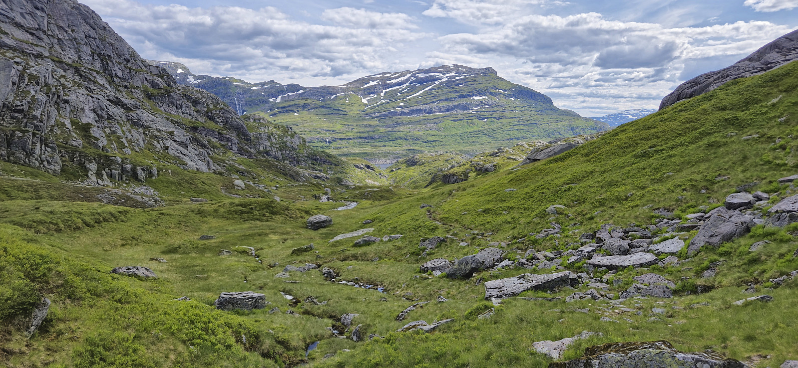
Bergsdalen to Evanger via Hamlagrøhornet
- Dato:
- 06.07.2024
- Turtype:
- Fjelltur
- Turlengde:
- 5:24t
- Distanse:
- 18,4km
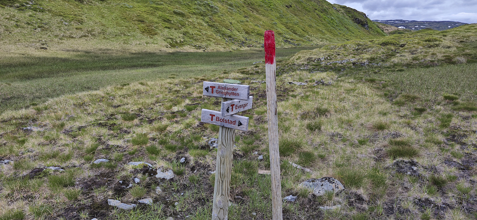 I started by taking the train to Dale and from there the bus up to Bergsdalen where I got off at the start of the gravel road to Alexander Grieghytten . After a quick look at the cabin I continued on a marked trail north towards Evanger. At the top of the pass I however turned right, left the marked trail, and headed off-trail to the summit of Hamlagrøhornet . Here I visited all of the potential highest points (the one just south of the largest cairn seems to be the real summit) before continuing northeast via Såta to Løva .
Løva stood out from the rest of the terrain but could still be easily ascended. The unusual rock formations making up the ridge seemed to be very good cairn building material, as there were at least four cairns at or near the summit. After a short lunch break, I descended the same way before heading north and >>>
I started by taking the train to Dale and from there the bus up to Bergsdalen where I got off at the start of the gravel road to Alexander Grieghytten . After a quick look at the cabin I continued on a marked trail north towards Evanger. At the top of the pass I however turned right, left the marked trail, and headed off-trail to the summit of Hamlagrøhornet . Here I visited all of the potential highest points (the one just south of the largest cairn seems to be the real summit) before continuing northeast via Såta to Løva .
Løva stood out from the rest of the terrain but could still be easily ascended. The unusual rock formations making up the ridge seemed to be very good cairn building material, as there were at least four cairns at or near the summit. After a short lunch break, I descended the same way before heading north and >>>
Mysterfjell and Åsen
- Dato:
- 01.06.2024
- Turtype:
- Fjelltur
- Turlengde:
- 4:57t
- Distanse:
- 12,5km
 I started by taking the train to Dale and from there the bus to Eidslandet where I got off at Olavika at the start of Mystervegen. After passing the last house in Mystervegen I passed through a gate, and later on a second gate, and continued on a tractor road that soon turned into a marked trail that lead me up to Leiro . Here I had hoped to locate a trail towards Storfjellet but only found weak animal tracks and before long I was simply aiming for Storfjellet and heading off-trail in that direction. Thankfully the terrain was easy to navigate and I arrived at the summit without any issues. Excellent views back down towards Myster and Eidslandet from just west of the highest point.
Due to lots of flies I however did not stay long before turning my attention to the real goal of the day: Mysterfjell . Not sure where the name >>>
I started by taking the train to Dale and from there the bus to Eidslandet where I got off at Olavika at the start of Mystervegen. After passing the last house in Mystervegen I passed through a gate, and later on a second gate, and continued on a tractor road that soon turned into a marked trail that lead me up to Leiro . Here I had hoped to locate a trail towards Storfjellet but only found weak animal tracks and before long I was simply aiming for Storfjellet and heading off-trail in that direction. Thankfully the terrain was easy to navigate and I arrived at the summit without any issues. Excellent views back down towards Myster and Eidslandet from just west of the highest point.
Due to lots of flies I however did not stay long before turning my attention to the real goal of the day: Mysterfjell . Not sure where the name >>>
Kvamsnova from Furnestreet
- Dato:
- 11.11.2023
- Turtype:
- Fjelltur
- Turlengde:
- 5:09t
- Distanse:
- 8,6km
 Most people visiting Kvamsnova (also referred to as Kvamsnovi) seem do so as an extended detour when visiting Store Dustingen/Dystingen . This route however did not look too appealing and I was therefore more eager follow in elbow (Vegard Magnussen) 's footsteps based on his trip report indicating an easier route from Furnestreet (or Fornestræet as it is now written on the map). The only issue was that getting to Furnestreet (and back home afterwards) by public transport is not straightforward (requires first taking the train to Bolstadøyri, waiting half an hour at the station, and then taking the bus to Furnestreet). I was therefore very happy when Kjell showed an interest in joining and we could travel by car.
After leaving the car at the parking lot along the fjord (now partly occupied by the company working on Dalseidtunnelen), we crossed the main road and continued >>>
Most people visiting Kvamsnova (also referred to as Kvamsnovi) seem do so as an extended detour when visiting Store Dustingen/Dystingen . This route however did not look too appealing and I was therefore more eager follow in elbow (Vegard Magnussen) 's footsteps based on his trip report indicating an easier route from Furnestreet (or Fornestræet as it is now written on the map). The only issue was that getting to Furnestreet (and back home afterwards) by public transport is not straightforward (requires first taking the train to Bolstadøyri, waiting half an hour at the station, and then taking the bus to Furnestreet). I was therefore very happy when Kjell showed an interest in joining and we could travel by car.
After leaving the car at the parking lot along the fjord (now partly occupied by the company working on Dalseidtunnelen), we crossed the main road and continued >>>
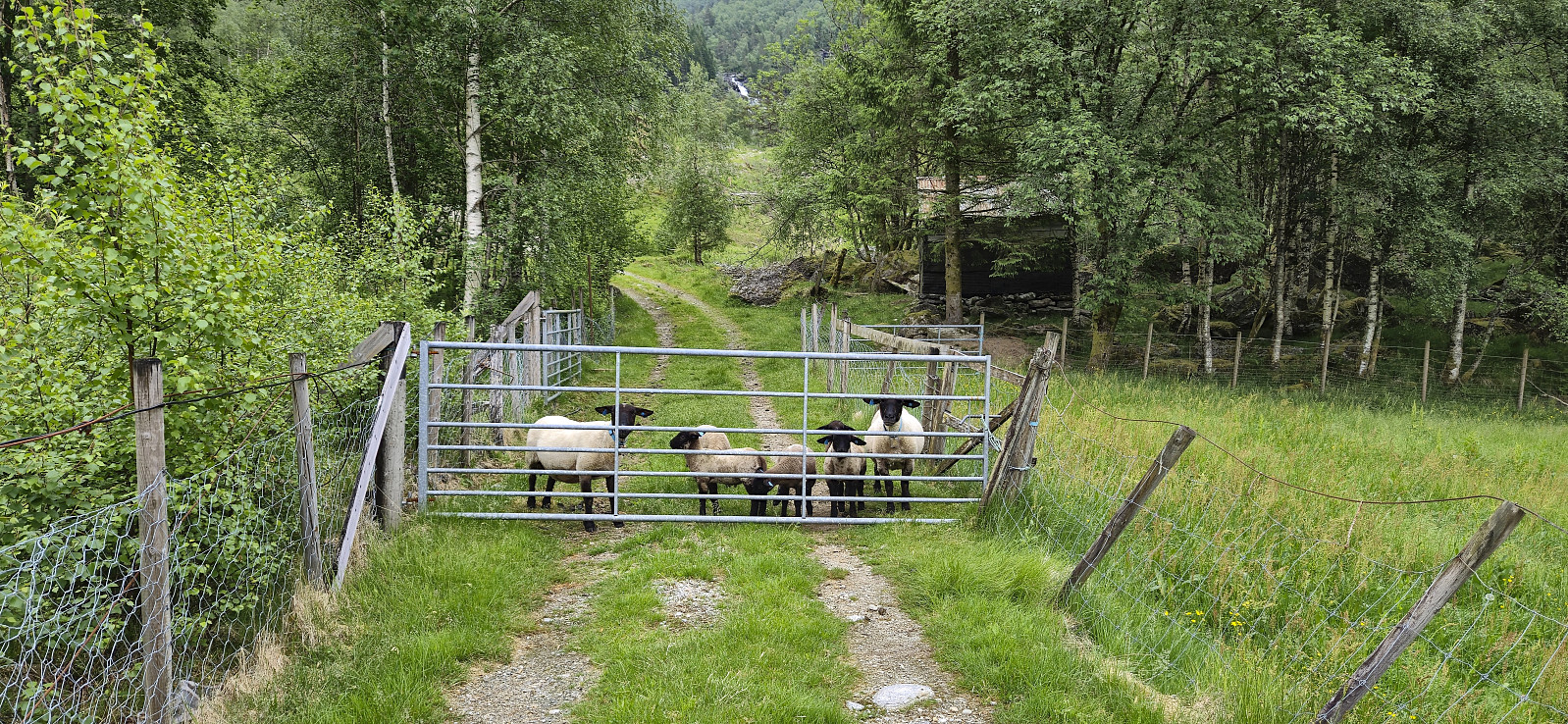
Norddalsfjellet, Sørdalsfjellet and Saudalsnovi
- Dato:
- 12.08.2023
- Turtype:
- Fjelltur
- Turlengde:
- 8:05t
- Distanse:
- 21,0km
 Initially I had other hiking plans for this Saturday, but when Fjellsamleren (Endre Myrdal Olsen) asked if I wanted to join him on a hike in Norddalen at the end of Øvstedalen, an area that is pretty much unreachable by public transport, I of course quickly changed my plans. Endre picked me up at my place at 08:15 and after driving as far up Øvstedalen as possible, passing through two gates on a narrow gravel road, we found parking near the end of the road at Øykholmane and were ready to start hiking around 09:45.
The road quickly turned into a wet trail that we followed via a couple of cabins. After crossing the river on a wooden bridge, and managing to avoid the grazing cows in the area, we left the cabins and trail behind and headed off-trail towards Kyrahjellen, which should provide us an easy ascent route to Norddalsfjellet (incorrectly >>>
Initially I had other hiking plans for this Saturday, but when Fjellsamleren (Endre Myrdal Olsen) asked if I wanted to join him on a hike in Norddalen at the end of Øvstedalen, an area that is pretty much unreachable by public transport, I of course quickly changed my plans. Endre picked me up at my place at 08:15 and after driving as far up Øvstedalen as possible, passing through two gates on a narrow gravel road, we found parking near the end of the road at Øykholmane and were ready to start hiking around 09:45.
The road quickly turned into a wet trail that we followed via a couple of cabins. After crossing the river on a wooden bridge, and managing to avoid the grazing cows in the area, we left the cabins and trail behind and headed off-trail towards Kyrahjellen, which should provide us an easy ascent route to Norddalsfjellet (incorrectly >>>
