Arkiv - dato
Arkiv - aktivitet
-
Annen tur (3)
- Kajakkpadling (3)
- Fottur (1735)
-
Kjøretur (9)
- Biltur (9)
-
Skitur (109)
- Fjellskitur (65)
- Langrennstur (44)
-
Sykkeltur (106)
- Blandet sykling (25)
- Gatesykling (81)
Lister jeg samler etter
-
Utvalgte topper og turmål i Bergen
(330/331)
 99%
99% -
Alle topper i Bergen
(378/385)
98%
-
Kvam ≥ 100m pf.
(41/44)
93%
-
Opptur Hordaland
(143/159)
89%
-
Voss ≥ 100m pf.
(84/98)
85%
-
Stasjoner på Bergensbanen
(28/36)
77%
-
Hordaland ≥ 100m pf.
(585/863)
67%
-
Ulvik ≥ 100m pf.
(24/38)
63%
-
Dagsturhyttene i Vestland
(33/61)
54%
-
Sunnhordland PF >= 100m
(99/186)
53%
-
DNT-hytter i Hordaland
(22/45)
48%
-
Jondal ≥ 100m pf.
(11/23)
47%
-
Hordaland: Hardanger PF>=100m
(162/359)
45%
-
Kvinnherad ≥ 100m pf.
(35/79)
44%
-
Sogndal ≥ 100m pf.
(23/81)
28%
-
DNT-hytter i Sogn og Fjordane
(8/47)
17%
-
Eidfjord ≥ 100m pf.
(6/42)
14%
-
Etne ≥ 100m pf.
(7/51)
13%
-
Ullensvang ≥ 100m pf.
(15/153)
9%
-
Opptur-topper i Sogn og Fjordane
(17/177)
9%

Melstveitåsen and Økterberg from Fyksesundvegen via Berge
- Dato:
- 28.05.2022
- Turtype:
- Fjelltur
- Turlengde:
- 2:47t
- Distanse:
- 9,3km
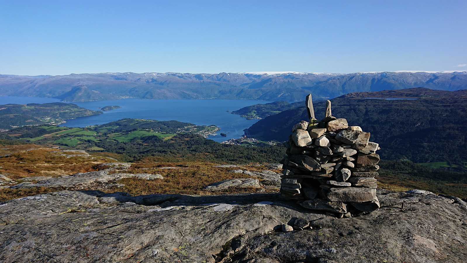
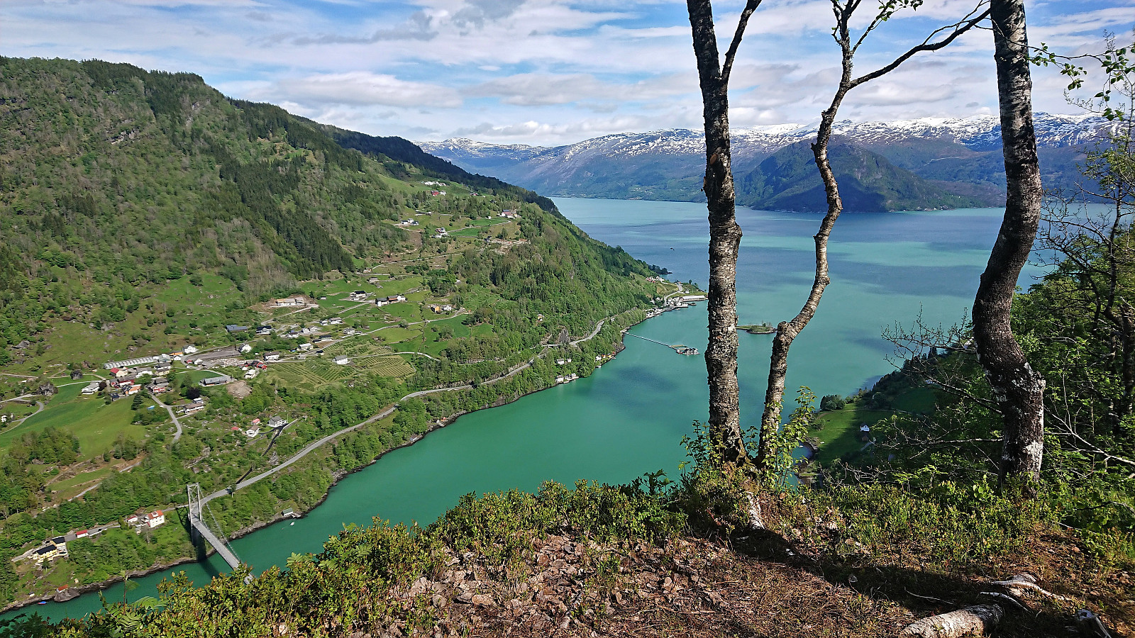 Earlier trip reports indicate that the summit of Melstveitåsen is a location that most hikers will probably not feel the need to visit. However, upon researching how to get to Melstveitåsen by public transport, I came across a suggested hike at ut.no promising excellent views from Økterberg , a location only 600 meters northeast of the summit, which I then of course had to add to my planned hike.
But even with this addition, and the fact that my hike had to start from the bus stop at the main road, the hike would still be quite short. I therefore decided to add a sightseeing element and arrive at the trailhead via first taking the train to Voss and from there the bus via Granvin. This provided excellent views along the way, especially the drive along the fjords, and as a bonus made it into a roundtrip.
Upon finally arriving at the bus stop >>>
Earlier trip reports indicate that the summit of Melstveitåsen is a location that most hikers will probably not feel the need to visit. However, upon researching how to get to Melstveitåsen by public transport, I came across a suggested hike at ut.no promising excellent views from Økterberg , a location only 600 meters northeast of the summit, which I then of course had to add to my planned hike.
But even with this addition, and the fact that my hike had to start from the bus stop at the main road, the hike would still be quite short. I therefore decided to add a sightseeing element and arrive at the trailhead via first taking the train to Voss and from there the bus via Granvin. This provided excellent views along the way, especially the drive along the fjords, and as a bonus made it into a roundtrip.
Upon finally arriving at the bus stop >>>
Steinsdalsfossen from Norheimsund
- Dato:
- 02.04.2022
- Turtype:
- Spasertur
- Turlengde:
- 0:45t
- Distanse:
- 3,1km
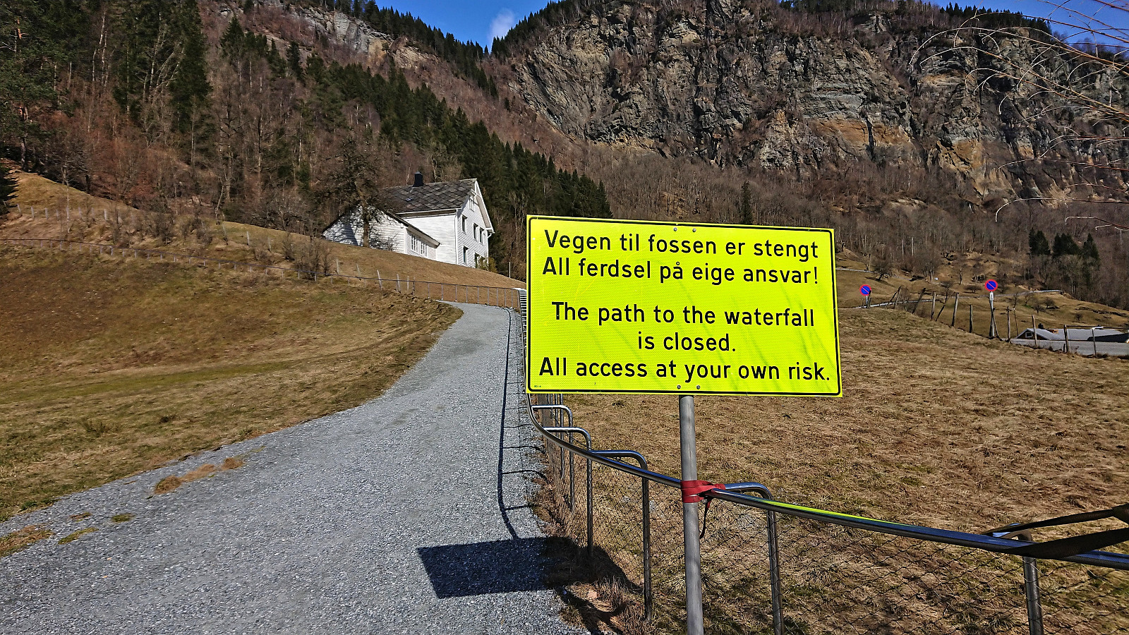 After my short hike to Åsen , I returned by bus to Norheimsund, where I had almost an hour to kill before the next bus to Bergen. I therefore decided to pay Steinsdalsfossen a visit. A location I had not visited since I was a child. Sadly, the waterfall was not yet officially opened for the summer, and I could not do the unique walk behind the waterfall. But at least I more or less had the waterfall to myself, which is rarely the case during the summer. After a short lunch break, the bus arrived to take me back to Bergen.
Åsen from Fonnaland/Vikøyvegen
- Dato:
- 02.04.2022
- Turtype:
- Fjelltur
- Turlengde:
- 1:09t
- Distanse:
- 5,6km
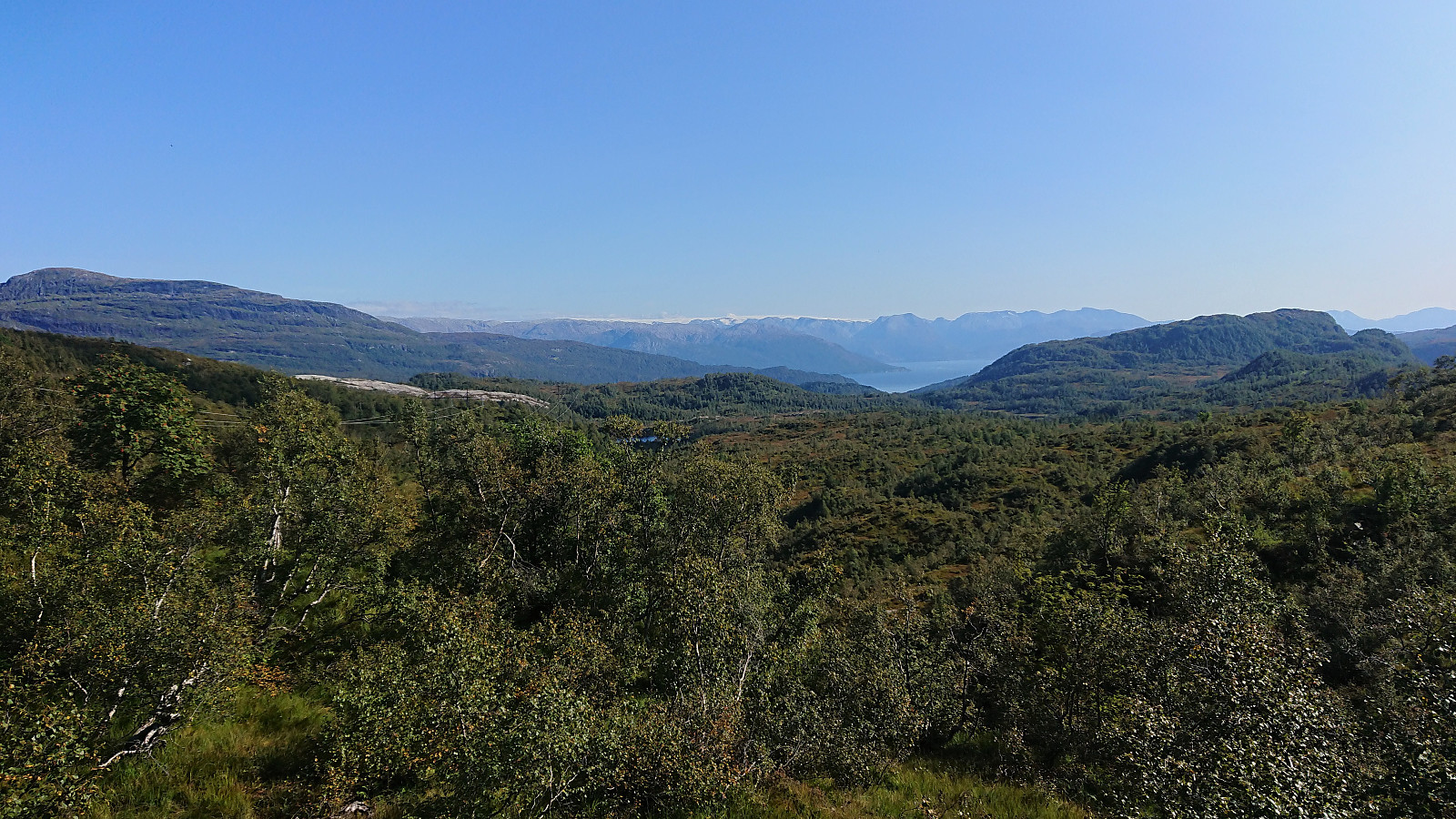
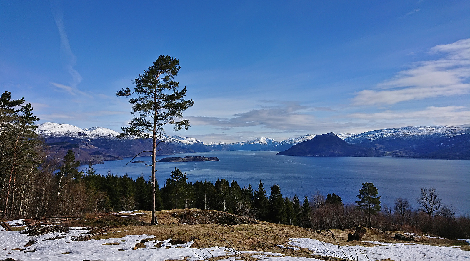 A short hike to the summit of Åsen starting from the bus stop at the main road and heading up the paved side road to Øvre Aksnes. After passing the final house (and a turkey farm, see elbow (Vegard Magnussen) 's trip report as I did not see any turkeys myself), I continued on a tractor road that took me almost all the way to the summit. Reaching the summit was thus straightforward and only required a short off-trail section (less than 150 meters). Still some snow on the tractor road and at the summit area, but it was packed hard and I could easily walk on top of it. No clear highest point and very limited views, hence I did not stay long before returning along the same route. Overall, not the most interesting summit, but the excellent views from Øvre Aksnes more than made up for it.
Gravdalshorga from Gravdal
- Dato:
- 31.10.2021
- Turtype:
- Fjelltur
- Turlengde:
- 3:57t
- Distanse:
- 10,2km
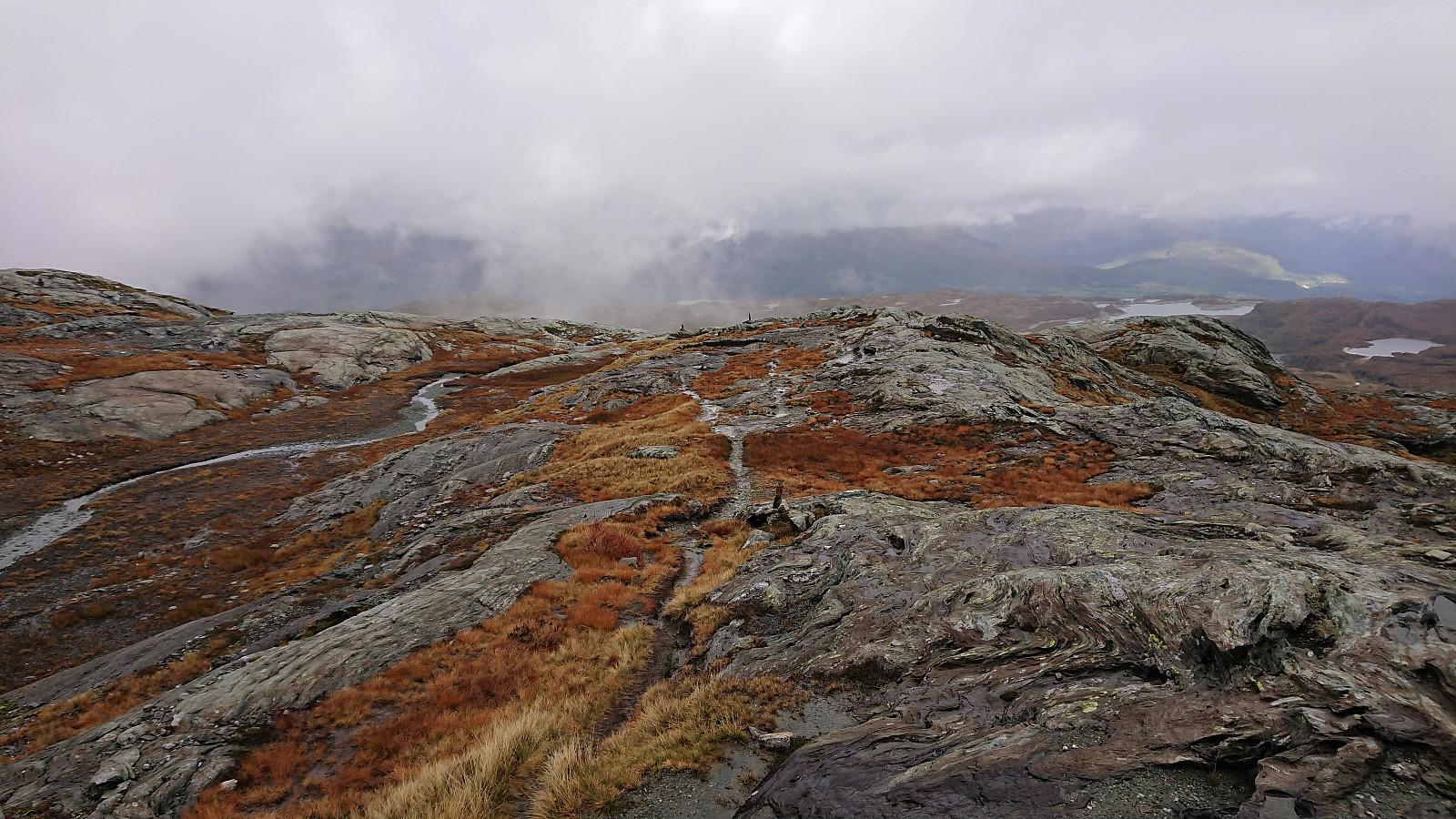
 I started by taking the bus from Bergen to Gravdal and got off at the bus stop called "Gravdal sør, Kvam". From there I pretty much followed in the footsteps of previous PB-hikers to Gravdalshorga , and could thus take advantage of their efforts at finding the best route.
After passing the last houses at the end of Gravdalsvegen, I continued on a tractor road taking me to an unmarked trail following the river up to the unnamed cabin at the northeastern end of Sakresvatn. While the trailhead was unmarked, the trail itself was relatively easy to follow.
As I arrived at the cabin, I however noticed that this was an unnecessary detour and that I should rather have stayed on the south side of the stream (see the return route). But after finding a place to cross the stream I was shortly back on track >>>
I started by taking the bus from Bergen to Gravdal and got off at the bus stop called "Gravdal sør, Kvam". From there I pretty much followed in the footsteps of previous PB-hikers to Gravdalshorga , and could thus take advantage of their efforts at finding the best route.
After passing the last houses at the end of Gravdalsvegen, I continued on a tractor road taking me to an unmarked trail following the river up to the unnamed cabin at the northeastern end of Sakresvatn. While the trailhead was unmarked, the trail itself was relatively easy to follow.
As I arrived at the cabin, I however noticed that this was an unnecessary detour and that I should rather have stayed on the south side of the stream (see the return route). But after finding a place to cross the stream I was shortly back on track >>>
Vesoldo and Slåttenuten - from Tørvik to Norheimsund
- Dato:
- 25.09.2021
- Turtype:
- Fjelltur
- Turlengde:
- 6:31t
- Distanse:
- 22,4km
 I started by taking the bus to Tørvik and getting off at the bus stop called "Heradstveit kryss". At the initial crossroads there were hiking signs pointing in both directions. I went for the southern option, passing through Tørvik and Tveiten, before following a toll road to the parking lot at Perslå . I briefly considered heading southwest to Tveitestølen to ascend Tørvikenuten from the south. But while there was a trail indicated on the map, the hiking information sign at Perslå did not mention this option at all. Not wanting to risk spending most of the ascent searching for a potentially weak trail, I instead went for the safe option and followed the marked trail via Osadal.
The tractor road continued all the way to Finnhellersvatnet, though it looked more like a trail than a road towards the end. From >>>
I started by taking the bus to Tørvik and getting off at the bus stop called "Heradstveit kryss". At the initial crossroads there were hiking signs pointing in both directions. I went for the southern option, passing through Tørvik and Tveiten, before following a toll road to the parking lot at Perslå . I briefly considered heading southwest to Tveitestølen to ascend Tørvikenuten from the south. But while there was a trail indicated on the map, the hiking information sign at Perslå did not mention this option at all. Not wanting to risk spending most of the ascent searching for a potentially weak trail, I instead went for the safe option and followed the marked trail via Osadal.
The tractor road continued all the way to Finnhellersvatnet, though it looked more like a trail than a road towards the end. From >>>
Vedasnerta and Nessteinen from Nes/Mundheimsvegen
- Dato:
- 18.09.2021
- Turtype:
- Fjelltur
- Turlengde:
- 6:17t
- Distanse:
- 18,9km
 Since my trip to Vågenipen and Lukefjellet two weeks earlier , I had wanted to get a closer look at Vedasnerta and Nessteinen on the opposite side of Mundheimsdalen, as they both looked quite dramatic from a distance. When researching how to best visit both summits, I came across a route description at ut.no that looked very promising as it indicated a marked trail all the way to the summit of Nessteinen: https://ut.no/turforslag/119653/nessteinen . The suggestion did not mention Vedasnerta at all, but I assumed that the short off-trail ascent from Vatnadalsvatnet (in the valley between Nessteinen and Vedasnerta) would not be too difficult.
I started by taking the bus from Bergen to Mundheim. Here I switched to a connecting bus heading for Norheimsund, which I only stayed on for two stops before getting off at the bus stop called Teigland right next to the start of the tractor road indicated on the route at >>>
Since my trip to Vågenipen and Lukefjellet two weeks earlier , I had wanted to get a closer look at Vedasnerta and Nessteinen on the opposite side of Mundheimsdalen, as they both looked quite dramatic from a distance. When researching how to best visit both summits, I came across a route description at ut.no that looked very promising as it indicated a marked trail all the way to the summit of Nessteinen: https://ut.no/turforslag/119653/nessteinen . The suggestion did not mention Vedasnerta at all, but I assumed that the short off-trail ascent from Vatnadalsvatnet (in the valley between Nessteinen and Vedasnerta) would not be too difficult.
I started by taking the bus from Bergen to Mundheim. Here I switched to a connecting bus heading for Norheimsund, which I only stayed on for two stops before getting off at the bus stop called Teigland right next to the start of the tractor road indicated on the route at >>>
Haukåsfjellet from Tokagjelet
- Dato:
- 28.08.2021
- Turtype:
- Fjelltur
- Turlengde:
- 6:58t
- Distanse:
- 23,8km
 For some time I had been looking into the possibility of hiking to Haukåsfjellet from Tokagjelet/Langvotnevatnet, as the map indicated that I should be able to follow a trail the whole way. Getting to the start of this planned hike by bus would however turn out to be slightly more complicated than I had thought, as I happened to pick the same day to go hiking as when seemingly half of all the international students in Bergen had decided to hike Trolltunga (as the same bus was going all the way to Odda). When the bus finally showed up at the bus stop next to NHH, it was more than ten minutes late and had in fact turned into two buses, but both of them already with no free seats. I therefore had to stand until we got to Arna, where, after another short break, yet another bus showed up to take over all of us excess >>>
Skiing: Steinskvanndalen
- Dato:
- 11.04.2021
- Turtype:
- Fjellskitur
- Turlengde:
- 4:04t
- Distanse:
- 14,6km
 More or less a repeat of our skiing trip in Steinskvanndalen just over a year ago . (Although this time struggling much less with trying to find out where to start skiing from.) Overall excellent conditions for skiing, with freshly made ski trails that could be followed all the way to Øvre Kvanndalsvatnet. Before starting our descent, we made a short off-trail detour in relatively deep snow to the summit of Rundehaugen (the only reason why this trip is labeled backcountry skiing and not cross-country skiing), which provided great views towards the bigger surrounding mountains and a good place to enjoy our lunch. In summary, once again an excellent trip in an area that can be highly recommended for skiing!
Bjørnaknausen and Gråhorga from Kvitingsvatnet
- Dato:
- 27.09.2020
- Turtype:
- Fjelltur
- Turlengde:
- 5:59t
- Distanse:
- 21,1km
 We parked at Kvitingen p-plass and, after paying the 50 kr parking fee, followed the gravel road towards Holmavatnet. When reaching the last bend in the road before the road’s final climb to the large dam at Holmavatnet, we left the road and instead followed the marked trail for Vending , Høgabu and Gullhorgabu . The trail was marked with red T's and overall easy to follow.
Upon reaching Trongasmogtjørna, the trail forked and we continued northeast on the trail to Vending. We did not stay on this trail for very long though, leaving it at the top of Austra Trongasmoget and from there heading off-trail to the summit of Bjørnaknausen . The summit was reached without any difficulties, and after a couple of pictures we returned to the trail along more or less the same route.
After a quick bite, I continued on my own to the summit of the nearby Gråhorga . Given >>>
We parked at Kvitingen p-plass and, after paying the 50 kr parking fee, followed the gravel road towards Holmavatnet. When reaching the last bend in the road before the road’s final climb to the large dam at Holmavatnet, we left the road and instead followed the marked trail for Vending , Høgabu and Gullhorgabu . The trail was marked with red T's and overall easy to follow.
Upon reaching Trongasmogtjørna, the trail forked and we continued northeast on the trail to Vending. We did not stay on this trail for very long though, leaving it at the top of Austra Trongasmoget and from there heading off-trail to the summit of Bjørnaknausen . The summit was reached without any difficulties, and after a couple of pictures we returned to the trail along more or less the same route.
After a quick bite, I continued on my own to the summit of the nearby Gråhorga . Given >>>
Geitafjellet from Tokagjelet
- Dato:
- 16.09.2020
- Turtype:
- Fjelltur
- Turlengde:
- 3:12t
- Distanse:
- 10,3km
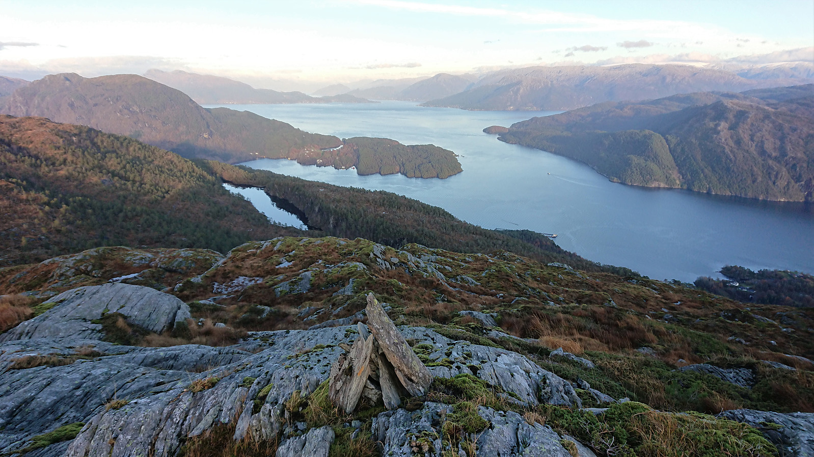
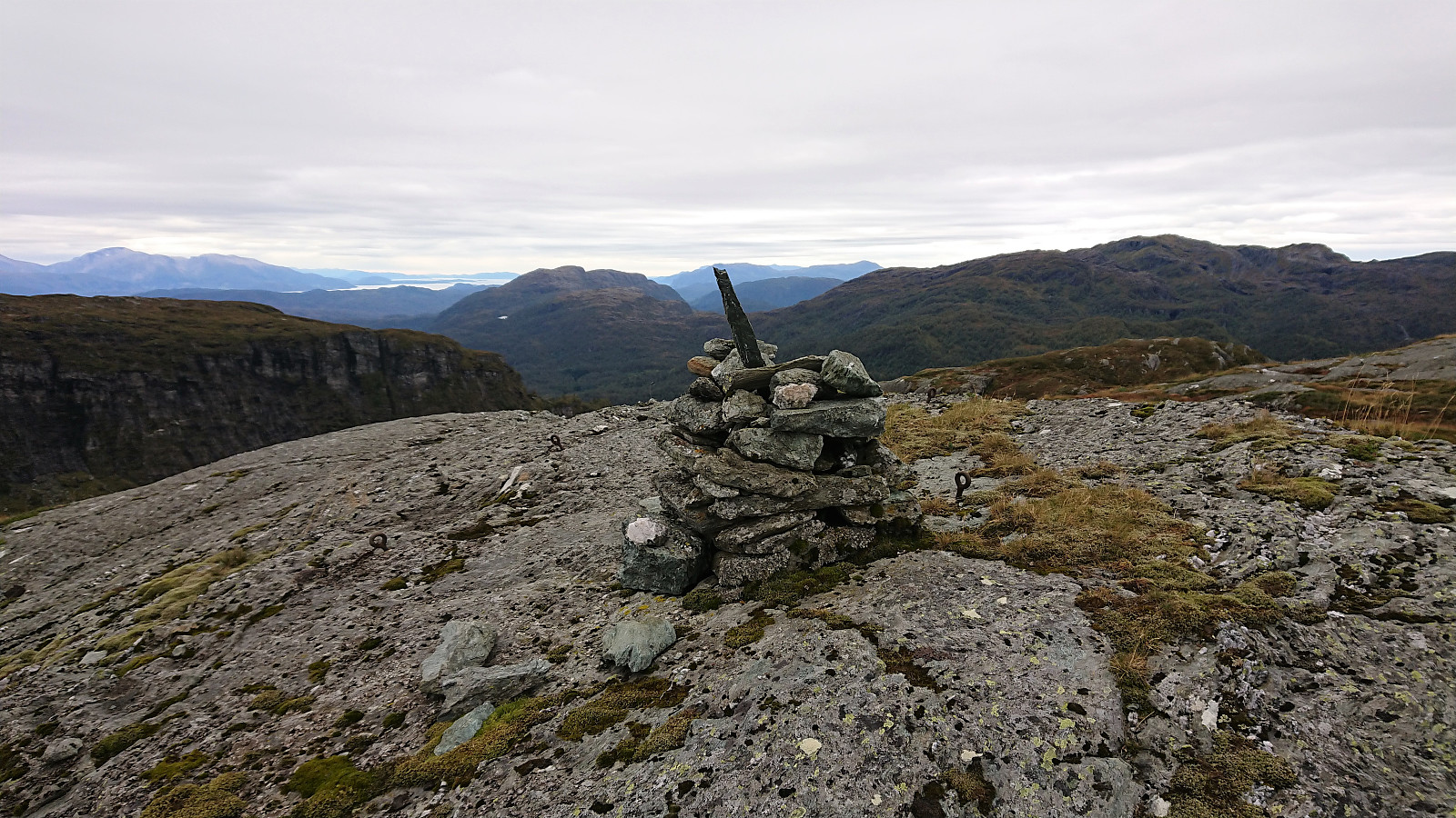
 I started by taking the bus to the eastern end of Langvotnevatnet (bus stop called Tokagjelet), and from there followed the gravel road up to Byrkjesete. Here I continued on the trail towards Myklavatnet, but not long after entering Klypet I left the main trail and instead headed east on another trail marked "Alkleiv - Stuasete - Norheim". Did not stay on this weaker trail for long though and soon left it to head off-trail towards the summit of Geitafjellet which was reached without any difficulties.
The views from the summit were even better than expected, with an excellent overview of Norheimsund with Folgefonna in the background. Strong winds made me cut my stay short however and I did not wait long before descending along more or less the same route. The only difference being that I at the beginning >>>
I started by taking the bus to the eastern end of Langvotnevatnet (bus stop called Tokagjelet), and from there followed the gravel road up to Byrkjesete. Here I continued on the trail towards Myklavatnet, but not long after entering Klypet I left the main trail and instead headed east on another trail marked "Alkleiv - Stuasete - Norheim". Did not stay on this weaker trail for long though and soon left it to head off-trail towards the summit of Geitafjellet which was reached without any difficulties.
The views from the summit were even better than expected, with an excellent overview of Norheimsund with Folgefonna in the background. Strong winds made me cut my stay short however and I did not wait long before descending along more or less the same route. The only difference being that I at the beginning >>>
